Loopin’ Lake Geneva (4/24/21)

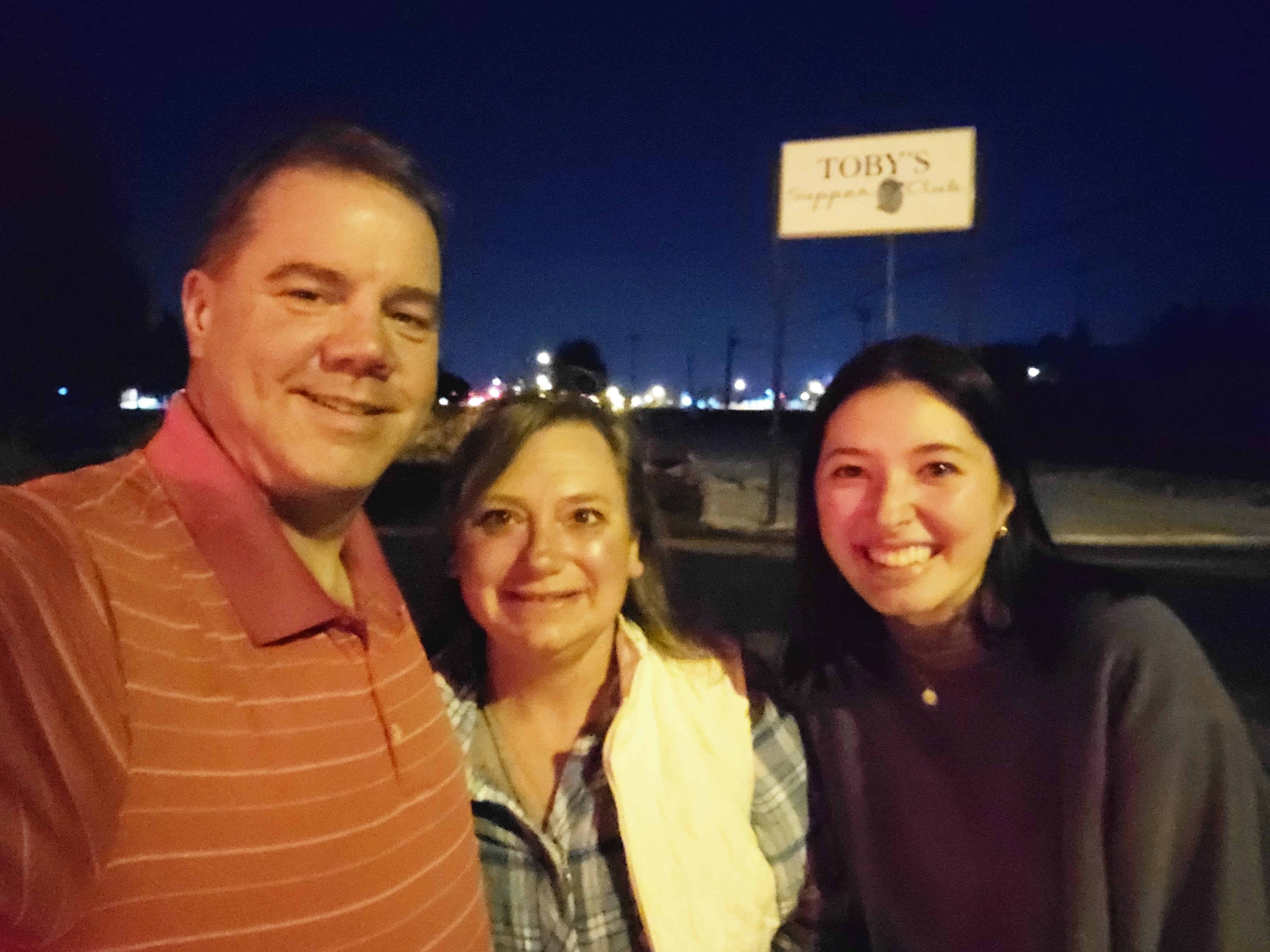
This weeks #SplorinSaturday is a little different than the usual. We had to start the weekend off with driving to Milwaukee so we could deliver rainbow Jello to our youngest daughter, Carrie, who goes to Marquette University. This is a tradition dating back to Kindergarten when Tammy made her rainbow Jello for her class treat and it has become something that Tammy (although she complains about the long hours to make it) loves to do for Carrie. This year it was a surprise delivery. Carrie was not expecting us to drive 3.5 hours to bring it to her; we just showed up on Friday evening to deliver it — and she was quite surprised!! So first off the plan for #SplorinSaturday had to include #RainbowJelloDeliveryFriday. Luckily Mike is always looking at things for future #SplorinSaturday adventures and this was a great way to take advantage of something on the east side of the state. We have talked about walking the short path (oops — that was a typo, but too interesting to correct), it should be “shore path” around Geneva Lake for a while. This was our opportunity to actually do it. The weather looked like it would cooperate and if it didn’t, we could go to Lapham Peak (one of those busy places that might be less used if bad weather).

The reason the “short” typo above was allowed to stay is this not even remotely close to “short”. From Mike’s research we knew that it is 21 miles to go all the way around the lake. Mike also found some places that said that the shore path was 26 miles, but his trusty go-to app said it would be about 22 miles all the way around. Mike found a great article called Around the Lake in a Day that laid out the distances and times for each of the sections. This led Mike to lay all of this out in, of course, a spreadsheet.

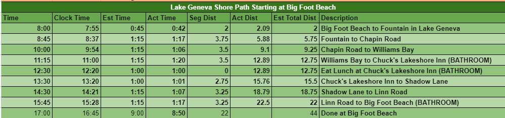
Amazingly he got very close to right on the money. He had estimated a total time of 9 hours (including an hour break for lunch time happy hour) and we ended up doing it in 8 hours and 50 minutes. He estimated a total distance of 22 miles and the actual total was 22.5 miles (according to All Trails recording).

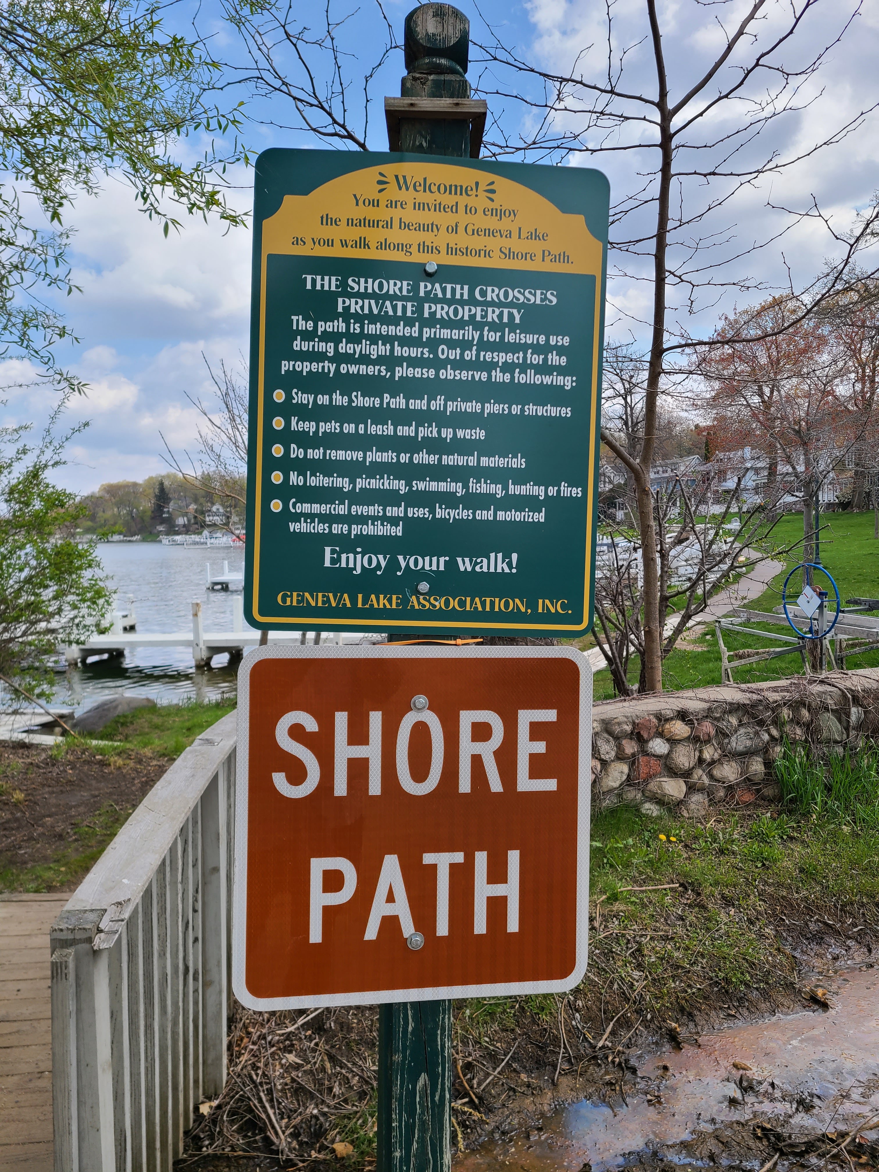
The shore path has been used by indigenous people dating back to 2500 B.C. Up until the early 1800s it was used for travel between villages along the short of the lake. Early settlers wanted this path to remain available to the general public and decreed that 20 feet leading to the shoreline be preserved as public domain. It is up to the homeowners to maintain the path on their property. Some go all out: paved paths, stone or decorated brick paths, some just have a dirt path. Others just force you to walk across their lawn. The shore path is mostly on private property, so you are advised to remain solely on the trail and not venture into peoples yards/gardens/piers/boathouses/etc. If you would like more information on the shore path, Visit Lake Geneva has a very good article that provides a lot of good information on the Geneva Lake Shore Path. It really is a unique experience.

This is kind of an atypical #SplorinSaturday post as we did not take too many pictures. While we saw AMAZINGLY beautiful and very large houses/mansions/estates/etc., it got to the point where if we were going to take a picture of a few, we would have had to take a picture of them all. They were all different and unique in their own way. By one quarter of the way around, we ran out of expressions for how beautiful and amazing most were. I think we set our single day record for the number of times we said “oh wow!”. Actually, I don’t think we set it, I know we set it, but we have no idea as to how many times it was actually uttered.

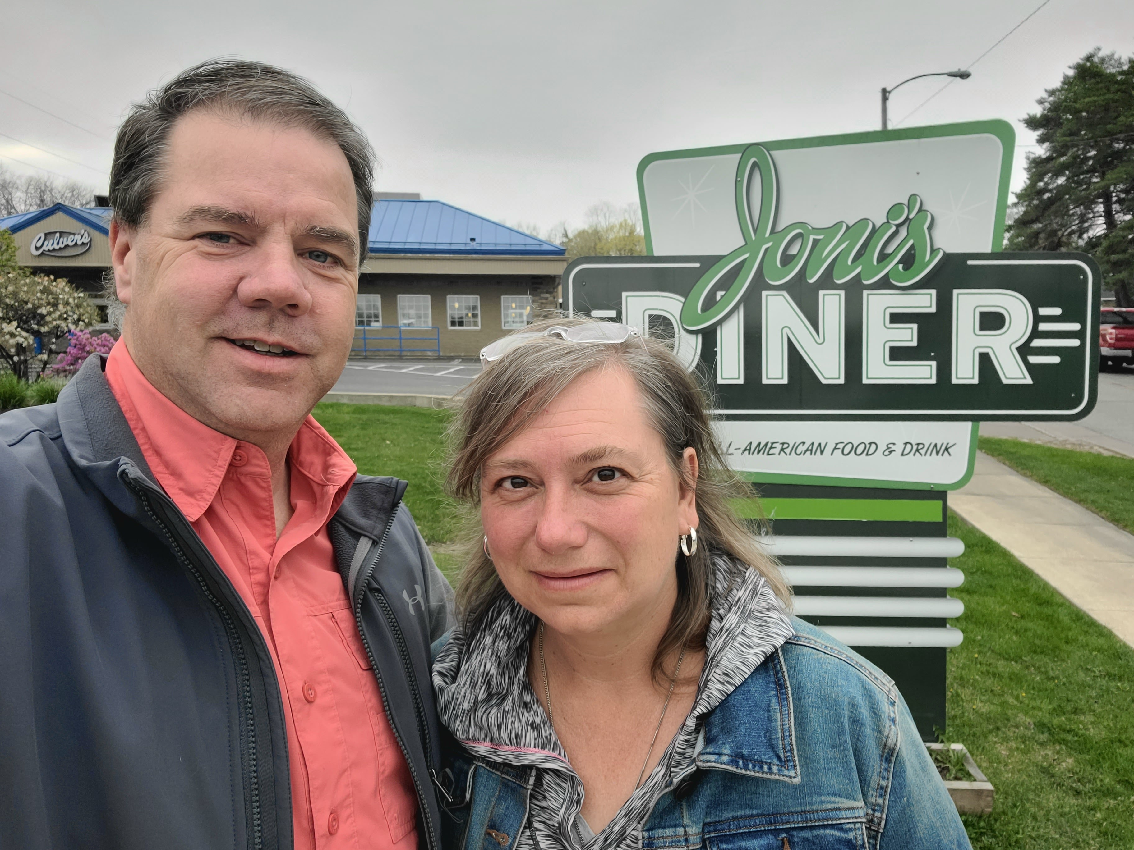
Before we get to the actual hike around the lake — we were excited to go to a place in Elkhorn, WI for breakfast. The Elk restaurant looked like a great place to start this day. The plan had us getting there for breakfast at 6:30, which was no problem as they were supposed to open at 6 (according to their website, Google and Facebook), but alas it was still dark inside when we got there. There were employees inside but it was obvious they were not opening until 7. Instead of waiting and being farther behind schedule, we decided to take a chance at a restaurant right in Lake Geneva for yet another Plan B breakfast. It also opened at 7, but going there was a lot closer to our starting point so it made sense. We made our way to Joni’s Diner. We pulled into the parking lot at 6:57AM and there were already four or five other cars in the lot. We knew we had hit the jackpot for breakfast!! As we pulled into our parking space we saw the OPEN light come on and we made our way into the restaurant.

We were the second or third table to sit down. The only other person we saw was the one waitress who was rushing around trying to get everything ready. She was was frantic but in control. She was behind the counter with a pot of coffee making eye contact with each table asking they wanted coffee so she could pour and deliver them all at once! It was awesome — organized chaos! She made it around to all the tables and took their orders pretty much in turn to when they arrived, but it didn’t matter the food and the experience was amazing. It didn’t take long and there were others helping her with coffee, taking orders and saying “thanks for your patience” — it was just such a neat place to start our day. By the time we left the entire restaurant was almost completely full — we were very lucky to have arrived when they first opened.

Big Foot Beach State Park was our starting point for our trek around the lake. Mike picked here because he knew it would be an easy place to park for the entire day, we didn’t have to pay for parking and, well, it was a state park afterall!! We started the walk along the road right next to the beach.

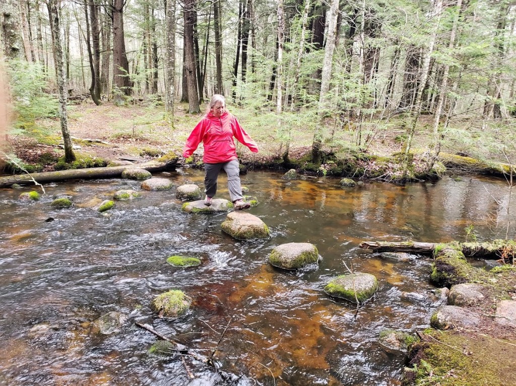
Immediately after the beach was where the real “shore path” began. Tammy really felt awkward “walking through people’s yards” even knowing it was ok.

She did not give this feeling up the entire day and could often be heard mumbling “sorry, hope this is ok etc” to people that weren’t even there. Mike had read the Visit Lake Geneva article (and many, many more) and knew this was what walking the trail was like, but it can be a little strange to start out. One picture that Mike took was right away on the path was a mansion where one of his coworkers in Bloomington had worked on the grounds’ crew when he was in high school. This was one of the “smaller” houses we saw. 😉

Just past here we ran into a group of 5 or 6 people heading the opposite direction. They asked if we were doing the whole shore path, we said we were and so were they. We knew we would see them eventually again on the trail, unless they stopped somewhere for lunch and we passed them or vice-versa.

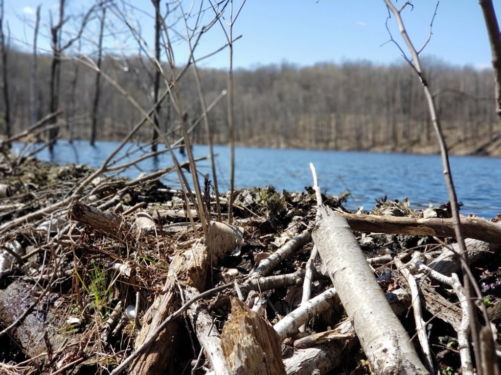
Everywhere in the yards, on the path, on the shore of the lake were piles and piles of wooden bracing. They were piers that had yet to be placed in the lake. Almost every yard had stacks and stacks of these. Some of them were placed well off the path, but we often had to walk around or through big piles as well.

While it kind of cut down on the beauty of the yards, it was actually kind of neat because it really gave the lake a completely “clean” look to it. The stretches where all the piers were in and people already had their boats and toys on them really cluttered the look of the lake. We would much rather look at the lake itself rather than pier after pier after pier.

In short order we made it to downtown Lake Geneva and walking along the beach where, of course, they had stacks and stacks of pier parts. Here we saw the first crew setting up people’s piers around the lake. As Mike suspected they would need not only smarts and brawn, they would also need cranes to lift these pieces. Many of the large pieces were placed way up on shore where the only way you could get them down to the water would be a crane. The cranes are attached to barge-like boats and allow them to lift very heavy pieces way up on shore. We tried to stop at the bathrooms at the end of the beach, but unfortunately they were still locked for the season. Oh well, we were hoping there would be some at the next public access point along the lake.

We saw many things for the first time — it was such an interesting walk. One of the very large houses had a very large yard that was freshly cut. All over the yard we noticed two wheel tracks. It looked like someone had pushed a lawnmower all over the yard in a million different directions. But the yard was easily 5 acres; there is no way someone used a push mower on it. When we rounded the corner we saw “Roomba” lawn mowers. They were just tooling along cutting the grass going back and forth across the yard. Well, they were Husqvarna mowers, but “Roomba” is something that most would understand. It was pretty bizarre to see.

We also had fun looking across the lake trying to figure out what we would be seeing later in the day. After walking about two hours (six miles-ish) we could still see Big Foot Beach State Park. Well we could tell where it was, not really “see” it. We also could see a very large golf course right on the short across the way. (Little did we know at the time, that the golf course would be almost the very end of our day.) We eventually made it to Williams Bay where Mike had said there would be bathrooms. Of course we went to the first set of restrooms and they were locked. Tammy was prepared to have to make it another hour and half before we were stopping for lunch, but luckily the next building was also a set of bathrooms — that were open!! The building was really nice and had a cute map of the area on the wall.

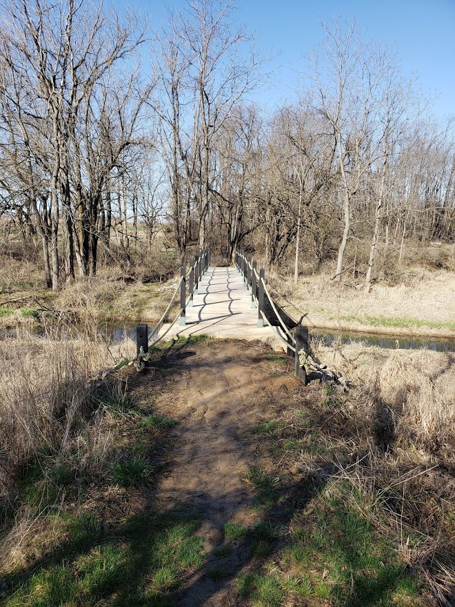
We then made our way from there toward the town of Fontana where we were going to stop for lunch/happy hour. Not only was it weird going through peoples’ backyards, it was also different passing through small towns while splorin. One of the more interesting things in between the two was Conference Point. This is a 150 year old camp that used to be one of the highlights on the lake shore. Now, unfortunately, a lot of the buildings are run down and in need of being torn down. There were several spots along the path here that it felt like the little bridges were about ready to fall into the water below — but we survived!!

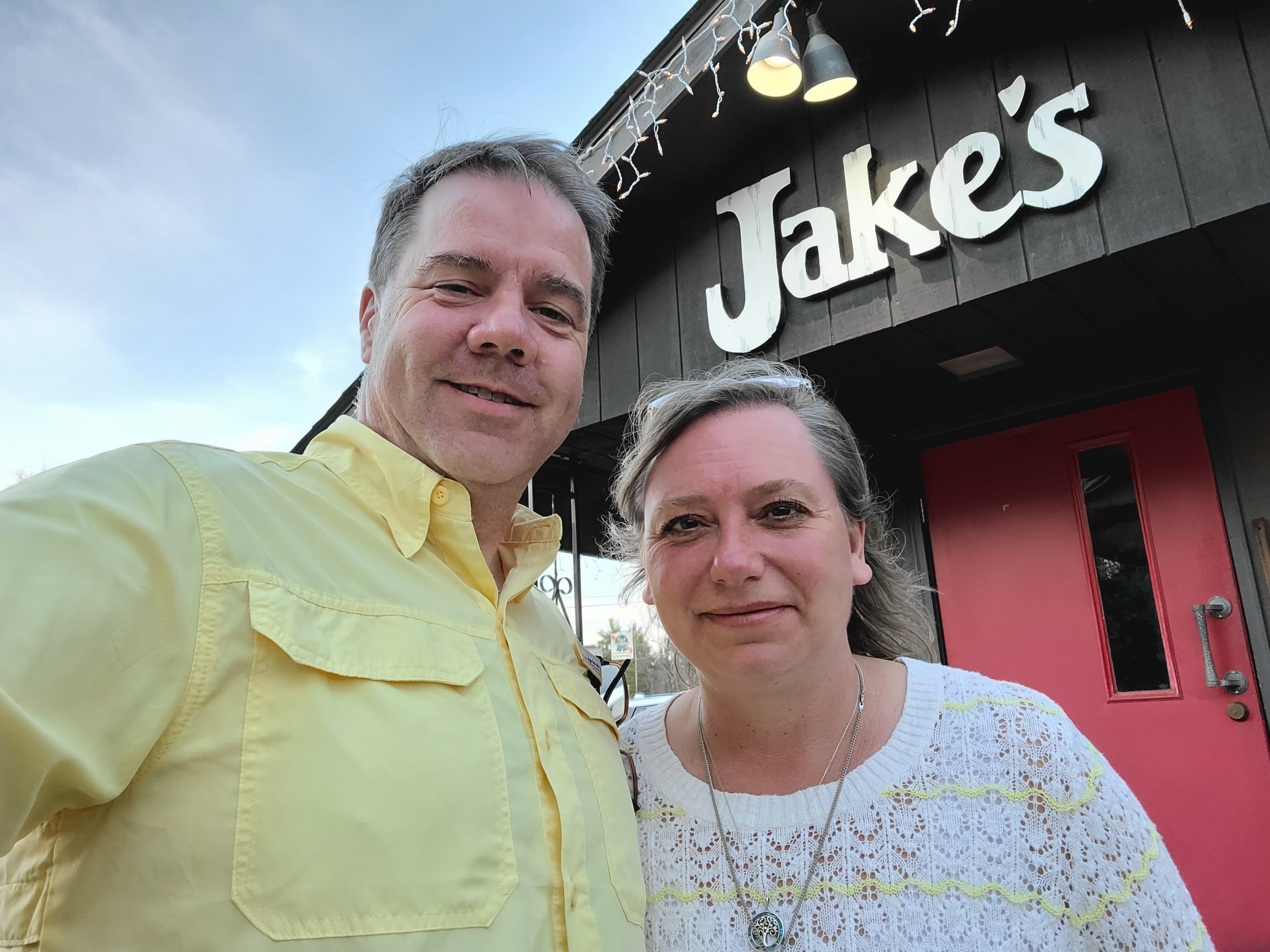
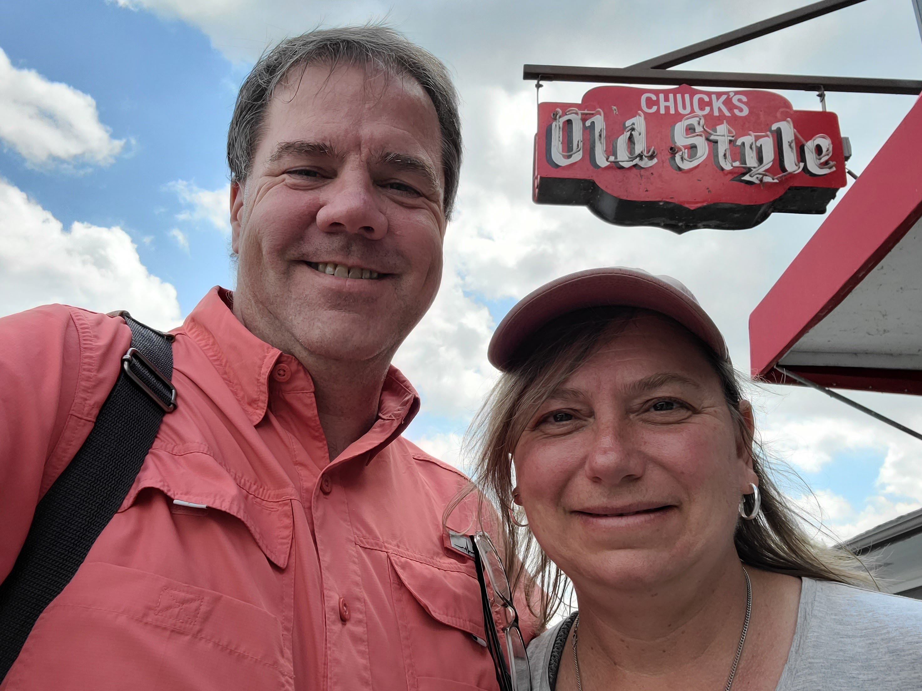
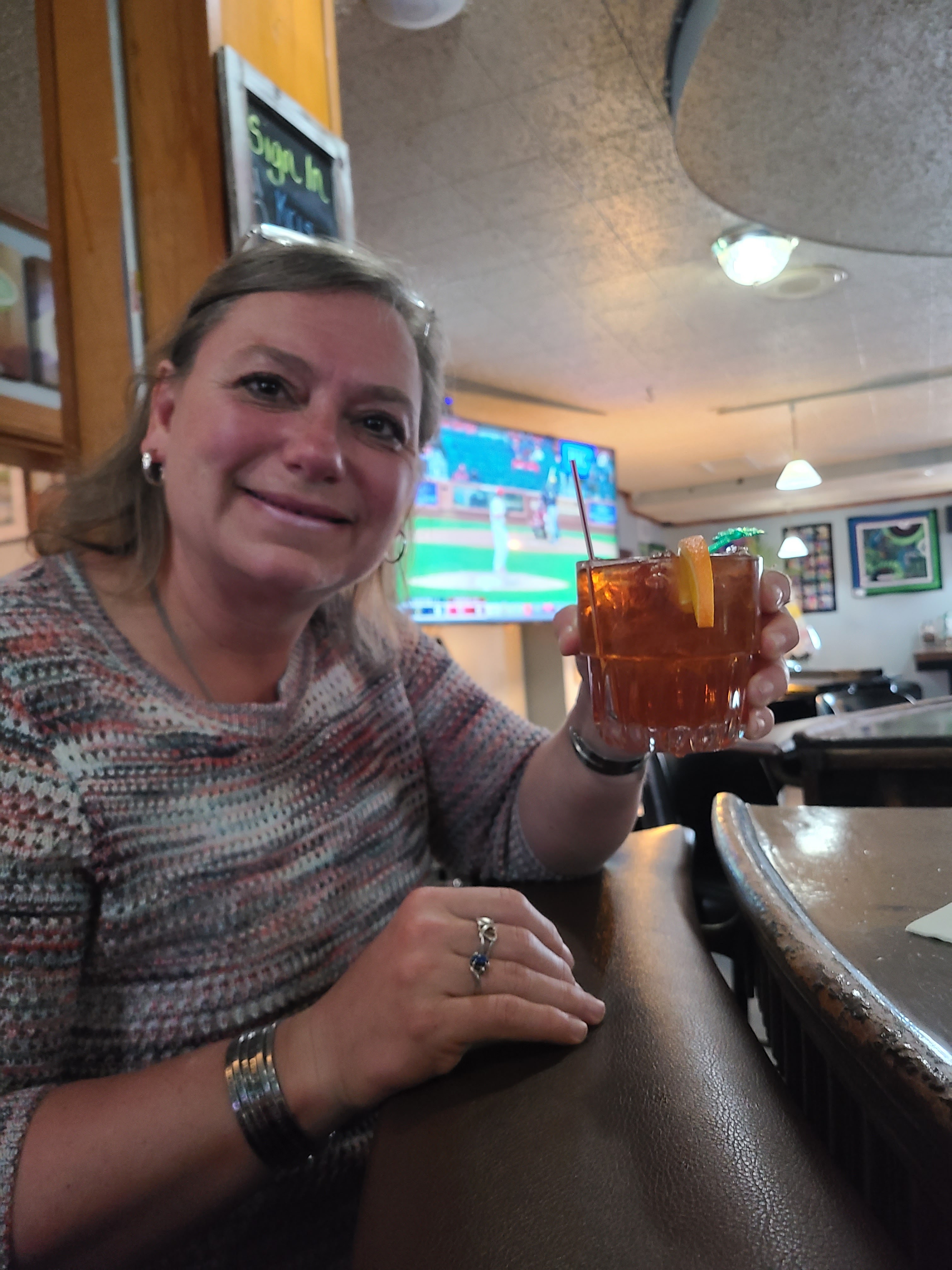
Not too much longer and we were to Fontana — and Chuck’s Lakeshore Inn. We walked in and immediately fell in love with the place. A very unique dive bar and grill type location right on the lake. We found a table and went up to the bar to order. Of course we had to get Bloody Marys along with a salad for lunch. We decided to forgo our “usual” appetizers knowing that we still had more than 10 miles to get back to the van. Before we could say no, the bartender was handing us two open 8oz bottles of Miller Lite as chasers for our Bloodys, saying he would bring the drinks to us when they were done. We just looked at each other and shrugged and took our beer to the table. Mike hasn’t had a beer in forever and Tammy has never liked beer in the first place, but……somehow walking 12.5 miles and the promise of Bloodys made those beers taste very, very good. (even to Tam) Mike’s Ahi Tuna salad came with an Asian style dressing (typically pretty sweet) and Mike ate it right along with drinking his beer — “blood sugar be damned” was his motto for the meal — but in reality, it did not affect him that much at all!

While we were eating, Tammy looked up and saw that group of 6 people we met earlier in the day come in!!! They made a beeline straight to the bathroom. We were going to wait until they got a table and then go over and talk to them. But as soon as they got out of the bathroom, they headed back outside and left! How rude. They came into the bar, used the bathroom and left without ever making a purchase. Some people’s kids, we tell you…. Just didn’t seem right to us.

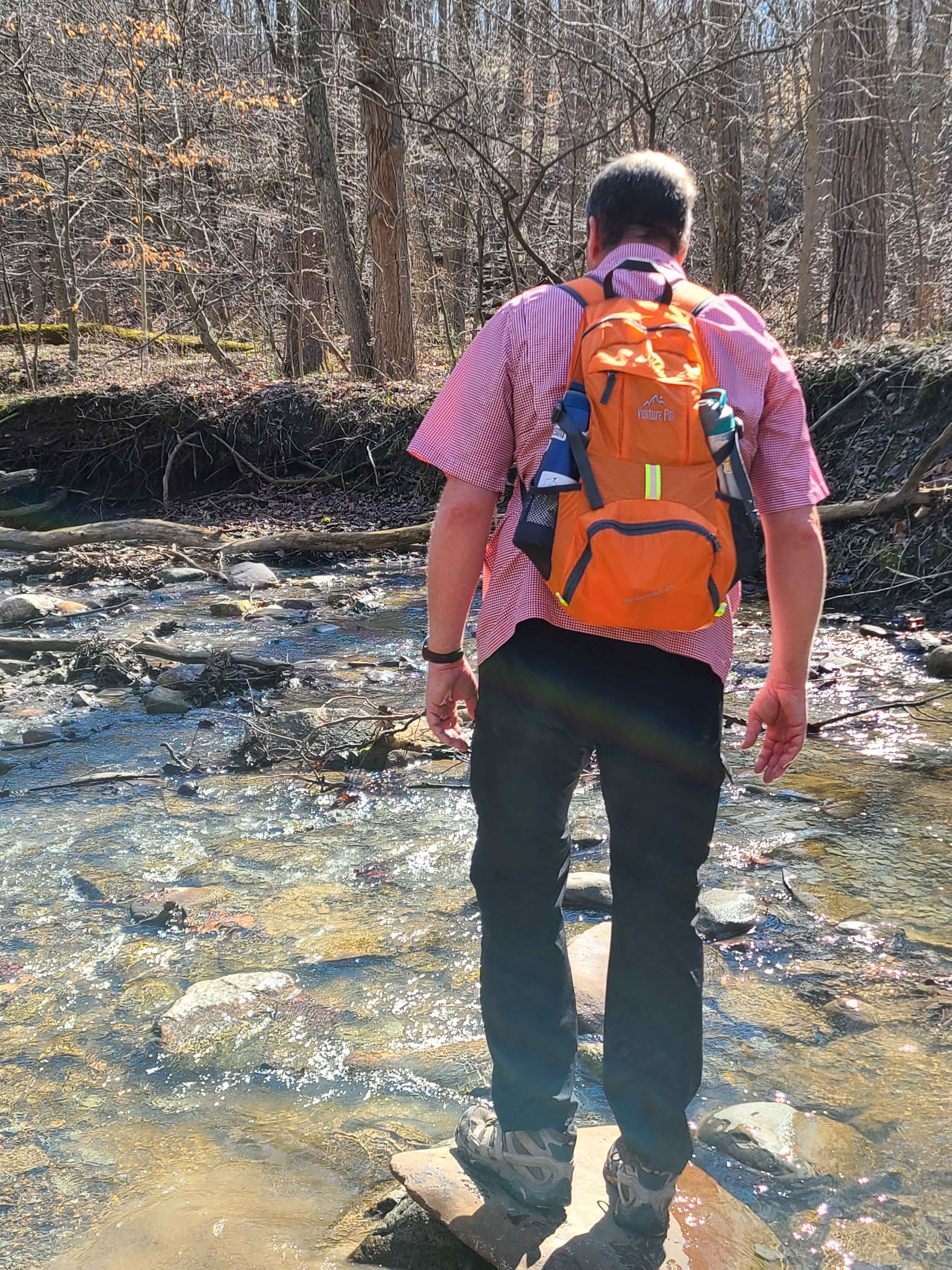
We were too soon done and as ready as ever to start the final 10 miles. Once again there were sections along here that had amazing houses and gorgeous pathways that were built to accommodate the shore path walkers, but there were also many where you had to “make it up” and just walk across the grass of people’s yards. Apparently most people are very happy to have the path and make it an adventure, but others barely seem to tolerate it, doing their best to seemingly push you into the lake. We finally made it to the golf course we had seen across the lake and discovered it had a brand new boardwalk across a wetlands area and a small stream. As we got close to the stream we saw a splash and something moving through the water. Just on the other side, a muskrat popped up to see if we were still there and immediately dove back down when it saw us starting at it.

We kept seeing glimpses of Big Foot Beach State Park. It started off and we could see the shoreline of the beach itself. Then we could see cars going along the road behind the beach. Then we could see the wheels of the cars going back and forth. Finally we were on the road and trying to play “Frogger” with the traffic to avoid being hit while crossing. Strangely enough, it started raining right at the end of our walk too. We were watching the weather closely all week and we thought rain would only be a possibility in the morning, but the afternoon is when we got a little wet. We made it to the van and tapped out at 22.5 miles and 7 hours and 50 minutes of moving time. Tired, but it was such a great day!

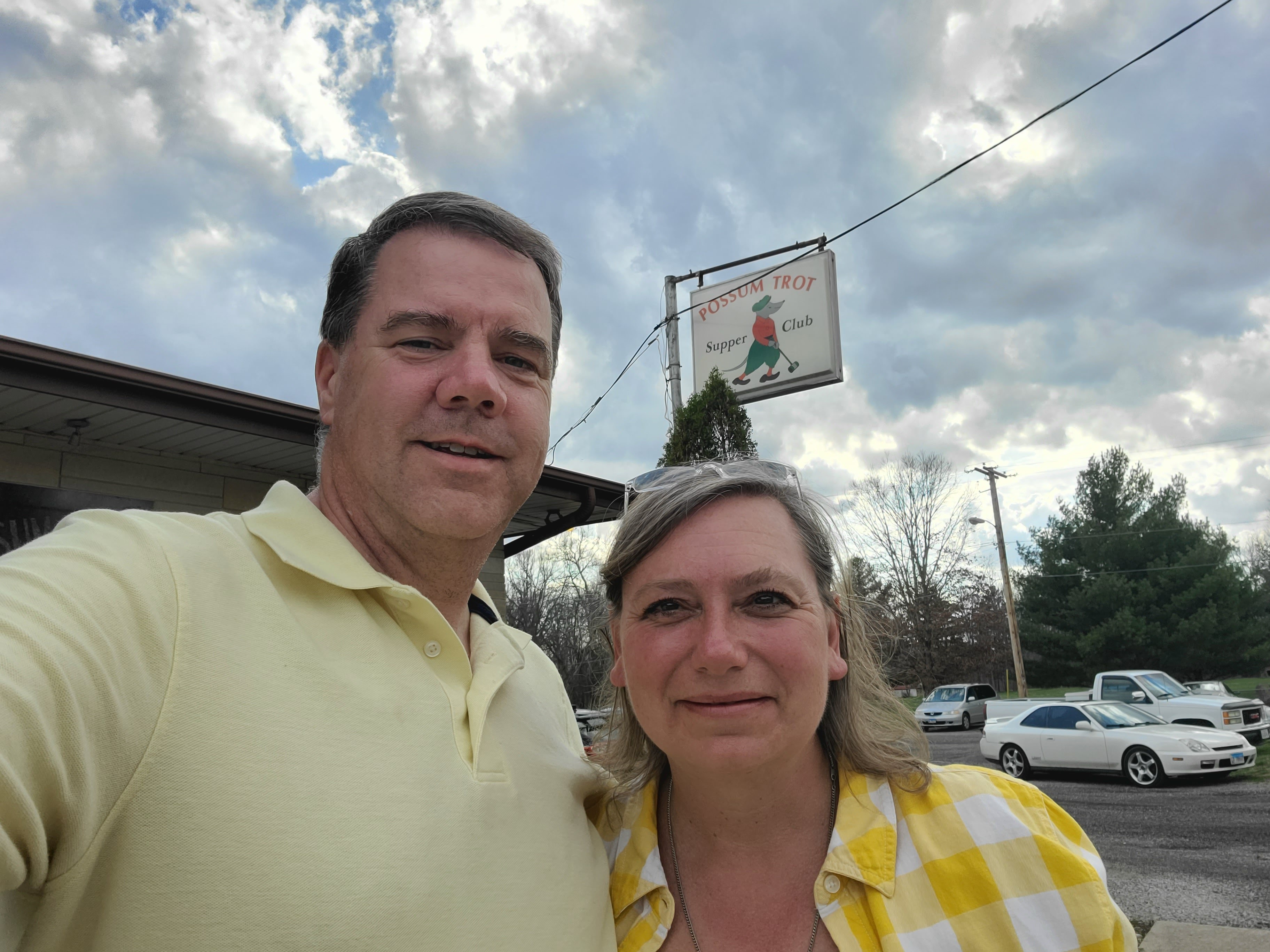
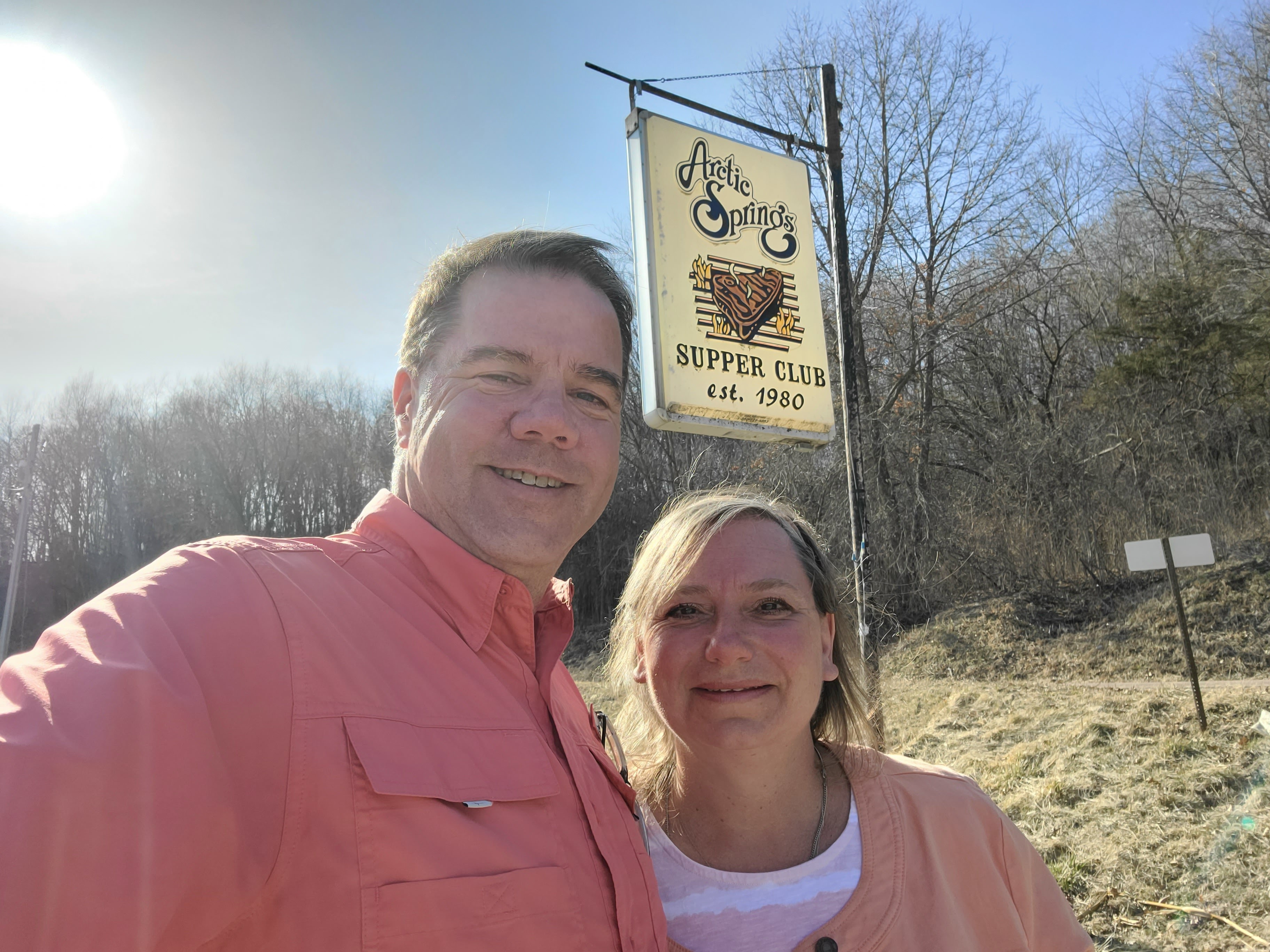
#SupperClubSaturday was a the Duck Inn Supper Club in Delevan, WI. On Friday and Saturdays they don’t really take reservations, instead it is more of an advanced seating request. We arrived 15 minutes before our reservation hoping we wouldn’t have to wait too long and we were immediately taken to our table!

We had stuffed mushrooms and a relish tray (yay!!) for an appetizer. Mike of course had the Prime Rib and Tammy had the “Not Prime Rib”. Unfortunately again for Mike, the Prime Rib was only “OK”. It was done perfectly, but the seasoning and the au jus left a lot to be desired. Luckily the company was way better than the food!! This was the first time in a long time that we were at a place that was really crowded. It is definitely one of the more “better known” Supper Clubs in the area and while it was nice, we think we will stick to some of the more “out of the way” places from now on.

The bad thing about today was the LONG drive home. 3.5 hours after walking 22.5 miles and eating a heavy dinner made the drive even longer than it normally would have been. But we made it home, collapsed in bed (after being attacked by Henry) and got some much needed rest dreaming about where the next #SplorinSaturday would take us.

Blue Hillsin’ It! (4/17/21)

As explained in last week’s #SplorinSaturday blog, when the weather is less than ideal, we make our way to a more popular location in hopes that the weather will keep the crowds down — and it was successful last week! This week the weather was supposed to be PERFECT (sunny, mid 50’s/60’s) so we decided splore where Mike had us planned to go last week — an “out of the way” location that was amazingly beautiful and also amazingly empty of people. There was only one possible issue with this week’s adventure. Tammy tripped over a three year old at the daycare she works at on Thursday and banged her knee pretty bad. Friday’s “pre-splore” walk with Henry went pretty well, but we were taking this hike a little easy to start with to ensure that her knee was going to hold up — and being the every awesome trooper that she is, the knee and her attitude got her through this most awesome day of hiking!!

We started the day at the Cameron House in (unsurprisingly) Cameron, WI. This was a very cute little bar and restaurant. You first walk into the bar and it is all decked out in pine logs and mounted animals but then for eating you turn into a very large dining room.

When we arrived there was a table of four and several tables of one — it was like a “dispersed coffee klatch”. We joked that maybe this was the “older generation singles club” where you came to meet others. Throughout our breakfast several other singles came in — they all seemed to know one another, but apparently not well enough (or may too-well enough) that they didn’t sit together. The menu was your typical small town diner fare with some interesting names like “Road Kill”, “The Terminator” and “The Big Mouth”. We stuck to our normal breakfast with Tammy opting for a side of two sausage patties instead of asking about a salad. They were not only the best breakfast sausage we have had, each was at least a quarter pound in size!!! Oh, they also had an “Irish Breakfast”:

As of right now, beers are out for us (subtle foreshadowing music playing in the background), so we passed on that one, but were soon down the road to start our day of Splorin’!! Mike knew this location was a little off in the “boonies” of Wisconsin, but we didn’t know exactly how far…until we started driving. First, Michelle tried to route us up a road that had a parked train sitting across it. Hmmm, not going to make it through there!! So we had to turn around and go back to the little town of Weyerhaeuser to take a different route. Shortly after leaving town we ended up on a very narrow dirt/gravel road and several more gravel roads before we arrived at the parking lot. Given that it was such a beautiful day we were worried about how many people might be here, but as we pulled into the lot we saw we were the only ones here — YAY!!!

With Tammy’s potentially bum knee, it was good that the first mile or so of the hike was on a gravel road and a little bit easier to negotiate. Of course she never complained and said her knee was feeling quite good, so we were able to keep going.

The trails here are VERY well marked — it seems as though this is primarily used for cross country skiing in the winter, but the hiking is awesome as well. What wasn’t well marked was what to do at the gate at the end of the gravel road. Of course Mike was using AllTrails, but it wasn’t immediately obvious if we were supposed to go around the gate, or go somewhere else. We went around the gate and just a little further down we found the “2km” marker (this was part of the 11km loop trail) and each kilometer was marked off. This entirety of the trail was two lane “road type” former logging roads. We thought this would make the hiking much easier, but as we were about to find out, that is not always the case. A portion of this part of the trail led along this beautiful little stream that was gorgeous in the early morning sun.

As we hiked along the trail we were surprised at all the standing water we could see just off the trail. Lots of little “puddles” with leaves/twigs/etc. in them, but thankfully none were on the trail. Sure we found a couple of “soft spots” here and there, but nothing too bad — it was between “pre-Spring” and “Spring” afterall so we were expecting there to be soft spots here and there.

The central part of the trail is on top of a ridge so were also expecting a little bit of an uphill section — what we didn’t expect was that the trail was going to turn into a total spongy mess in parts. As we turned away from the stream and started to make our way up the hill, we noticed that there was a little more mud than we had seen earlier in the morning. Actually, the worst part was that you really could not see most of it. The trail was completely covered with leaves and those leaves covered both the good solid ground for hiking and also the very muddy, soupy ground not so good for hiking.

Mike gets to “lead” while hiking. Not so much because he has the plan, but more so Tammy knows where to go, and NOT to go, on the trail. Today was an excellent case of the where NOT to go. Mike had hit a couple of muddy pockets here and there, but for the most part we were able to go over or around them without too much difficulty. The problem comes when you hit multiples of these soft muddy spots in a row with successive steps. Mike took an ill advised step and sank down in about 2 inches, then his next step was down 3 or 4 inches and his following step seemed like he was going to go up to his knees (although it was just to the top of his boot). The best part of this, for Tammy anyway, was Mike doing a “Oh God, OH God, OH GOD!!!” with each of his three steps. Mike thought he was going to be sucked into quick sand and only his head would be above ground — Tammy just watched and decided she would take a different route over that section (after a good laugh of course). The surface was just that deceiving.

We never were really able to determine why the ground here was so muddy. Sometimes it is obvious: recent rainfall, snowmelt, water from springs, etc., but this time it was not so obvious. We made our way along the ridgeline scaring a few ducks out of the little ponds of water here and there not really any other wildlife to speak of. We hit a few more muddy spots but seemed to be able to work our way around them with no more “oh God, Oh God, OH GOD” moments. Our boots definitely showed the effects of the mud.

We encountered a portion of the trail where active logging was taking place, lots of piles of logs spread along the road; luckily no one was actually logging on this Saturday morning. As we came down off the ridge we could see this amazingly blue little lake that stood in stark contrast to the all the browns of the leaves on the forest floor waiting for the greenery of Spring to pop its way through. There were a couple of turtles on one of the logs, but they plopped into the water before a picture could be taken of them.

Tammy’s knee was getting a little sore and the last couple of kilometers of this section of the trail were hiked in silence — especially the downhill sections. She is able to hike on level ground and uphill sections just fine, but the downhill portions really hurt her knee. As we neared the van we talked about how many other cars would be in the parking lot when we got there…Mike guessed 3 and Tammy guessed 1 since we had not seen another person along the entire 7.2 miles (11 km) of trail. We were both surprised when we got to the parking lot and found 0 cars there (aside from our van)!! We sat an enjoyed our happy hour treats of Bloody Marys, cheese, sausage and nuts.

The Blue Hills Trails are split between the East and West sides of the road. We were heading for the West portion this afternoon. Given Tammy’s knee situation, Mike offered her 4 different plan options: 3 miles, 4 miles, 5 miles or right around 6 miles. We had about 3 hours of time before we had leave for #SupperClubSaturday, so we decided to play it by ear. We had done the morning’s 7.2 miles in 3 hours, so we should be able to do 6.5 miles in 3 hours too. So we took off down the trail not know how much we would get done. Along the road to where the trail officially started we once again passed an amazing little lake — it was absolutely resplendent in its reflections of the blue sky.

We were quickly on the trail and bypassing the option to only go a measly 3 miles. The trail was nice and wide and seemed much less muddy than the other side of the road.

We bypassed the 4 mile option as well — the only remaining choice was 5 or the 6.5 miles option. Before we were able to make that decision we came to an area where you could see a little body of water of the left hand side of the trail. There was a path where obviously others had worked their way down to the water — so, not wanting to feel left out we did the same. This little path took us down to the edge of a obvious beaver pond — the water was all backed up around trees, etc. It had obviously been that way for quite a while. While we couldn’t see any beavers, we did see a lot of Blue Herons. We could see five or six of their nests and quite a few of them flying amongst the trees. We had obviously stumbled upon a Blue Heron rookery! The pictures do not do it justice, but it was cool seeing all the birds.

Back on the trail we reached the point of no return and opted for the 6.5 mile option. We hiked down a little “lollip-pop” trail that Mike thought might takes us along the other side of the beaver pond, but no luck. It was just a lovely walk in the woods with nothing outstandingly noteworthy, but beautiful none-the-less.

Mike had noticed on the maps on the far backside of this hike we were going to pass yet another little lake. He didn’t know how close we would come to this lake so it was quite a surprise when we came along the shore and found a HUGE beaver dam holding the lake up. Both of us had seen beaver dams before, but not quite from this angle. We were literally walking below the beaver dam where a little bit of water was trickling out. We stood where our eyes were exactly level with the water in the dammed up pond and our feet were below it. It looked like an infinity pool. It was amazing!!! This dam has been here for a VERY long time — long enough for the lake to show up on Google maps as something permanent and not just a temporary water feature.

This was the first beaver dam that we had encountered during our Splorin’! (Which is actually kind of amazing since we have spent so much time in the woods over the last year.) What was even more amazing was that came across 3 or 4 more beaver dams in the next 3 miles! None as big or as beautiful as the first one, but it was really cool to see all of them — and all the trees the beavers cut down in making the dams.

Most of this trail was pretty “moderate” with ups and downs but nothing too difficult. There was one point on the trail ahead that was labeled as “difficult”. Mike knew it was short, but looking at the maps he was unable to tell what would make it difficult. When we stood at the top of the very large hill that led down to a little stream and then what looked like back up and equally steep hill, we knew what the “difficult” section was. But, Tammy has a noticed something over all of our hikes. The hills that we look at like this that appear to be huge, usually end up not being so bad. (Or at least that is what she tells herself to keep going!) So we started down the hill, and that was bad because of Tammy’s knee, but we were up the other side in about 4 or 5 minutes — not bad at all.

The very last section of the trail was walking along the road back to the parking lot. Usually you would think walking along the road is boring, but this time there was a small stream that went along the road. It was no more than 3 or 4 feet wide at its widest points, but it was flowing very quickly around rocks, branches and little waterfalls here and there. When it would get to its wider/calmer stretches we could see little minnows darting around some moving upstream pretty slowly, others flying downstream in the current. We have no idea what kind of fish they were or where they were going/coming from, but it was something that was really neat to see right on the edge of a road.

#SupperClubSaturday was at a little place that we have passed several times in all of our Splorin’ adventures. It was right along Hwy 27 just north of Ladysmith (this is one of the north/south routes we take to get to lots of places) called the Cedar Lodge. We were going to arrive fairly early so we didn’t think it would be that busy and we always enjoy a cocktail at the bar before sitting down to eat if we have to wait anyway.

We pulled up to see the parking lot almost completely full!! Oh oh! But so many times that can be deceiving. We’ve encountered times where there are full parking lots but empty supper clubs as well as the opposite. This time was a full parking lot meant a full supper club. We walked into the bar to see that every table and every stool at the bar was occupied. We walked through the bar to the dining area to see that there were still a couple of tables left open, two two-seaters and a 6 person table. We took one of the two person tables by a window looking out at the deck. We had already discussed that it was a little chilly to sit outside, but we looked out the window and saw two ladies sitting out at a picnic table with a little baby enjoying their food — yep, we are apparently wimps! 😉 Once again the Prime Rib was less than spectacular. Once again, not bad, but certainly not good. The au jus just seemed like colored water. Oh well, maybe better next week!!! Tammy had the “not Prime Rib” again and really enjoyed it! This place really reminded us of the Old Abe Supper Club — more of a bar than supper club, but still a supper club!! Can’t wait to see where next week’s #SplorinSaturday takes us!!!!!!!

Doin’ the Dells (no, not those Dells) (4/10/21)

We did not Splore last week — instead we spent our Saturday with family in Governor Dodge State park celebrating Easter. It was a nice, socially distanced day for us. But this made us all the more excited to get back to Splorin’.

In our vast years of Splorin’ experience there are several things we try to avoid: bugs (mosquitoes, wood ticks, black flies, horse flies, etc.), mud (“pre-spring” in Wisconsin) and people. People? Even in the pre-pandemic, world our Splorin’ has been about us (and several “guest splorers” that we have shared this experience with) and getting out into nature on the trails where it is quiet, peaceful and serene. It is not something we really want to share with tens or hundreds of people that we don’t know who too many times are too loud, too messy and just plain spoil the experience for us. Why mention that this week? Mike had a Splorin’ trip planned right down to the breakfast restaurant, #SupperClubSaturday, trails, etc. for this weekend. But there was a possibility that the weather would not be so nice — cold and possibly rainy. Now, that doesn’t stop us, but it does stop many, many other folks, which is why Mike has added a new Splorin’ rule: “When the weather is expected to be adverse, drop current plans and head for a more popular location”. Why? Well, when the weather is not nice we can go visit the places that are usually crawling with people, because “fair weather adventurers” tend to stay home. So — we decided to shelve the plan for this weekend and head to one of those locations: the Dells of the Eau Claire County Park in Aniwa, WI. We’ve heard and seen so much about this park, but it is one of those places that is usually overrun with people, so we have not visited yet. Well today was this park’s lucky day to have two hardy Splorers’ such as us visit!!

We started out, as always, listening to the Y106.5 Saturday Morning Polka Party with Don Wayerski while driving to Wausau. We were excited to have found a little eclectic type breakfast place, but as we neared downtown Wausau we noticed something strange. Many of the stop lights were out and their stop signs were popped open. We saw quite a few people running right through these stop signs. We finally found the one-way street that the restaurant was on and were surprised to see no cars out front. As we pulled up and parked we could see why — there were no lights on inside. It was kind of like Benders in Elroy all over again — but this was different, there were no lights on…..anywhere. None of the businesses, etc. So, we had to resort to backup planning (which Mike messed up on this one and didn’t really have a backup this time — WHAT?) and searched for a new breakfast stop. We made our way to Blue Willow Cafe, in Wausau, WI. This is yet another formulaic family restaurant in the “Altoona Family Restaurant” genre.

We have to laugh when we find them because they are all the same: a huge menu, someone always roving with a coffee pot, food that comes out fast, typical “American homestyle” cooking and pies/desserts. They are never the best restaurants, but they also are never the worst — they know what works for them and for their customers. So — we enjoyed our “standard Splorin’ breakfast” with coffee and nice conversation. Unfortunately there were no coffee klatches here, but lots of families enjoying breakfast including a couple of “regular” elderly gentlemen sitting at the counter where every time a waiter or waitress would walk by for the first time they would greet them with a “Good morning Bob, how are you doing today!?”.

Per usual Mike has our planning done at a detailed level — where we’re going to park, walk, have happy hour etc. We arrived at the Dells of the Eau Claire County Park and turned down the road to the parking lot only to find the road blocked off with a gate. It appears that where we were going to park was in an area associated with the campgrounds and they were not open for the year yet. We saw a couple of cars back on the other side of the road, but having to park somewhere differently puts the plan into chaos. Luckily it was just a half-mile or so off from where we were going to park. There were only three or four cars in the parking lot — which is EXACTLY why were here today. The weather was a little chilly (40ish), cloudy and still a slight chance of rain. Mike ended up putting the legs back on his hiking pants and opting for a light jacket — and he was very thankful he did because it was a chilly first couple of miles.

This is one of those locations where the main attraction is right there by the parking lot. Literally 100 yards from the parking lot is the rushing, crashing, roaring Eau Claire River. It is truly an amazing sight to behold. At the first overlook the river appears to be going in 10 different directions at a time. There had been rain for the last couple of days so we think it was running a little higher than usual, but to see all the swirling, churning, boiling water flow around all those rocks, ledges, and little (and big) obstructions was mesmerizing.

Some could sit and watch this all day! But not us, we had hiking to do!! We enjoyed the view for a little while, but soon started hiking down the trail. The Ice Age Trail cuts through this park and we were hiking down it for a little ways following the familiar yellow blazes. The trail leads right alongside the river, we stopped several times to enjoy the view and take some pictures.

We ran into a little family with a two year old who found an acorn in the middle of the trail and was excited to be able to show us as we walked on by — cute! We then came to a part of the trail where we rose up above the river and there was a chain link fence blocking the river side of the trail. You could tell you were right on the edge of a bluff, but the fence kind of spoils the natural look. Sure, it probably saves a several lives a year, but come on man, nature! At the end of this section we arrived at the bridge over the Eau Claire River — we didn’t cross it as the other side of the river would be saved for hiking a little later in the morning.

We soon were venturing off the Ice Age Trail back onto a local park trail that was heading towards the group campground. The walking was pretty easy here — it was a two lane rutted road trail that had some muddy and wet spots, but they were easy enough to get around. We ran into another small family with two dogs and two kids — the dad asked us “Are there a lot of people up ahead?” This confirmed our decision to change plans for today and pleased us. No — there were not a lot of people and that is exactly why we were here today! Obviously they were regulars who know what the park can get to be like. The trail was nice, typical wooded scenery but a lot of standing water and even little trickles of water down the trail. There must be springs nearby in the woods that keep this so wet — it had rained, but we didn’t think it had rained that much.

We finished our first little loop and were back at the parking lot and headed across the bridge over the river to reach our next loop. This was to take us back around the other side of the park and meet up with the Ice Age Trail again. It was a very cool section of trail. The earlier trail could be called “woodland,” this part of the trail could be called “swampy primeval”. What is “swampy primeval”? Think Princess Bride and the Fire Swamp where Westley and Buttercup encounter the lightening sand, fire spurts and Rodents of Unusual Size. No, we did not see any of those, but the scenery was very similar — in other words, very stunning and beautiful. We came upon a little shelter that had been built out of the local granite rocks that you see everywhere around. Unfortunately it was covered with graffiti on the inside, but it was really cool.

Thankfully we emerged from the “swampy primeval” forest unscathed and met up with the Ice Age Trail again. This is another aspect of Splorin’ where we need to leave a little leeway in our planning. We never know exactly how fast we are going to hike (due to conditions, elevation, etc.) so we try to leave variable pieces where we have options to add or subtract from a hike. At this point, it was about 30 minutes to get back to the van, but we had about an hour and 40 minutes until we needed to be back. That meant we were going to be able to do an “out and back” hike on this segment of the Ice Age Trail that would last just a little over an hour — SWEET! Mike set and alarm on his phone and down the trail we went. Once again the trail was following right along the Eau Claire River. The river was still raging and there were lots of rapids. We wondered if there were ever people that braved the river and kayaked down it. Certainly not something we would do, but it would be cool to see.

Soon enough we were down and back on that section of the Ice Age Trail and at the van to drive a couple miles to tackle one half of the Plover River Segment of the Ice Age Trail.

We had enough time to do an out-and-back hike on the lower portion of this segment and it was a mighty beautiful walk in the woods. It started off on some narrow “board walk” and crossed a little stream. We had fun trying to dodge the mud in the middle of the trail — luckily there were lots of logs, roots and rocks to aid us in staying fairly dry and mud free.

We then came to the actual Plover River itself. Rivers are not all the same shape and size — some are big and some are small — luckily for us at this point in its existence the Plover River is pretty small and the water was not very high. There were a series of stone steps to get across the river. Mike just took right off and crossed the river with no qualms or difficulties at all. Tammy, crossed with no difficulties, but she did have qualms about it. Crossing water on something less sturdy than a big steel bridge with solid railings is as scary to Tammy as looking down sheer drop-offs is to Mike. None-the-less she made it across staying nice and dry (although she was sweating a little bit upon reaching the other side).

The remainder of this section was wandering along the river, going through recently logged areas that were full of aspen trees and finally going across a lovely open prairie — it was then time to turn around and do the whole hike in reverse — we love out-and-back hiking. You would think that coming back the way you just came would be boring — but there is a lot you don’t see when looking in one direction; it can be a completely different hike even though it is something you just did an hour ago going in the opposite direction.

We were soon back to the van and getting ready for #SupperClubSaturday. This weeks installment of that journey was at the Palms Supper Club in Schofield, WI. Our GPS in our van, Michelle, gave us a little bad direction before arriving. Somehow she didn’t think you could turn into the parking lot from the main road so she took us around a block where we had to make a perilous spring across four lanes of traffic into the lot that we could have turned left in to had we just kept going. We have since forgiven Michelle, but we watch her directions a lot more closely now.

Today, was the anniversary of the passing of Tammy’s dad (28 years) so in his honor, Tammy swayed from her “regular” pre-dinner cocktail and ordered an Old Fashioned (low sugar and diet soda).

We tried something completely new to us for an appetizer: “walleye cheeks”. They are amazingly delicious — lightly pan fried served with a lemon cream sauce. Mike thought they were over the moon good and Tammy liked them, but still doesn’t really like walleye as it tastes “fishy” to her. Of course Mike had the Prime Rib — his review was “OK”. Not sure if we have mentioned it before here, but there are two main “flavor” components to Prime Rib — the bark/seasoning used on the outside and the au jus that is served with it. The seasoning on the outside isn’t enough to carry a Prime Rib if the au jus is not equally seasoned. Unfortunately this au jus was just so-so, Mike had to add salt to it to get some flavor going. Tammy had “not Prime Rib” for dinner. Soon enough though #SupperClubSaturday came to an end and we were on our way home to sulk around the house for another week until we could get out again into the wonderfully wild and beautiful outdoors in Wisconsin.

Splorin’ South of the Border (3/27 and 28/21)

We were off to Illinois (yes, that border) for another dentist appointment for Mike in Bloomington. He COULD get a dentist in Eau Claire now that he has been working at home for a year, but it is a good excuse to take our ‘splorin’ out of state and see some of his “people.” While there we enjoyed meeting up with some of the hotel staff, work people and walking some of the trails Mike used to walk daily when he would spend half his week there. AND being down in the Land of Lincoln also gives us new venues for Splorin’! Originally, the plan Mike was working on was going to involve heading to way southern Illinois and hiking Garden of the Gods in the Shawnee National Forest. But the more we looked at that plan, it was a 4.5 hour drive just to get there (and obviously 4.5 hours back) — a little bit too much car time to have a good day Splorin’especially after the 5.5 hr car trip to get to Bloomy. Mike came up with a new plan, and thankfully so because it turned out to be a “top five” hike for us! On the way back to God’s Country, we also got to visit a park that we tried to visit last time we were here; it was a good trip south of the border!

We were up before the sun (yet again) to get our Splorin’ on. We were out the hotel room door at 6:34AM (19 minutes behind plan already) and on our way to Merry Ann’s Diner in Champaign, IL. As we got closer and closer to the diner we noticed that it sure seemed like we were getting closer and closer to the University of Illinois campus — flashbacks from our brief foray into the University of Michigan campus a year and a half ago were discussed. Yes indeed we were very close to campus, but 7AM on a Saturday morning is quite a bit different than 6PM on a Friday night. Whew! This was yet another score on the breakfast diner front — a lovely little place with counter service and all the booths are lined up so that the waitresses would access the tables from the backside and not have to even leave the kitchen area.

Unfortunately there were no coffee klatches or good conversations to eavesdrop on, so we had to entertain ourselves with conversation (and who knows, maybe someone else was listening in on us).

Mike, with the help yet again of All Trails, found a place for us to go today: Forest Glen Preserve in Danville, IL. Specifically we were going to be hiking the River Ridge Back Pack Trail. 
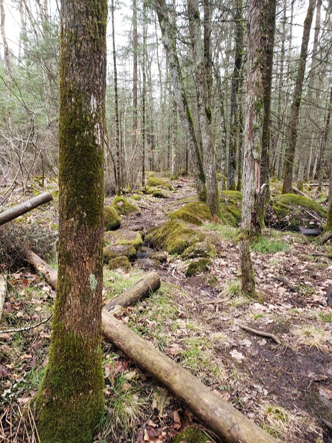
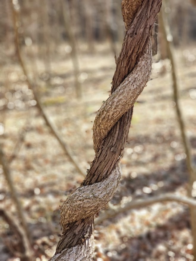
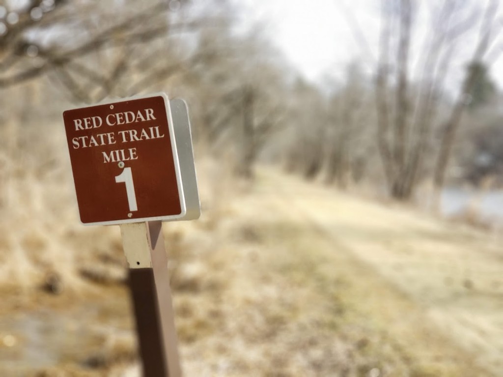
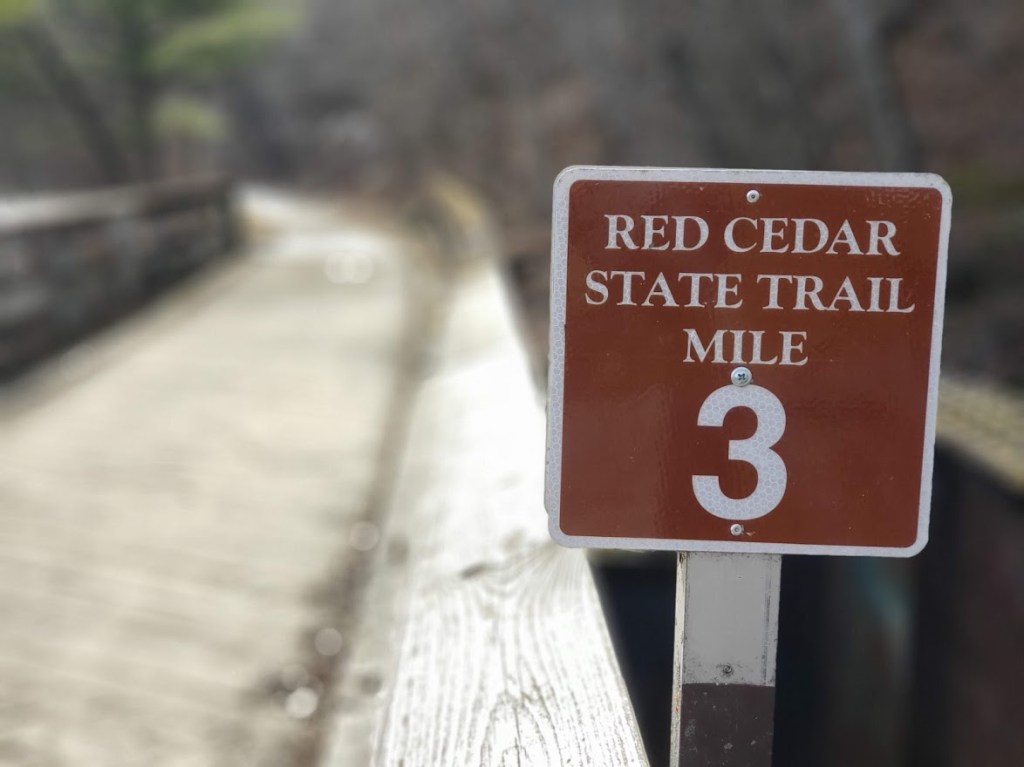
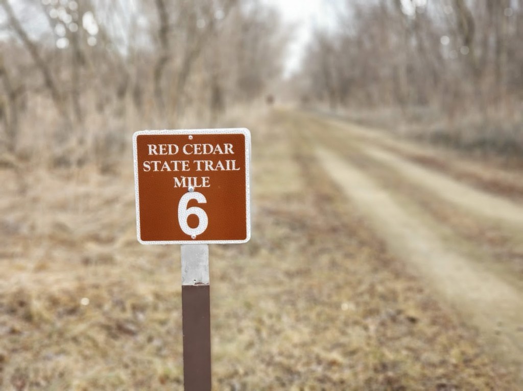
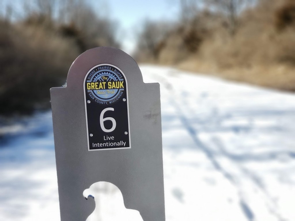
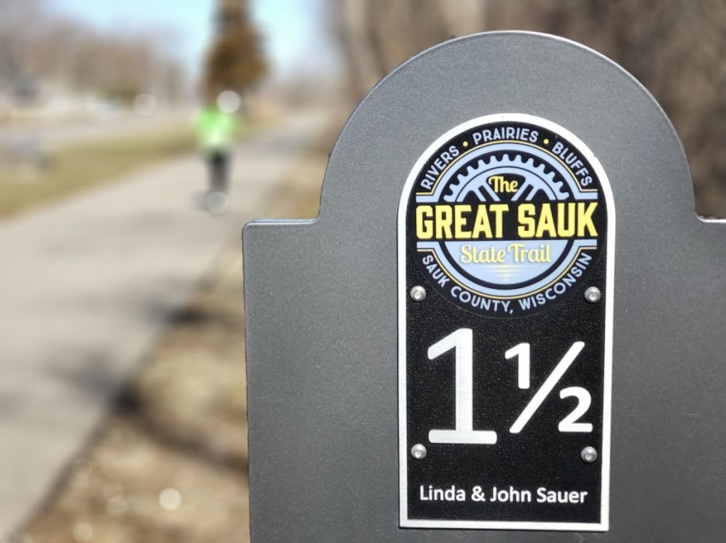
We would be following these trail markers all day long — AND LOVIN’ IT!!!! One trail reviewer commented: “This has to be one of the best hikes in central IL if not IL” — while we have not done a lot of IL trails, in our limited experience we completely agree!!
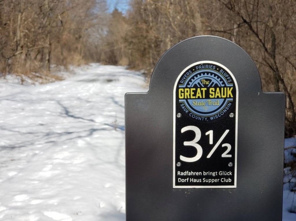
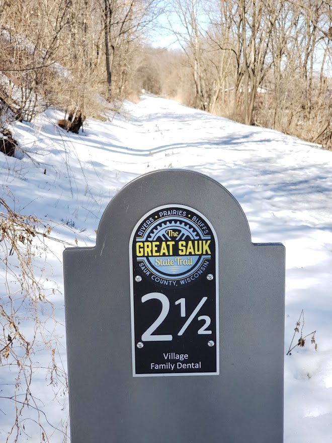
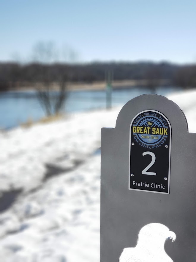
We were not even out of sight distance from our van before we started to fall in love with this trail. The views within the first quarter mile let us know we were in for a treat today.

There were way too many Canada Geese honking for our liking, but that was our only complaint! We hiked in and out and up and down not knowing what we were getting ourselves into. We thought this was going to be a pretty typical hike for us, but boy were we in for a treat. It had been raining for most of the last several days so we knew the trails might be a little muddy, but one thing we were not prepared for was the streams and creeks that cover this park. The first one we encountered was a simple bridge crossing.

We crossed the bridge and made it up the other side and followed some ridges for a quite a while and could see a small stream at the base of the ridge meandering its way through the little valley. It wasn’t until we made our way down the trail straight to the edge of the stream that we figured out — uh, oh, we had to cross this stream! The water was running pretty fast and there was no easy crossing point. There were some mostly submerged rocks to step on, but that was our only assistance in getting across. This is when we figured out that all the recent rains must have contributed to the water being just a little bit higher than normal. We made it across with mostly dry feet — but even if they got a little wet, it was not cold at all for our hike, so no big deal.

We then hiked up the hills and towards Deer Meadow — and true to it’s name we saw about 4 or 5 deer bounding through the woods. We then proceeded to a very nice path right along the stream that we had just crossed (at least we think it was the same stream). We followed this for half a mile going through some very pretty lowlands where plants were starting to pop up and something that we do not usually see in our hiking — vines! There were vines everywhere, hanging from trees, twisting around trees, bridging gaps between trees and vines wrapped around other vines. It was difficult to get pictures of all of those but we got a couple.

We continued up the trail following all the trail markers until we got to another (or is it the same) stream. The trail led right up to the edge of the stream and then turned right along the bank of the stream. The trail kind of forked in several directions at that time and we decided to stay right by the stream. We made it about 20 yards and the trail just….disappeared. OK, made a wrong choice on that one, so we backed up and tried a different branch — nope— ended up at the same dead end. So we made our way back to where the trail met the stream. It took us a while until we finally noticed the trail marks…on the other side of the stream!! This stream, or at least this portion of the stream, was running much faster and was much deeper than the last crossing we made. We took our time poking across it and again, made it to the other side mostly dry. It was awesome! These were the first two stream crossings we had done while hiking, most of the time there is some kind of “bridge” that you can decipher, but on this trail, you just have to kind of “wing it” to find your way across. Little did we know that by the end of the day we would be experts at it and Tammy would hear Mike repeat the phrase “Hey look, another stream crossing” about 47 times (and that is just a guess, but probably pretty close to accurate). Once we got across the stream, we noticed another hiker coming up behind us pretty fast. We saw him taking the same wrong turn down stream that we made – Mike asked if we should tell him, but we decided he saw us on the other side so he should figure it out quickly enough.

Once safely across and several pictures taken, we then had to go up, up and more up the trail. We climbed from the stream level up to the top of the ridge. This was a very steep and long climb. Luckily there were some steps to make it a little easier, but it got your heart and breath going!

We always laugh just before or after going up or down a big hill that pictures just never do justice to the hill. They always seem to end up just making it look like a slight incline (although Tammy astutely figured out that taking a pic of Mike halfway up or down the hill gives it some perspective — see below) . After stopping at the top of the huge hill we just climbed to try to catch our breath, Mike snapped this picture above. If you look closely at the red circle in the center — that is the hiker that was coming up behind us — this finally shows a little scale to the hill!!

Thankfully after that big hill climb we were in for some relatively flat hiking along a road heading toward a group campground. The hiker behind us caught up and we let him pass us. He made sure to comment that he might not have found that stream crossing had he not seen us on the other side. Mike had the trusty All Trails app pointing us in the right direction, so we knew that we were coming up to a spot where it looks like we would be making a big loop around a valley — but as would be the case many more times, we had to go down before we could go up again. Once on the top of the ridge we were just in awe of the valleys. They were HUGE! The elevation changes in the terrain were incredible — we kept commenting on how lucky were were that we were traversing across the top of the ridge and not up and down all those valleys. We finally made to the end of the ridge where Mike thought we just went and followed the ridge down the other side of all the valleys. (We also talked about how it might be fun come back and walk down through these valleys instead of just staying up on the ridgeline.) We made our way for half a mile down the ridgeline before Mike noticed two people and a dog WAY down below us headed in the opposite direction. Mike commented that they must be doing exactly what we were just talking about — hiking the bottom of the valleys. Little did we know that about 100 yards down the trail we would encounter a very steep descent into that very same valley. It was on this descent that we found out that they do not bug Mike at all, but Tammy is deathly afraid of them. (or at least afraid of losing her footing and falling all the way to the bottom)

Once we reached the bottom safely and the little stream that meandered there, we began a journey of many, many crossings of the stream. Some were simple little hops across the stream where it was 18 inches wide, while others were having to hop across on stones carefully placed, while yet others were mixtures of logs, sand bars and rocks. They were ALL a blast!! Some came within feet of one another. By the time we had made it to where we could (finally) see the Vermillion River the stream was getting wider, deeper and slower. But there were so many little cool crossings before we got there.

We finally caught up to the two men and their dog and found that not all hikers have the same “trail etiquette” as we do. We traversed up a big hill to find them standing at the top taking a rest. As we approached them and got within 50 yards of them we thought for sure they were going to step aside and let us pass as we were obviously hiking faster than they were. Nope. 😦 When we got even closer they turned and started hiking again. Their dog kept stopping to turn and look at us and the one man just kept egging the dog on. It was almost like the dog was saying “Umm, Dad — shouldn’t we let these people pass?”. We thought for sure they were going to step aside, but they never did. We had to finally say “Excuse us, could we pass?” before they stopped. Mike has since done some reading and apparently there is no true “trail etiquette” that says they should allow us to pass, but common sense says if you are hiking on a narrow trail and someone is moving faster behind you, you allow them to pass. It didn’t really matter because we were quickly approaching the halfway point of our hike where we were planning on making our way down to the river to enjoy our “happy hour”! We found a bench where we could sit and watch the river flow by while enjoying our bloodies and charcuterie meats that, while cold when Mike put them in the backpack, had gotten quite warm from riding right up against his sweaty back for 3 hours already. (We will have to come up with a better plan as the weather gets warmer) Didn’t matter — the view and the company were enough to make this stop quite an enjoyable break.

But a quick check on how far we had hiked so far (a little over 5 miles) and what our elevation gain was so far (around 400 feet) we knew we still had a LOT of trail and climbs ahead of us before we made it back to the van. So, once again, down the trail we went. Mike was convinced that we were mostly done with the stream crossings, but like he is so many times with these things, he was wrong. About a quarter mile down the trail was our first one — then we hiked right along the river for a ways where we crossed a couple more little streams that were flowing down from the hills to the river. We finally came to one that was a little bigger where the trail actually turned away from the river and we had to hike up the little valley that the stream flowed in and we saw a new bridge with a little waterfall under it. Mike remembered people commenting on this bridge and the hills on either side of it — supposedly they were pretty daunting.

We slowly made our way down the hill on the one side to the bridge. It was pretty darn steep! Mike made it down without falling and helped Tammy slowly down. Across the bridge was an almost straight up cliff of mud and tree roots. Luckily Mike has long legs so he was able to make it up (slowly) on his own and once again give Tammy a hand making her way up. Wow!! That little crossing was a fun challenge! That is what our Splorin’ is about — we do it not because it is easy, but because, at times, it can be difficult! This was something that we would have never attempted before splorin became “our thing” , but now we just take it in stride.

The remainder of the hike was kind of surreal. It was a LOT of up and down, and side hill walking. Never would have thought that there could be so many big valleys like these concentrated in one area — and every single one of them had little streams running down in their bottom. Mike was watching the mileage and we knew we were getting close to being done, but it always seemed like every time we were getting to a point where it would be nice flat and take us to the van we would run into something like this:

But we finally made it to the end and even thought we might have enough time to visit a winery (that is what kept Tammy going for the last 2 to 3 miles of the hike — the thought of the winery) before #SupperClubSaturday. So we quickly got changed and Mike started driving, heading for that winery.

On the way early this morning, Mike had mentioned that we might have some time to fill in between hiking and #SupperClubSaturday and that maybe there would be a winery somewhere around where we were going to be eating. Tammy heard that and quickly found Sleepy Creek Winery and also found out that they made something called “Winey Mary” wine. What is “Winey Mary” wine? They describe it as “This will make you re-think wine…and your life. Tomatoes and Jalapenos were fermented like any other wine but the result is a white wine that tastes like a very light Bloody Mary.” Mike, of course, was skeptical but we arrived at the winery with enough time to do a tasting and have a glass of wine so we got a tasting of 6 of their wines. A couple of the reds were interesting — but the Winey Mary stole the show. The wine by itself has the aroma of tomato leaves but the flavor and a little bit of the bite of jalapeños. It was quite interesting! They then had you try it with a little of their bloody mary mix splashed in and sure enough — tastes just like a bloody mary. We liked it enough to get 2 bottles. We had Easter coming up soon and that would make an interesting morning change up for a bloody mary!!! (BTW — it was awesome to have just by itself, no bloody mary mix needed. Drinking a whole glass, it had the zip and flavor that you would not expect out of a white wine).

We left the winery with plenty of time to make to the Possum Trot Supper Club in Oakwood, IL. “Possum Trot”? Yep, “Possum Trot”!!!! Before we talk about the supper club itself, we get so many people who ask us how we find our supper clubs and aren’t we afraid of picking a “bad one”? First and foremost — Google is our friend (occasionally friends IRL will also recommend places), searching for places is key. Once we have a general area in which we will be done Splorin’ we start looking. Mike uses Google Maps, while Tammy just uses straight out Google search. But we start with a list and start narrowing it down by reviews and websites and Facebook. And we have also been known to use websites like http://www.wisconsinsupperclubs.com. And we also have 2 Supper Club posters hanging up in our living room. Supper Clubs are serious business for for us! Sometimes they just jump out at you like “Possum Trot”. We have been known to pick places just based on the name! In this case (as in most) it is a combination of reviews, location, and whether or not they have certain food (prime rib is must for Mike, Tammy usually likes scallops; a relish tray is an immediate move to the front of the line, sometimes popovers). Then there is atmosphere. We like the “old fashioned Wisconsin supper club” ambiance. This usually means a nice big bar, big booths, a salad bar (pre-pandemic), dark wood walls, a candle on the table, etc. About being a afraid of picking a bad one? It does happen, but thankfully rarely. When it does, it reminds us that it is much more about the company that you have with you at the table than the food or drinks. Those just enhance the supper club meal, it really is about who you are there with!

So, back to this particular supper club — when we walked in we knew it was a winner. A great big horseshoe shaped bar and dark wood walls and we were shown to our very private booth. We sat right next to a huge salad bar that a couple of years ago would have been very busy, but this year was out of service. For cocktails Mike stuck with his tried and true whiskey diet coke and Tammy went on an adventure with a French 75 (gin, champagne, lemon juice and sugar (minus the sugar)). She loved it!! Mike got his usual Prime Rib and Tammy got a chicken something or maybe steak and shrimp….idk, but she will correct this upon editing. (Tammy’s memory is NOT as good as Mike’s, however, she DID take a picture this time and apparently she had an “oscar style” fish with brussel sprouts.)

We also had an appetizer — Thai Lettuce Wraps. Had we known it was just going to be a partial iceberg lettuce wedge with cashew chicken in a bowl we would have gotten something else. It was good, but WAY too sweet for our palates, and Mike’s blood sugar! Oh well. Mike’s prime rib was passible — not the best, not the worst and Tammys was pretty gosh darn good (if I am remembering it right). But once again, it was the company that made it awesome!

Soon we were on our way back to the hotel in Bloomington. Tired from the day we both fell asleep very quickly, so we could get up early the next day and do a little additional Splorin on our way home.

We left the hotel early the next morning we were heading for Matthiessen State Park in Utica, IL. It was a short 50 minute drive from the hotel so trying to find a breakfast place that still left us 30 minutes before arrival was a little difficult, but Mike found a little out of the way place called Lj’s Garden Cafe in Magnolia, IL. Magnolia is a tiny little village out in the middle of nowhere Illinois — it has a massive population of 302. Lj’s Garden Cafe sits right in the middle of downtown (as does everything else ;-)). Walking in you felt like you were walking into your grandma’s kitchen (if grandma actually had 8 tables there). All the tables were big, tables for 8, except one which had 4 chairs at it. It was obvious it was a little down home restaurant with living space above it (we sat right next to the steps to upstairs). The food and coffee was good! There was no coffee klatch but there was a big family around one of the tables and another couple of couples came in while we were there. ( the Sunday morning before or after church crowd) We were sure there was a lot of talk about us when we left, but….we would have it no other way!!!

Back out of nowhere and to the freeway, we were just 30 minutes from the state park. Interesting that we were going to Matthiessen State Park and never saw a single sign for it until the sign at the driveway. Its “bigger brother” state park, Starved Rock, is the big tourist draw and thus commands all the signs. (see our review 9/19/20) We were just going to be doing a short hike today (about 2.5 miles or so) so that we could get going on our long drive home. As such, we stayed away from the more “touristy” areas of the park (there are several waterfalls) just to try to stay away from people. We will be back down this way again and can do those other areas when we have more time and better weather allows. Where yesterday was bright and warm, today was chilly, windy and threatening to rain – but that doesn’t stop us!

Interesting thing to note — hiking the trail yesterday on the eastern side of the state, we were on the Vermilion River — Matthiessen State Park is also on the Vermilion River (although they are NOT the same Vermilion River). Yesterday the Vermilion River was in Vermilion County that flows south into the Wabash River, while today’s Vermilion River flows north into the Illinois River. Mike is surprised these rivers don’t get identity complexes within the same state with the same name.

The reason we could not go to this park before was the storm that came through in August of 2020. Lots of tornadoes and just straight line winds reaching over 100 mph. The cleanup obviously took a long time and is still ongoing. While it is amazing to see all the trees down, it is equally amazing to see all the trees still standing. So many lost their battle with their roots while many others survived. Heading down towards the river we walked across a ridge high above the water, still just in awe of all the trees down. With no leaves on the trees you could see deep into the forest to see them all lying there.

Once we descended to the river level we were down below some limestone cliffs that look like they took a beating during the storm too. We even found a tree that survived….barely.

Once down on the river it showed off it’s beauty. While the weather was cold and windy, the river was calm and gentle, but still moving with gusto. We can only imagine what it would look like in the middle of summer with all the trees leafed out and bushes growing along the shores.

Since this was a short hike we were already making our way back to the van. We came across a couple of places where the trails were still closed because of storm damage so we had to adjust, on the fly, the route we were taking back to the car. Even though the trail we were on was still open, there were a couple of very large trees blocking the way here and there, but they were in no danger of harming anyone on the trail, just a nuisance that you had to go around them.

We were soon back in the car and on our way back to God’s Country. Back to real life, Henry the pupster and work.

Just call me Butch (3/20/2021)

This was a hike we’ve done before, but a ‘Splorin trip is not always about finding some place new.  Sometimes you have to head back to places you’ve already been to but at different times of the year just to see how different they are in the different seasons.  Perrot State Park was on the docket for today and it is a park that we will go back to many, many times.  Not only is the scenery utterly amazing, the elevation gains on the hikes are really a really great workout! AND it is only 90 minutes away!!

But sometimes even the best made plans go a little sideways.  Breakfast this morning was supposed to be in Tammy’s parent’s hometown of Fountain City, WI at the Wing Dam Bar and Grill.  However, Mike messed up on what time they opened and we found out that we would be arriving a little too early.  We quickly regrouped and Tammy found us River Ratz Saloon in Buffalo City, WI that opened at 7AM. 

The only problem was that the website said they opened at 7, but they didn’t “really” open until 8….oh well, there was a line of people waiting to get in when they finally opened the doors so we weren’t the only people who checked the hours online.  I don’t know if you could really call it a coffee klatch, but you could call it people who knew each other and sat at the bar drinking coffee and catching up on their local stories.  The restaurant was wonderful and the sayings that were posted all over the restaurant were hilarious. Including the ones on the wall on the outside of the building.

Tammy has a thing for taking pictures in bathrooms and Mike usually scoffs at that, but this time he had to take the picture in the guy’s bathroom as we were leaving.

With that, we were off down the road in search of Perrot State Park and some hills to climb.  It was supposed to be an absolutely beautiful day — mid 50s and sunny.  Mike had already said he was going to be OK with the thought there would probably be a lot of people, but all y’all out there that know Mike and his hiking style know that is a lie. ;-).  We parked and were the only car there….for 30 seconds.  Another car pulled in and two ladies jumped out and started up the trail in front of us….ugh, Mike was already perturbed.  But they were fast and were talking about “stress-induced incontinence” when they walked past the van, so maybe they were in a hurry looking for a bathroom?

The trail started off a little rocky with some compacted snow and ice, but we soon got beyond that ugly mess to some beautiful views.

This was Brady’s Bluff Trail.  Anyone who has been to Perrot knows that this trail goes straight up hill.  You got up about 500 feet in about half a mile.  Is a very strenuous workout, but the views you get on the way up are outstanding!

When you finally recover from the hiking straight up the side of the bluff, you could sit and look out at the view for days.  Nothing can prepare you for the beauty.

The only thing you can’t do when re-visiting a park is hike the trails in the same manner again.  While we started doing the immediate climb to the top of Brady’s Bluff the same way from the same parking lot, instead of going off the back side, Mike had a plan to take us down the front to the park office.  So after a quick respite to enjoy the view at the top, we were on the move again.  We encountered a couple of people heading up on our way down, but not too many.  The trail is so steep you have several switchbacks that you have to traverse.  One of them is in the middle of huge grass field on a very steep section of the hill.   This picture looks like the camera was twisted at an angle, but I can assure you it was level.

Mike thinks this was the inspiration for the “As you wish…” scene from “The Princess Bride”, but he thinks a lot of crazy stuff.

We made it to the park office to find that the parking lot there was already completely full.  Ugh, Mike’s patience would be tried today, but we headed back up the Perrot Ridge Trail in the reverse direction we took last time.  We passed a nice little waterfall and some obvious storm damage where they had to reroute the trail because trying to restore the trail would have caused more damage than just rerouting it.  Unfortunately this portion of the trail was a very long and consistent climb up.  Where Brady’s Bluff is a blast of straight up, this was a long drawn out up where you never really got a level stretch to catch your breath. 

The top of Perrot Ridge is as equally breathtaking as Brady’s Bluff.  However, the climb down the front of Perrot Ridge is NOT for the faint of heart.  It is climbing straight down some very steep sandstone rock faces.  As we neared the bottom we saw someone coming up the trail who stopped and exclaimed “Well, hello to my favorite hiking couple!”  It was a friend from Eau Claire, Lucinda.  We’ve joked before that she must “follow” us as she seems to travel to places we have been recently, but this time we coincided at the same place!  What a small world!

We still had to ascend and descend Brady’s Bluff one more time, so after our quick conversation with Lucinda we were off yet again.  Climbing up the back of Brady’s Bluff is actually more strenuous than going straight up the front.  There are no steps on the back side so it is all uphill hiking on some very steep sections.  We huff and puffed but made it to the top.  We had decided to go back down the same way again rather than go down the stairs that we had taken on the first trip to the top. Tammy was concerned about the potential to meet a lot of people on the those narrow stairs and the difficulty passing them so we opted for the “safer” option.  Once we made it back to the park office we decided to walk along the Riverview Trail on a different section than we had done before so it was worth it!! We also got to walk along the railroad tracks and even got to see a train pass us

We were both pretty tuckered out and ready for our “happy hour”.  This week’s happy hour was going to be a little different.  Rather than sitting in the car and enjoying it, Mike brought a little charcoal grill, camp chairs and our new bluetooth speaker and we were going to head to our campsite where we will be staying at the end of June and enjoy a little picnic.  However, when we got to the campsite there was actually someone camping in the one right next to it — so in order to allow them their privacy, we went to the next campsite up.  We enjoyed our time enjoying the view, drinking, eating and listening to music.  But, we had more hiking to do!!

We were going out on the ski trails.  We knew there were some fairly big hills along this trail, but we were ready (or so we thought).  As we started down the trail at the first junction point where we were going to turn, the trail was closed.  A little further down the main trail was closed too.  We thought for sure these were closures for skiing and not for hiking, so we went around the signs and kept going.  We then hit our limit — there is a very long and fairly steep hill on this trail called “Tow Rope Hill”.  By the time we got to the top of that we decided to re-evaluate what we were doing.  We knew the big loop was very strenuous and maybe just a little too much for us to get done and still make it to dinner, so Mike re-planned us a way back to the van that wasn’t quite so long or hilly.  We made it back to the van with plenty of time to get ready for #SupperClubSaturday.

Again in the “we’ve done this before” theme, we were heading back to Arctic Springs Supper Club in Galesville, WI.  This is an awesome little out of the way supper club that we stumbled upon by accident a couple years ago.  It is situated on a lovely little lake that we have never seen as it has always been dark when we’ve been there, but the waitresses have always told us how beautiful it was.  We arrived with enough time to sit at the bar and have a drink.  We joined two older couples at the bar and listened to the stories they were swapping — it was almost like a coffee klatch with cocktails.  After a while one the gentlemen looked at Mike and asks “Are you Butch?”  Mike just looked back and said “Nope, we’re from Eau Claire!”.  The gentlemen’s wife said “I could have told you that wasn’t Butch, because that is not Butch’s wife!”.  Mike being the smartass that he is, said “Well, don’t call Butch’s wife and ask her if Butch is around — maybe he is out fishing”.  We all had a good laugh — I guess we are going to have stop calling them “older” soon and start calling them “peers”.

The drive home was, thankfully, uneventful. Time to start planning ‘Splorin for our trip to Illinois!!

Milin’ it around Menomonie (3/13-14/2021)

Anyone who reads this blog realizes the amount of planning Mike puts in to make everything perfect for our Splorin’ adventures. This weekend proved the old Yiddish proverb “Mike plans, God laughs”. Mike had a plan for us to go to breakfast in Gilmanton, hike the Red Cedar State Trail from Downsville to Menomonie, stop and do happy hour in Menomonie, hike back to the van, then head to a supper club in Ellsworth, WI. On Friday we took the van in for an oil change and tire rotation and when we were called to let us know it was done they also let us know the coolant was half empty. A refill and pressure test later let us know the radiator would have to be replaced at a cost of $1100. This is our old, not so trusty 2006 Chrysler Town and Country van. It was determined that this was the time to let her go to the great junkyard in the sky and for us to replace her. We decided to still ‘splore on Saturday and go van shopping on Sunday, but a quick survey showed us that would not work as no place to buy a van is open on Sunday. Some quick research Friday evening led us to one particular van and we decided to go as soon as the used car dealership opened Saturday morning to see about it. 3 hours later we were walking out with the keys to the new van and a chance to still do some abbreviated ‘Splorin for the day!!!

Luckily we had already talked about the Lake Menomin Loop trail that goes around (oddly enough) Lake Menomin in Menomonie, WI. So after getting everything squared away with the van, we were ready to ‘Splore. This was an 8.3 mile loop. We decided to start with Happy Hour since we were already starting our splorin’ day a little late and stopped by Waterfront Bar and Grill where we had amazingly good bloodies and some appetizers (spicy naked wings and spicy cheese curds). We were then off to conquer the trail.

This was a really nice and easy walk where, once again, we could avoid some of the nasty “pre-spring” trail conditions. When not walking on the sidewalk or streets, the trail is fully paved. It winds its way around the lake, sometimes close to it, sometimes far from it, but it was a lovely “pre-spring” day to enjoy the weather and some fresh air!

We made our way around the lake and you would think getting lost would be out of the question, but alas not for us! At the trailhead in Wakanda Park, it was not clear where the trail actually started. So when we got to the end of the trail, we didn’t know where to go to get back onto the start of the trail. We eventually figured it out, but they do need to do just a little better job with trail markers there.

We did still enjoy a #SupperClubSaturday dinner at one of our old favorites — Jake’s Supper Club. We have been here many times. First with Tammy’s parents for some family celebration, then for Senior Prom, then several of our own family celebration and taking pictures for our kids Proms. Last time we were here however we got stuck at a table in the bar and the food was not that great. This time, thankfully, we got a nice window table with a view of the Red Cedar River. We walked down on the deck by the river and grabbed a couple pictures before we left.

That is typically the end of our blog entry as #SupperClubSaturday usually completes #SplorinSaturday — BUT WAIT! Don’t stop reading yet — this entry is a TWOFER!!!! (I bet you didn’t know twofer was actually a word….but, yes, yes it is!). We decided to push our plans for Saturday to Sunday (well at least the breakfast and hiking part)…this is not all bonus edition of a #SploringSaturday blog entry!!!

We started with breakfast at Donna Mae’s Panther Cafe in Gilmanton, WI. We thought since it was Sunday we probably wouldn’t see a good ‘ole coffee klatch and we were right, but when we pulled up and saw ALL the cars we thought for sure we might be in trouble. Turns out everyone must have driven their own (or maybe two) vehicles. There was a just a single family eating breakfast. The food was awesome, the coffee was OK (what I think we have explained before we would call it “airport coffee”). It was a perfect fuel up for our day!!

The Red Cedar State Trail is a 14.5 mile trail that stretches from Dunnville to Menomonie. Since we were doing out and back hiking, we started about halfway up the trail in Downsville and hiked to Menomonie.

While those pictures make it look like we started at the beginning we actually went in reverse to start. We knew the trail might be a little muddy and when we started we could tell it certainly HAD been muddy.

There were very deep foot prints, but they were in frozen mud along the trail. One of the “perks” of starting early in the day. We figured we might be in trouble if that thawed out for our way back. We quickly came to a bridge across the river — and boy was the water flowing fast!! There had just been some rainfall and snow melt, so the water level and speed were up.

The trail was really nice two-track with lots of room to walk. There was a little ice and softer spots, but nothing too difficult at all. The scenery was absolutely breathtaking though! The trail parallels the river for the entire route — there is never a time that you cannot see or hear the river.

At one point in the trail we came across three Sandhill Cranes half a mile up the trail. As we got closer they kept moving up the trail until they finally went off into a marshy area and began their very distinctive loud, rolling, trumpeting sound to indicate their displeasure that we disturbed them on a such a beautiful day.

A little further up the trail we saw some beautiful rock formations that apparently were signaling some not so great trail conditions to come. You can see in the picture a little bit of snow/ice on the trail.

What you can’t see is that the snow/ice stretches for a about half a mile and was very treacherous. This trail is used and groomed for skiing in the winter. This particular section of the trail gets almost no sun all day long so it take a long time to melt in the spring. We did our best to stay upright by walking the edge of the trail. Even in the middle of this section there were some pretty amazing rocks (that were obviously blocking the sun from the trail).

A little further up the trail was a gorgeous stream cascading down into the river.

Up around a bend in the trail we could see more snow/ice. We were worried this would be yet another dangerous section of slipping and sliding. But as we approached we saw that it was melting ice from the bluffs. In this area of Wisconsin we see a lot of this in the winter where water moves through the limestone and when exits in winter it makes beautiful ice formations. These were the remnants of those. The pictures in no way do justice to the formations now as they are melting from the back to the front. So, these were actually like ice “walls” that had space between the bluff and the ice. There were large chunks that had fallen out onto the trail, so you really did not want to linger too long and look.

We made it to the beginning (our end) of the trail and walked the mile into downtown Menomonie for a stop at the Log Jam Bar and Eatery on Broadway St. We had a couple of bloody marys and some food (bunless burgers and salads). The burgers were unremarkable, but the salads were very good and very large! Our break was too quickly done and we had to get back out on the trail.

The remainder of the hike back was equally breathtaking. It always amazes us that you see such different things on the same trail just by walking the opposite direction. The trail conditions actually improved for the hike back. The areas that were a little muddy on the way up had dried out (the compacted ice/snow was still ALL there but a little easier to maneauver since we had done it once before) and we didn’t have to do as much walking on the side of the trail as we did on the way up. We got to one section where there was a large cut corn field to our right and we heard this very loud echoing cackling. At first we thought it was more Sandhill Cranes, but it ended up being turkeys — their gobbles were echoing off the bluff walls. We saw a group of about 10 – 15 streaking across a field. Not sure if they were running from us or if something else spooked them, but they were moving fast!

A little further up the trail we were surprised when about 50 feet in front of us a big turkey ran out onto the trail and began to run away from us. Followed by another, and another and another and still yet another. Five turkeys came out on the the trail. The last three ran for about 10 feet and then flew off towards the river. Mike commented it was like clowns coming out of a car — they just kept coming. Mike yelled off into the woods to let any more turkeys know it was time for them to go, none responded. But, another 50 yards down the trail there was one more left that took off flying instead of running and flew right across the trail in front of us.

We made it back to the van in time to head back to Eau Claire to pick up our weekly groceries…yawn. It was still Sunday afterall. What a terrible ending, but hopefully you’ll come back to see where we ‘Splore next weekend!!

Huffin’ and Puffin’ on the Great Sauk Trail (3/6/2021)

“Pre-Spring” continues in Wisconsin and so does our loss of appetite for mud and snow. But Mike’s appetite for Prime Rib helped with the planning for this Saturday. It is the first Saturday of the month and any real Prime Rib fan knows that means “All You Can Eat” Prime Rib at Arthur’s Supper Club in Spring Green, WI. We did #SupperClubSaturday there once before and Mike could not stop talking about how good it was, so…..we’re heading back. Searching for paved trails around Spring Green, Mike came across the Great Sauk State Trail in Sauk Prairie, WI. This was a trail that we never knew existed. Even more interesting is that the northern end of the trail was in the Sauk Prairie Recreation Area — another place we never knew existed even though we have driven past it many, many times. This sounds like a #SplorinSaturday adventure in the making!!! Researching the trail we found it is about 10 miles long and stretches from right in downtown in Sauk Prairie all the way out almost to Devil’s Lake State Park. The only problem with the trail is that it is not plowed in the winter (or pre-spring). The weather the whole week before we were going was very warm with temperatures in the mid-40s — surely that meant the snow would be melted, right? Mike reached out to a “Friends of the Great Sauk Trail” Facebook group to get some more information on where to park, etc. He received a couple of replies including one on Friday afternoon where one of the members drove out to see what the end of the trail looked like where we were starting — they said the trail was partially snow-covered, but that we could get to where we wanted to start — Splorin’ is on!!!

The plan was to do about 18 miles of walking (uooing the 18 mile total we did last week) broken into two parts from the far northern end of the trail to downtown Sauk Prairie, stopping somewhere to have our happy hour and some appetizers, and then walk all the way back out to our van. Averaging 3 miles per hour would mean a 3 hour trip down and back, with 45 minutes to an hour for our break — this was going to be a LONG day on our feet. And in order to get that long day in, it meant leaving early…as in 5:20AM early. The plan was to stop at Bender’s Family Restaurant in Elroy, WI. We tried stopping here last fall but they were closed. We are sure glad we came back! The food was amazing but the service and the cuteness of the owner pushed this restaurant way up on our list of favorite breakfast places. The motto of the restaurant appears to be “Because Nice Matters” — and there “nice” was plentiful. The only thing we were really missing there was a nice coffee klatch. But given that we got there just minutes after they opened, it was understandable that the older gentleman of the area were waiting to arrive.

Just like the Great Sauk State Trail itself, the roads in the Sauk Prairie Recreation Area are not plowed in winter, furthermore it is an old ammunitions factory ( Badger Ammunition Plant, the largest ammunition factory in the world during World War II, and the Korean and Vietnam Wars) that was donated to Wisconsin and various other organizations where the roads have not been improved….at all….since the 1960s/70s. So the pavement is falling apart, there are large pot holes and in general you cannot drive more than 20mph on the roads. The 5 miles we had to drive to our parking spot took us about 20 to 25 minutes, but we made it. Before getting to where we were parking we crossed over the trail once. We didn’t know if the snow would be melted on the trail and we could wear our shoes or if there would still be snow and we would have to wear boots. The one crossing told us all we needed to know– boots would be in order; there was still lots of snow on the trail. We began at Rescue Point 5S. A little unnerving that it was labeled as “rescue point” but we’re brave, intrepid explorers, we don’t scare easily (unless there is a sheer cliff or bear, or river crossing on rocks nearby).

Down the trail we went. It was pretty easy walking for the first 1.5 miles. We passed by a nice Ho Chunk Nation mural that was attached to some solid concrete remnants from an ammunition plant built or mechanism of some kind. The trail was mostly bare with little sections of snow here and there. Mike (foolishly) commented that he thought he would wear his shoes on the way back if the rest of the trail remained like this. (They were packed in the backpack)

But as our luck always has it….

That escalated quickly!!!!! The next mile was about 6 to 8 inches of snow that someone, with presumably a 4×4, drove through. At first we thought those nice tire tracks would be easy to walk in, but we quickly found out the bottom of the tracks were pretty darn icy. Thankfully it froze over night and the snow was still fairly solid so we could walk on top of it without falling through for the most part. At the next intersection with a road, the tire tracks went a way and the snow began to get a little more soft as the temperature kept rising. So the next 1.5 miles was pretty challenging and quite the workout. Walking through 6 inches of sloppy snow is no fun. After that stretch, we came to a blessedly clear section for another mile.

The rest of the way to downtown Sauk City was pretty snow covered but, as Mike correctly suspected, as we got closer to town the trail became more heavily used and thus the snow was pretty packed down making it much easier to walk on. It was a very pretty walk along the Wisconsin River; we didn’t see any eagles but every winter they block off a portion of the trail because the Bald Eagles roost in the trees there while they fish below the dam. We were definitely getting tired as we approached downtown. The plan had us spending 45 minutes at our “happy hour”, but given the extra time it took us to get there due to snowy trail conditions. and likely the extra time to get back, we really only had about 30 minutes to spare.

We arrived at the Vintage Brewing Company in Sauk Prairie excited to finally get the chance to sit down and rest our weary feet. As luck would have it, again, we were told it would be 10-15 minutes for a table. We looked at the bar and there were seats and tables available and were told these were first come, first served…PERFECT!! We went and sat down and our feet sighed with relief (ok, maybe our feet didn’t, but we sure did). We had some cheese curds and “Rip Rip Chicken” which really just turned out to be boneless chicken wings made out of chicken thighs. Both were VERY good and were accompanied by a bloody mary of course (two for Mike)! Our short respite soon came to an end though and our feet began screaming at us to sit back down — but, we don’t respond well to being screamed at, so we kept going. We knew what we were in for and wanted to get to it.

The first 4 miles were a piece of cake, but we knew the next 3 were going to be difficult. Turns out the section that was pretty sloppy on the way down had melted a little bit more and we were able to make our way through it a little easier than on the way down — we could walk from patch to patch of clear space and the non-clear spaces were not so deep this time. We were focused on what it would be like when we got to the “tire track” section. We knew there would be no way we could walk on top of the snow as we did on the way down and we hoped the tire tracks were no longer icy on the bottom. We were so focused on looking ahead to that section, we completely missed a runner coming up behind us and he nearly gave us both heart attacks when he passed us! Unreal, here we were complaining about the conditions on the trail walking, and he was running on them! Wow! When we got to the tire track section we were correct about not being able to walk on top of the snow and thankfully were also right that the ice was gone and the tire tracks were just a little bit wider than they were on the way down. Better but still kind of “balance beam” walking in the tracks –but certainly doable if a bit awkward at times!! When we got to the end of the tire track section we noticed the stark difference of the trail being in a wooded area vs. being in a wide open area. You can see immediately across the road the trail is almost completely clear.

No matter, we were about a mile away from being done and our feet were rejoicing!! We made it back to the van with about 10 minutes time to get changed and ready for #SupperClubSaturday.

On the way to Arthur’s we saw about 764 deer (okay maybe less than one hundred, but there were a LOT!!!). Thankfully all were well away from the roadway. We also saw several Sandhill Cranes — Mike has converted Tammy into a Sandhill Crane fan — YAY!!! We made it to Arthur’s with enough time to stop for gas and purchase some of Mike’s “little blue pills” (no, not those – Naproxen Sodium, aka Aleve). The all you can eat prime rib was just as fabulous as Mike remembered it, however not being able to have the salad bar was a bit of a let down (but understandable). We will definitely be back sometime in the future (and most definitely on the first Saturday of the month).

Can’t wait for next week!!!! (insert eerie foreshadowing music…..)

Mashin’ Madison (2/27/2021)

In Wisconsin we call this time of year “Pre-Spring”. It could also be called “Post-Winter”, but since the Wisconsin state motto is “Forward” we are always looking forward (and by the end of February you can get quite sick of Winter). When you think of Winter you think of snow, snow, cold, more snow and more cold. When you think of Spring you think of plants blooming, flowers popping and opening, trees budding and then leafing out. So “Pre-Spring” (or “Post-Winter” for you Negative Nellies) is characterized by melting snow, ugly black snow banks, messy yards and, of particular interest to us, muddy and very messy trails in the woods. We’ve done lots of mud hiking before; we’ve mentioned it many times in the past here — Tammy’s lost a shoe (well, it came off, not really lost), we’ve hopped from rock to rock trying to keep our feet dry on flooded trails and most recently had to turn around when the good Lord didn’t will it and the creek did rise on us at Roche-a-Cri. Why talk about “Pre-Spring” and mud-hiking? Because this year we did not want to do it!!! So, instead of mud-hiking we looked for places where we would have paved trails that would be nice and melted. Our attention turned toward Madison, WI and our “bonus daughter” Angela. We hadn’t seen her since this whole pandemic began, and we were excited for the chance to see if she would want to do some walking with us. We called and she said yes!! Mike pulled out trusty “All Trails” and found……nothing. So he started hunting around and found there was a trail that circled around Lake Monona that looked to be 11 miles long. We could do that! However, Angela, miss cross-country-running-training-for-a-triathlon, thought walking 11 miles with us was a little too much. We decided to get to Madison early and go for a shorter walk with her and do the 11 miles just the two of us after “Happy Hour”.

Since it was a longer hike to get to Madison (get it?) we were out the door at 6AM. The plan had us stopping at the Broadway Diner in Baraboo, WI. This is an awesome little “shiny diner”. When we got there we thought it felt just like eating at a quaint little diner in New Jersey. Then we read the history and found out the diner actually used to be in Groton, CT and was move to Baraboo in 2005. It was built originally by the Patterson Vehicle Company in Patterson, NJ — so our feeling was right on track!! That is how well this diner was restored! If the diner itself was done that well, the food should be phenomenal too, right? Right? Well, yes it was!!! We finally found a restaurant that would take us outside of our comfort zone to order something we don’t usually have. Tammy’s was the closest to a “normal” breakfast — she had the Farmer’s Market Benedict Scramble (minus the corn bread) and Mike had the Country Benedict Scramble (minus the potato pancakes) and both of us had awesome salads. Seriously — look at the menu, if you make it to Baraboo it is imperative that you stop and eat here.

We were then off to Madison to pick up Angela. We stopped by her apartment and anxiously waited for her outside. We saw her come bouncing across the street and she hopped in the van and it was like we never missed any time with her. Stupid COVID means no hugs and having to wear masks, but just being able to see her, walk and talk with her was very uplifting. She is such a breath of fresh air and always good for lots of smiles and laughs. We headed towards the Henry Vilas Zoo for a quick one hour-ish walk. We had already been to the zoo, and it was pretty busy so we were just looking for some nice walking. Turned out this is the kind of walk we absolutely adore! It was through older neighborhoods with most houses having been renovated to keep their old style, their historic charm. It is amazing the houses that were built and how unique they all are. We ended up near campus where the houses are still old and full of rustic charm, but had touches that only students can bring to the mix: bikes, beer cans, camp chairs and evidence of their taking time off from their studies to have a good time.

Our walk came too quickly to an end, but it was awesome catching up with Angela. As we took her back to her apartment, it was not “goodbye” as we were going to take her along with us to #SupperClubSaturday later that afternoon. Lake Monona was calling….but not hard enough to draw Tammy away from a quick trip to Trader Joe’s. Mike has 2 go-to items at Trader Joe’s: their 85% chocolate bars and their ultra dark coffee and he had been out of both of those for quite some time so he was also pretty ok about making a stop too. We picked up some of Tammy’s favorite items too: green goddess dressing, balsamic glaze and some other unique items. Finally we were off for Olin Park to enjoy our quick happy hour before our walk around the lake.

Mike always has us planned almost down to the minute. Today the 11 mile walk around the lake should take us about 3.5 hours without much of a problem. He even had it planned down to if we had enough extra time before we had to pick up Angela, we could park and walk around the area by her apartment. After the bloodies were gone we walked off down the trail. The first part of the trail was pretty gosh darn…..boring. Standard walking trail in a city — cars on one side and snow and businesses on the other. Thankfully this did not last for long as we quickly moved on to a little road along the lake. Here we had nice houses on one side and absolutely gorgeous, amazing homes and smaller cottages on the other lakeside. It was interesting to see the differences among all the houses and cottages that circled this part of the lake. They ranged for upgraded houses that were worth almost a million dollars to unimproved cottage-style houses that have most likely been in families for generations that were only worth a paltry 750,000 dollars. This was one of the first nice days of Pre-Spring so there were LOTS of people out and about. Most on bikes, (this really was a bike trail after all) but there were plenty of walkers like us too (most were probably not “dumb enough” to try to make it all the way around the lake though). We were making pretty good time and enjoying all the houses, Mike even added a little 1/2 mile detour to go down another loop just to see more lakeside houses (insert loud, reverberant fore-shadowing music) because “we had plenty of time.” The view across the lake made it look HUGE!!! You could see the Capitol on the very far side of the lake. It was pretty magical.

One of Mike’s favorite things to do when walking past big, old or unique houses is to whip out his phone and pull up Zillow just to see how much the houses are worth. We passed by a couple that we just had to know — they were both $2.5 million. WOW! However, the crazy thing that Mike found was the property taxes that were being paid on those $2.5M homes as $50,000 a year!! YIKES! The monthly cost of that property tax is several times what we pay for our mortgage PLUS our property tax. Wow….even if we were gifted that house we would not even be able to afford the property tax.

We eventually popped up a little off the lake and right past somewhere that we had been many times — Monona Grove High School. We spent plenty of Saturdays there at show choir competitions over the years. We then walked along the main drag of Monona Grove and eventually made it back down by the lake. Looking at how far we had come, about 8 miles, and looking across the lake we both kept saying…”that looks so much farther than 3 miles to go”. Once again Mike whips out his phone and opens Google Maps — we had 5 miles to go….WHAT?!?! But that would mean our walk would be 13 miles…it was only supposed to be 11 miles? That’s it — one of Tammy’s favorite sayings “Trust the Google” just got thrown out the window, because it HAD to be wrong!. How were we off by 2 miles! Well, we had 5 miles to go and a little over an hour and a half to get there. We had better pick up the pace. Wouldn’t you know this was also the time that we started to get into some sloppy sidewalks and had to walk across a snow covered field — passing by some cool drum music by some percussion group in a park. We wish we could have stopped to see exactly what was going on, but just walking past was cool. Tammy texted Angela saying that we would be later than our planned 4PM to pick her up — she said no problem she was still working on a group project. Once again we were on the path of really cool old houses. We may have picked up our pace, but we still enjoyed all the old houses that we got to admire on our walk.

We talked about stopping and taking an Uber back to the car so we would not be late for dinner; we were trying to get to the car at 4PM, so we could pick up Angela and be to the restaurant at 4:30PM, but neither of us really wanted to do that. We hoofed it!!! We finally made it back to the van at 4:15PM. We had time to pick up Angela and make it the restaurant by 4:40ish — only ten minutes late –that was a miracle!!!

We jumped in the van and took off for Angela’s apartment. Tammy texted her on the way and said we would be there about 4:25 — this was going to work, we would only be about 10 minutes behind! But, as luck would have it, Angela ended up running late too. She gets done with her team project, drops her books at a friends, grabs a long board and starts riding back to her apartment about 4:40.

So we arrived at Toby’s Supper Club at 5:03PM. There were a LOT of cars which is what we were afraid of since they do not take reservations. Angela ran in to to see if they could seat 3 anytime soon and as luck would have it, they had room for us! We were seated and quickly started into more talk of times gone by and times to come.

We got our relish tray and were also treated to one of the “Angela-isms” we have come to love so much over the years. This young lady is one of the smartest, most “put together” people I have ever known. She is also rather….. naive and well, not too savvy. When they set the platter down, she kind of looked at it quizzically and asked Tammy, “What are those red and white things by the carrots?” “Angela. those are radishes!” She was completely taken aback! “Can you eat them or are they just for looks?” At this point, we just didn’t know what to say so Tammy just took a bite. Angela actually enjoyed her first taste of the “exotic” radish and we have another Angela story to add to the archive. We also had some awesome cheese curds! Sadly they did not have Prime Rib, so Mike had to settle for a T-bone steak, Tammy had steak and shrimp and Angela had the fish fry. Unfortunately while both of our steaks were done perfectly, both lacked seasoning. A perfectly cooked med-rare and rare steak with no seasoning isn’t very appetizing. Sadly where this supper club delivered so strongly last time were here, this time it was a swing and a miss. 😦 Unfortunately we will not hurry to get back here again. But where the food failed us, the conversation was awesome. We sure do miss our time with Angela!! The evening was too soon done and we were taking Angela back to her apartment. Bitter sweet to have to say goodbye again, but we are sure we will see her sooner than we did between now and the last time.

The drive home was long, but thankfully uneventful.

Tramplin’ the Trempealeau (2/20/2021)

We apologize for the delays in getting blog posts out….Mike writes them and hasn’t been “in the mood” for writing lately – but we’re going to catch up again!!! It is a good thing his memory is much better than Tammy’s.

Splorin’ had to take a two week hiatus as Tammy ended up on quarantine due to a possible COVID exposure through her job as the school-age teacher at a childcare facility. Luckily her test was negative and all was well, but it meant we had to stick around home and couldn’t get out and do #SupperClubSaturday anyway. Also, the past two weeks happened to be a bit of a cold spell here in northern Wisconsin where the low temps hit -24 degrees F and the wind chills were in the -30 degree range. So all-in-all if we had to take two weeks off — those were good weeks to take a break. 😉

Finally the weather was going to “warm up” a little. This particular Saturday, the high was supposed to be around the mid-20s; perfect weather for Splorin’ to return. However, as often is the case, we get a little too focused on the mid-afternoon temperature and forget it has to start somewhere a little lower than that. Today, it was a LOT lower than that. When we left the house at 7AM it was -12F — WHAT?!? We were ready for it to be a little cold, but surely the temperature would go up quickly, right? On our way to breakfast it kept going the other way. It was a nice little game we like to call “call out the temps in the car” (kind of like “My cows” for those of you playing along at home) — where every time you glance and see the temp has changed you call it out. We were headed for Blair, Wisconsin this morning so we had lots of hills to go up and down. As is often the case in the middle of winter in Wisconsin, the temperature goes up on the tops of the hills and down at the bottoms where the cold air pools if there is no wind. Most of the drive it would go between 0 and -16, although we hit -17 and even -18 for the briefest of seconds (Tammy saw it, Mike never did).

We arrived at Rainbow Restaurant in Blair, WI just before 8 and there were several cars there, but it was not overrun with people. Unfortunately there were no Saturday morning older gentleman’s coffee klatches going on, but there was a “family reunion breakfast” going on at a table across the restaurant. It was couple, plus another woman. The man and the extra woman were reminiscing the way old family does — about George and his family, the family down the road, being left alone at home when they were 8 years old and being scared out of their minds, etc. The conversation got quite lively with raised voices and laughter — seemed like they hadn’t seen one another in quite some time. It was nice to see and hear! The man’s wife just sat there and nodded.

As is often the case in these COVID times the restaurant did take measures to ensure a little bit of social distancing. Every other booth was blocked off — to be honest, the blocked off booths were just covered with stuff like extra chairs, decorations, etc., but they were unavailable for seating. Around 8:15ish or so the masses started to arrive. When we got to these small town places we kind of always feel like the outsiders (probably because we are) and feel bad because we are probably taking someone’s regular table. Soon a family of four with two small children showed up with the dad already telling the kids that yes indeed, they could have pancakes. Another couple arrive and took a booth by the window. Two older gentlemen came in and took the last booth — the restaurant was now full. It should be noted that there was ONE waitress. She seemed oblivious to the amount of people that kept coming in. She just kept doing her job. She didn’t get flustered, she didn’t complain, she didn’t speed up, just kept taking orders, getting coffee and bringing food out. Shortly a group of four came in. That group became five, six, seven and eight pretty quickly. They were all standing by the counter waiting. When one table to opened up they took it upon themselves to start arranging the tables so they could all sit down and once seated they helped themselves to the coffee and menus. Apparently they had done this kind of thing here before. While all this hullabaloo was going on and older gentleman came in alone and looked at all the people waiting and no tables available and wasn’t too pleased. By this time we were feeling kind of out of place thinking we ruined someone’s Saturday morning routine. But in true Wisconsinality fashion the couple in the booth by the window called him over and invited him to sit at their table — kind of a throwback to what happened in Holcombe WI to us a couple years ago where there were a couple of communal tables. Just goes to show you that even a simple breakfast at a simple restaurant can provide a great Splorin’ adventure!!

We left the restaurant and the van was saying the temp had risen to -10F — woo hoo!! We had a half hour drive to get to the Trempealeau Wildlife Refuge hoping the sun would do it’s job and keep that temp going up. We had been to the refuge in the early fall of 2020 and were excited to see it in snow. The plan for the day was to hike the loop drive (about 5-6 miles) in the morning and then possibly do some snowshoeing in the afternoon. If time was available we were going to head to nearby Perrot State Park and do some freestyle Splorin’ (same thing as regular Splorin’ but Mike doesn’t make a plan for it). Arriving at the refuge with the temp right at 0F — we decided the only way to stay warm, as often is the case in winter in Wisconsin, was to get moving! We struck out on the loop road and quickly noted all the places on our bodies we were not quite ready for this temp (primarily our noses, fingers and toes). But the sheer beauty of nature in Wisconsin distracted us from our cold bones quite quickly.

We started walking down to the Mississippi and gazing out over its frozen expanse. The slight haze to the sky can be awe inspiring when you realize you can almost see forever. But standing still gets cold very quickly.

We headed off down one of the dikes that we didn’t go down last time — Pine Creek Dike. This is a nice little dike that extends out in the back waters of the Mississippi. In summer it must be full of wildlife: waterfowl, birds, bugs, etc. Today it was barren and beautiful. The snow wasn’t too bad for hiking and had been trampled down by people who hiked before us. We then made our way through the woods on the nature trail we took last time. Along the way the we saw a huge owl take flight from a tree and swoop in front of us before flying out of sight.

Sometimes you come across the strangest of things in the Wisconsin woods. This time we noticed what looked like a little box a little off the trail ahead. As we got closer we couldn’t really figure out what it was. Finally as we got right along side we could see it was a headstone about 5 yards off the trail. Mike ventured off the trail to snap a picture. Kind of strange to see this here, but I’m sure good old Jim Yellow Bank (1871 – 1895) enjoys so many people visiting him.

The rest of the loop was fairly unremarkable except for two things. First, the sun was out in a practically clear blue sky. It didn’t warm up as quickly as we hoped, but boy was it BRIGHT! We both wished we had brought sun glasses. The snow reflects the sunlight and by the end of the day we were both a little sunburned (yes, in February in Wisconsin). (Tammy would like to insert ominous foreshadowing music to accompany this factoid)

The second thing was Mike spotted a red color around the base of a tree off the side of the trail. At first Mike thought it must be some kind of algae or something growing on the surface of the snow. But pretty soon we started seeing more and more of it and it became apparent it was something was sprayed at the base of trees and bushes along the trail. We then noticed a “oily scent” in the air. Mike tried to smell the “red snow”. Much to Tam’s chagrin he did so while removing his gloves — thankfully his fingers didn’t melt from whatever the chemicals were. A quick inquiry after we got home to the Trempealeau National Wildlife Refuge gave us the answer. It turns out it is a herbicide to try to kill the invasive Black Locust trees that have shown up in the refuge. They add the red coloring so they can ensure direct application to the base of the tree/bushes.

Enough hiking…time to get in some snowshoeing! We began to see more and more people in the refuge. While not overwhelming by any stretch, we still don’t like crowds or being in groups of people when Splorin’. So Mike decided that rather than taking the marked trails for snowshoeing we would cut our own trail. That is the really nice thing about snowshoes — you really can go just about anywhere (as long as the brush is not too thick). So, we got our trusty snowshoes on and headed along the woods towards one of the marked trails.

While walking in snowshoes is not difficult, it does get tiring after a while. It become especially tiring after you’ve already hiked over 6 miles. Mike decided we would do two loops starting from the car — that way if we got too tired we would not have far to get back to the van if we gave up. The first loop out and back was partially on a shared trail, but we saw no one else. We saw lots of deer trails and tracks but no deer. It is a little more difficult not having a map to follow, so Tammy took advantage of one of Mike’s “route checks” to leave her “mark.”

We made it back to the van just in time for someone else to pull up behind us and get their snowshoes out too — what can we say, we’re trendsetters. The next loop was going to be complete bushwhacking (snow-whacking?) where Mike wanted to head down to the river and back. Mike attempted to assure Tam that we would NOT be going through super thick brush like our last snowshoe adventure to the Chippewa River. As we got closer to the river thought the brush got thicker and thicker.

Mike decided we would abandon hope of getting to the river and just go sideways alongside the thick brush rather than through it. Sometimes it is better to be lucky than good at planning and we quickly found the that the river cut up through the brush and we go make it there without too much difficulty. We can now add “snowshoed across the frozen Mississippi River” to our list of Splorin’ feats.

We then began to make our way back to the van. Mike kind of forgot he had thicker pants on than Tammy and headed through some pricker bushes that didn’t affect him at all, but easily penetrated Tam’s leggings. We made our way up and down and across sidehills. Tam thought we would never make it back to the van. Mike stopped at one point to look at the map only to say “the van should be right there”. Now, you can hear that statement and interpret it several ways. It could be “oh crap, the van should be right there but isn’t, we’re completely lost!!” which is the way Tammy interpreted the statement. Or it could be “I can’t quite see the van, but it is right there about 100 yards away, its just that the brush is a little too thick to see it yet” which is the way Mike intended it to be taken. Sure enough after 20 more steps you could see the van and the blessed relief to our legs it would bring! As is always the case with our Splorin’ hiking when we are done, we are done. We are always glad we pushed it and didn’t take the easy (or short) way, but it is nice when you finally get to rest after a long day of walking/hiking/snowshoeing.

We still had some extra time to kill before dinner, so we were going to head for Perrot State Park. On our way there we passed by the Elmaro Winery and they had a huge “Wine Tastings” sign up. Well, we couldn’t pass that up. We knew they were not allowing people to stay inside for the tastings and that they had “igloos” set up so we decided to take a shot and stop by. Turns out they didn’t really have “igloos”, they were just enclosed pop-up shelters, but you have to reserve them in advance. And they did have outdoor heaters and these cool little “fireplace tables” that were first come, first served. So we had a tasting and a glass of wine at an outdoor fireplace table….in February….in Wisconsin. It was about 24F but with the wine and the fire it was bearable (for the first 30 minutes, then it started to get cold). As we were leaving we saw others arriving who knew what was up as they came prepared with big blankets to keep warm by the fire. What a cool little place!!!

We still had just a little bit of time, so we decided to hike about a quarter mile into the campground at Perrot State Park to see a campsite that Mike booked us for this summer. It is right on the water, but you can just never tell what the site will be like from the pictures online. Sometimes you get winners and sometimes you get losers…..this time….it is a WINNER. We cannot wait to come back and camp.

#SupperClubSaturday was at Sullivan’s Supper Club. We have been there before and really enjoyed it so we thought we would give it a try again. It is also RIGHT at the entrance to Perrot. As is the case sometimes the second time is not as nice as the first. Sometimes restaurants accept and embrace the post-COVID world and sometimes they try their hardest to just get back to “normal”. This was one of the latter. It turns out there dining room had just as many tables, just as close together as they did last time we were here. They also still have their salad bar, but you have to wear your mask and a glove while serving yourself from it. All in all, still a great place to eat, but it will probably be quite a while before we stop again. It is kind of hard to blame a restaurant though — so many didn’t survive and so many had to cut so far back that trying to get back to making money again has got to be a difficult line to try to balance along. One thing we can say is that they made every effort to get us out of there quickly. At 50 minutes that is, without a doubt, the fastest #SupperClubSaturday we have ever had!!!

The drive home was, thankfully, uneventful (and warm) — we never once saw the temperature even approach 0F.

No Fallin’ at Copper Falls (1/30/2021)

Our Splorin’ adventures last week were changed by the weather and the impending snow and, while the snow didn’t actually happen, we were glad to have stayed close to home “just in case.” We had originally planned to go up to Copper Falls State Park then, but didn’t want to have to drive 2.5 hours home in the snow. Well, the weather for this #SplorinSaturday was afternoon/evening snow too, so what did we do? Threw caution to the wind and said “Splor’ it!” — off to Copper Falls.

The day started out good — we left 4 minutes earlier than planned — and it just kept getting better. Our breakfast spot for the day was, appropriately enough, in Winter, WI. The Lakewood Cafe is a very cute little place right on Main St. in Winter. You have to turn off of Highway 8 to get there, but Winter has small town Wisconsin plastered all over it. The cafe is a very neat little typical diner for Wisconsin — a counter with stools, lots of tables and a very nice looking patio out front that would be awesome to sit at when it was not completely covered in snow. Most of our breakfast places do not server alcohol, but this one did. We chose not to partake in the bloody marys as we had our own packed away in the car for later in the day. The only disappointment we had about this place was there were no elderly gentleman’s coffee klatch going on. When we arrived there were two older guys at a table, but official #SplorinSaturday coffee klatch rules state there needs to be 3 or more to be considered a coffee klatch. We had our typical breakfast and it was very good — Tammy was even able to get a salad! No time to dilly dally though, we had Splorin’ to do. We were ahead of schedule and not wanting to waste a minute of this beautiful winter day.

The drive to Copper Falls State Park wound it’s way through the Chequamegon-Nicolet National Forest (it is pronounced exactly as it is spelled). Mike gets excited every time we drive through here because they have an elk herd that is around 200 animals. But alas, it was not to be, no elk were seen. When we arrived at the park, we headed to the area that we knew would receive the most traffic hoping to beat any crowds (if there were any). Even though we were arriving kind of late, 10AM (due to a 3 hour drive and breakfast) we were the first car in the lot!! Awesome! The plan called for taking in part of the Doughboys Trail around the falls first, then striking out on the North Country Trail for a bit. Having been here in the middle of summer last time, we were excited to see the park decked out in all its winter glory — and it did not disappoint!!

But first a little history lesson — why is it called the “Doughboys Trail”? Back in the 1920s, a power company owned all the land around the falls. They were going to dam the river and turn it into a hydroelectric power plant. A local group of World War I veterans led the charge to stop that and lobbied to get the local people behind them and the state to purchase the property for a state park. The original trail was built by the Doughboys returning from World War I.

We headed down to the main bridge to get to the other side of the falls and one thing that really stuck out to us was all the steps were covered in snow. You may laugh and say “of course they were silly”, but what we mean is that the steps really just became a hill because they were so packed with snow and ice. We sure were glad that we had our lovely new crampons on again — it would have been a nightmare getting up and down the these steps without them!

We finally made it through the trails and down the steps to the river. Last time we were here there were a lot of people swimming and wading in the river — today, not so much! Since there was no one else around, we explored down by the river. It was kind of eerie seeing it completely covered in snow. You just didn’t know how close you could get without going out onto an ice shelf, so we stayed a respectable distance back from where we thought the edge was. The bridge over the river was awesome and afforded an tantalizing view.

After drinking in the beauty of the river, we had work to do — we had to climb back up out of the river valley. While the steps coming down to the river on the one side were real steps, the ones on the other side were stone steps placed by the CCC many, many years ago. As such there has been a lot of settling and deterioration so some of those steps are very big and there are stretches of trail in between the steps that are quite steep. We made it to the top in no time however, our crampons doing a lot of the work for us. We then made it to where the North Country Trail veers off of the main Doughboys Trail.

Having already hiked about 1 mile and about another 1 mile back to the car, we decided that we would hike about 1.5 miles up the trail, turn around and come back to get us right around 5 miles for the first hike of the day. As we made our way along the trail the hiking was pretty easy. Even though it had snowed the previous weekend, it seemed like quite a few people had made there way along this trail, including some with snowshoes that really packed the trail down. That is until we came to the point where the state park trail wound its way back into the park and the North Country Trail kept heading north. There was a sign pointing out the the backpack camping site was just up the trail a little ways. Mike decided that this should be the our destination and turn-around point on this hike. The hiking became a little more difficult as this portion of the trail had not been hiked since the last snowfall, but it was still packed down a little as some people had been along it.

About a mile up the trail we came to the sign for the backpack camping site. Mike originally thought it was going to be on a bluff above the river (based on looking at the map), but it quickly became apparent that it was right down on the river. Tammy being the trooper that she is said this was fine and that we could make our way down. Earlier in the week she tweaked her knee after slipping and falling on an icy driveway on our daily Henry walk- but she was doing much better today. Now this trail to the backpack campsite was even LESS traveled than the North Country Trail. It looked like only one set of tracks and maybe some cross country skis had gone down sometime since the first snow had fallen, but certainly not recently. Mike had his All Trails app going and looking at where we were on the map vs where the trail was supposed to be — well, we were kind of staying on the trail. For the first couple tenths of a mile, it was pretty easy to follow the trail — it was a nice wide area along the creek. However, very soon that nice, obvious, trail turned down to the creek and this is what we saw:

While the picture is a gorgeous winter wonderland, if you look in the middle you will see a nice flat platform. That is apparently the remains of the bridge that was supposed to take us over the creek to continue down the trail to the backpack campsite. Mike was flummoxed. Standing by the creek it was obvious the trail was supposed to cross the creek, but without the bridge you would have had to either go across on the ice or balance your way across the log in the top right of the picture. If it were the middle of summer, no problemo! We would have forded the stream (getting our feet wet) but nonetheless headed down the trail. But in winter? No way. It was ice and snow covered and you could hear the creek flowing below. You would not know if your next step was going to send you through the ice into the creek or just onto your next step. Looking around, the footprints and ski tracks that we had been following continued down the same side of the creek. Mike thought maybe they led down to another place to cross the creek, so, once again, down the “trail” we went. It got kind of difficult in a couple places where you were walking very side hill — instead of a nice flat trail, but we persevered and kept going. The side hill was made even more difficult due to the snow, some spots the snow was a couple inches deep, some it was a foot — weird. Tammy wanted to stop and turn around thinking that we were going to get nowhere, but Mike went ahead and found that the terrain once again became pretty flat and looked easy to hike (and this was where the other tracks went after all). We finally got down to a spot where Mike thought he could see where we could cross the stream, but by the time we got there we saw it was a straight downhill descent to the stream (and we saw that the other tracks we were following went no further either). So, we turned around and had to hike back up the “trail” to get back to the North Country Trail. It was an awesome hike and a great adventure but on the way back up, Mike remarked that maybe he remembered reading that the backpack camping site was temporarily closed. Sure enough, it was closed due to “safety issues”. Still an awesome hike nonetheless. Now we left two sets of tracks down that trail — my only hope if someone else gets to that point and decides to follow our tracks that they have the same sense of adventure that we do!

Making our way back to the Doughboys Trail and the car there are numerous overlooks and one more bridge across the Tyler river that has an awesome view down into the gorge. It really is breathtakingly beautiful in the winter. You can see all the rushing water and the ice and air bubbles moving under it all and just thank God for the beauty of His creation.

We passed several other people along the trail and it was obvious that our time was just about done because now after COVID, any time we see more than just a couple people we have decided that it is time to go somewhere else. Back in the parking lot our van was joined by about 10 other cars. One of the cars had a couple camp chairs set up and were grilling some food. HOLY COW! The lightbulb went on –we were about to have our happy hour, but we could bring our chairs and little grill and have happy hour with hot dogs on the grill!!! Noted for some time in the future!!!

We hoped our next destination within the park would not be so crowded. We were going to do the Red Granite Falls trail and maybe a little of the North Country Trail at the other end of the park. When we arrived at the parking lot there were only two other cars there — yes! Three cars spread out over a 2.5 mile trail — we most likely would never see anyone! We put all of our now sweaty clothing on — hats, gloves, jackets and headed on down the trail. Mike had called ahead a couple weeks ago about this trail. It shows up on both the skiing trails map and the hiking/snowshoeing trails map. Being very conscientious about not hiking on groomed ski trails we wanted to make sure that we did not commit that cardinal sin. This trail is “groomed corduroy.” It is a “multi-use” trail so can be used by hikers/snowshoes/skate skiing. It was pretty nice to have the snow packed down for us to hike on, but Tammy kept saying that it was kind of like walking in sand – not her favorite hiking surface. Her knee was starting to get to her a bit. You wouldn’t sink down in as far as if the trail were not groomed, but you sunk down in with every step you took. We didn’t let that deter us — it was a gorgeous hike back out to Red Granite Falls.

We will not kid you — on the way back, both of us really started dragging. Although we had only hiked about 8 miles-ish our legs were really starting to feel it. Walking in snow, even if on a groomed trail is NOT the same as hiking on a regular dirt trail in summer. As we got closer to the parking lot, we came across the sign pointing the way to the lot. Mike had to snap this picture of a little…Dinosaur? Alien? Chupacabra? perched on top of the sign.

We did a little more hiking back by the van to get some more miles in, but we were ready for #SupperClubSaturday!!!! This week’s supper club was the one that we tried to go to last time we went to Copper Falls — the Northwoods Supper Club in Fifield, WI. We say “tried” because the last time we were here the Saturday night was a “Smoke House Saturday” where they were not serving their normal menu and only serving BBQ, ribs, chicken, etc. Once again, Mike called to ensure that Smoke House Saturday was a thing of the past and they would have a regular supper club menu. It turns out that they had just opened back up to indoor dining a week before we were there — so GREAT timing!

The food, service and drinks were excellent!! It was also nice to see a restaurant taking COVID seriously. They had very big signs stating that masks were mandatory and and we had to snap a picture of this sign hanging on on the wall by the door:

It was a LONG 2.5 hour drive home after dinner. We only encountered a couple of light flurries here and there on the way. We actually arrived at home 30 minutes ahead of the plan!! Imagine that, we left early and arrived home early, can’t let that happen again…