Unfortunately (fortunately?) as we become more adept at hiking, we want more and more of a challenge. While last weekend’s Splorin’ was a marathon (literally — over 26 miles), it was not much of a challenge. Tammy thought we needed a more difficult hike this weekend — as you know dear readers, she just LOVES those hills! But we are getting to the end of state parks that will give us a challenge as far as elevation gain and distance. Luckily, this week we were able to visit Wildcat Mountain State Park. The only problem with Wildcat Mountain State Park is that it is right on the same route that we took to get to Wyalusing. We try to not go the same way as we have in the past for variety sake and so that we can see more of this great state, but this time we threw in the towel. We headed down highway 27 to see where it would lead us.
We stopped for breakfast in Westby, WI at Borgen’s Cafe. We pulled up front and saw a lot of motorcycles parked…everywhere! We parked (amidst all the motorcycles) and made our way into the cafe. It was packed — there were only a couple of tables open. The waitresses seemed especially harried trying to take care of everyone. It took a while for one to finally stop by our table. While we were waiting, Tammy noticed someone wearing a t-shirt that mentioned Wildcat Motorcycle Rally. Great…we somehow managed to get ourselves into the middle of some big motorcycle rally. Mike was worried we would end up seeing, and hearing, motorcycles everywhere — luckily, as usual, Mike was wrong on his worrying. Breakfast was awesome as usual — Veggie Omelette and fruit (no salad this time) for Tammy and Turkey, Bacon and Swiss omelette with a bacon side salad for Mike. This was one of the rare times we could NOT get a “real” side salad with our omelettes. Once again it was people watching that was the excitement of this Splorin’ breakfast. Lots of biker-types that seemed kind of out of place in the restaurant, but at the same time, they could have been stopping at this restaurant for years during this rally. As we were getting close to leaving, a table started filling up with ladies next to us (instead of the typical guy coffee klatsch, this one was little (old) ladies!) They ended up with 6 or 7 at a four person table. Again, obviously they were regulars (more than likely every week, not yearly like the motorcycle rallyers). Tammy enjoyed the little gnomes holding the salt and pepper shakers. Each table had a different one.


Off to the state park. Since we were about 30 minutes away from the park, Mike opted for the “long” route that would take us 40 minutes to get there — a GREAT choice. If you have never driven east from Westby towards Highway 131 on County Highway P — you are missing one of the most beautiful drives in Wisconsin. It is a super twisty route, and you pass many Amish farms, travel from high bluffs overlooking absolutely stunning valleys, and descend down into those valleys. You can only imagine how difficult those roads would be to drive in winter. Once on Highway 131 you pass over the Kickapoo River about 267 times on the way to the state park. Arriving at the state park you have to go up several very big hills and around some very narrow corners just to get to the park office. We picked up a map and the since Mike had already figured out “The Plan” for the day, when the park ranger lady asked us if we wanted any information, we said “Nope, we’re good!” <insert ominous foreshadowing music here>.
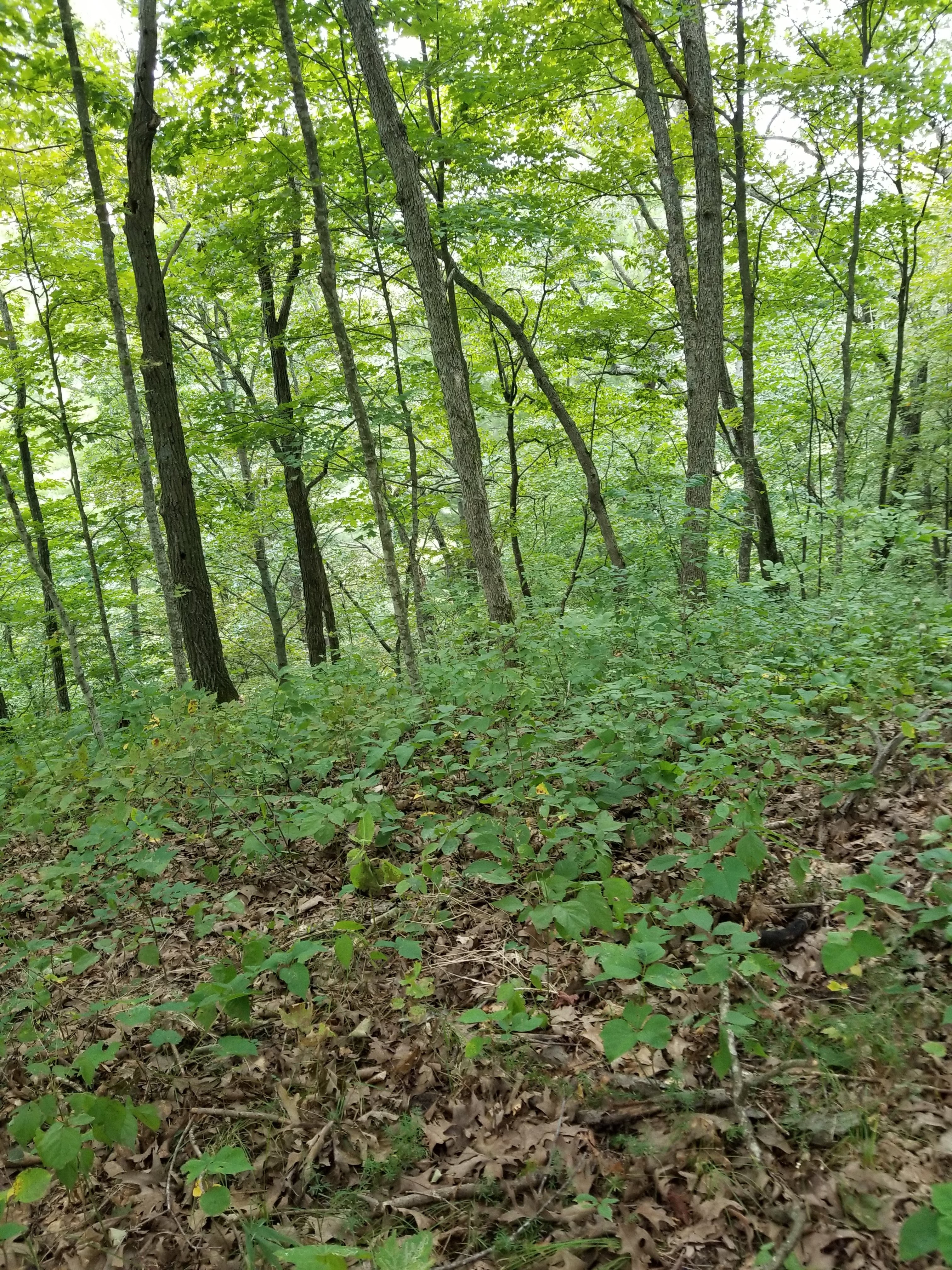
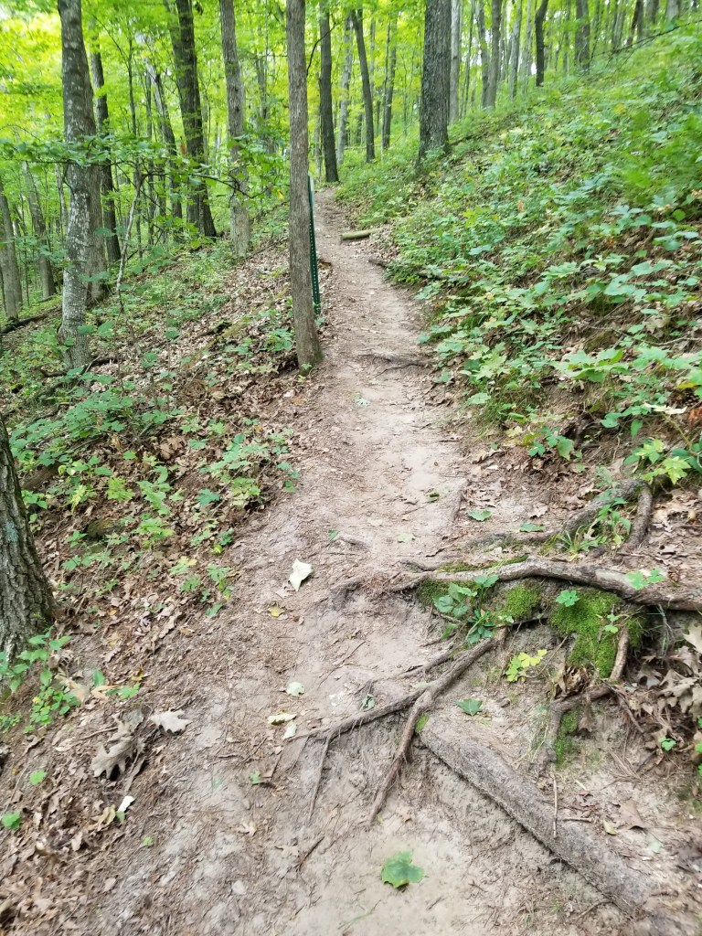
This park was going to have a lot of elevation changes — we didn’t exactly know how many, but we headed for the lower picnic area and the Hemlock trail, which we thought would have about a 300 foot elevation change. This was a loop trail — so we were going to follow “Mike’s rule” and go to the left and follow the loop in a clockwise fashion. We took off from the car looking forward to the climb ahead!! We immediately began to climb and we came to a pole in the trail with arrow on it that pointed up at a 45 degree angle. Going up the hill, we could see a trail that required some difficult climbing. It was not the typical trail (well traveled, steps, etc.), but it was obviously climbed by quite a few people. Mike went first and made it to the top, almost crawling on all fours at some points. Once at the top, the trail…..was nowhere to be seen. Mike quickly decided that we were not supposed to crawl all the way to the top. Tammy was halfway up, so Mike told her to wait and he was going to try to find where the trail was. Searching a around a little he saw steps about 50 yards away across a little valley.
He crossed over to that and was pleased to find that this was, indeed, the trail. What the heck? Oh well, Tammy then began to climb her way over. A little while earlier, Tammy had noticed what she thought was a bench. Upon further inspection, it was not a bench but a sawhorse. Now that Mike was closer, he noticed that the sawhorse had yellow caution tape all over it. While Tammy made her way, Mike decided to look at the sawhorse and caution tape — where he found signs that said “THIS SECTION OF THE TRAIL IS CLOSED”. Oh boy. We somehow went around the trail closure and got back onto the trail past where the signs were that told us not to go that way. Working our way back, we found there were a couple of trees that had fallen which hid the trail that would have taken us to the “trail closed” signs. When we made it back to the arrow that pointed us up the hill, Mike noticed there was a trail going back the other way. It turns out the arrow pointing up the hill, really meant to turn you around and follow the trail that was behind you (although it didn’t do this very well) <more ominous foreshadowing music>.
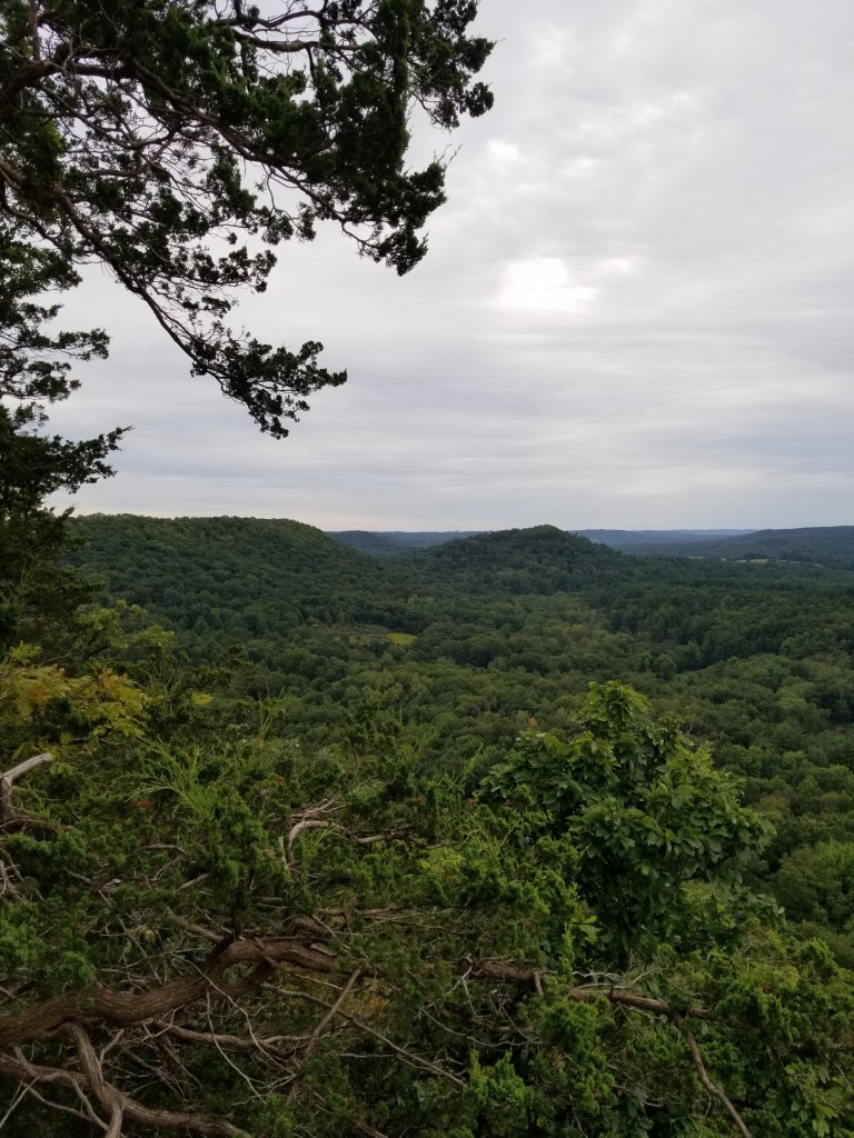
Now that we were on the right trail — we began our journey to the top of the bluff. Before we started the uphill section of the trail, we traveled for quite a ways just above the Kickapoo River — and it was quite the sight. We climbed over several freshly fallen trees (that must why the other section of the trail was closed) and across a couple spring fed streams working their way down the hillside. The trail then took a turn uphill. We began climbing, and climbing. There were quite a few switchbacks – but the climb was long and steady. Not much of a chance for break while walking. But we had to take a break — turns out we were almost to the top of the hill where we stopped — oh well, it means we arrived at the top fresh. At the top of the hill there were supposed to be two overlooks. We made our way to the first one only to find that it would have been a lovely overlook had the trees not grown up over the last 50 to 100 years. The only thing you could see from the overlook was: trees. We were worried the other overlook would be the same, but we were mistaken — it had a gorgeous view of the valley and rolling hills below.

As Tammy predicted right off that overlook there was CAUTION tape all over the trail indicating it was closed going down the other side of the overlook (where we tried to come up earlier). We had to go back down the way we came up — amazing how much easier it was to go downhill than it was going uphill. We debated if we should stop and tell the park ranger lady that she really should tell people about the closed section of the trail, and probably more importantly the seemingly incorrect arrow sign. When we made it back to that portion of the trail, we saw a family of five ( mom and dad, and very small kids (4, 8 and 10 years oldish) trying to scale the hill like we had done an hour earlier. We quickly told them they were going the wrong way and we made the exact same mistake. Tammy, being the awesome mom that she is, helped the little kids make it back down the hill without falling. The dad mentioned that they saw other people going up that hill too. Oh well, we showed them the way to go and we continued on back to the car; it was now decided that we would HAVE to stop and let the park ranger lady know about the problems with this trail. We were concerned for the safety of others — thinking that trail went to the top of the hill and then having to come back down.
We had to drive right past the park office to get to our next trail so we figured we would stop in right away. When we got into the office there was a line of 3 or 4 people waiting to check into the campgrounds, so we had to wait to talk to the ranger. While we waiting patiently in line (that’s a lie, Mike was not that patient) Mike walked around the office looking at the pamphlets, maps, etc. He found one pamphlet that sounded interesting: Sharing the Trail with Horses. We knew there were horse trails here, but we’ve been to several state parks that have horse trails and haven’t seen a single horse yet. For some reason, Mike pulled the pamphlet out and read about what to do if we encounter a horse on a trail — interesting because we had no idea there was actually a protocol for meeting a horse on a trail. It said: if you encounter a horse don’t stop, but keep walking and make verbal contact with the rider. Apparently stopping and moving off the trail is seen as predatory behavior and can spook horses. Talking to the rider let’s the horse know you are there and that their rider also knows you’re there. It was very good information (even though we knew we would never need to use it). We finally got our turn to talk to the ranger about the trail — either she didn’t really understand what we were trying to tell her (that they need better signs/markings on the trail to let people know a portion of it is closed) or she had no idea what we were talking about because she was unfamiliar with the trail, but she didn’t seem to interested in doing anything about it. She probably just thought we were whiners. That’s OK, we did the right thing – hopefully she did something. Off to our next hike.
Our next hike was to be on the Old Settler’s trail, but before that we were going to stop at Observation Point just off the upper picnic area parking lot. We already knew what we would see — a grown-over scenic overlook that if you squinted through the trees you could see….something. Boy, were we wrong!!! This was an unbelievably gorgeous view of the entire Kickapoo River valley. 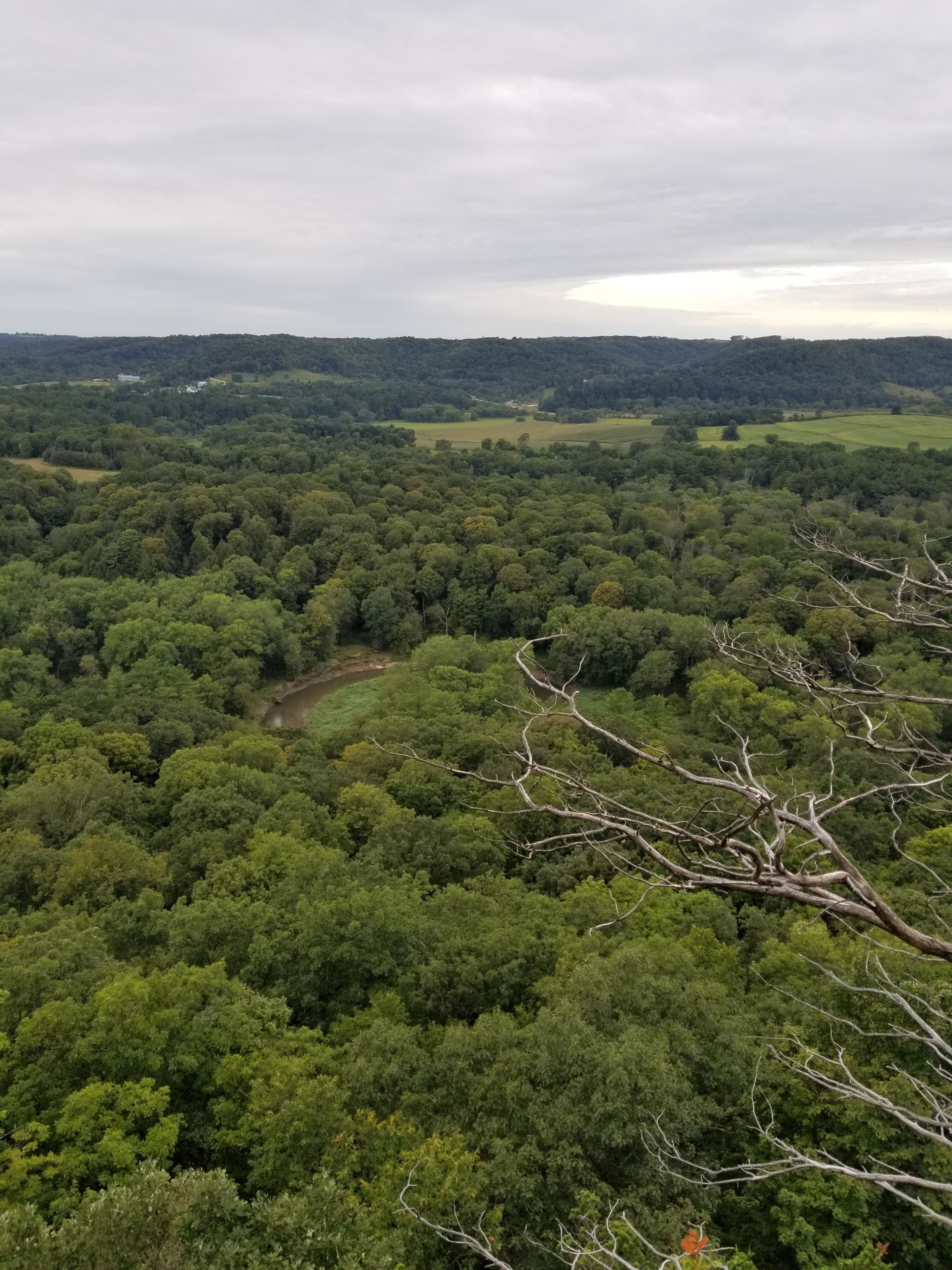
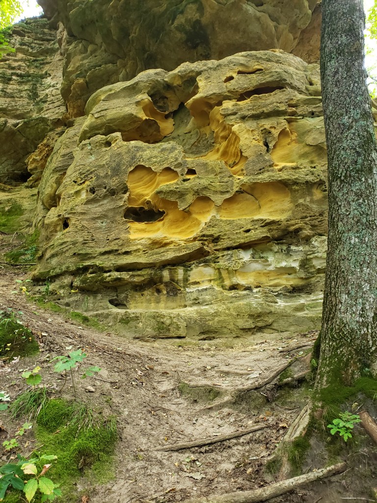
This overlook was perched on top of a cliff — and thus why there were no trees to block our view. We took a couple pictures, did the National Lampoon Vacation head-nod, and began our next hike. We had to walk down the bluff to get to where the Old Settler’s trail started. This trail description said it had a 390 foot elevation change — but we had no idea if that was all at once, only once, or multiple times, so, we just took off. At the beginning of the trail there was an informational sign that said the trail was 2.5 miles long and would take 1.5 to 2 hours to hike it. GAME ON!!!! The trail almost immediately started going downhill, and downhill, and downhill… There was some very pretty rock formations along the way.
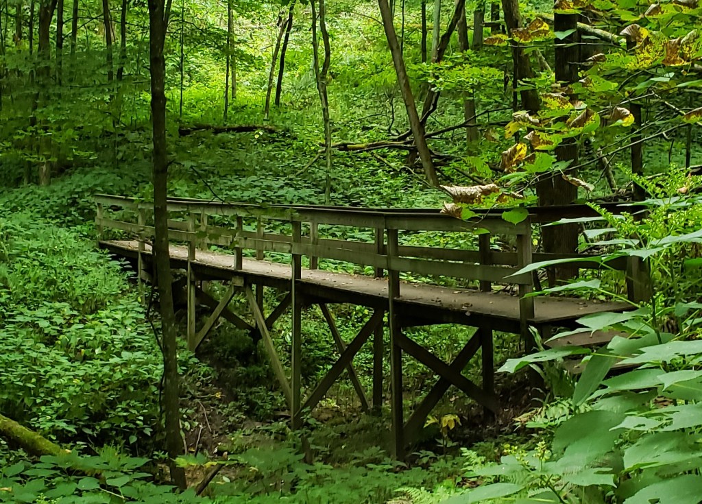
Mike’s watch said we dropped 350 feet in less than half a mile — Tammy began to worry about the climb back up almost immediately. Mike knew that halfway through the trail there was a scenic overlook, so we had to climb fairly high well before the end of the trail. What Mike didn’t know was if we stayed up high for the remainder of the trail or went all the way back down and then back up. Right at the very bottom on the this trail we came to a striking bridge over a small stream. Mike snapped a quick pic of it that we keep going back to look at.
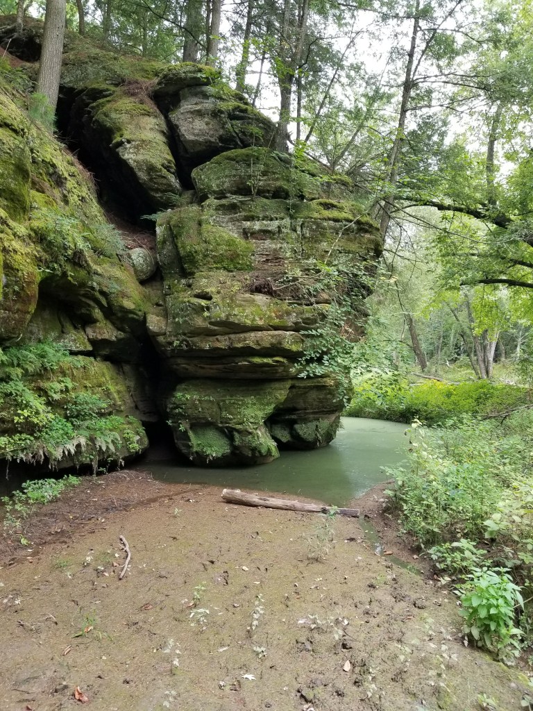
Right before the overlook we came upon a group of 5 or 6 people hiking the same direction as we were. This was not really a trail that was conducive to passing. It had a lot of ups and downs and some very narrow sections. So, as we got closer and closer to them we saw that the overlook was just ahead of us. We hoped they would stop at the over look and we could go right past them. Thankfully they did — but they did not stay at the overlook long, and started down the trail shortly behind us. We came upon the backside of the overlook into an area that had some really cool looking limestone cliffs. They looked like they were carved by water, but we were hundreds of feet about the river level, hmmm. We couldn’t stop long for the pictures as we wanted to get ahead of the people behind us.
We began to descend again. Pretty soon we came upon the unmistakable smell of cigarette smoke. A couple minutes later we saw 4 young guys hiking down the trail ahead of us. Once again we knew we would catch up to them — we only hoped we could pass them once we got to them. Luckily, they were not paying close attention to the trail and made a wrong turn and we made the correct turn and we were able to slingshot by them. Awesome! Well, Tammy didn’t think it was so awesome because she was worried that we would have to stop on the way back up the last hill and they would pass us and laugh at us. They got closer and fell back a couple of times along the trail — but no matter where they were, we knew they were there — they were loud!!
We finally got to the final climb back out of the trail valley. Tammy had already said she would have to stop somewhere along the hill, but she would make it as far as she could (Mike doesn’t understand because there have been quite a few big hills that she’s made it up without stopping, but he just listens to her and says “yes, dear” …). We were worried about those darn, young kids and their clear, young lungs, hearts and arteries that are wide open and capable catching up and passing us. So, we just kept going at a slow but steady pace — and like the turtle, we won!! We made it all the way to the top without stopping!!! Mike was so proud of Tammy — not because she made physically it (because Mike knew she could do it), but because she mentally made it. She didn’t psych herself out thinking that she had to stop. She now knows she can do it and nothing can stop her!! The news got even better — those young guns were nowhere in sight. Not only did we stay ahead of them, we extended our lead and got further and further ahead of them!!! We then passed the sign at the top of the trail and it was the best news. Where the sign said the trail would take 1.5 to 2 hours — we did it in 58 minutes!!! Success! But, we were tired. We had to sit and drink plenty of water and eat some almonds and take a nice break before our next trail.
The “back side” of Wildcat Mountain State Park is a series of loop trails that are classified as horse trails. They are around 3 miles long each. “The Plan” had us doing two of these loops (the green and purple). The only problem was that we couldn’t just do one and then decide to not do the other because of the way they were laid out. We had to do both of them or only one and we would have to decide right away before we even started on the second trail. We had 3.5 hours before we had to leave for dinner and if we did what “The Plan” said we would be hiking about 6 miles. We can do 2 miles per hour easy (we hoped), but since we didn’t really know what the trails held, we were crossing our fingers. We started from the parking lot and Mike thought he knew where he was going. All of the other horse trails we hiked along were big, wide, grass covered trails So that is what we were looking for. We found the orienteering course where the map showed this trail starting, so we searched for the trail on the course. After a couple of wrong turns (and turning around) we found the trail and began the hike down it. We would encounter 4 overlooks on this trail — the first one very quickly. As we walked down the wide trail, we noticed several very large (and fresh) pile of horse$&@*. Maybe we will actually get to see a horse today!! As we made our way out onto the first point to the overlook we saw four horses ahead!!! Woo hoo!!! That was something new for us! As we got closer Mike hollered out a greeting and we had a short chat with the riders as they rode past us. Boy, we had forgotten just how big horses are!! We then hiked on to the overlook only to realize it had a beautiful view of the trees 15 feet in front of you. At this point, we wondered if we were confused by the definition of “overlook.”
We kept going down the nice wide trail and up the other direction came a couple more horses! 6 horses and were were barely half a mile into this 6 mile hike. We then came to the group camp area where we had to cross a dirt road a couple of times to stay on the green trail. Upon crossing the road for the second time, the trail went from being the typical wide, grass covered trail that we thought must be required for a horse trail, to a small foot- (maybe two) wide trail heading down a fairly steep side hill. No way could this be a horse trail…but there were horseshoe prints everywhere. Wow, it would take a lot of trust in your horse to ride along this trail. We came upon several downhill sections that had large limestone rocks strewn everywhere. We thought this would be very difficult for horses to climb (or descend), but there were prints everywhere — and scuff marks on almost all of the rocks from horseshoes. It was on this trail that we really questioned what we would do if we met horses along it — there really wasn’t anywhere to step off the trail without climbing up or down the side of the hill. Luckily we didn’t run into any — but we did finally run into the purple trail and a long, slow, steady climb several hundred feet back up to the top of the bluff. Tammy was not pleased, but we made it to the top and to yet another “non” scenic overlook – just more trees. We decided that maybe in the winter when all the leaves were off the trees it might be pretty, but that would required hiking along these in snowshoes to get out here. No thank you! We saw many more horses along the trail — wow, what beautiful animals!! We were quickly approaching our third overlook and we seriously discussed not walking out the point of the bluff to see if it was yet another non overlook. We decided to check in out, just in case, and it was a disappointment. Luckily we do this for the hiking and not just going for the scenic overlooks. We had one more overlook — as we walked down the trail we came to a spot where there was a break in the trees that you could see through for a long way! Here we were in the middle of the trail with a much more scenic overlook that any of the designated scenic overlooks. Go figure. (BTW — the fourth scenic overlook was a bust too.)

Before we left that last overlook we ran into 5 horses. They were resting as we passed them. We knew that must mean that we would be going downhill again — and boy did we. This hill had been covered in gravel with “steps” built into it. We cannot imagine how the horses do on these hills. Do they go right up them with no problems at all, or do they need to take occasional breaks in the middle like we do? We made it to the bottom and traversed along a little stream before we started climbing back up yet again. We were back on very narrow trails and thankfully had not met any horses — yet. A short way up the trail where it was very narrow with vegetation on each side — we saw more horses coming. The front rider called out a “Hello” to us and we responded back in kind and had a nice little conversation with them as they approached. We told them we’d step off to the side of the trail as there was no way we could keep walking as we passed them — there just wasn’t room. The lead rider said how nice it was for us to talk back to them, and so many times people are afraid of the horses and just go quiet, which spooks the horses to see people but not hear them. I mentioned that I had read the pamphlet in the park office and they were impressed that the park was “advertising” how to interact with horses on the trails.
Shortly up the trail we came to an opening that turned into a big prairie like area surrounded by woods. It was beautiful with flowers, bushes, and very tall grasses swaying in the wind. We knew we were getting close to the end of the trail, and we were both beat for the day. Tammy was disheartened to look in front of us and see a big hill we would have to climb. Mike saw off to the side that we would not have to climb that hill, but rather keep going down even further before we start to climb. He briefly foreshadowed that with her, but didn’t dwell on it. We came to a section of the trail that was a complete mud pit with standing water and everything — much like what we encountered so many times earlier in the year. We made our way through it like the pros we are!! We encountered one more group of four horses as we were finishing our final ascent back to the car. Our total horse count for the day was 29. Amazing!!! We made it back to the car and headed off to the showers. Even though this was one of the cooler days for Splorin’, a shower was very welcome.

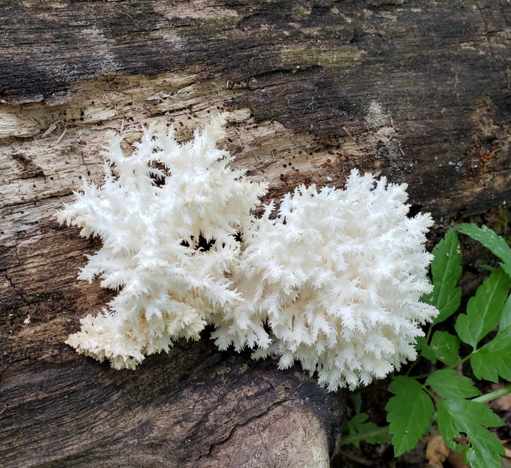
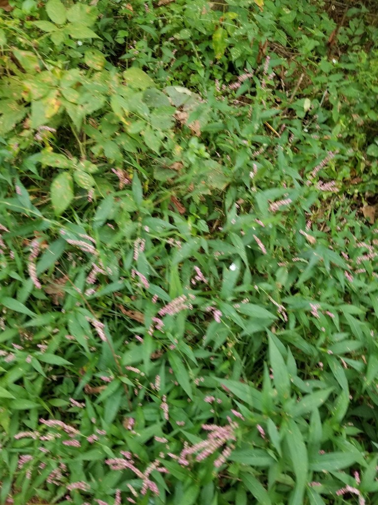
Though we definitely try to keep up a pretty good pace when we are hiking (ideally under 20 minute miles) we do stop to snap some pictures of flowers, funky looking mushrooms etc when we can. We are always amazed at the variety of plants we see in one park.


Off to dinner. When we dreamed up this idea of “Splorin’ Saturday” back at the Buck-a-neer Supper Club in Stratford, WI, we mentioned to our waitress about #SupperClubSaturday (because that was all it was at that point) — she mentioned a supper club she had just been to for a family reunion — Club Oasis Supper Club in Sparta, WI. This is your typical old fashioned supper club. We had a very nice meal and Tammy shed a few tears. The music reminded her of her mom, (so many songs from the tape in Jude’s van) Sparta was where Art and Loretta (Tammy’s grandparents) were traveling when they got into a car accident that landed them in the hospital, and Auntie Vera lived in Sparta her whole life –Tammy wondered how many times she and Uncle Romie had eaten there. We had an order of the chicken wings and the salad bar — both were good. Mike had the (surprise, surprise) prime rib while Tammy had the Pesto-Encrusted Salmon. Tammy went on and on about her Salmon, so it must have been good. (and she was excited to bring home half of it for lunch the next day) Mike’s prime rib was OK, but it did have a lot of fat on it. It was a very long day, so we were decided to take the “fast” way home this time. Besides, as it gets closer to fall, it is getting darker when we start the drive home and there is not so much to see. Wildcat Mountain was a success!!!

