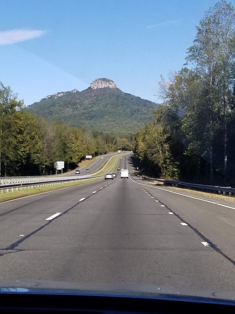
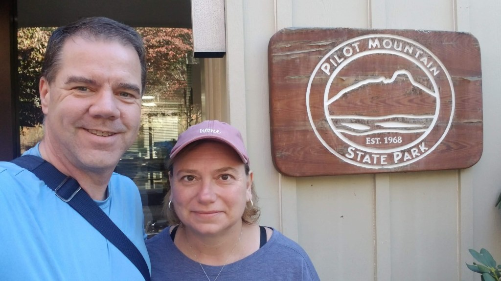
Having lived just outside Raleigh, NC for 6 years (1993-1999) we did plenty of driving back and forth between Raleigh and Hudson, WI (our hometown). One of the routes we would take to Wisconsin took us up through Winston-Salem along Highway 52 and right directly towards Pilot Mountain. The mountain just looks so cool from the highway. We would ooh and ahh every time we drove past it. INSERT YOUR PICTURE HERE TAM!!
But, I don’t think we ever even remotely thought that we would climb it some day. That drive would also take us through Mount Airy (aka Mayberry from the Andy Griffith show) and Pilot Mountain is “Mount Pilot” from the show. You can’t help but think about seeing Opie fishing along a creek when you are driving through this area (go ahead…you can start whistling). But before we get to climbing the mountain, we have breakfast and time with Meg and Carson to talk about.
Meg and Carson were planning to join us on the hike up and down the mountain, but based on Meg’s experience on Monday with Hanging Rock, they decided to partially sit this one out. One of the really cool things about Pilot Mountain is that there is a road all the way to the top where you can then walk around the pinnacle without having to hike all the way up. So, it was decided that they would meet us in the parking lot at the top and we would walk along the pinnacle together. But first was breakfast! We stopped at Cagney’s Kitchen in Winston-Salem. Even though this is a chain, and something we don’t like to do, the menu online looked so good that we had to try it. Here’s a shocker for our loyal readers: Mike and Tammy both had omelettes. No salad, but Mike was able to have a side of Country Ham — his favorite!!! No groups of old men to listen in on their conversations so we spent our time visiting with our kids. Oh well, breakfasts can be boring, let’s get to climbing!!
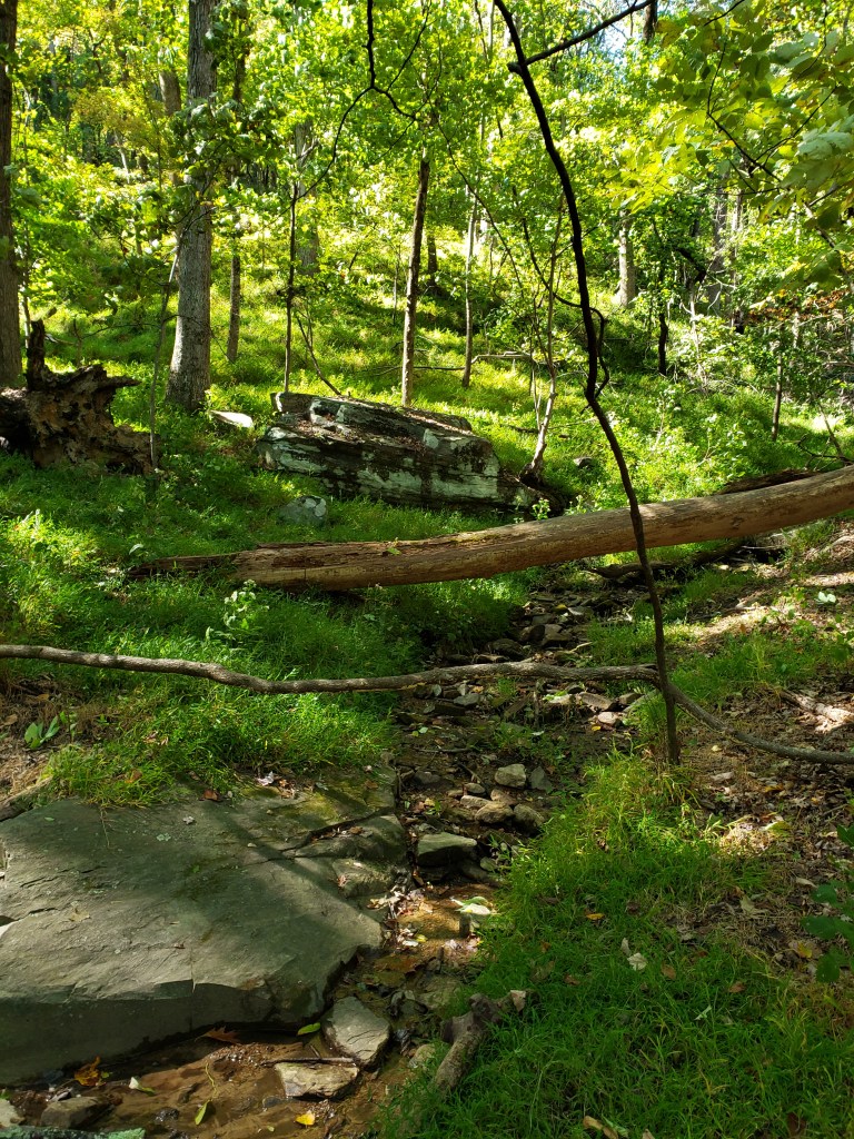
We arrive at the base of Pilot Mountain and we are rip raring and ready to go!! The “plan” is to take the Grindstone Trail to the top; it basically goes right up the side of the mountain, at times paralleling the road but also veering off to go above some of the cliffs. The lower portions of this trail are unbelievably beautiful with the ground cover and the brush, it is almost completely green.
Since it was mid October when we were there it made us wonder what it would be like in the middle of summer (maybe just as green, but hotter and with mosquitoes 😉 ). The trail was almost just a solid uphill climb. There were spots where we went a little side hill and some where it was more steep but the first 3/4 of the way up was pretty much just a constant uphill climb – Tammy’s worst nightmare. But — she did it like a CHAMP!! She claims it is because it wasn’t as bad as some of our other hikes, but I think it is because she is just in better shape than she was earlier in the summer.
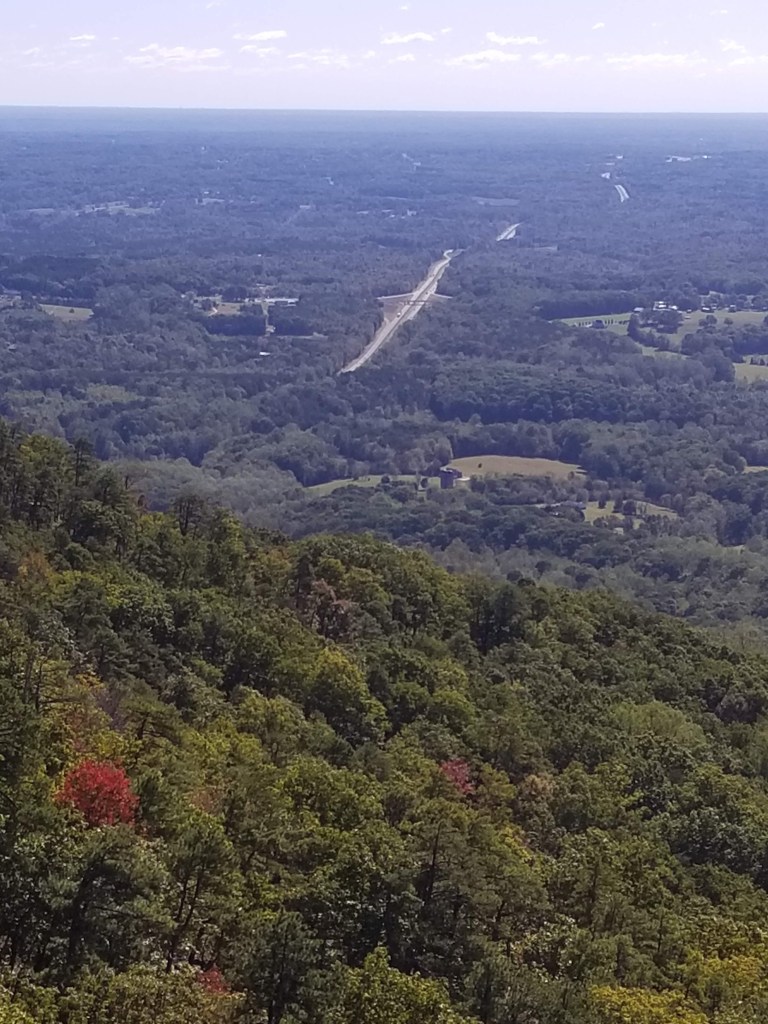
We could tell we were getting closer to the top because every once in a while we would be able to see glimpses of the amazing views out through some of the gaps in the trees. But it was also at this point where the trail became steep, very steep. There were lots of steps — mostly made of 6×6 wood pieces, but there were some stone steps too. We came to a couple of places where you could get a good view out through the trees — again, just absolutely goregeous.

Mike was very happy because we never got to the point where we were standing right on top of a cliff where there was no ground below. There were a couple places where we would get to a wooden fence with a view — he wasn’t happy about those, but he tolerated them. We knew we were getting closer to the top when you could start seeing nothing but sky above us. We came to a point on the trail where we saw the same sign that we saw at Hanging Rock — but it was for people going down the trail, and we were going up. So — people have plunged to their death in the area that we just hiked and Mike didn’t know about it, he was happy to NOT know that…
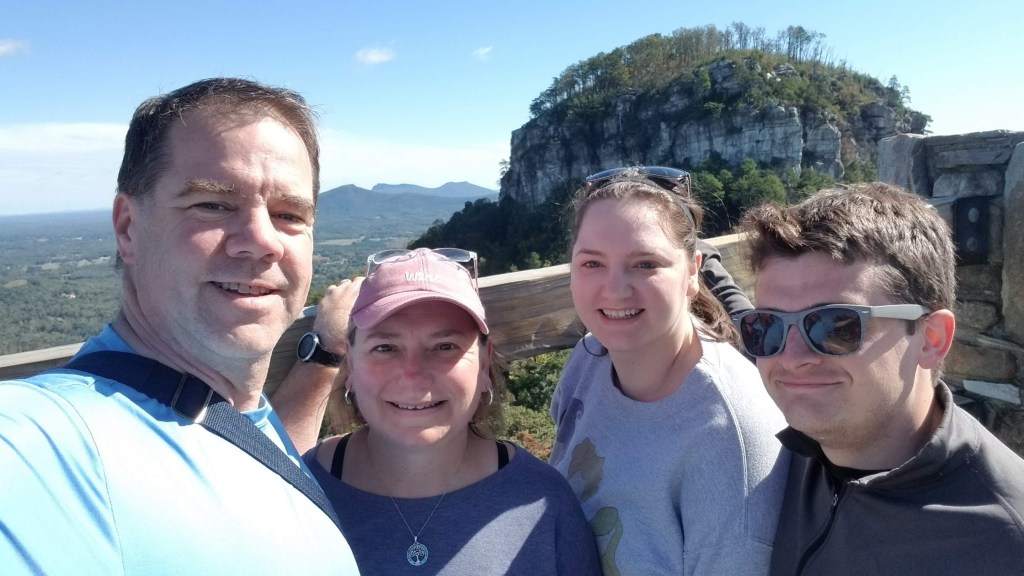
Now that we were at the summit parking lot, on top of what is called “little pinnacle”, we took the opportunity to take a break. After all, we just hiked 2.89 miles with, to us at least, an astounding 1135 feet in elevation gain! Wow!! We took a well deserved rest to wait for Meg and Carson to arrive. We got a good 15 minute break. It was kind of chilly and really quite windy at the top. Mike was wearing his traditional shorts and short-sleeved shirt and Tammy was in her leggings and a short-sleeved shirt. Someone wearing a winter coat, hat and mittens on her way to the bathroom exclaimed “you two must be from the North dressed like that.” Not knowing which side of the “War of Northern Aggression” she was on, we just laughed and said yes, we are from Wisconsin.
Meghan and Carson arrived and we made our way to the overlook where you can see the big pinnacle. What an outstanding view. Even though it was cold, windy and the middle of October, the overlook was packed with people. We could hardly imagine what it would be like in the middle of summer during nice peak tourist season and nice weather. Doesn’t matter to us though, we were just glad to be there! We snapped some good pictures and were off to hike around the base of the big pinnacle.
It was fun to look back out from the top and see the highway (52) where we took the picture of Pilot Mountain coming IN to the park.
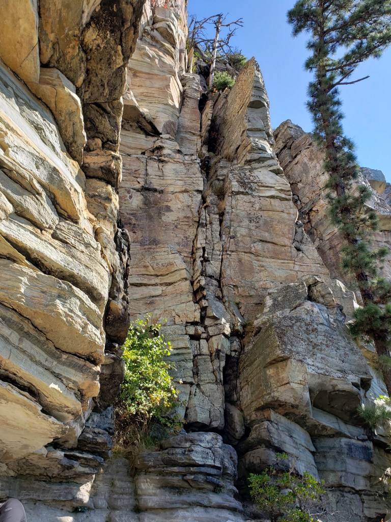
We made our way over to the big pinnacle and it was absolutely breathtaking to see up close. It’s kind of funny because the views looking down are so amazing that you almost forget to look up at the cliffs that are above you.
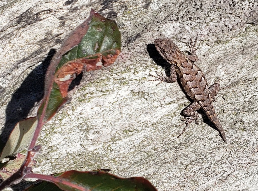
We actually saw some wildlife along the trail too (well, Mike did, and he never passes up an opportunity to take a picture).
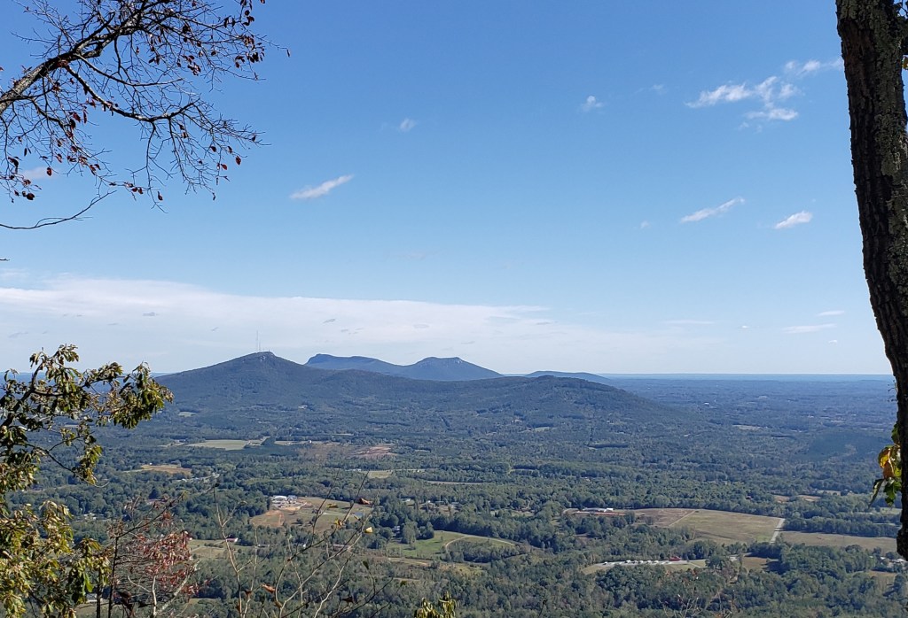
We made our way around the big pinnacle in awe the whole way. When we had made it most of the way around, we were able to look towards Hanging Rock — that is it out in the distance there.
As we made our way around the rest of the big pinnacle, we saw a group of people that were rock climbing even though there were signs explicitly forbidding this activity. They were quite a way up the rock fact too. Definitely something that we would not even think of (well at least Mike wouldn’t anymore).
On our way back to the parking lot we took the Ledges Spring Trail while Meg and Carson made there way back to their car. We still had to hike our way back down the mountain. How difficult could that be– after all — “it’s all down hill from here”, right? WRONG!!! While obviously for the most part it was down, there were still some pretty significant portions of uphill hiking. But worse than that, the down hill was sort of like the downhill portion of Moore’s Wall Loop Trail at Hanging Rock State Park — it was lots, and lots (and lots and lots more) of stone steps. Just like going around the big pinnacle there were some cool cliffs above us.

Mike is fine with cliffs above us, not so much with those below us. We kept climbing down going over all those stone steps. If someone tries to tell you going down stone steps is easy, just send them to Tammy because she just might punch them in the face. 😉 At least when the stone steps are 18-24 inches tall and you have to jump down them.
Eventually we made it back to where the Ledges Spring Trail and the Grindstone Trail met and it was just a steady downhill from there. We eventually made it back to the car. That “down hill” portion of the trail still had a whopping 413 feet of elevation gain. Don’t let anyone tell you that you cannot go uphill going downhill.
There was no supper club at the end of this day. Instead we ran to the grocery store and grabbed a bunch of food and had a lovely evening at home with Meg, Carson and River. We ate and played games and decided it was an even better way to end a #splorinsaturday than a supper club!!!
