
As explained in last week’s #SplorinSaturday blog, when the weather is less than ideal, we make our way to a more popular location in hopes that the weather will keep the crowds down — and it was successful last week! This week the weather was supposed to be PERFECT (sunny, mid 50’s/60’s) so we decided splore where Mike had us planned to go last week — an “out of the way” location that was amazingly beautiful and also amazingly empty of people. There was only one possible issue with this week’s adventure. Tammy tripped over a three year old at the daycare she works at on Thursday and banged her knee pretty bad. Friday’s “pre-splore” walk with Henry went pretty well, but we were taking this hike a little easy to start with to ensure that her knee was going to hold up — and being the every awesome trooper that she is, the knee and her attitude got her through this most awesome day of hiking!!
We started the day at the Cameron House in (unsurprisingly) Cameron, WI. This was a very cute little bar and restaurant. You first walk into the bar and it is all decked out in pine logs and mounted animals but then for eating you turn into a very large dining room.
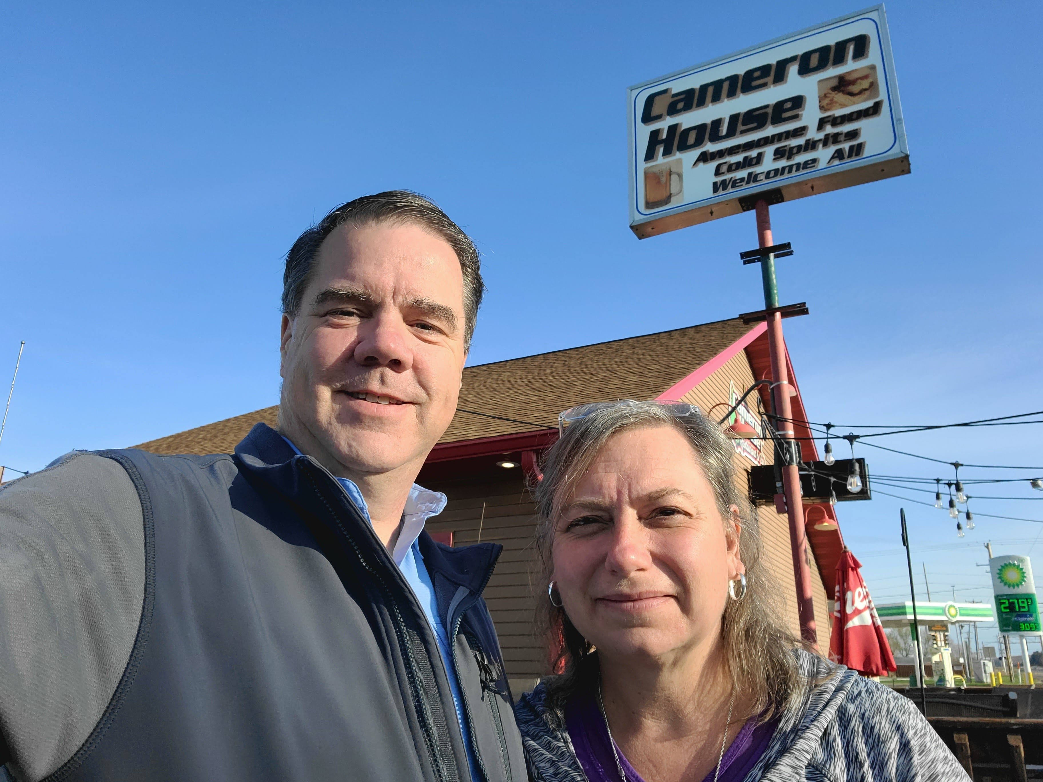
When we arrived there was a table of four and several tables of one — it was like a “dispersed coffee klatch”. We joked that maybe this was the “older generation singles club” where you came to meet others. Throughout our breakfast several other singles came in — they all seemed to know one another, but apparently not well enough (or may too-well enough) that they didn’t sit together. The menu was your typical small town diner fare with some interesting names like “Road Kill”, “The Terminator” and “The Big Mouth”. We stuck to our normal breakfast with Tammy opting for a side of two sausage patties instead of asking about a salad. They were not only the best breakfast sausage we have had, each was at least a quarter pound in size!!! Oh, they also had an “Irish Breakfast”:

As of right now, beers are out for us (subtle foreshadowing music playing in the background), so we passed on that one, but were soon down the road to start our day of Splorin’!! Mike knew this location was a little off in the “boonies” of Wisconsin, but we didn’t know exactly how far…until we started driving. First, Michelle tried to route us up a road that had a parked train sitting across it. Hmmm, not going to make it through there!! So we had to turn around and go back to the little town of Weyerhaeuser to take a different route. Shortly after leaving town we ended up on a very narrow dirt/gravel road and several more gravel roads before we arrived at the parking lot. Given that it was such a beautiful day we were worried about how many people might be here, but as we pulled into the lot we saw we were the only ones here — YAY!!!

With Tammy’s potentially bum knee, it was good that the first mile or so of the hike was on a gravel road and a little bit easier to negotiate. Of course she never complained and said her knee was feeling quite good, so we were able to keep going.

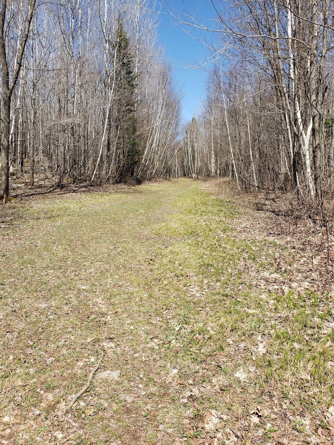
The trails here are VERY well marked — it seems as though this is primarily used for cross country skiing in the winter, but the hiking is awesome as well. What wasn’t well marked was what to do at the gate at the end of the gravel road. Of course Mike was using AllTrails, but it wasn’t immediately obvious if we were supposed to go around the gate, or go somewhere else. We went around the gate and just a little further down we found the “2km” marker (this was part of the 11km loop trail) and each kilometer was marked off. This entirety of the trail was two lane “road type” former logging roads. We thought this would make the hiking much easier, but as we were about to find out, that is not always the case. A portion of this part of the trail led along this beautiful little stream that was gorgeous in the early morning sun.

As we hiked along the trail we were surprised at all the standing water we could see just off the trail. Lots of little “puddles” with leaves/twigs/etc. in them, but thankfully none were on the trail. Sure we found a couple of “soft spots” here and there, but nothing too bad — it was between “pre-Spring” and “Spring” afterall so we were expecting there to be soft spots here and there.

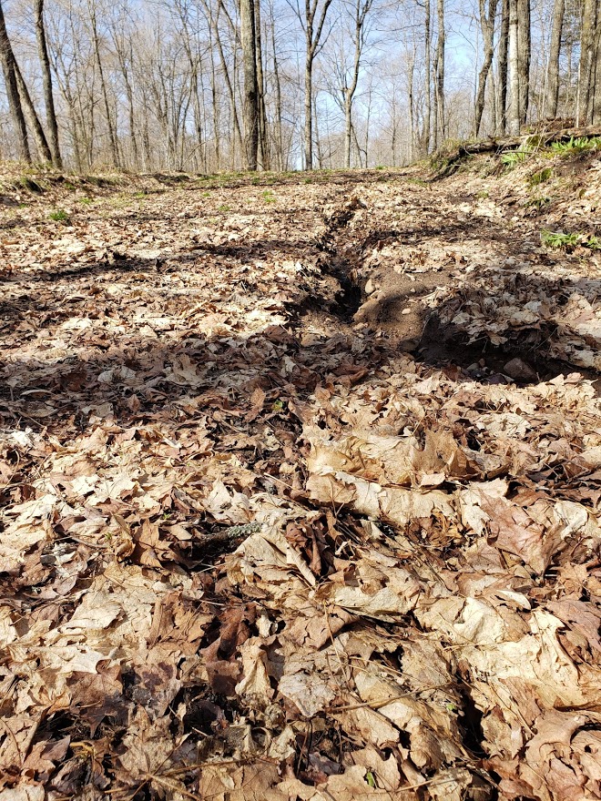
The central part of the trail is on top of a ridge so were also expecting a little bit of an uphill section — what we didn’t expect was that the trail was going to turn into a total spongy mess in parts. As we turned away from the stream and started to make our way up the hill, we noticed that there was a little more mud than we had seen earlier in the morning. Actually, the worst part was that you really could not see most of it. The trail was completely covered with leaves and those leaves covered both the good solid ground for hiking and also the very muddy, soupy ground not so good for hiking.
Mike gets to “lead” while hiking. Not so much because he has the plan, but more so Tammy knows where to go, and NOT to go, on the trail. Today was an excellent case of the where NOT to go. Mike had hit a couple of muddy pockets here and there, but for the most part we were able to go over or around them without too much difficulty. The problem comes when you hit multiples of these soft muddy spots in a row with successive steps. Mike took an ill advised step and sank down in about 2 inches, then his next step was down 3 or 4 inches and his following step seemed like he was going to go up to his knees (although it was just to the top of his boot). The best part of this, for Tammy anyway, was Mike doing a “Oh God, OH God, OH GOD!!!” with each of his three steps. Mike thought he was going to be sucked into quick sand and only his head would be above ground — Tammy just watched and decided she would take a different route over that section (after a good laugh of course). The surface was just that deceiving.
We never were really able to determine why the ground here was so muddy. Sometimes it is obvious: recent rainfall, snowmelt, water from springs, etc., but this time it was not so obvious. We made our way along the ridgeline scaring a few ducks out of the little ponds of water here and there not really any other wildlife to speak of. We hit a few more muddy spots but seemed to be able to work our way around them with no more “oh God, Oh God, OH GOD” moments. Our boots definitely showed the effects of the mud.

We encountered a portion of the trail where active logging was taking place, lots of piles of logs spread along the road; luckily no one was actually logging on this Saturday morning. As we came down off the ridge we could see this amazingly blue little lake that stood in stark contrast to the all the browns of the leaves on the forest floor waiting for the greenery of Spring to pop its way through. There were a couple of turtles on one of the logs, but they plopped into the water before a picture could be taken of them.

Tammy’s knee was getting a little sore and the last couple of kilometers of this section of the trail were hiked in silence — especially the downhill sections. She is able to hike on level ground and uphill sections just fine, but the downhill portions really hurt her knee. As we neared the van we talked about how many other cars would be in the parking lot when we got there…Mike guessed 3 and Tammy guessed 1 since we had not seen another person along the entire 7.2 miles (11 km) of trail. We were both surprised when we got to the parking lot and found 0 cars there (aside from our van)!! We sat an enjoyed our happy hour treats of Bloody Marys, cheese, sausage and nuts.
The Blue Hills Trails are split between the East and West sides of the road. We were heading for the West portion this afternoon. Given Tammy’s knee situation, Mike offered her 4 different plan options: 3 miles, 4 miles, 5 miles or right around 6 miles. We had about 3 hours of time before we had leave for #SupperClubSaturday, so we decided to play it by ear. We had done the morning’s 7.2 miles in 3 hours, so we should be able to do 6.5 miles in 3 hours too. So we took off down the trail not know how much we would get done. Along the road to where the trail officially started we once again passed an amazing little lake — it was absolutely resplendent in its reflections of the blue sky.


We were quickly on the trail and bypassing the option to only go a measly 3 miles. The trail was nice and wide and seemed much less muddy than the other side of the road.
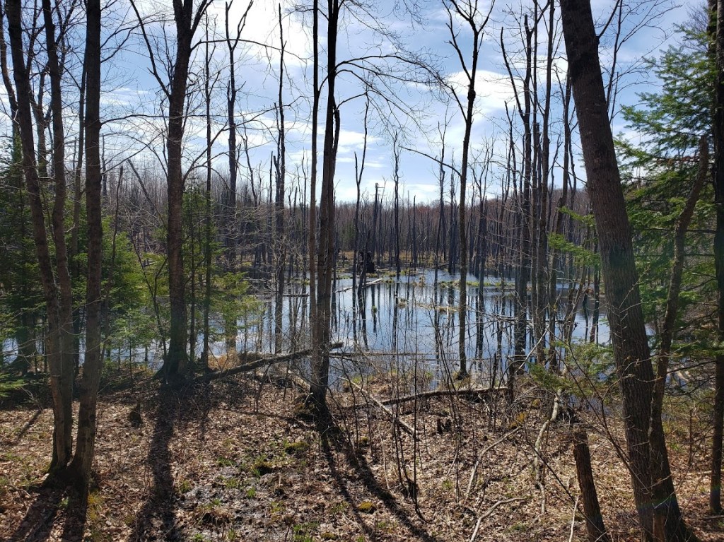
We bypassed the 4 mile option as well — the only remaining choice was 5 or the 6.5 miles option. Before we were able to make that decision we came to an area where you could see a little body of water of the left hand side of the trail. There was a path where obviously others had worked their way down to the water — so, not wanting to feel left out we did the same. This little path took us down to the edge of a obvious beaver pond — the water was all backed up around trees, etc. It had obviously been that way for quite a while. While we couldn’t see any beavers, we did see a lot of Blue Herons. We could see five or six of their nests and quite a few of them flying amongst the trees. We had obviously stumbled upon a Blue Heron rookery! The pictures do not do it justice, but it was cool seeing all the birds.
Back on the trail we reached the point of no return and opted for the 6.5 mile option. We hiked down a little “lollip-pop” trail that Mike thought might takes us along the other side of the beaver pond, but no luck. It was just a lovely walk in the woods with nothing outstandingly noteworthy, but beautiful none-the-less.
Mike had noticed on the maps on the far backside of this hike we were going to pass yet another little lake. He didn’t know how close we would come to this lake so it was quite a surprise when we came along the shore and found a HUGE beaver dam holding the lake up. Both of us had seen beaver dams before, but not quite from this angle. We were literally walking below the beaver dam where a little bit of water was trickling out. We stood where our eyes were exactly level with the water in the dammed up pond and our feet were below it. It looked like an infinity pool. It was amazing!!! This dam has been here for a VERY long time — long enough for the lake to show up on Google maps as something permanent and not just a temporary water feature.

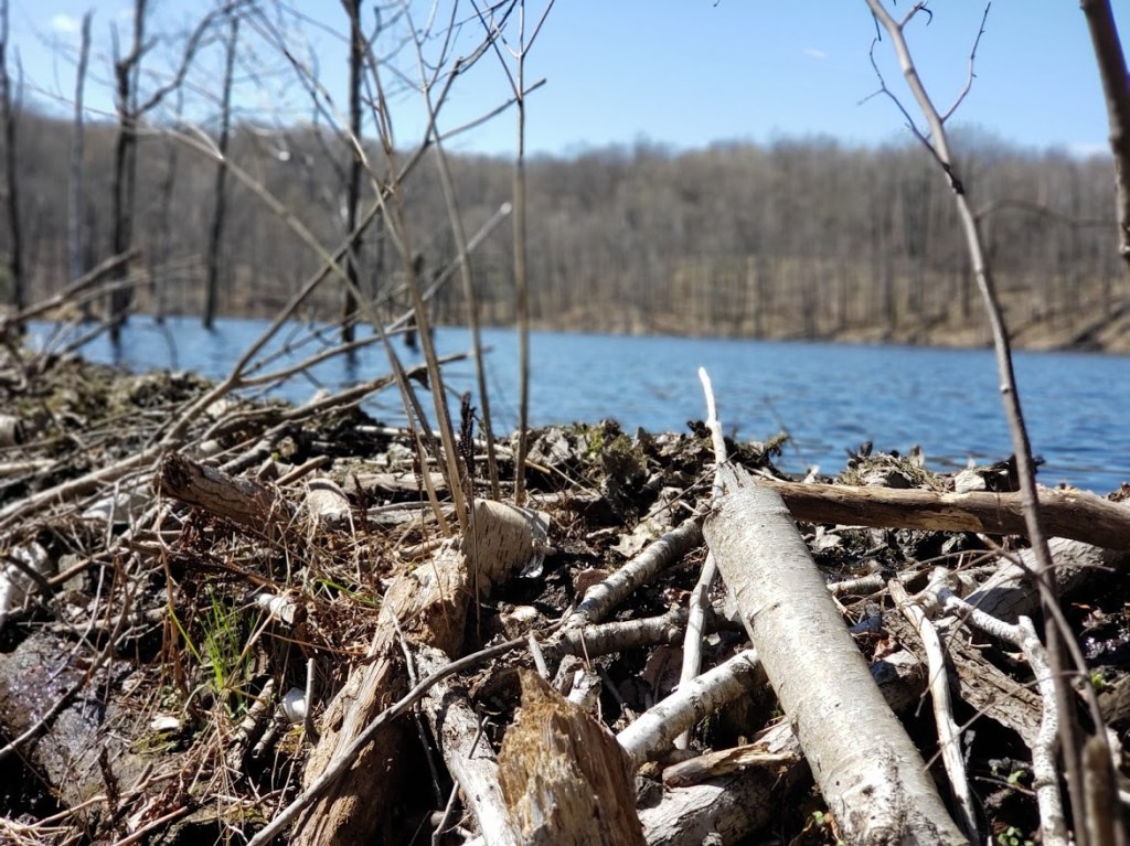
This was the first beaver dam that we had encountered during our Splorin’! (Which is actually kind of amazing since we have spent so much time in the woods over the last year.) What was even more amazing was that came across 3 or 4 more beaver dams in the next 3 miles! None as big or as beautiful as the first one, but it was really cool to see all of them — and all the trees the beavers cut down in making the dams.

Most of this trail was pretty “moderate” with ups and downs but nothing too difficult. There was one point on the trail ahead that was labeled as “difficult”. Mike knew it was short, but looking at the maps he was unable to tell what would make it difficult. When we stood at the top of the very large hill that led down to a little stream and then what looked like back up and equally steep hill, we knew what the “difficult” section was. But, Tammy has a noticed something over all of our hikes. The hills that we look at like this that appear to be huge, usually end up not being so bad. (Or at least that is what she tells herself to keep going!) So we started down the hill, and that was bad because of Tammy’s knee, but we were up the other side in about 4 or 5 minutes — not bad at all.
The very last section of the trail was walking along the road back to the parking lot. Usually you would think walking along the road is boring, but this time there was a small stream that went along the road. It was no more than 3 or 4 feet wide at its widest points, but it was flowing very quickly around rocks, branches and little waterfalls here and there. When it would get to its wider/calmer stretches we could see little minnows darting around some moving upstream pretty slowly, others flying downstream in the current. We have no idea what kind of fish they were or where they were going/coming from, but it was something that was really neat to see right on the edge of a road.
#SupperClubSaturday was at a little place that we have passed several times in all of our Splorin’ adventures. It was right along Hwy 27 just north of Ladysmith (this is one of the north/south routes we take to get to lots of places) called the Cedar Lodge. We were going to arrive fairly early so we didn’t think it would be that busy and we always enjoy a cocktail at the bar before sitting down to eat if we have to wait anyway.

We pulled up to see the parking lot almost completely full!! Oh oh! But so many times that can be deceiving. We’ve encountered times where there are full parking lots but empty supper clubs as well as the opposite. This time was a full parking lot meant a full supper club. We walked into the bar to see that every table and every stool at the bar was occupied. We walked through the bar to the dining area to see that there were still a couple of tables left open, two two-seaters and a 6 person table. We took one of the two person tables by a window looking out at the deck. We had already discussed that it was a little chilly to sit outside, but we looked out the window and saw two ladies sitting out at a picnic table with a little baby enjoying their food — yep, we are apparently wimps! 😉 Once again the Prime Rib was less than spectacular. Once again, not bad, but certainly not good. The au jus just seemed like colored water. Oh well, maybe better next week!!! Tammy had the “not Prime Rib” again and really enjoyed it! This place really reminded us of the Old Abe Supper Club — more of a bar than supper club, but still a supper club!! Can’t wait to see where next week’s #SplorinSaturday takes us!!!!!!!
