We were off to Illinois (yes, that border) for another dentist appointment for Mike in Bloomington. He COULD get a dentist in Eau Claire now that he has been working at home for a year, but it is a good excuse to take our ‘splorin’ out of state and see some of his “people.” While there we enjoyed meeting up with some of the hotel staff, work people and walking some of the trails Mike used to walk daily when he would spend half his week there. AND being down in the Land of Lincoln also gives us new venues for Splorin’! Originally, the plan Mike was working on was going to involve heading to way southern Illinois and hiking Garden of the Gods in the Shawnee National Forest. But the more we looked at that plan, it was a 4.5 hour drive just to get there (and obviously 4.5 hours back) — a little bit too much car time to have a good day Splorin’especially after the 5.5 hr car trip to get to Bloomy. Mike came up with a new plan, and thankfully so because it turned out to be a “top five” hike for us! On the way back to God’s Country, we also got to visit a park that we tried to visit last time we were here; it was a good trip south of the border!
We were up before the sun (yet again) to get our Splorin’ on. We were out the hotel room door at 6:34AM (19 minutes behind plan already) and on our way to Merry Ann’s Diner in Champaign, IL. As we got closer and closer to the diner we noticed that it sure seemed like we were getting closer and closer to the University of Illinois campus — flashbacks from our brief foray into the University of Michigan campus a year and a half ago were discussed. Yes indeed we were very close to campus, but 7AM on a Saturday morning is quite a bit different than 6PM on a Friday night. Whew! This was yet another score on the breakfast diner front — a lovely little place with counter service and all the booths are lined up so that the waitresses would access the tables from the backside and not have to even leave the kitchen area.

Unfortunately there were no coffee klatches or good conversations to eavesdrop on, so we had to entertain ourselves with conversation (and who knows, maybe someone else was listening in on us).
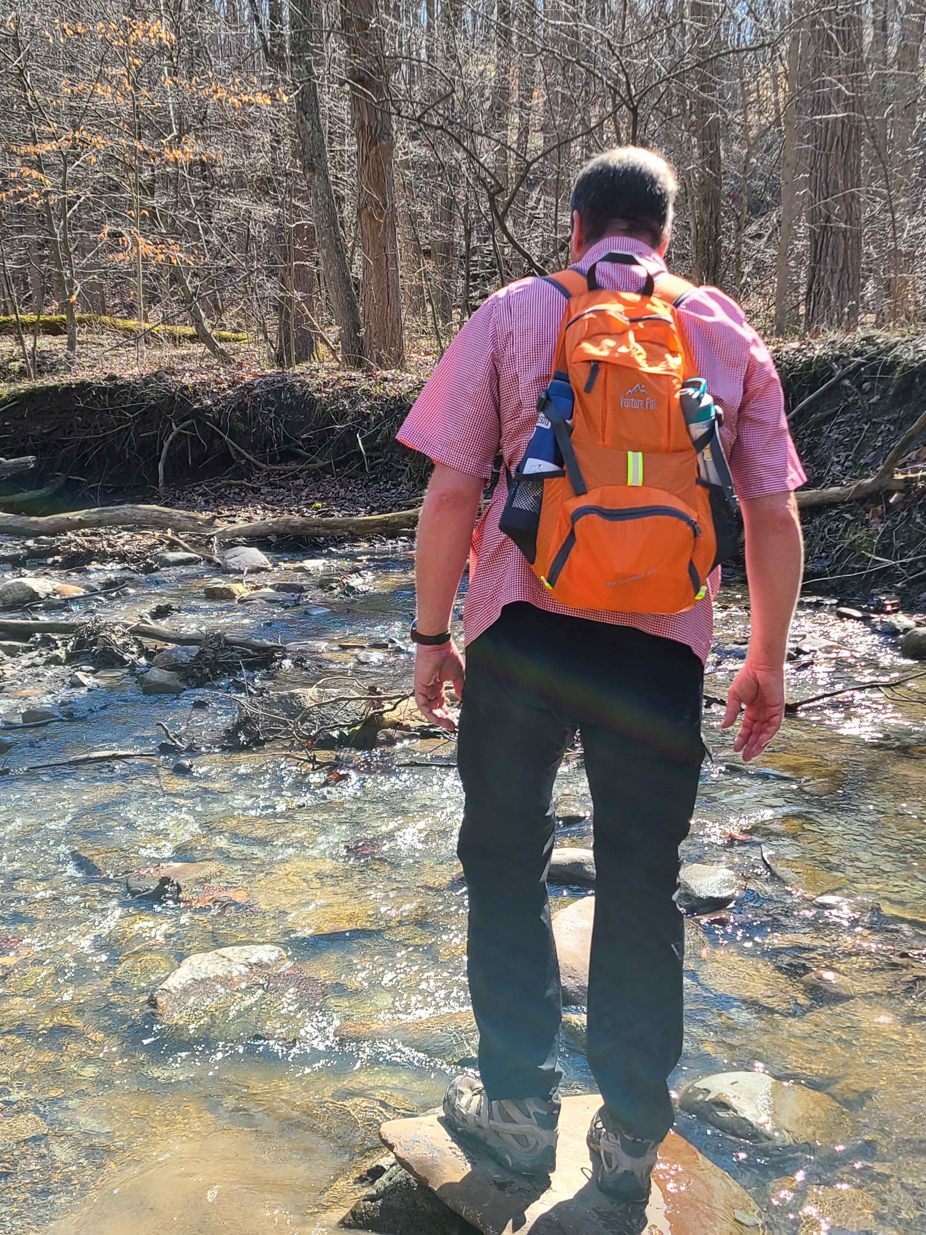
Mike, with the help yet again of All Trails, found a place for us to go today: Forest Glen Preserve in Danville, IL. Specifically we were going to be hiking the River Ridge Back Pack Trail.  We would be following these trail markers all day long — AND LOVIN’ IT!!!! One trail reviewer commented: “This has to be one of the best hikes in central IL if not IL” — while we have not done a lot of IL trails, in our limited experience we completely agree!!
We were not even out of sight distance from our van before we started to fall in love with this trail. The views within the first quarter mile let us know we were in for a treat today.
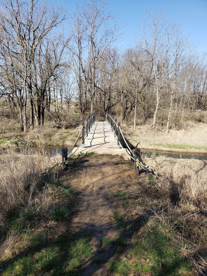

There were way too many Canada Geese honking for our liking, but that was our only complaint! We hiked in and out and up and down not knowing what we were getting ourselves into. We thought this was going to be a pretty typical hike for us, but boy were we in for a treat. It had been raining for most of the last several days so we knew the trails might be a little muddy, but one thing we were not prepared for was the streams and creeks that cover this park. The first one we encountered was a simple bridge crossing.
We crossed the bridge and made it up the other side and followed some ridges for a quite a while and could see a small stream at the base of the ridge meandering its way through the little valley. It wasn’t until we made our way down the trail straight to the edge of the stream that we figured out — uh, oh, we had to cross this stream! The water was running pretty fast and there was no easy crossing point. There were some mostly submerged rocks to step on, but that was our only assistance in getting across. This is when we figured out that all the recent rains must have contributed to the water being just a little bit higher than normal. We made it across with mostly dry feet — but even if they got a little wet, it was not cold at all for our hike, so no big deal.

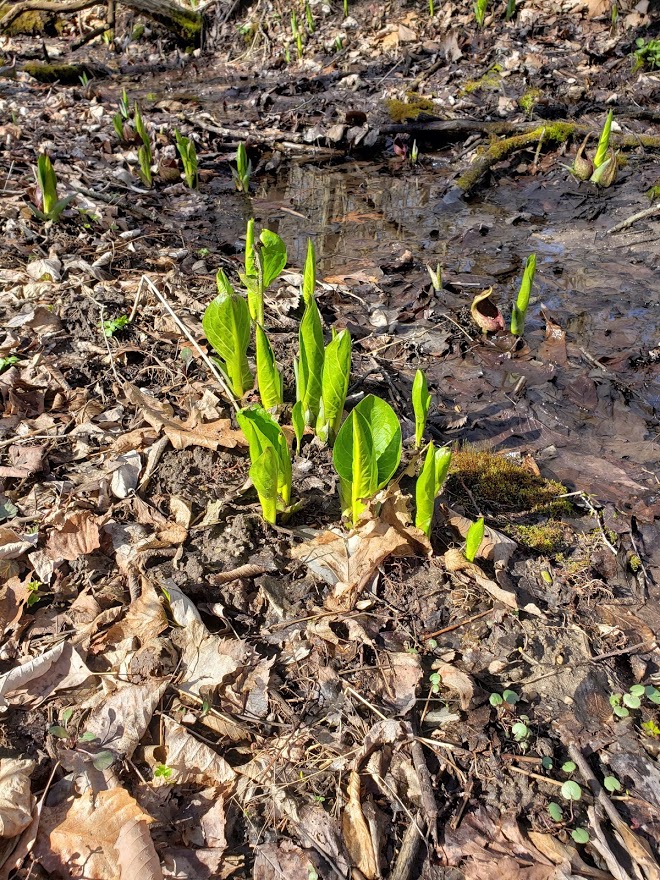
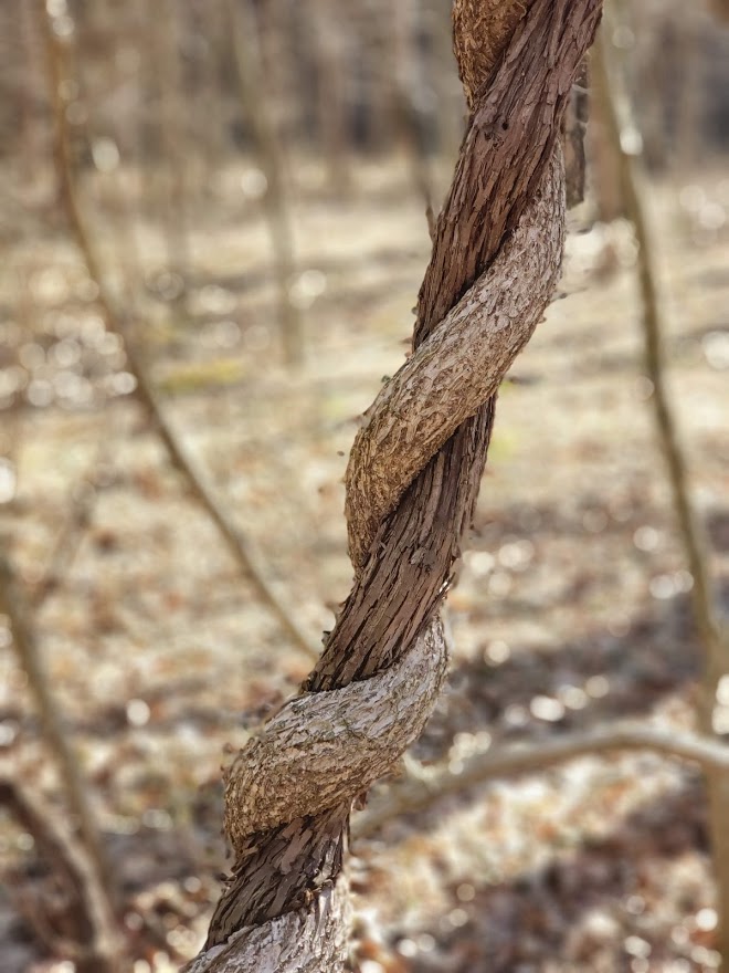
We then hiked up the hills and towards Deer Meadow — and true to it’s name we saw about 4 or 5 deer bounding through the woods. We then proceeded to a very nice path right along the stream that we had just crossed (at least we think it was the same stream). We followed this for half a mile going through some very pretty lowlands where plants were starting to pop up and something that we do not usually see in our hiking — vines! There were vines everywhere, hanging from trees, twisting around trees, bridging gaps between trees and vines wrapped around other vines. It was difficult to get pictures of all of those but we got a couple.
We continued up the trail following all the trail markers until we got to another (or is it the same) stream. The trail led right up to the edge of the stream and then turned right along the bank of the stream. The trail kind of forked in several directions at that time and we decided to stay right by the stream. We made it about 20 yards and the trail just….disappeared. OK, made a wrong choice on that one, so we backed up and tried a different branch — nope— ended up at the same dead end. So we made our way back to where the trail met the stream. It took us a while until we finally noticed the trail marks…on the other side of the stream!! This stream, or at least this portion of the stream, was running much faster and was much deeper than the last crossing we made. We took our time poking across it and again, made it to the other side mostly dry. It was awesome! These were the first two stream crossings we had done while hiking, most of the time there is some kind of “bridge” that you can decipher, but on this trail, you just have to kind of “wing it” to find your way across. Little did we know that by the end of the day we would be experts at it and Tammy would hear Mike repeat the phrase “Hey look, another stream crossing” about 47 times (and that is just a guess, but probably pretty close to accurate). Once we got across the stream, we noticed another hiker coming up behind us pretty fast. We saw him taking the same wrong turn down stream that we made – Mike asked if we should tell him, but we decided he saw us on the other side so he should figure it out quickly enough.

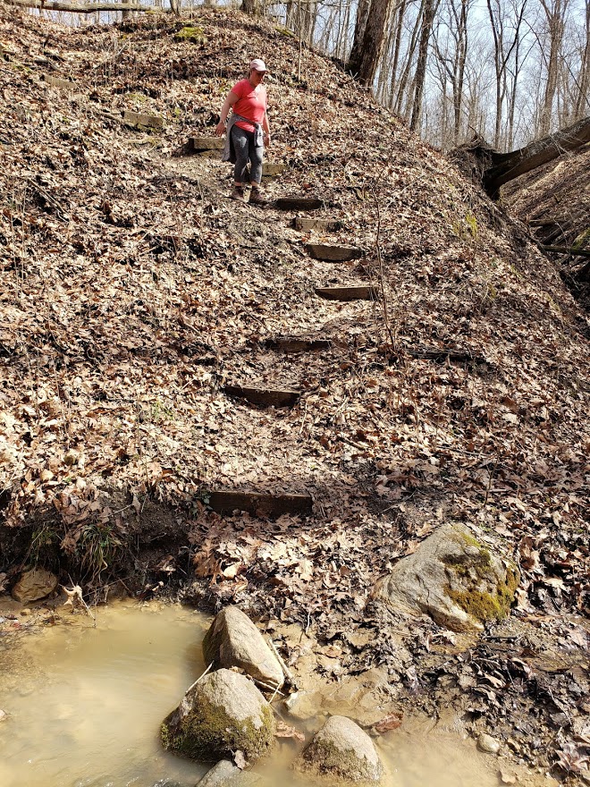
Once safely across and several pictures taken, we then had to go up, up and more up the trail. We climbed from the stream level up to the top of the ridge. This was a very steep and long climb. Luckily there were some steps to make it a little easier, but it got your heart and breath going!

We always laugh just before or after going up or down a big hill that pictures just never do justice to the hill. They always seem to end up just making it look like a slight incline (although Tammy astutely figured out that taking a pic of Mike halfway up or down the hill gives it some perspective — see below) . After stopping at the top of the huge hill we just climbed to try to catch our breath, Mike snapped this picture above. If you look closely at the red circle in the center — that is the hiker that was coming up behind us — this finally shows a little scale to the hill!!

Thankfully after that big hill climb we were in for some relatively flat hiking along a road heading toward a group campground. The hiker behind us caught up and we let him pass us. He made sure to comment that he might not have found that stream crossing had he not seen us on the other side. Mike had the trusty All Trails app pointing us in the right direction, so we knew that we were coming up to a spot where it looks like we would be making a big loop around a valley — but as would be the case many more times, we had to go down before we could go up again. Once on the top of the ridge we were just in awe of the valleys. They were HUGE! The elevation changes in the terrain were incredible — we kept commenting on how lucky were were that we were traversing across the top of the ridge and not up and down all those valleys. We finally made to the end of the ridge where Mike thought we just went and followed the ridge down the other side of all the valleys. (We also talked about how it might be fun come back and walk down through these valleys instead of just staying up on the ridgeline.) We made our way for half a mile down the ridgeline before Mike noticed two people and a dog WAY down below us headed in the opposite direction. Mike commented that they must be doing exactly what we were just talking about — hiking the bottom of the valleys. Little did we know that about 100 yards down the trail we would encounter a very steep descent into that very same valley. It was on this descent that we found out that they do not bug Mike at all, but Tammy is deathly afraid of them. (or at least afraid of losing her footing and falling all the way to the bottom)

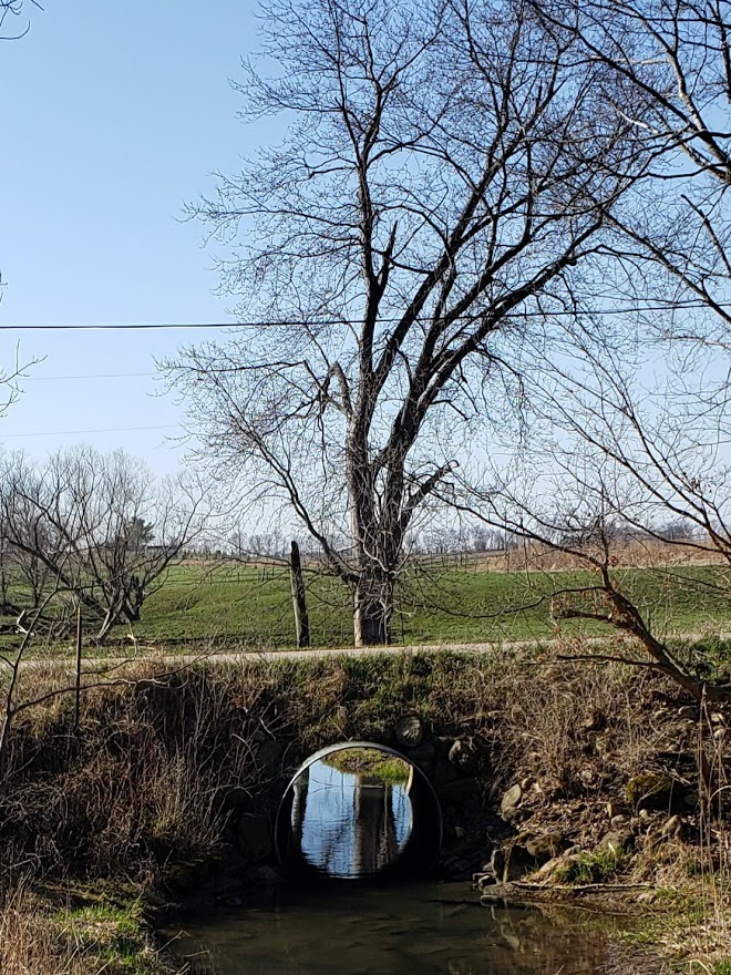
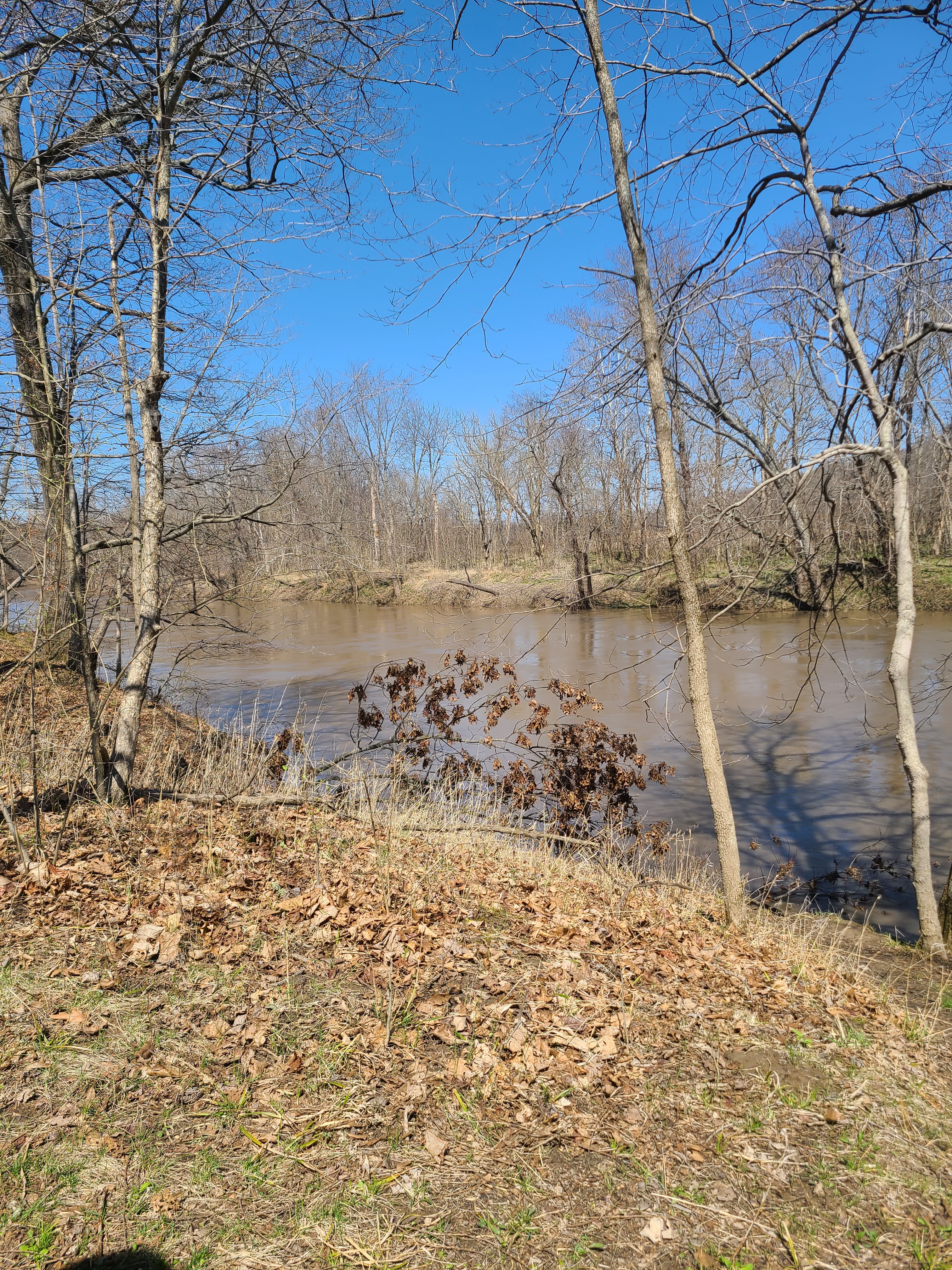
Once we reached the bottom safely and the little stream that meandered there, we began a journey of many, many crossings of the stream. Some were simple little hops across the stream where it was 18 inches wide, while others were having to hop across on stones carefully placed, while yet others were mixtures of logs, sand bars and rocks. They were ALL a blast!! Some came within feet of one another. By the time we had made it to where we could (finally) see the Vermillion River the stream was getting wider, deeper and slower. But there were so many little cool crossings before we got there.

We finally caught up to the two men and their dog and found that not all hikers have the same “trail etiquette” as we do. We traversed up a big hill to find them standing at the top taking a rest. As we approached them and got within 50 yards of them we thought for sure they were going to step aside and let us pass as we were obviously hiking faster than they were. Nope. 😦 When we got even closer they turned and started hiking again. Their dog kept stopping to turn and look at us and the one man just kept egging the dog on. It was almost like the dog was saying “Umm, Dad — shouldn’t we let these people pass?”. We thought for sure they were going to step aside, but they never did. We had to finally say “Excuse us, could we pass?” before they stopped. Mike has since done some reading and apparently there is no true “trail etiquette” that says they should allow us to pass, but common sense says if you are hiking on a narrow trail and someone is moving faster behind you, you allow them to pass. It didn’t really matter because we were quickly approaching the halfway point of our hike where we were planning on making our way down to the river to enjoy our “happy hour”! We found a bench where we could sit and watch the river flow by while enjoying our bloodies and charcuterie meats that, while cold when Mike put them in the backpack, had gotten quite warm from riding right up against his sweaty back for 3 hours already. (We will have to come up with a better plan as the weather gets warmer) Didn’t matter — the view and the company were enough to make this stop quite an enjoyable break.

But a quick check on how far we had hiked so far (a little over 5 miles) and what our elevation gain was so far (around 400 feet) we knew we still had a LOT of trail and climbs ahead of us before we made it back to the van. So, once again, down the trail we went. Mike was convinced that we were mostly done with the stream crossings, but like he is so many times with these things, he was wrong. About a quarter mile down the trail was our first one — then we hiked right along the river for a ways where we crossed a couple more little streams that were flowing down from the hills to the river. We finally came to one that was a little bigger where the trail actually turned away from the river and we had to hike up the little valley that the stream flowed in and we saw a new bridge with a little waterfall under it. Mike remembered people commenting on this bridge and the hills on either side of it — supposedly they were pretty daunting.

We slowly made our way down the hill on the one side to the bridge. It was pretty darn steep! Mike made it down without falling and helped Tammy slowly down. Across the bridge was an almost straight up cliff of mud and tree roots. Luckily Mike has long legs so he was able to make it up (slowly) on his own and once again give Tammy a hand making her way up. Wow!! That little crossing was a fun challenge! That is what our Splorin’ is about — we do it not because it is easy, but because, at times, it can be difficult! This was something that we would have never attempted before splorin became “our thing” , but now we just take it in stride.
The remainder of the hike was kind of surreal. It was a LOT of up and down, and side hill walking. Never would have thought that there could be so many big valleys like these concentrated in one area — and every single one of them had little streams running down in their bottom. Mike was watching the mileage and we knew we were getting close to being done, but it always seemed like every time we were getting to a point where it would be nice flat and take us to the van we would run into something like this:
But we finally made it to the end and even thought we might have enough time to visit a winery (that is what kept Tammy going for the last 2 to 3 miles of the hike — the thought of the winery) before #SupperClubSaturday. So we quickly got changed and Mike started driving, heading for that winery.
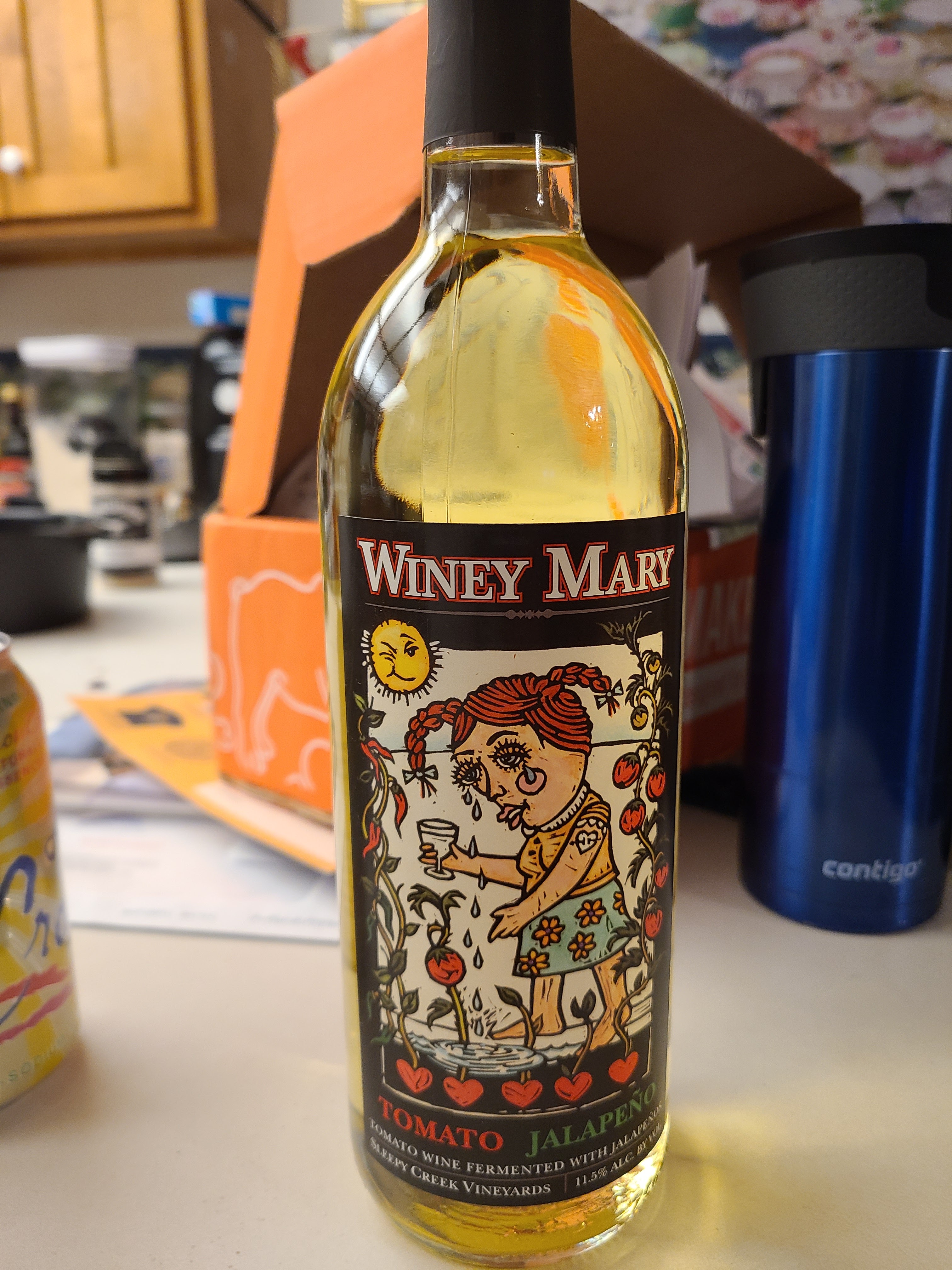
On the way early this morning, Mike had mentioned that we might have some time to fill in between hiking and #SupperClubSaturday and that maybe there would be a winery somewhere around where we were going to be eating. Tammy heard that and quickly found Sleepy Creek Winery and also found out that they made something called “Winey Mary” wine. What is “Winey Mary” wine? They describe it as “This will make you re-think wine…and your life. Tomatoes and Jalapenos were fermented like any other wine but the result is a white wine that tastes like a very light Bloody Mary.” Mike, of course, was skeptical but we arrived at the winery with enough time to do a tasting and have a glass of wine so we got a tasting of 6 of their wines. A couple of the reds were interesting — but the Winey Mary stole the show. The wine by itself has the aroma of tomato leaves but the flavor and a little bit of the bite of jalapeños. It was quite interesting! They then had you try it with a little of their bloody mary mix splashed in and sure enough — tastes just like a bloody mary. We liked it enough to get 2 bottles. We had Easter coming up soon and that would make an interesting morning change up for a bloody mary!!! (BTW — it was awesome to have just by itself, no bloody mary mix needed. Drinking a whole glass, it had the zip and flavor that you would not expect out of a white wine).
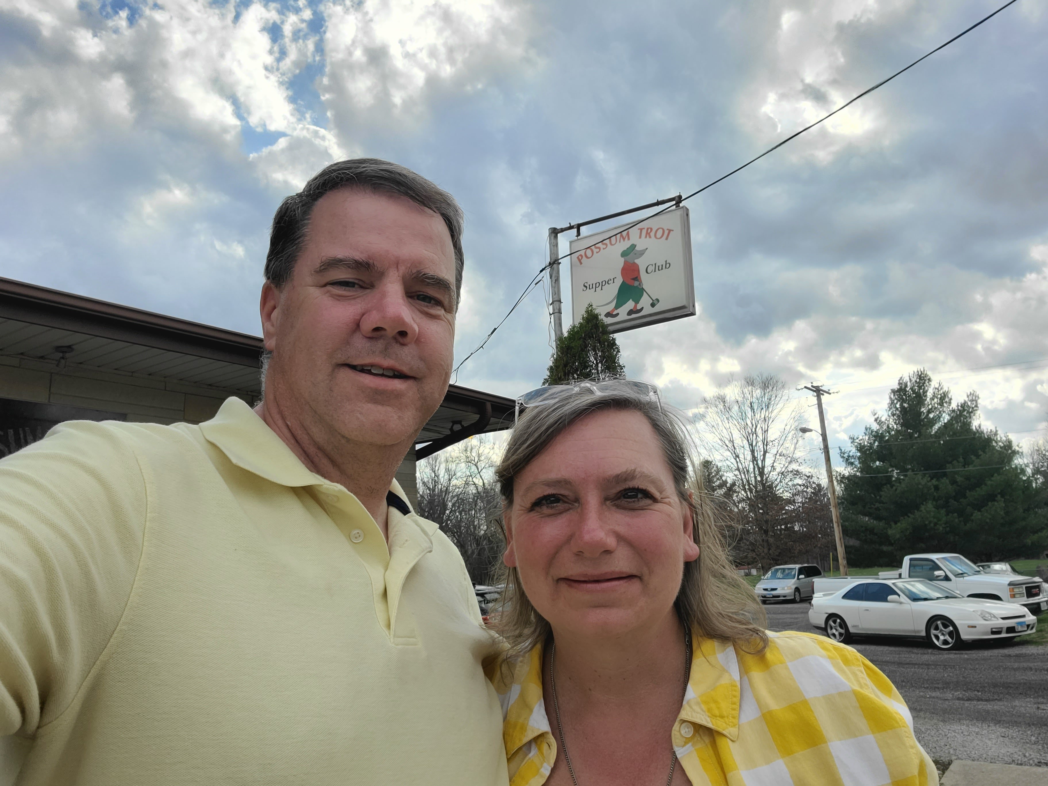
We left the winery with plenty of time to make to the Possum Trot Supper Club in Oakwood, IL. “Possum Trot”? Yep, “Possum Trot”!!!! Before we talk about the supper club itself, we get so many people who ask us how we find our supper clubs and aren’t we afraid of picking a “bad one”? First and foremost — Google is our friend (occasionally friends IRL will also recommend places), searching for places is key. Once we have a general area in which we will be done Splorin’ we start looking. Mike uses Google Maps, while Tammy just uses straight out Google search. But we start with a list and start narrowing it down by reviews and websites and Facebook. And we have also been known to use websites like http://www.wisconsinsupperclubs.com. And we also have 2 Supper Club posters hanging up in our living room. Supper Clubs are serious business for for us! Sometimes they just jump out at you like “Possum Trot”. We have been known to pick places just based on the name! In this case (as in most) it is a combination of reviews, location, and whether or not they have certain food (prime rib is must for Mike, Tammy usually likes scallops; a relish tray is an immediate move to the front of the line, sometimes popovers). Then there is atmosphere. We like the “old fashioned Wisconsin supper club” ambiance. This usually means a nice big bar, big booths, a salad bar (pre-pandemic), dark wood walls, a candle on the table, etc. About being a afraid of picking a bad one? It does happen, but thankfully rarely. When it does, it reminds us that it is much more about the company that you have with you at the table than the food or drinks. Those just enhance the supper club meal, it really is about who you are there with!
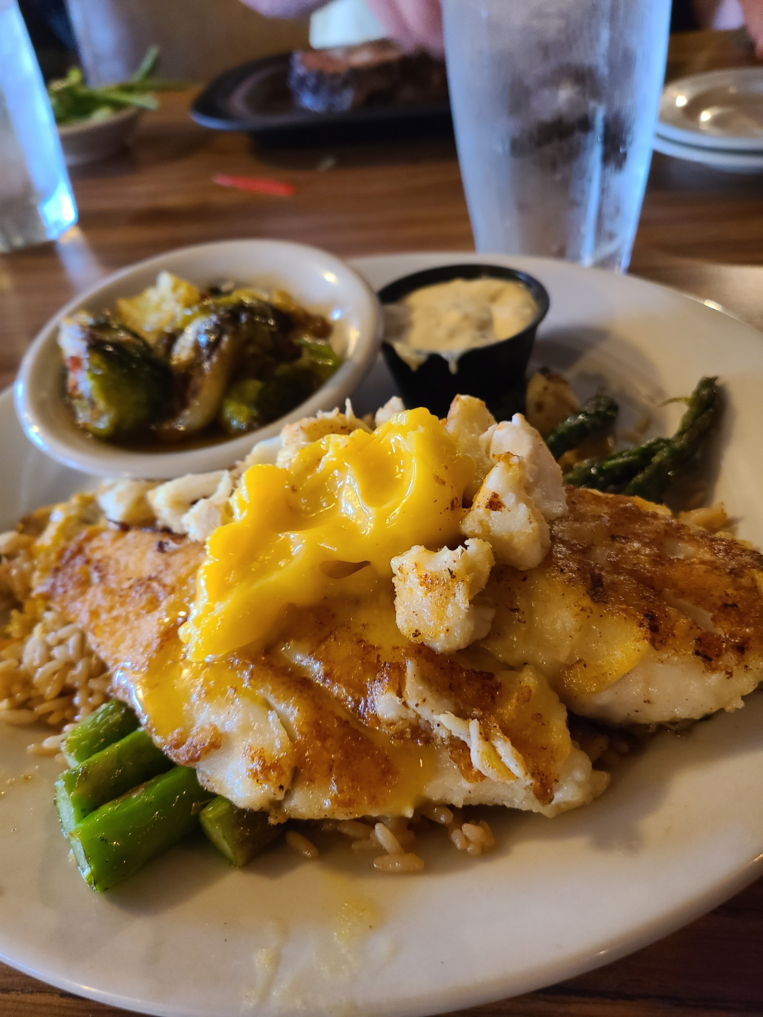
So, back to this particular supper club — when we walked in we knew it was a winner. A great big horseshoe shaped bar and dark wood walls and we were shown to our very private booth. We sat right next to a huge salad bar that a couple of years ago would have been very busy, but this year was out of service. For cocktails Mike stuck with his tried and true whiskey diet coke and Tammy went on an adventure with a French 75 (gin, champagne, lemon juice and sugar (minus the sugar)). She loved it!! Mike got his usual Prime Rib and Tammy got a chicken something or maybe steak and shrimp….idk, but she will correct this upon editing. (Tammy’s memory is NOT as good as Mike’s, however, she DID take a picture this time and apparently she had an “oscar style” fish with brussel sprouts.)
We also had an appetizer — Thai Lettuce Wraps. Had we known it was just going to be a partial iceberg lettuce wedge with cashew chicken in a bowl we would have gotten something else. It was good, but WAY too sweet for our palates, and Mike’s blood sugar! Oh well. Mike’s prime rib was passible — not the best, not the worst and Tammys was pretty gosh darn good (if I am remembering it right). But once again, it was the company that made it awesome!
Soon we were on our way back to the hotel in Bloomington. Tired from the day we both fell asleep very quickly, so we could get up early the next day and do a little additional Splorin on our way home.
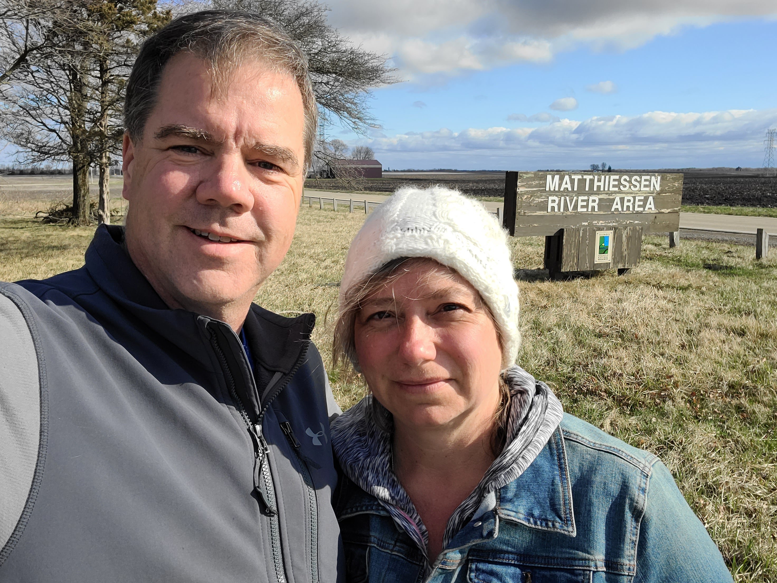
We left the hotel early the next morning we were heading for Matthiessen State Park in Utica, IL. It was a short 50 minute drive from the hotel so trying to find a breakfast place that still left us 30 minutes before arrival was a little difficult, but Mike found a little out of the way place called Lj’s Garden Cafe in Magnolia, IL. Magnolia is a tiny little village out in the middle of nowhere Illinois — it has a massive population of 302. Lj’s Garden Cafe sits right in the middle of downtown (as does everything else ;-)). Walking in you felt like you were walking into your grandma’s kitchen (if grandma actually had 8 tables there). All the tables were big, tables for 8, except one which had 4 chairs at it. It was obvious it was a little down home restaurant with living space above it (we sat right next to the steps to upstairs). The food and coffee was good! There was no coffee klatch but there was a big family around one of the tables and another couple of couples came in while we were there. ( the Sunday morning before or after church crowd) We were sure there was a lot of talk about us when we left, but….we would have it no other way!!!
Back out of nowhere and to the freeway, we were just 30 minutes from the state park. Interesting that we were going to Matthiessen State Park and never saw a single sign for it until the sign at the driveway. Its “bigger brother” state park, Starved Rock, is the big tourist draw and thus commands all the signs. (see our review 9/19/20) We were just going to be doing a short hike today (about 2.5 miles or so) so that we could get going on our long drive home. As such, we stayed away from the more “touristy” areas of the park (there are several waterfalls) just to try to stay away from people. We will be back down this way again and can do those other areas when we have more time and better weather allows. Where yesterday was bright and warm, today was chilly, windy and threatening to rain – but that doesn’t stop us!
Interesting thing to note — hiking the trail yesterday on the eastern side of the state, we were on the Vermilion River — Matthiessen State Park is also on the Vermilion River (although they are NOT the same Vermilion River). Yesterday the Vermilion River was in Vermilion County that flows south into the Wabash River, while today’s Vermilion River flows north into the Illinois River. Mike is surprised these rivers don’t get identity complexes within the same state with the same name.
The reason we could not go to this park before was the storm that came through in August of 2020. Lots of tornadoes and just straight line winds reaching over 100 mph. The cleanup obviously took a long time and is still ongoing. While it is amazing to see all the trees down, it is equally amazing to see all the trees still standing. So many lost their battle with their roots while many others survived. Heading down towards the river we walked across a ridge high above the water, still just in awe of all the trees down. With no leaves on the trees you could see deep into the forest to see them all lying there.

Once we descended to the river level we were down below some limestone cliffs that look like they took a beating during the storm too. We even found a tree that survived….barely.


Once down on the river it showed off it’s beauty. While the weather was cold and windy, the river was calm and gentle, but still moving with gusto. We can only imagine what it would look like in the middle of summer with all the trees leafed out and bushes growing along the shores.

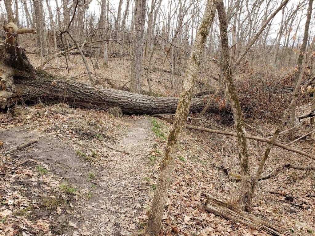
Since this was a short hike we were already making our way back to the van. We came across a couple of places where the trails were still closed because of storm damage so we had to adjust, on the fly, the route we were taking back to the car. Even though the trail we were on was still open, there were a couple of very large trees blocking the way here and there, but they were in no danger of harming anyone on the trail, just a nuisance that you had to go around them.
We were soon back in the car and on our way back to God’s Country. Back to real life, Henry the pupster and work.