On the Road Again: Trifecta 2 — Nelson Dewey, Belmont Mound and Gov. Nelson 1/4/2020

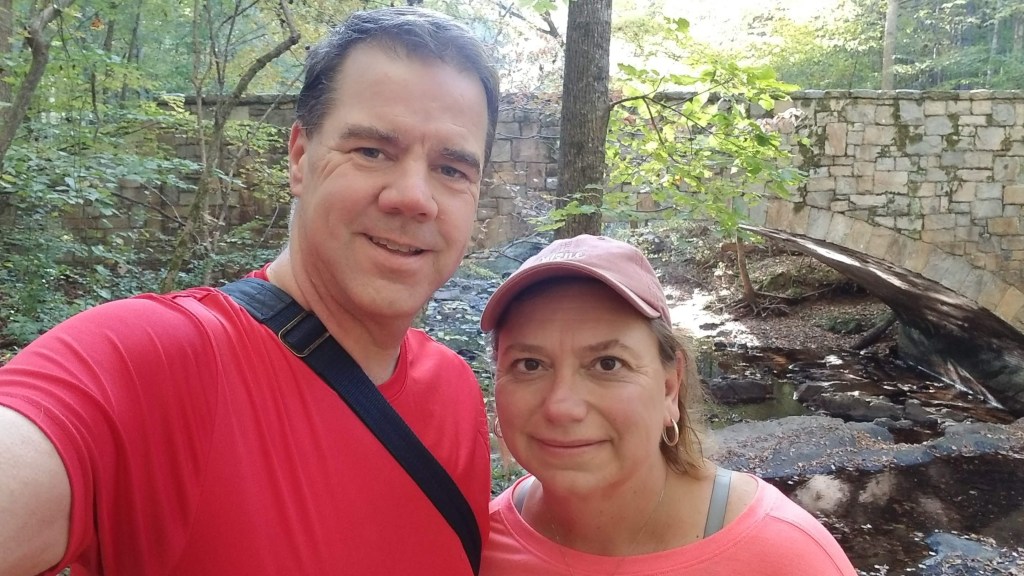
Nothing like last minute change of plans…..we originally had planned to stay close to home today and just head up to Lake Wissota State Park (yes, we’ve been there before) and try out our new Christmas presents: snowshoes!!! But, the weather was supposed to be good and we’ve still got plenty of Wisconsin state parks to so — we (foolishly?) decided with the nice weather this would be a good day to tackle three smaller parks that would require a lot of driving. This was going to be a long day, so….

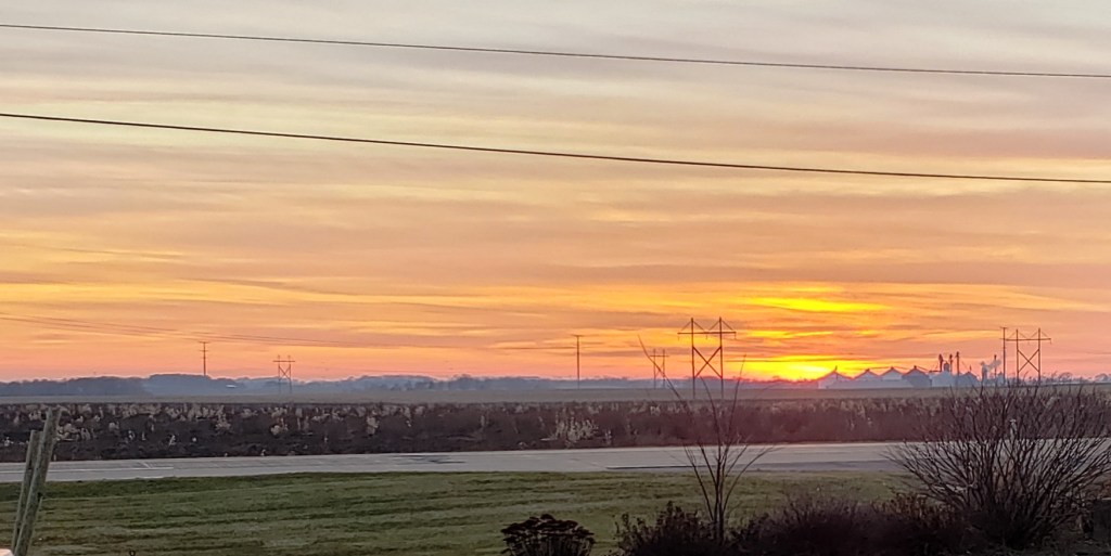
….we started early. We were out of the driveway at 5:36AM (darn it, late again). This was going to be a tough day — a lot of driving and a lot of hiking, so time was of the essence (insert dramatic foreshadowing music). Our first park of the day was way down in Southwestern Wisconsin (across the river from Iowa and almost to Illinois) so we were taking a very familiar route: I-94 to Hwy 27 South. We are always on the lookout for “firsts” during our Splorin’ and this time, the drive didn’t disappoint. Just south of Black River Falls, out in the middle of nowhere (so it was completely pitch black) something started across the road from the ditch on the left side. Mike saw it immediately and hit the brakes. He initially thought it was a deer, but it ended up being a very large owl…..carrying a very large rabbit. It made it about 6 feet in the air and started to cross the road. Luckily Mike was able to slow down enough so it made it across the road without coming through the windshield!! That was a little too close for wildlife viewing.

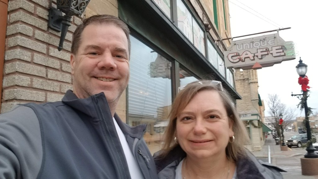
As we got closer to southern Wisconsin, somewhere around Westby — we noticed that it started to look like there was a light amount of snow on the ground. Not a lot, just a light trace. We were heading to Boscobel, WI and the Unique Cafe. The best way we could describe the Unique Cafe is that it was …. unique. How many cafes do you go to that have medieval suits of armor in them? That and ALL the other thousands of little memorabilia/kitschy type items. We were very happy to see that the men’s Saturday morning coffee klatsch was in full swing in the back of the restaurant, but we couldn’t sit near them as there were no other tables available there. Mike had his usual meat omelette with a side of bacon, Tammy had a “unique” omelette — sausage, mushrooms and marinara sauce, and we both had huge salads with lots of veggies in them. When one of the men from the coffee klatsch got up to leave he stopped by our table looked at Mike and said “Hey kid”. Mike looked at him, then at Tammy, then back to him and he finally realized that he was mistaken and said “I thought you were one of the Miller boys”. Tammy told him that we were from Eau Claire and he started asking what we were doing in town and Tammy had to explain it all to him. He was a little hard of hearing because every time Tammy said something he leaned forward and said “Huh?” It was kind of funny…nice local retired guy. We learned after he left our table and stopped to talk to someone a couple of tables away (coffee klatch guys always stop to talk to everyone on their way out) that his name was Lyle. We finished up and headed out to enjoy the rest of the day.

Almost immediately after leaving the cafe we ran into … ice. We decided to do this today because of the weather, yet here we were going down these twisty, curvy, country roads that are covered with ice and snow. We ended up have to go pretty slow to ensure we stayed on the road. The reason the road was so curvy was that it was following a river — it was beautiful!! The light snow that had fallen overnight to make the roads treacherous, made the trees on this hills and valleys along the river absolutely stunning! We finally made to the end of that road and onto a big highway — thankfully we would leave those icy roads behind us. Not. We went on the highway for about 1 mile before we turned onto “Fairground Rd.” which would take us to Bloomington! Never knew there was a Bloomington, WI (Mike has spent 4 days a week in Bloomington, IL at State Farm for the last 14 years). Fairground Road was even more treacherous that the last road. This was a very straight, narrow, up and down hill road that was very slippery. Tammy thought Rollercoaster Road would be a better name! We met about 5 or 6 cars and trucks along this road and every time we thought we were going off the road. But enough about the drive, let’s get to the park.

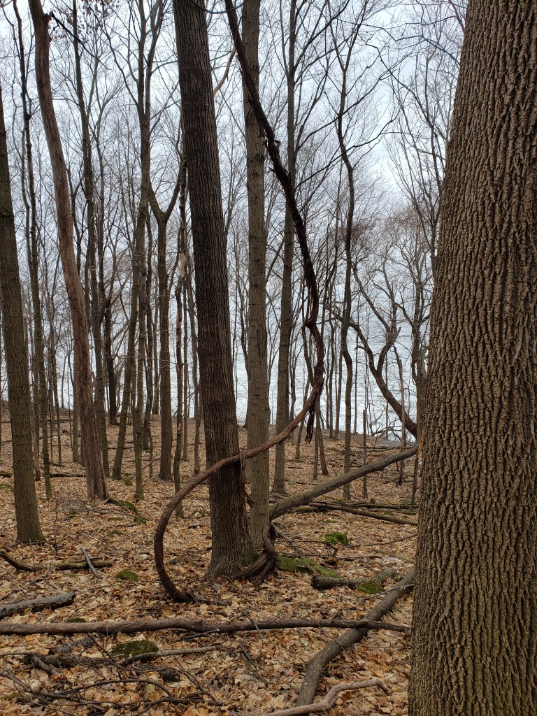
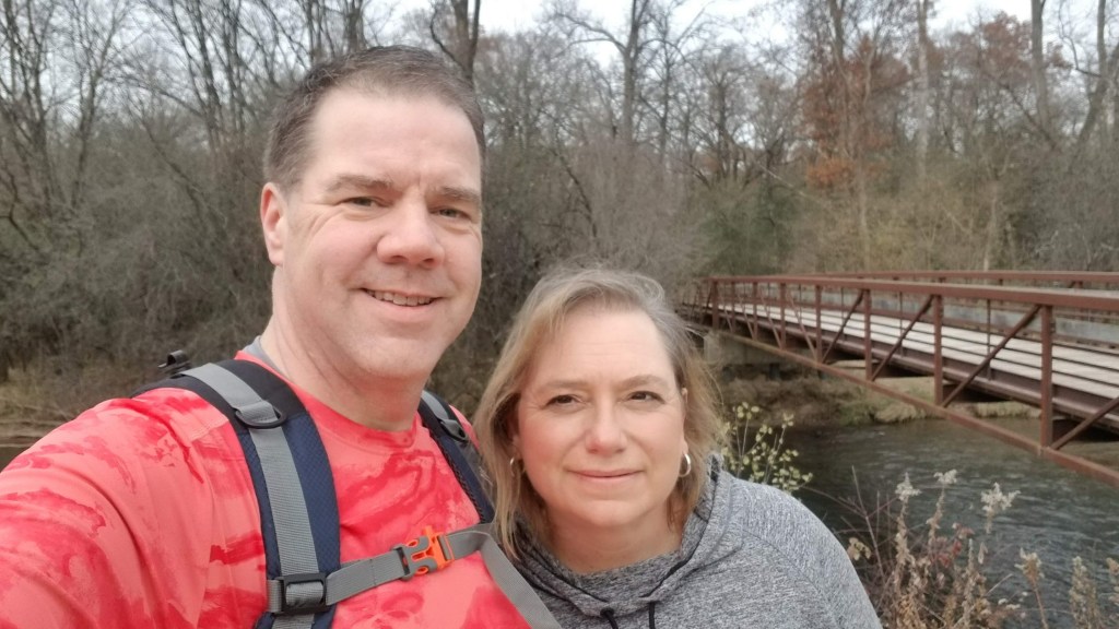
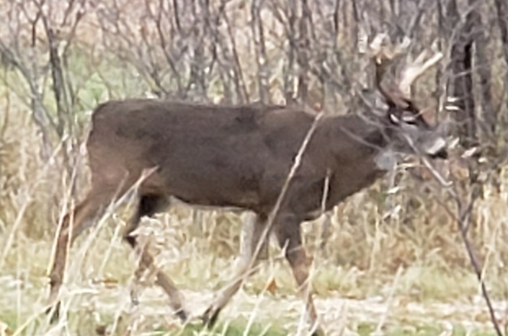
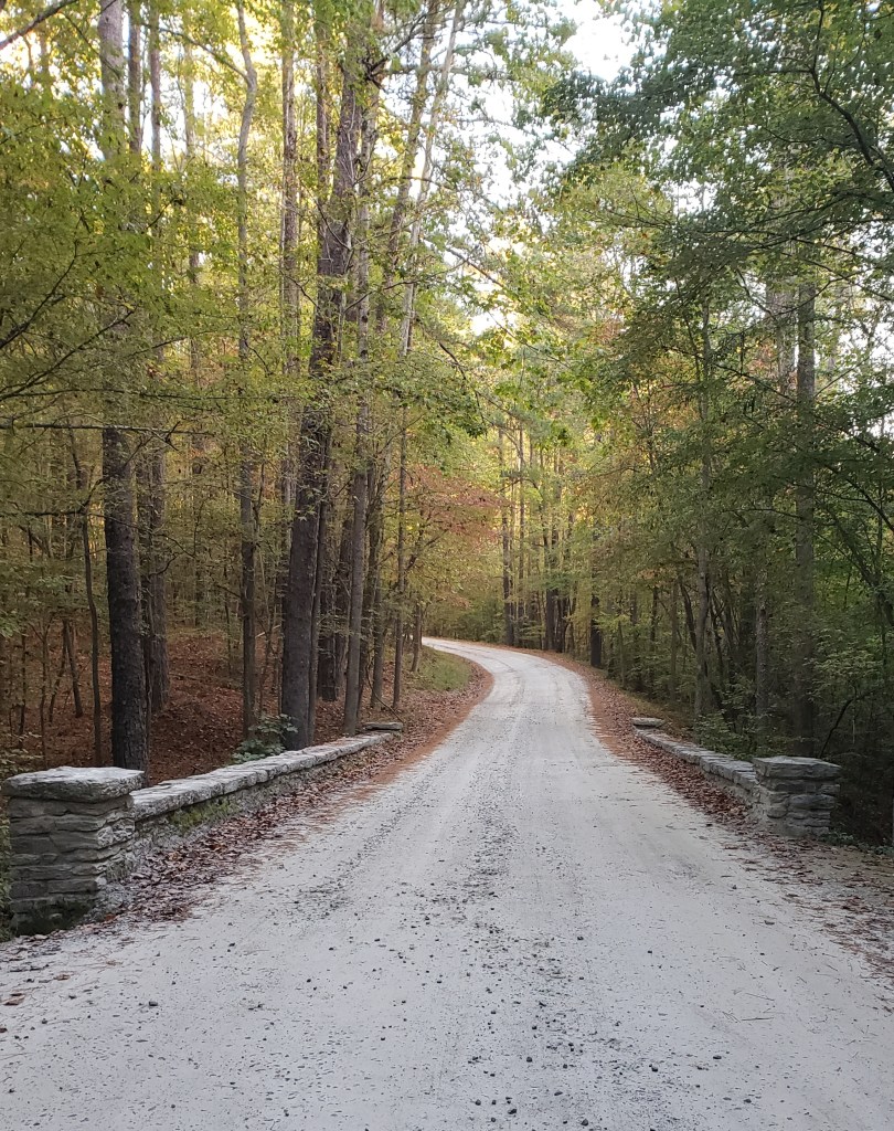
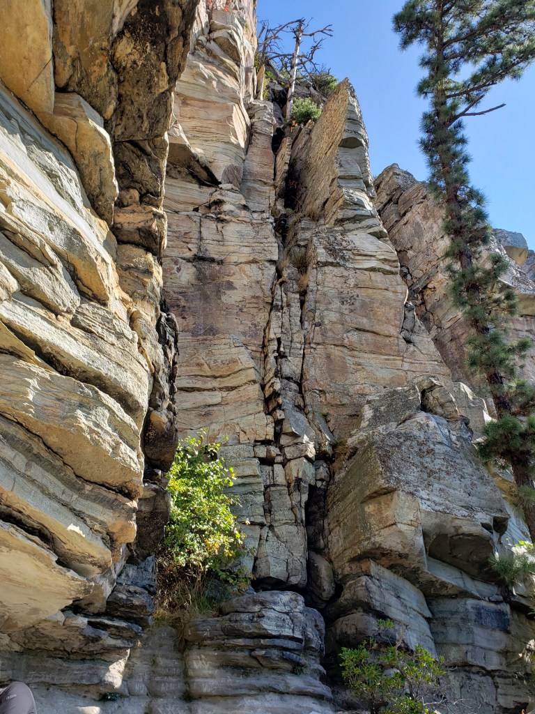
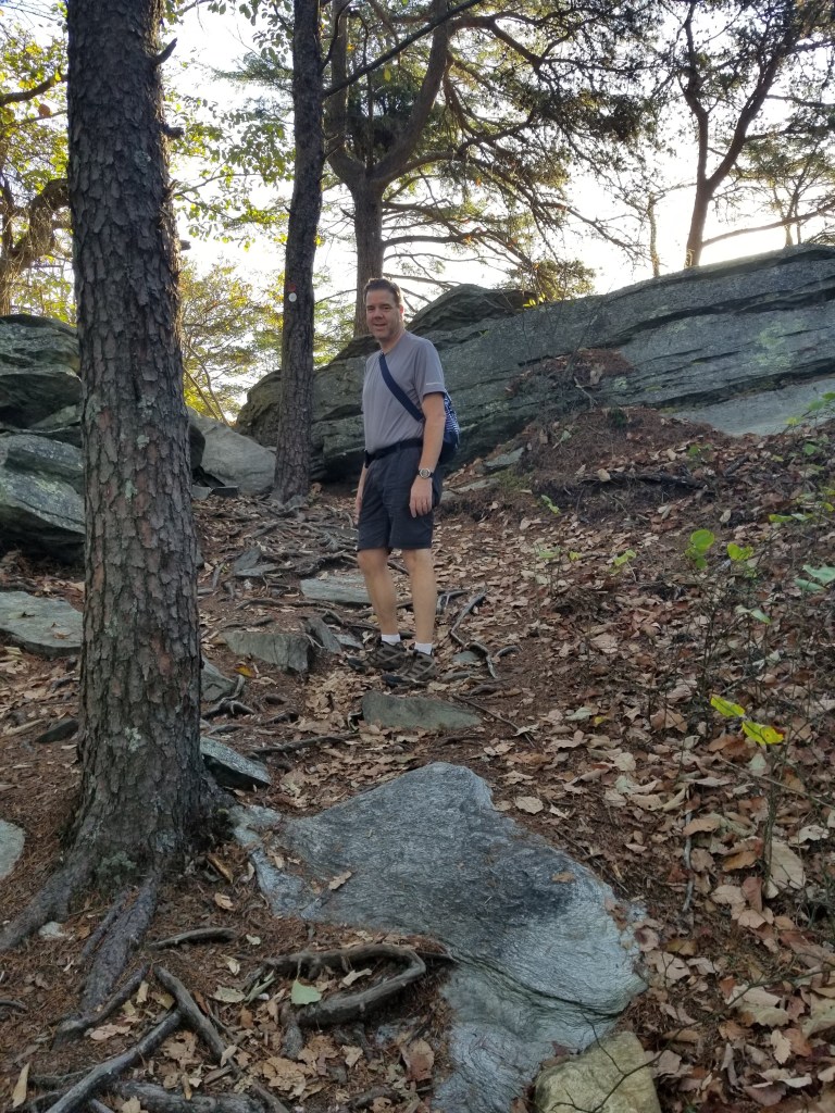
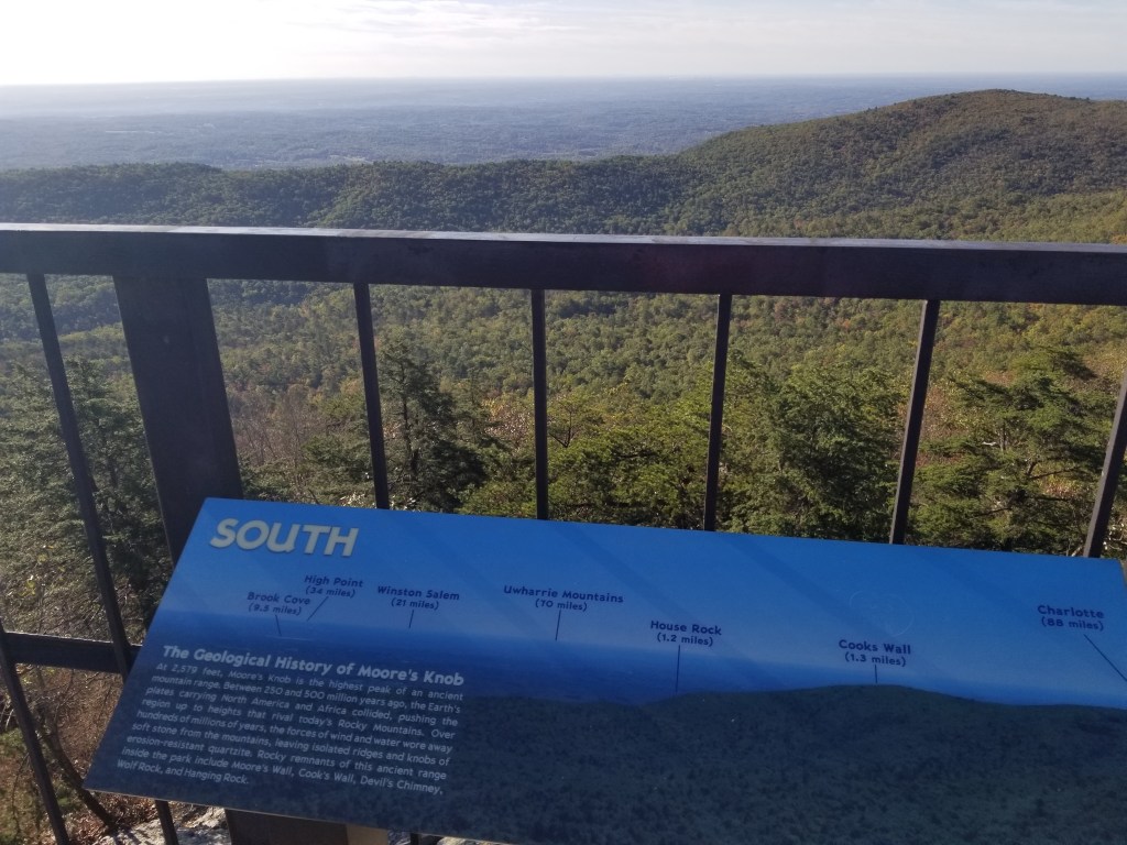
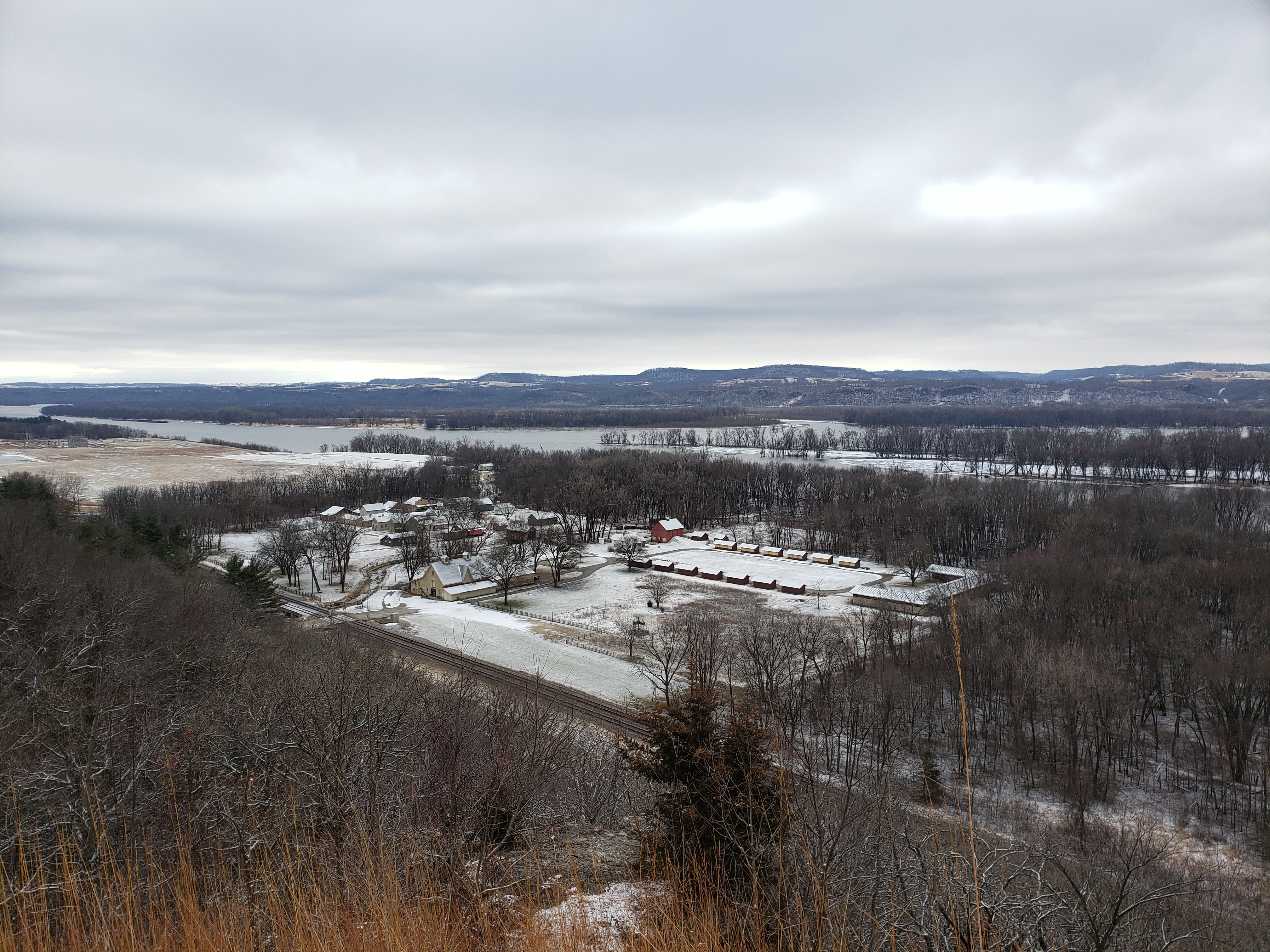
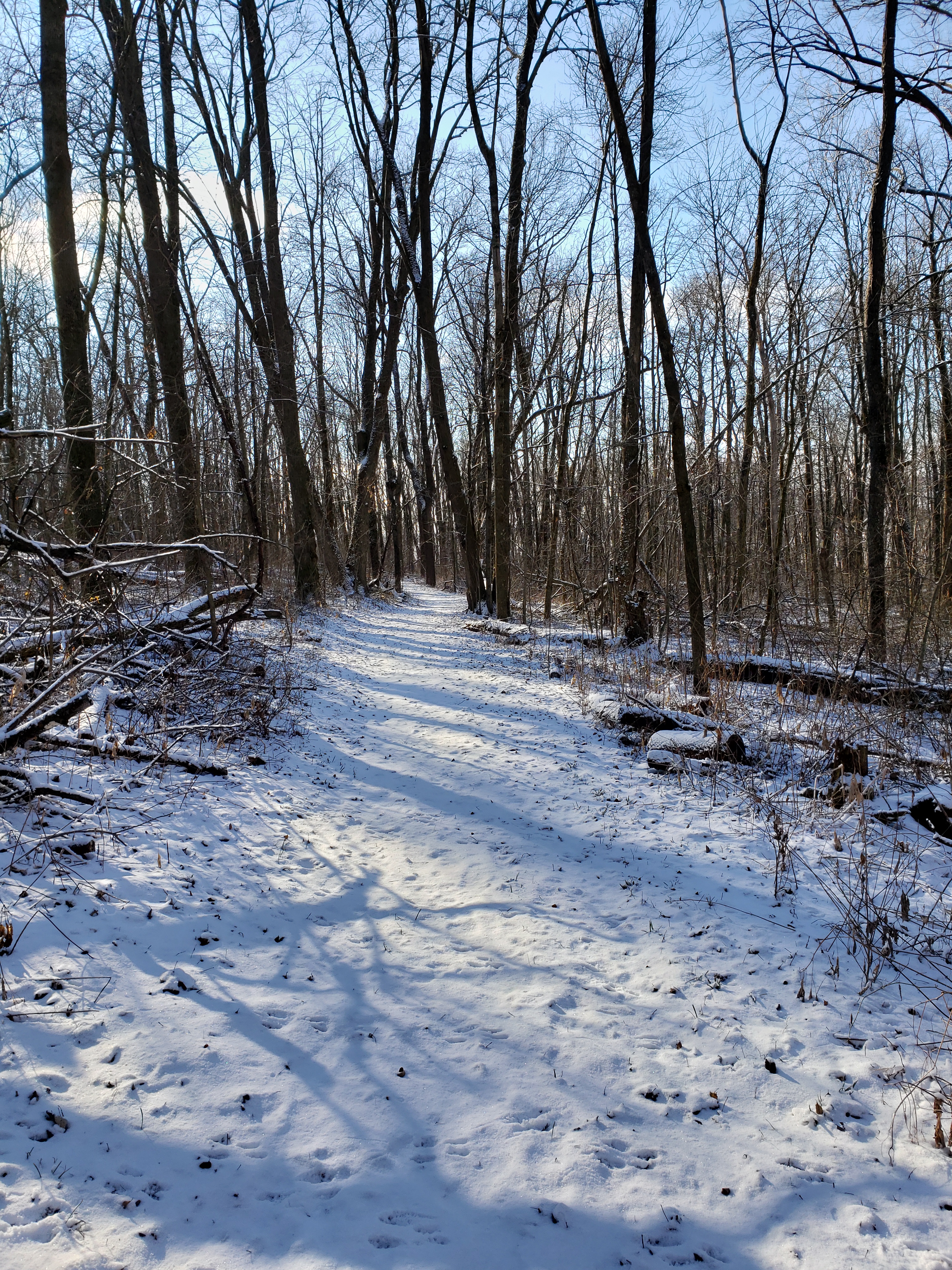
Our first park of the day was Nelson Dewey State Park. This is a very small state park on top of a bluff overlooking the Mississippi River you had to drive up to the top of the bluff from below. Mike had “The Plan” ready — we were going to drive to the far end of the bluff and do a loop hike that would, at most, be about 2 miles (across 4 or 5 different trails). As we turned onto the road that would take us to the park entrance, Mike said “I sure hope this isn’t a park that has a closed gate during the winter.” We’ve been to a couple of these, but they stated this on the website — that you had to walk in, but Mike had not looked closely at this one. Across from the entrance to the park, were signs for Stonefield Historic Site; it was closed for the winter but Tammy was curious what it was all about. Of course, we turned into the parking lot to a closed gate. It was more than a mile walk up the drive to the top of the bluff — we quickly discussed and decided even though we were on a tight schedule — we would walk to the top if we couldn’t drive. Well, we paid our self registration entrance fee and began the hike up. It wasn’t too bad as we made it to the group camp — then it began to climb elevation pretty quickly. No one else had walked to the top yet and with the light snow that had fallen, there were animal tracks everywhere. One set of tracks caught Tammy’s eye more than the rest.

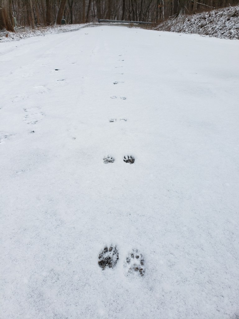
She kept saying the were “Tigger” tracks, because, well, you know — Tiggers bounce! Unfortunately Tiggers are extinct in Wisconsin — Mike found out later that they were some type of weasel tracks (more than likely Mink). After a 300 foot elevation climb up the road, we were ready to begin hiking. Tammy was already near the top of her frustration scale because her new boots were still bothering her. She had picked up gel insoles but they didn’t help at all.

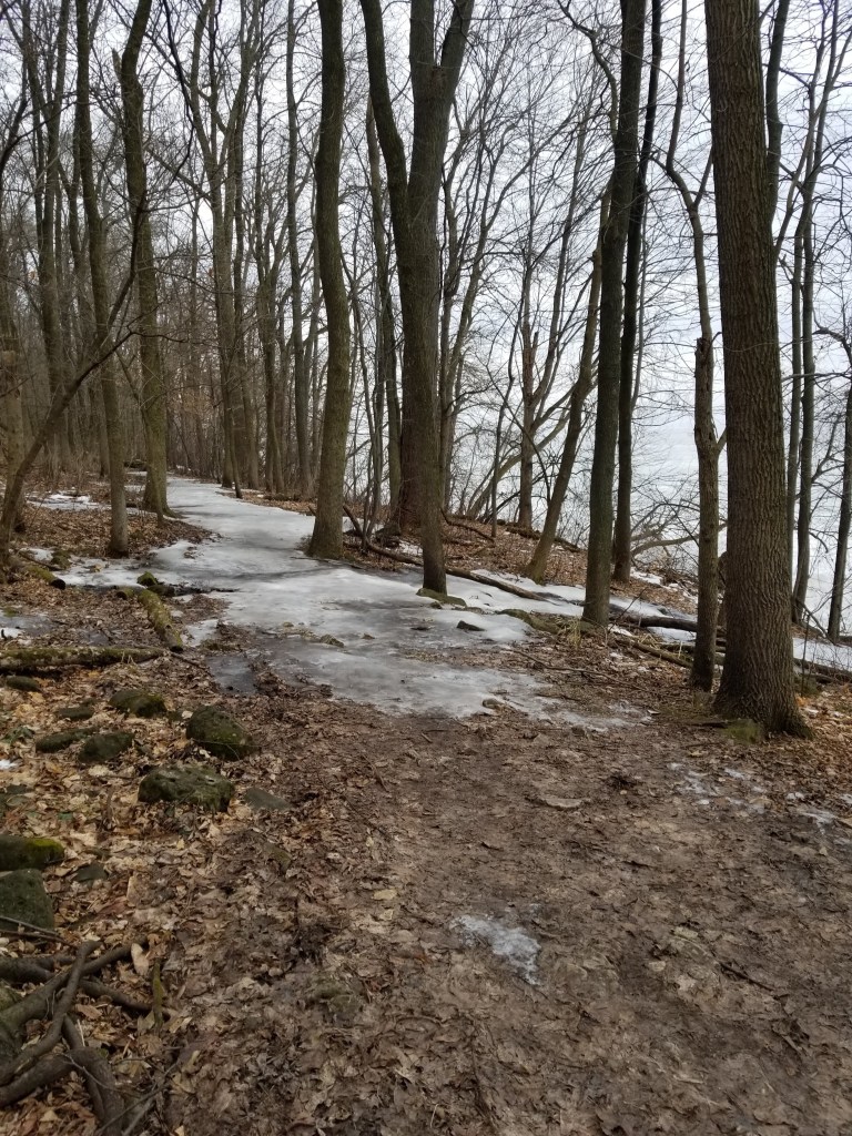
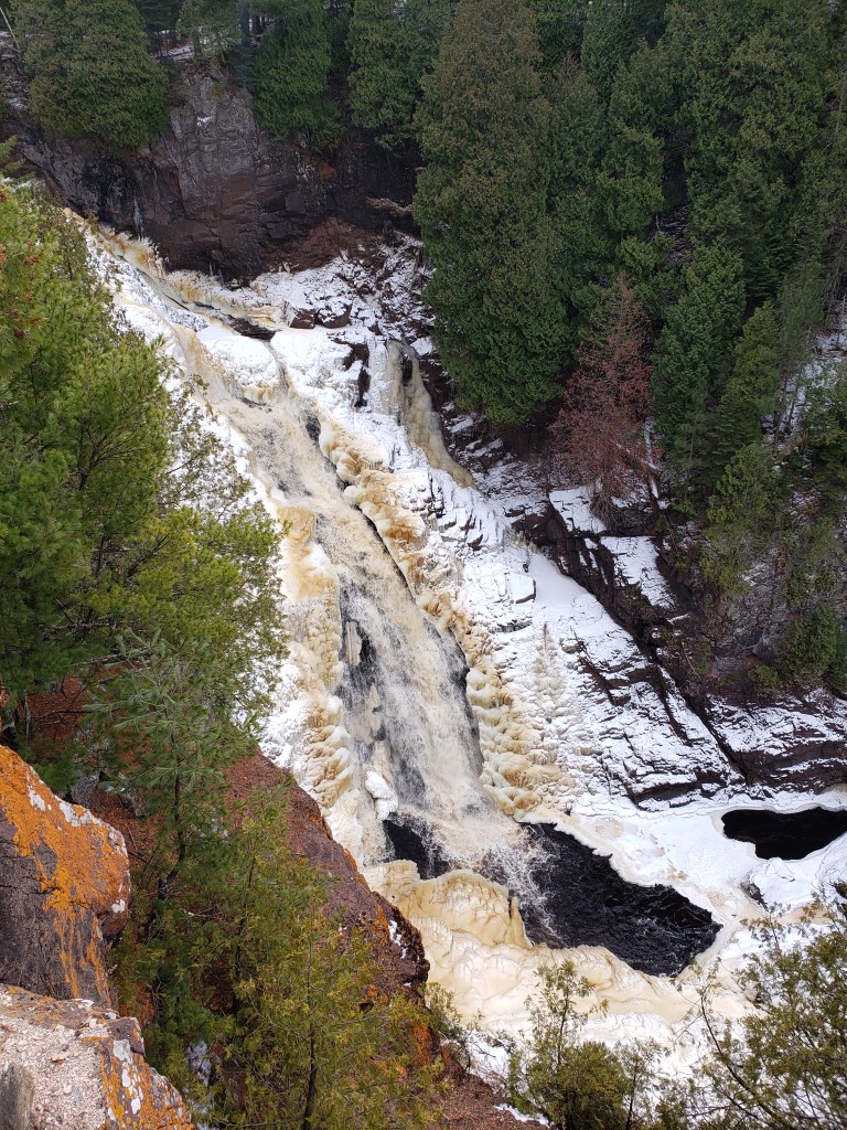
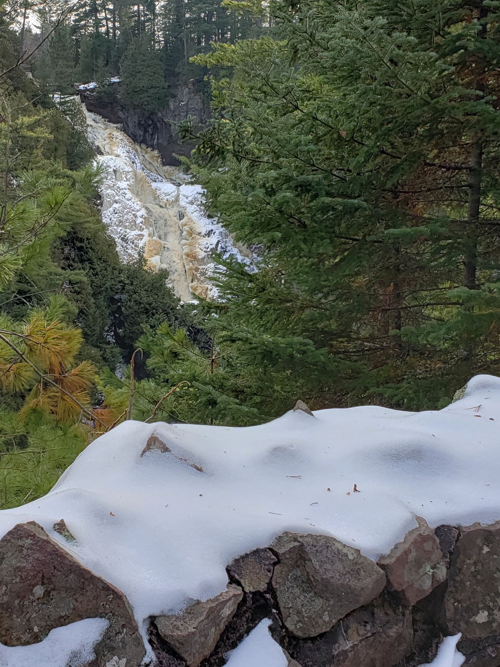
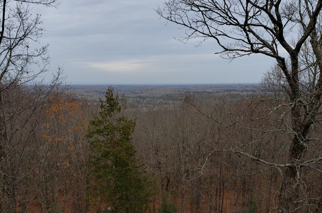
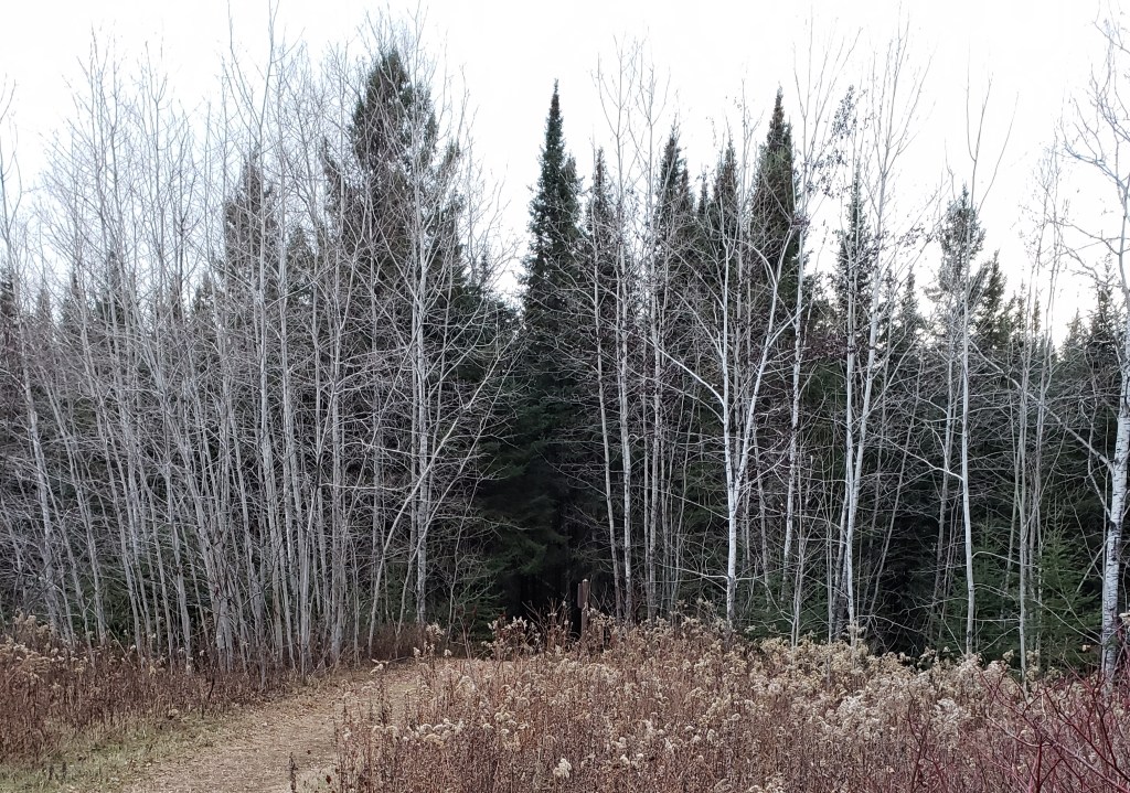
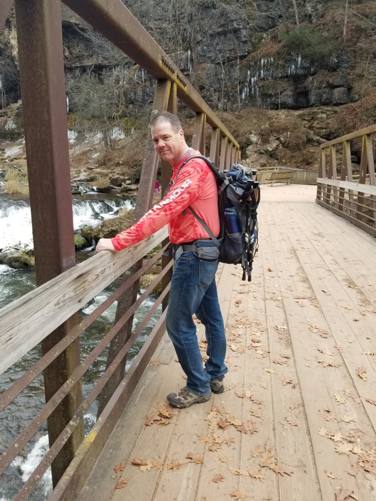
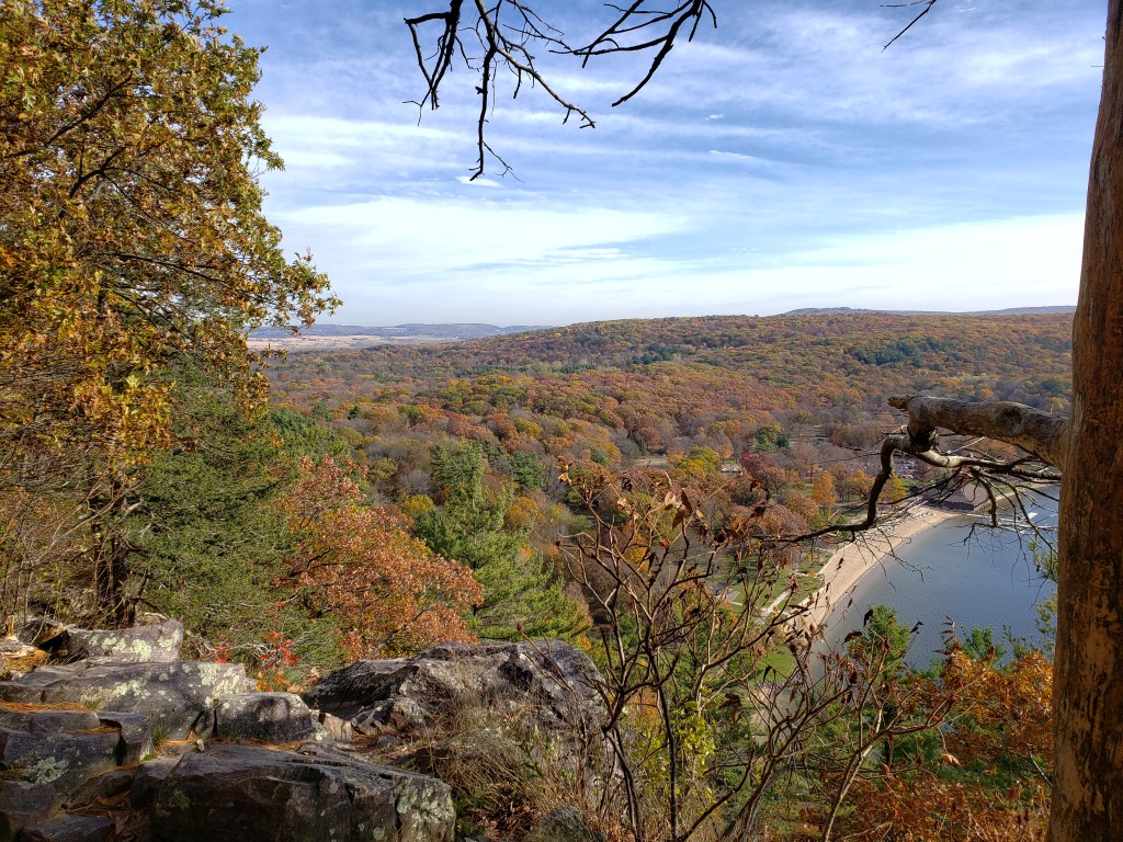
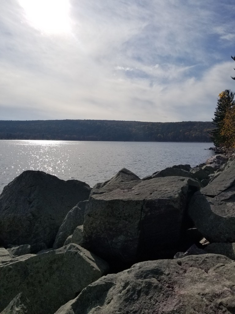
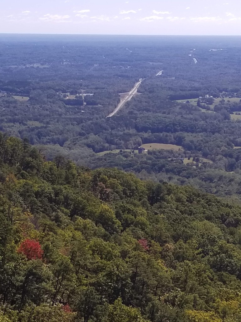
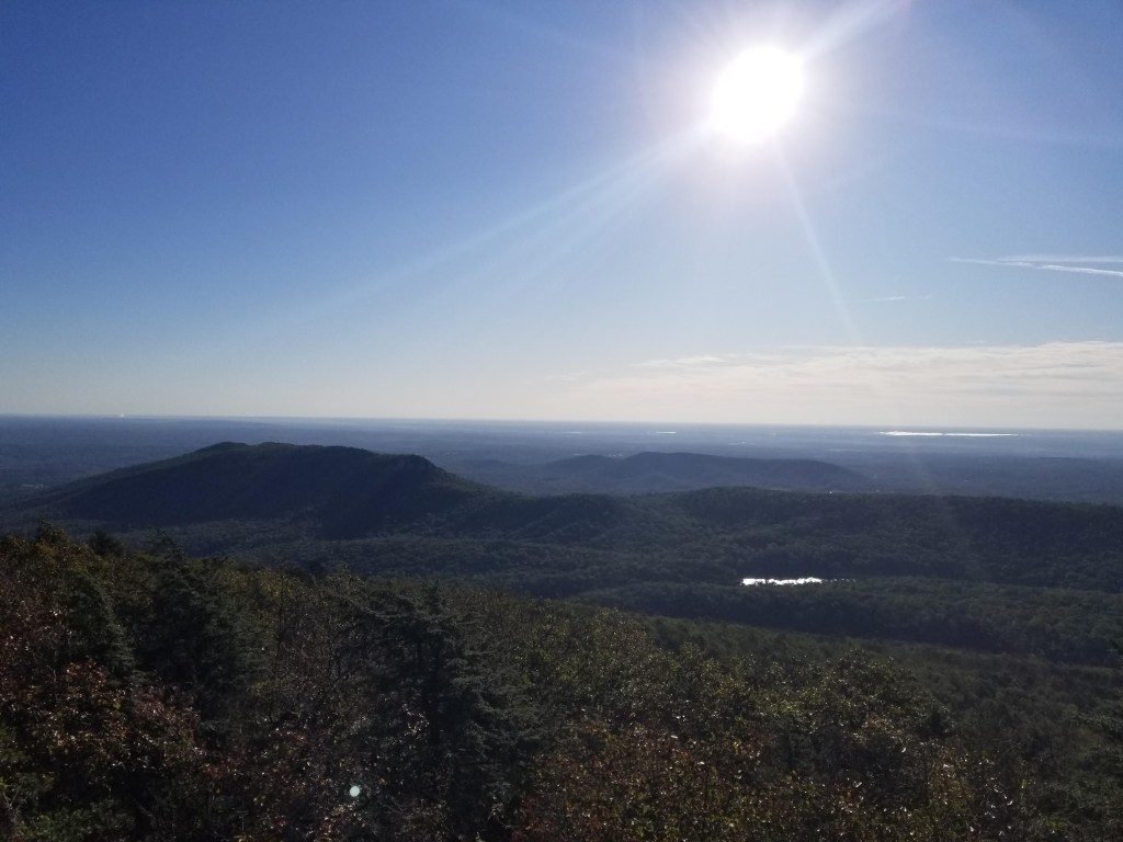
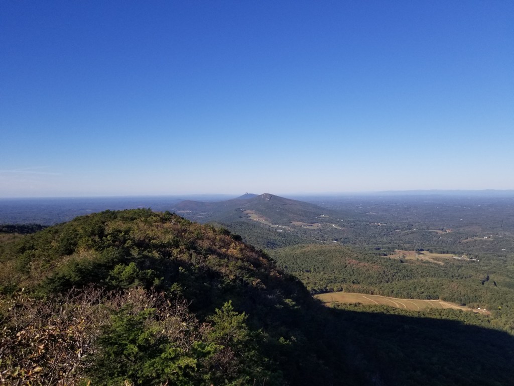
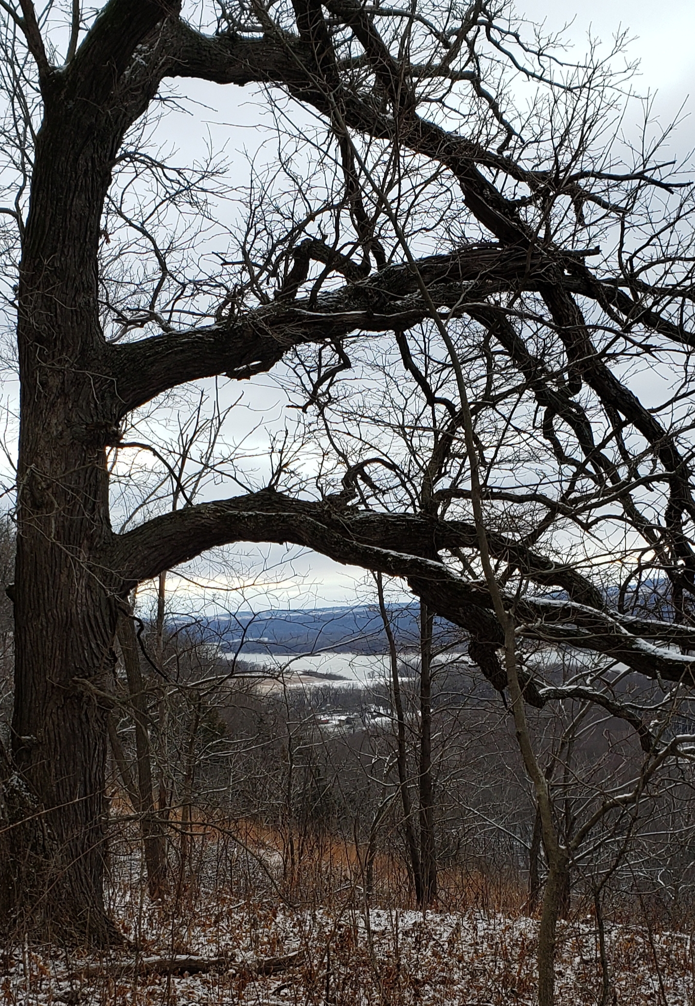
Mike had something new to try today — a hiking app and website that he uses to find trails now allows Android users to record their hikes so they can be shared with others. If you are interested, click here for the trails that we hiked at Nelson Dewey State Park. Our first trail was the Woodbine Nature Trail. It was just a short paved trail (even though we couldn’t tell because of the leaves and snow) but when we got around to the far side — it afforded us a breathtaking view of the Mississippi River.

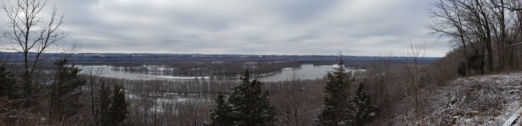
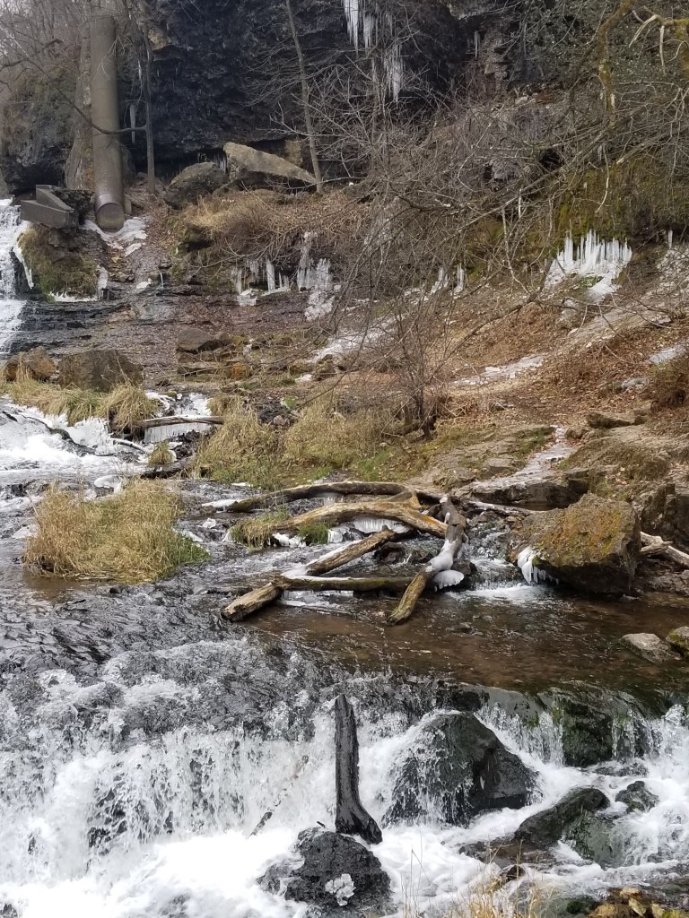
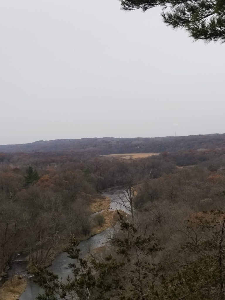
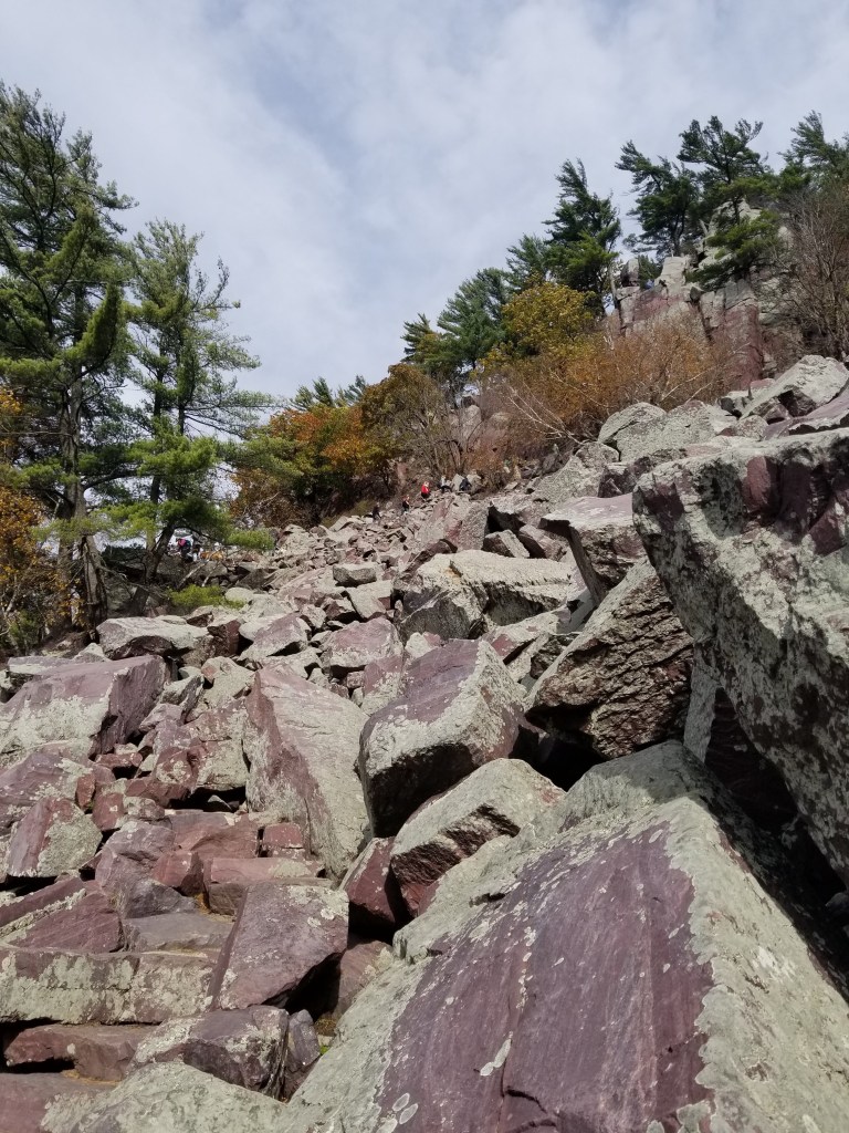
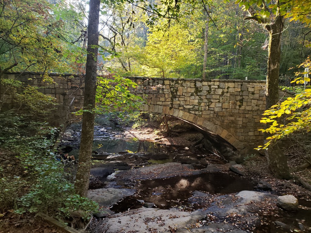
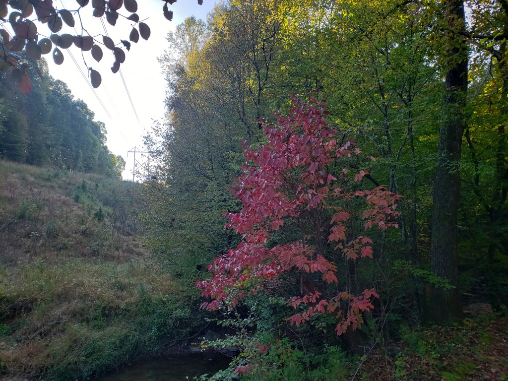
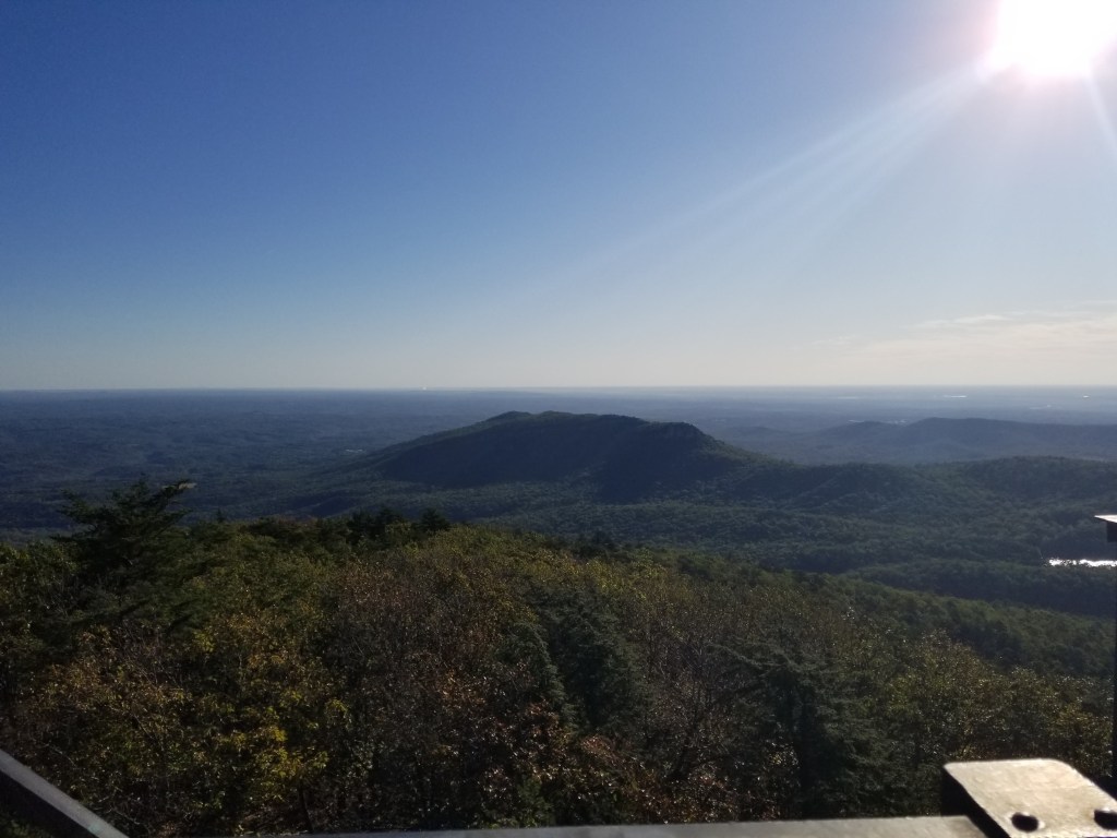
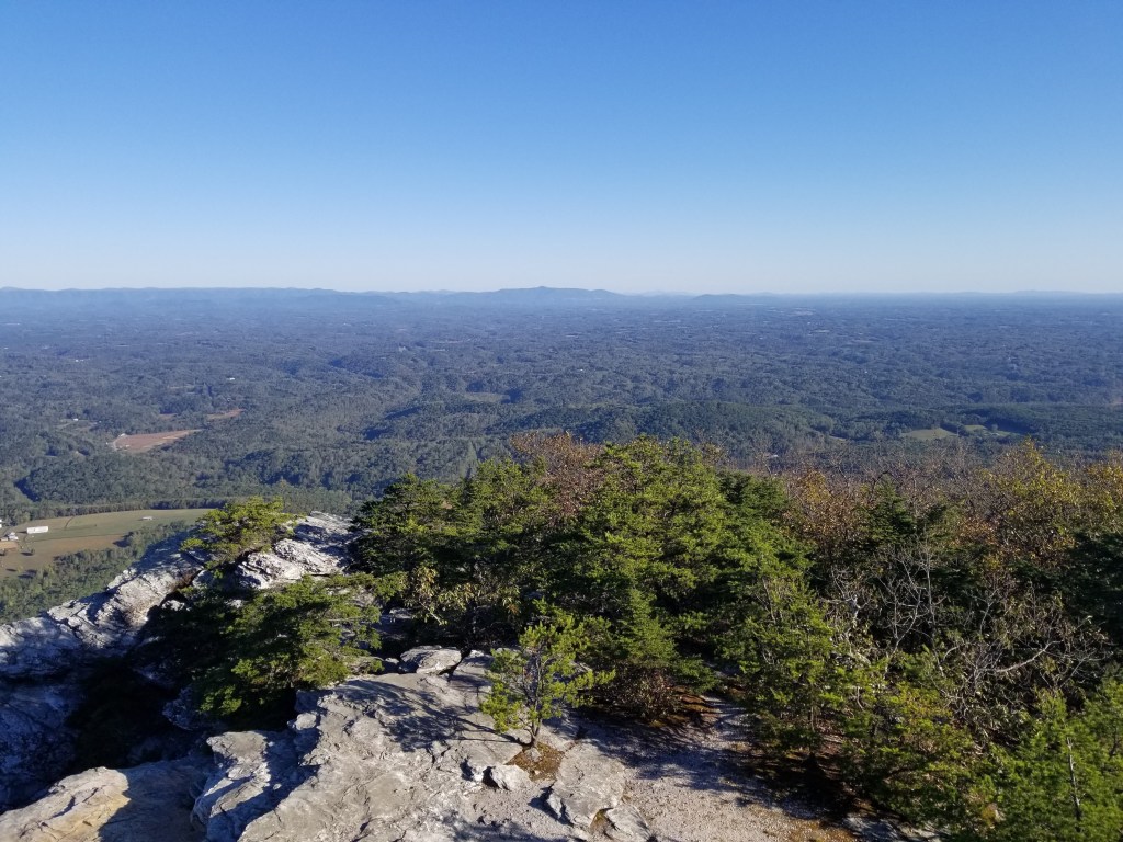
We then moved on to the Mound Point Trail. Mike thought this 0.6 mike trail would just follow the top of the bluff from one end of the park to the other. Well, the only thing he had right was that it went from one end of the park to the other….but instead of following the top of the bluff, it followed along the side of the bluff. It was absolutely gorgeous!! Lots of little “sneak peaks” of the river that you would never see in the summer. Up and down the ridges, over little bridges in the valleys, it was an awesome hike!!

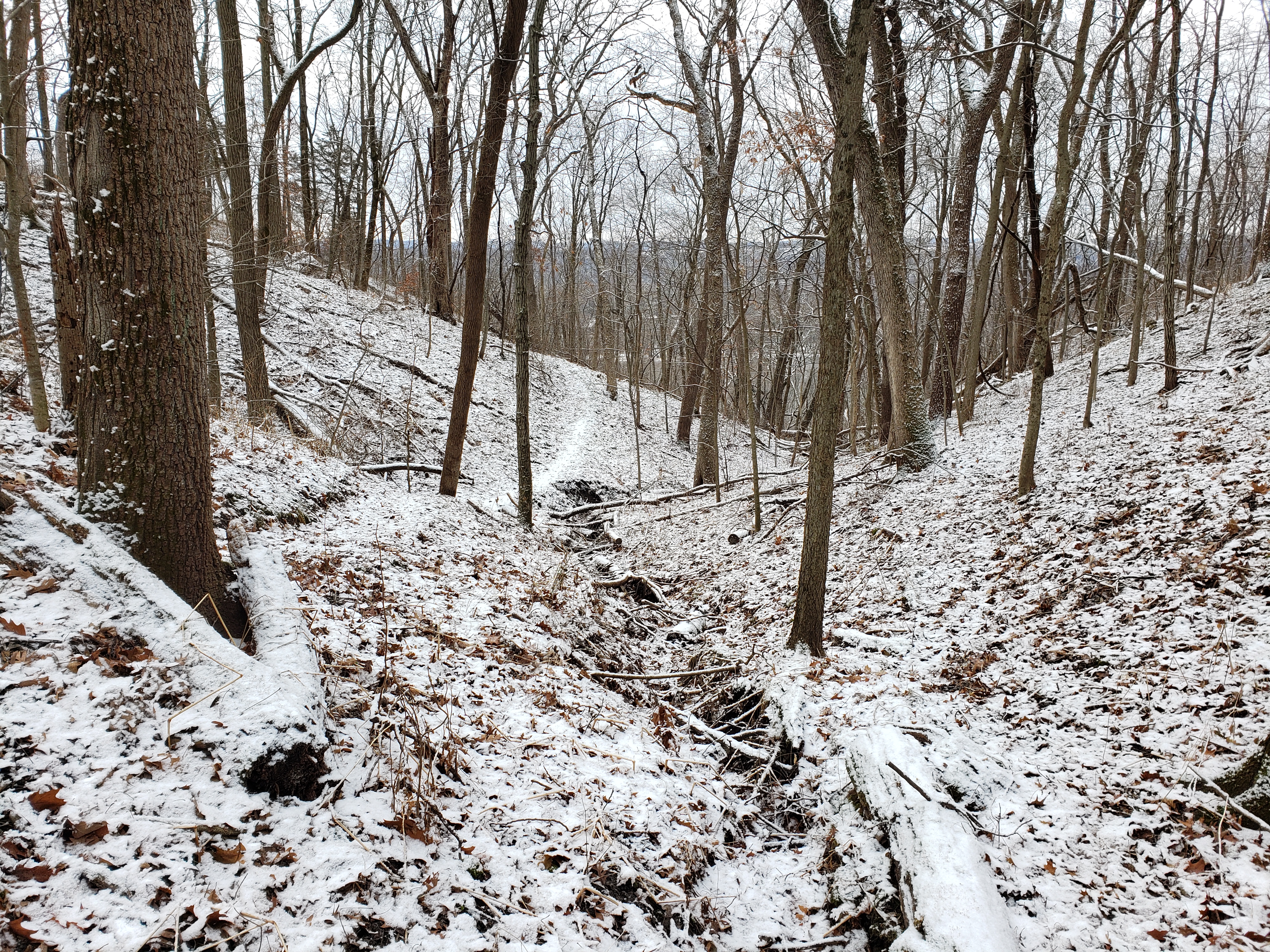
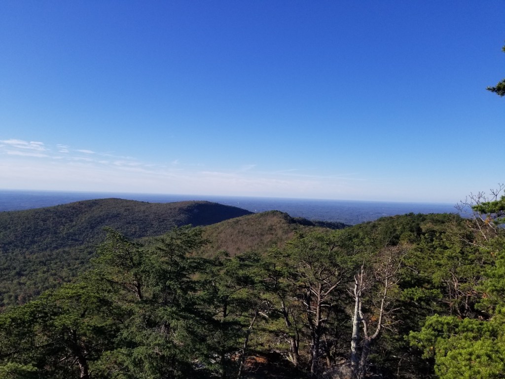
At the end of this trail we had to walk down the road a bit to get to the next trail. Unfortunately Mike read the map a little wrong (as he is very apt to do) and we walked farther on the road than expected. But alas, we finally found the Prairie trail. While this trail was very short, it had amazing views.

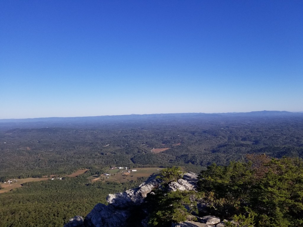
The last trail on the bluff side of the park was Cedar Point Trail. It quickly became apparent why it was called Cedar Point — the trail led you to a point with a cedar tree on it. 😉 Once again, cannot say enough about the views.

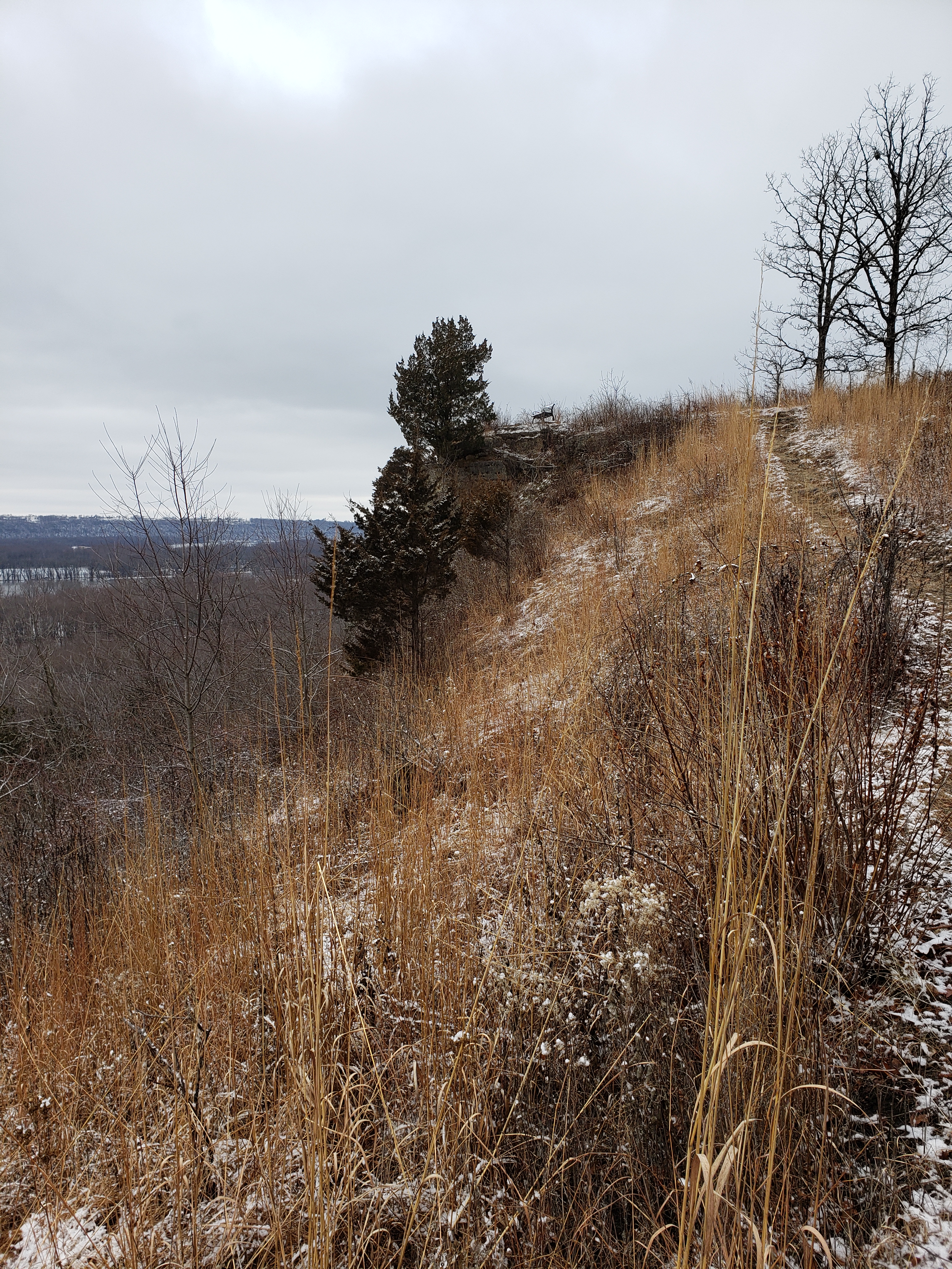
The funny thing here was that we were at the far end of the bluff where we had planned to start our hike if we had been able to drive all the way to the top and we were literally only about 100 yards (straight up) from our car in the parking lot below.

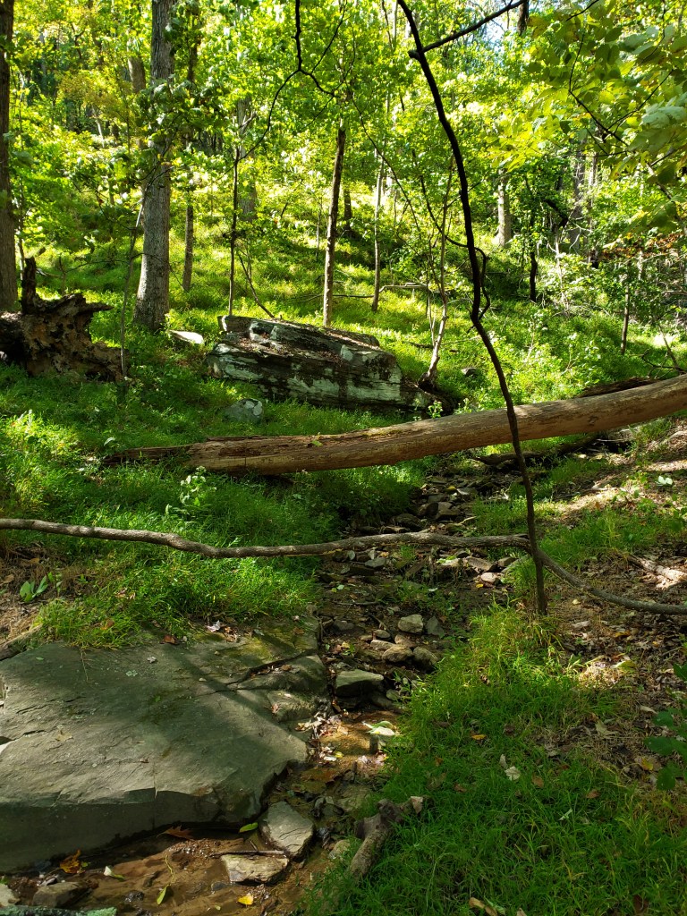
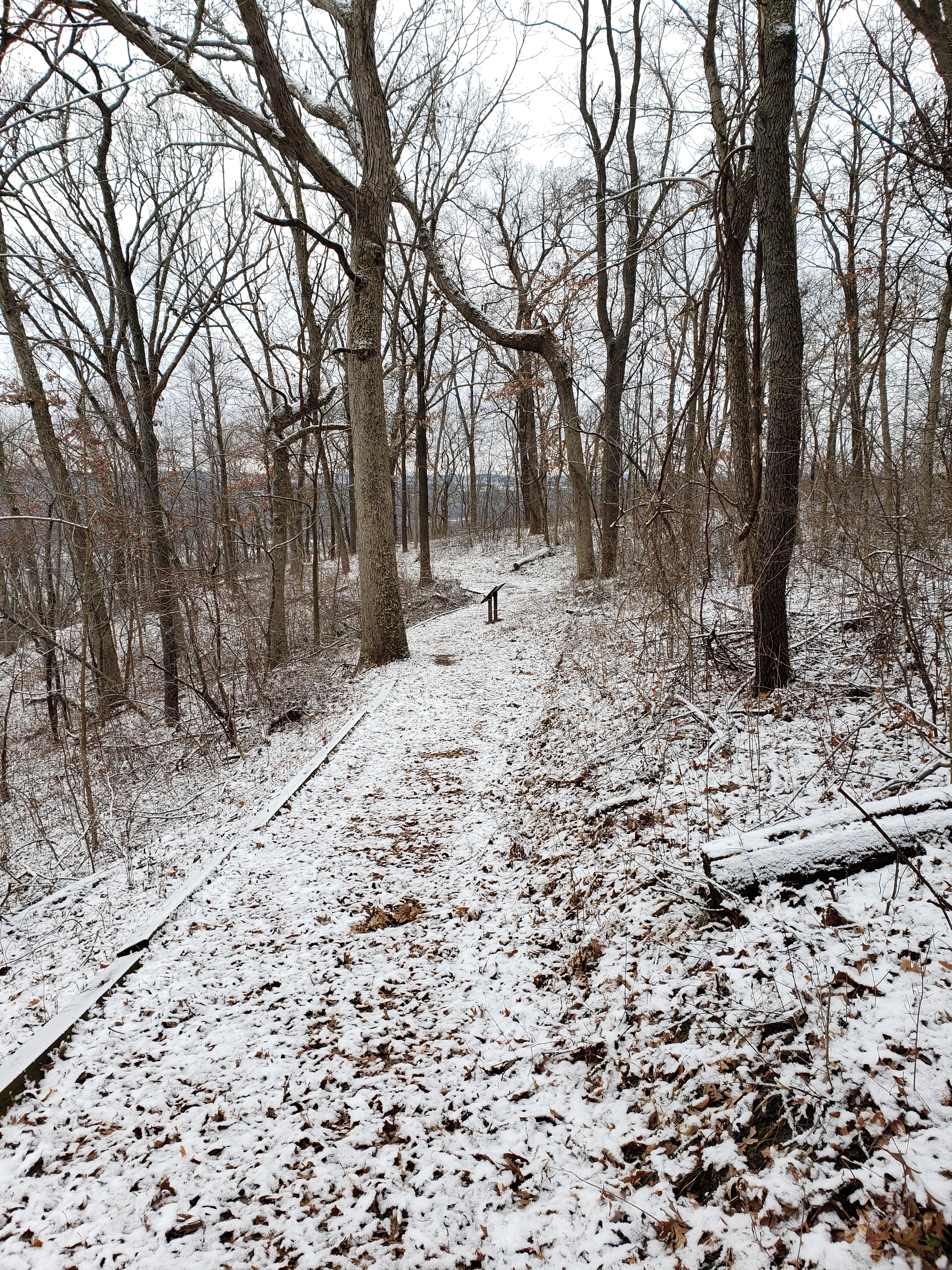
We made our way back to the top of the road along the Oakwood Trail which was just a nice walk in the woods. As usual for our hikes we found cool mushrooms.

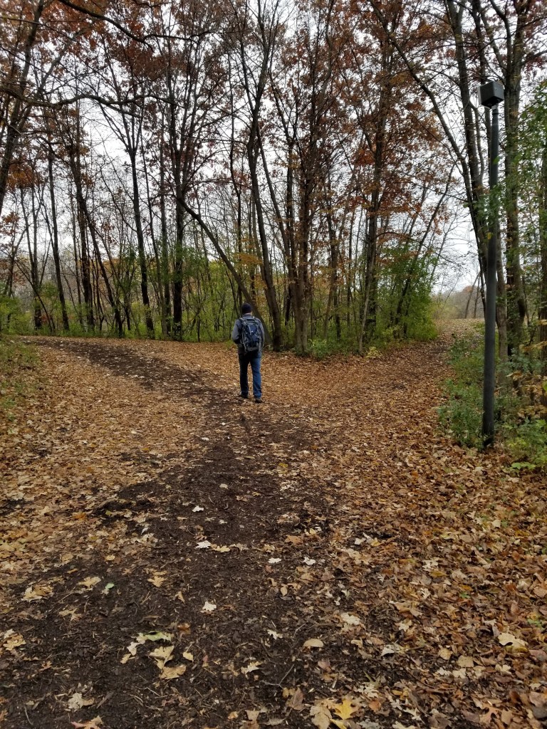
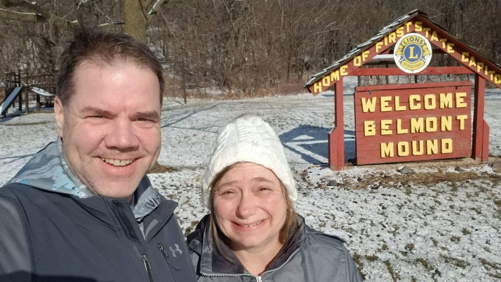
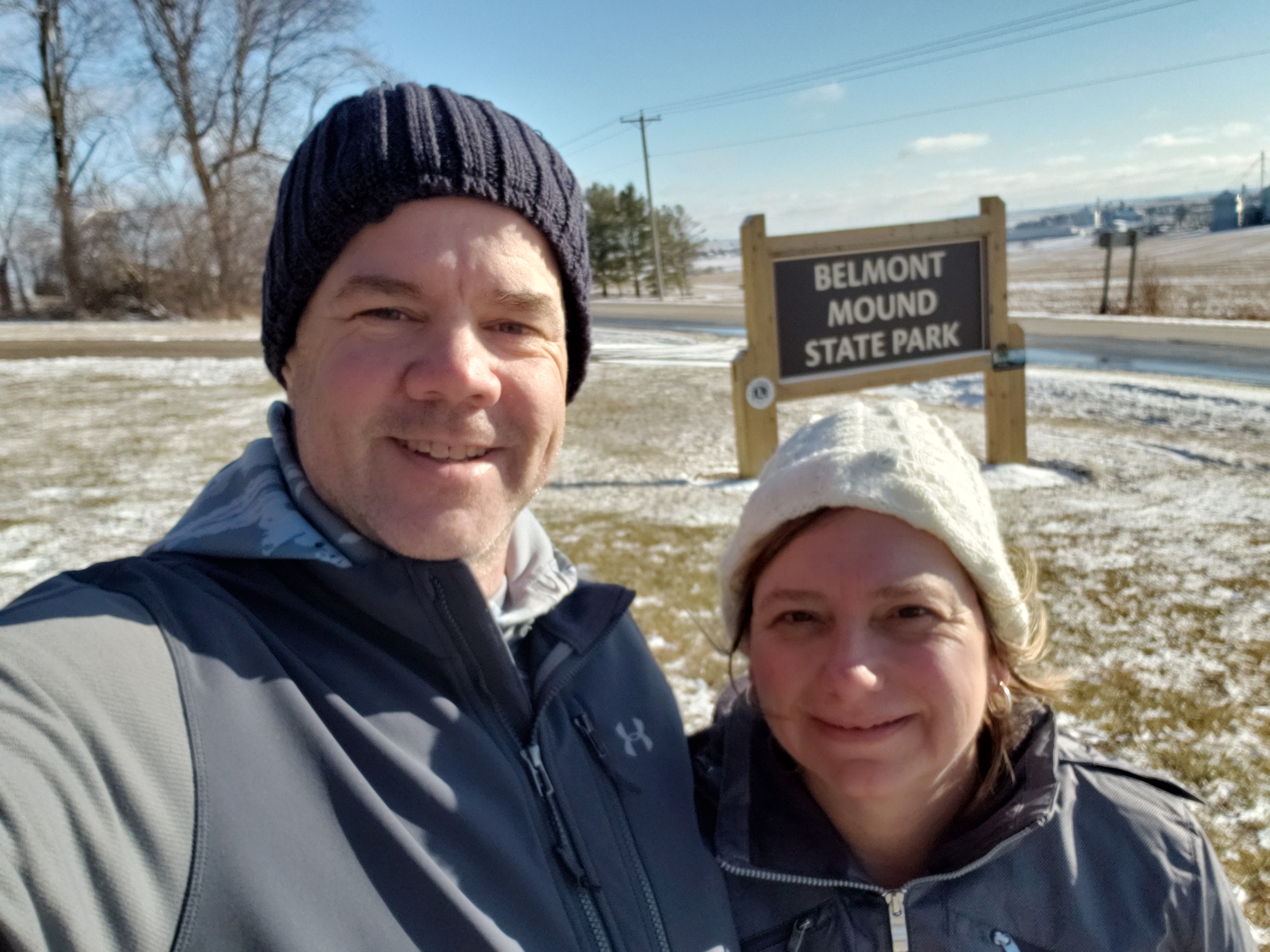
We spent about 1.5 hours more at this park than we expected — we had better get on the road, we have an hour drive to our next stop — Belmont Mound State Park. The trails we hiked were mapped by Mike here. Once again, this is a small park — only a couple miles of hiking trails, but we were ready to take them on!! The sun was out in full force now, making it hard to get a good picture of our starting point. Despite the little bit of snow, Tammy had decided she had had enough of her painful boots and traded them out for her summer hikers — better to get wet feet than have to say Hail Mary’s and Our Fathers for another whole hike!

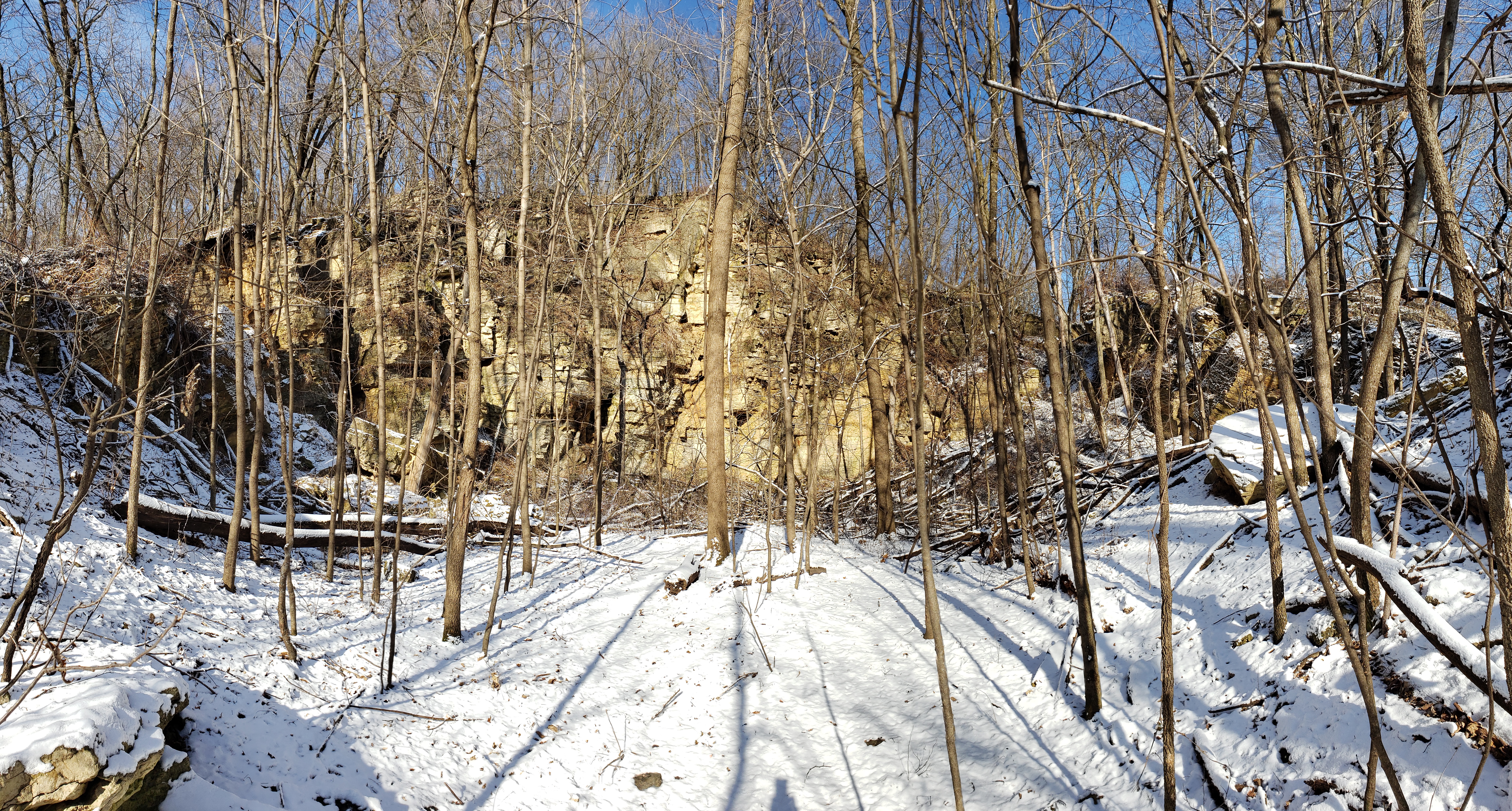
We took off from the parking lot to go up the Tower Trail which leads to the top of the mound. It goes straight up hill from the parking lot. No long slope with switchbacks…just straight up. We made it up to the tower and found a map that someone had made with all sorts of trails on it — lots more than were on the “official” map of the state park. It turns out these were trails that someone marked off with ribbons as s/he didn’t think there were enough. We made it back down to the parking lot and instead of doing the whole next trail, we just did the loop around the mound. We were running out of time if we were still going to make it to the last park on the list. It was a very pretty — and easy — hike. Along the way you pass an abandoned limestone quarry — the bluffs are pretty high.

We were now really cutting it close on time. We had an hour and 15 minute drive to get to Governor Nelson Dewey State Park and then a 45 minute drive to the supper club — we wanted to leave the state park by 3:15 in order to make it to the supper club early enough, but given that it was 1:45, we would not arrive at the state park until 3:00. Oh well, we would do our best. We may not be able to hike much at the state park, but times a wasting — let’s hit the road!

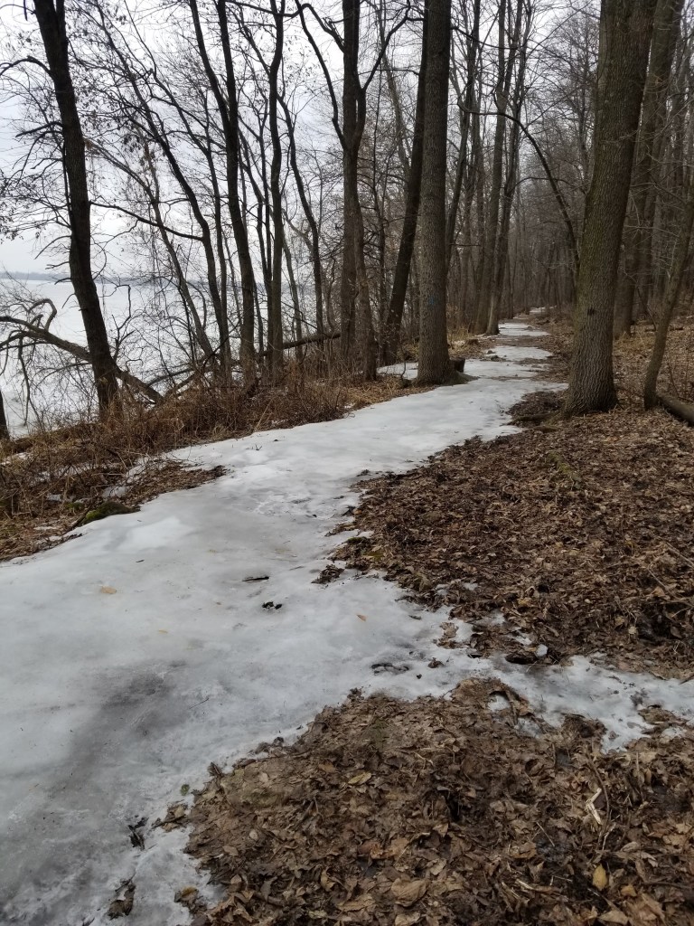
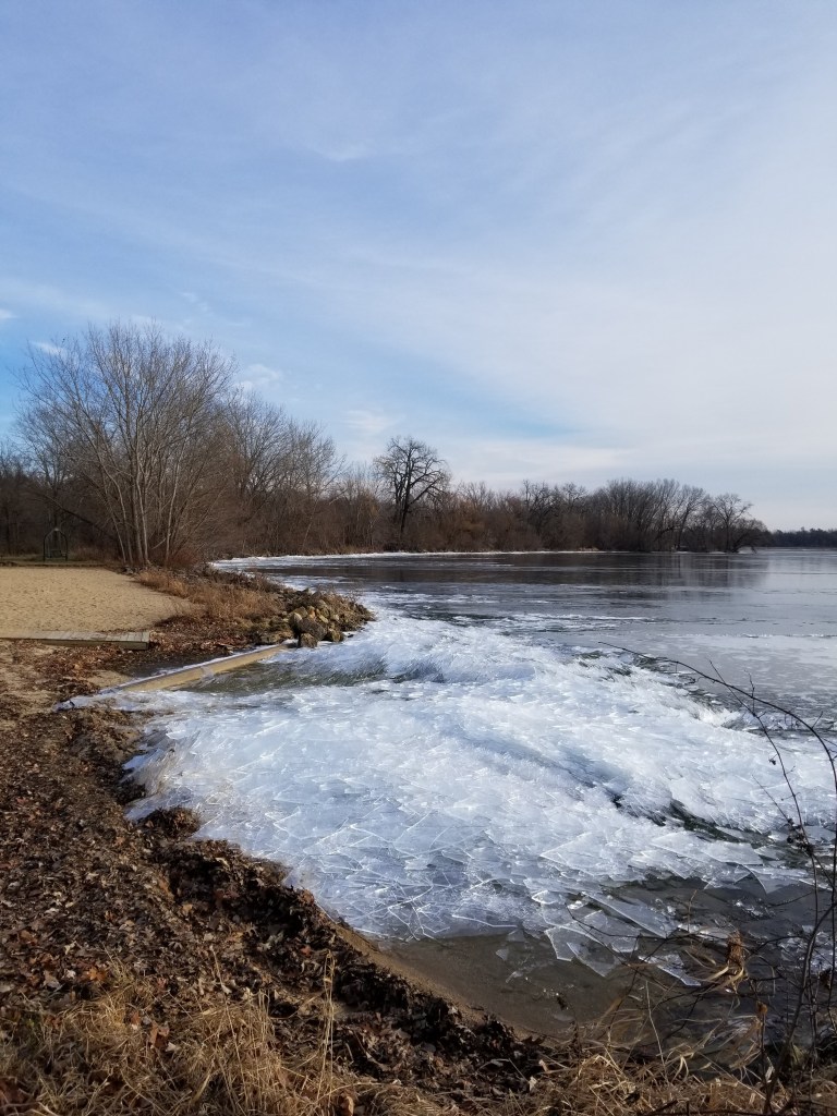
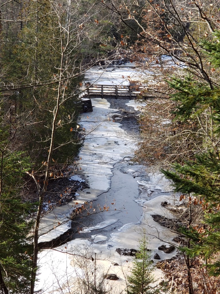
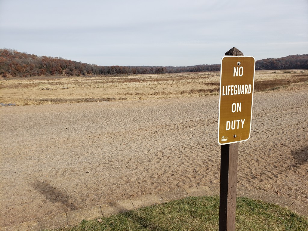
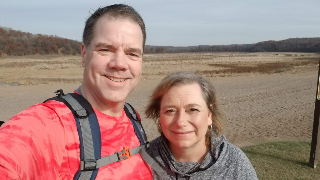
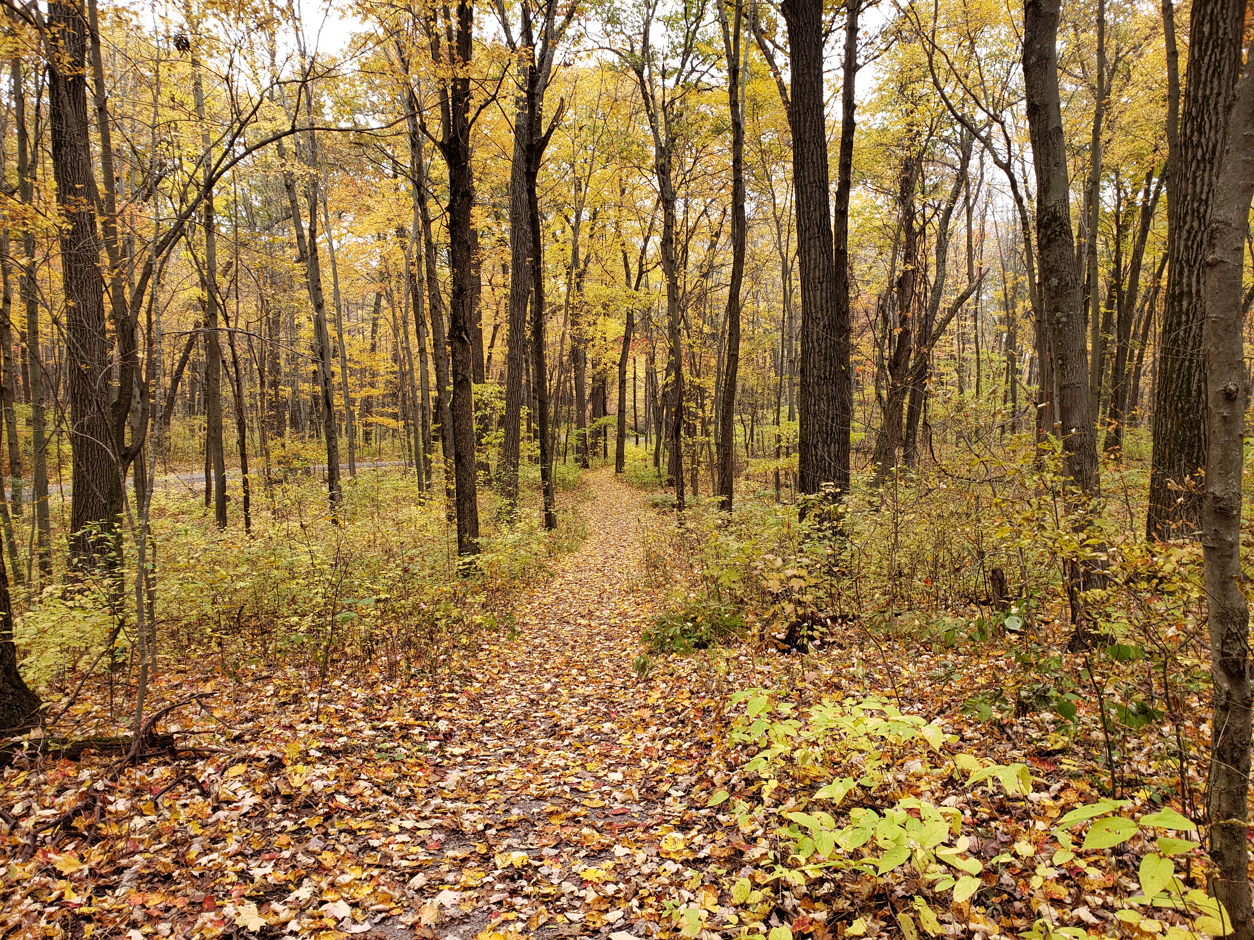
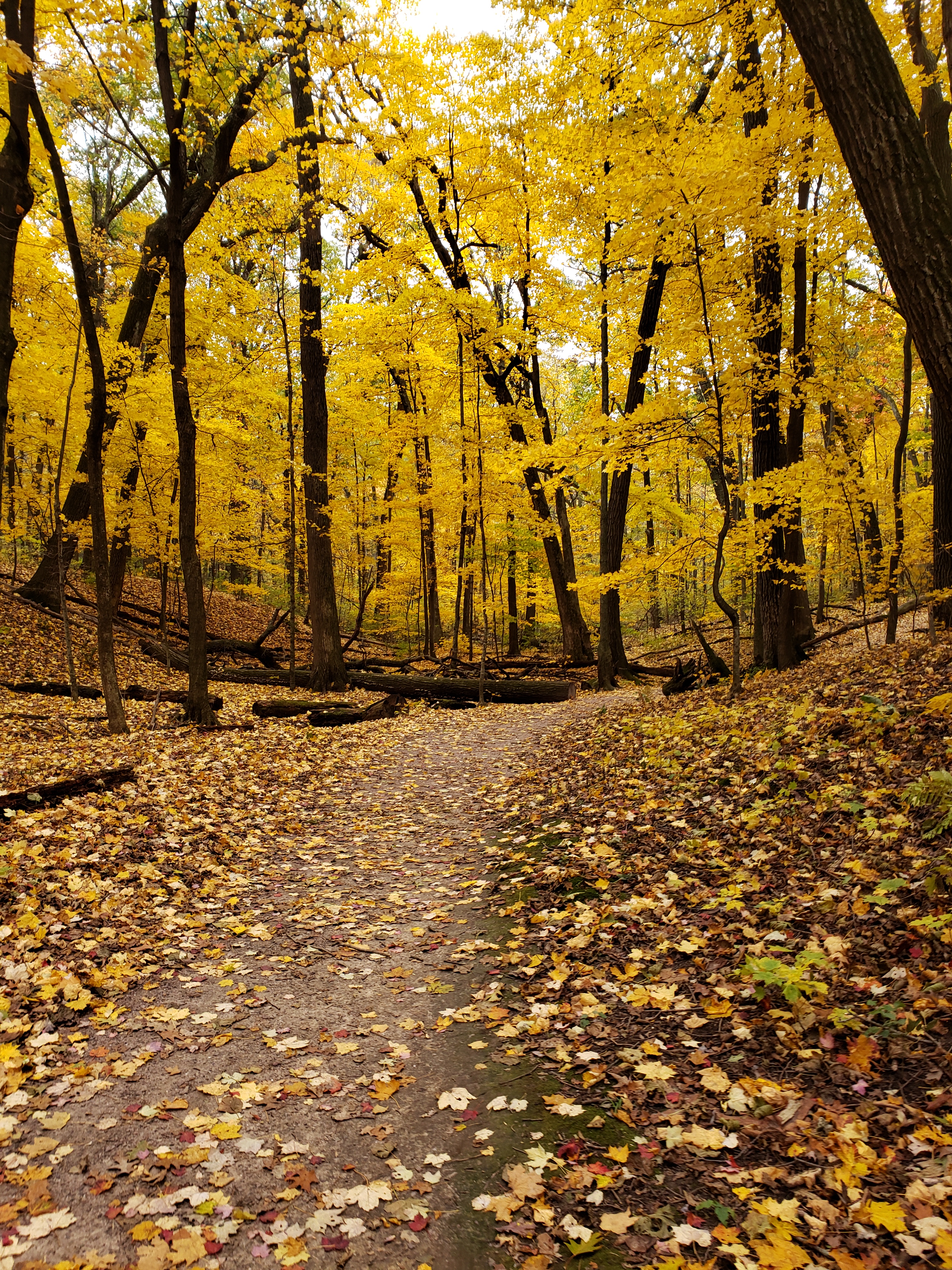
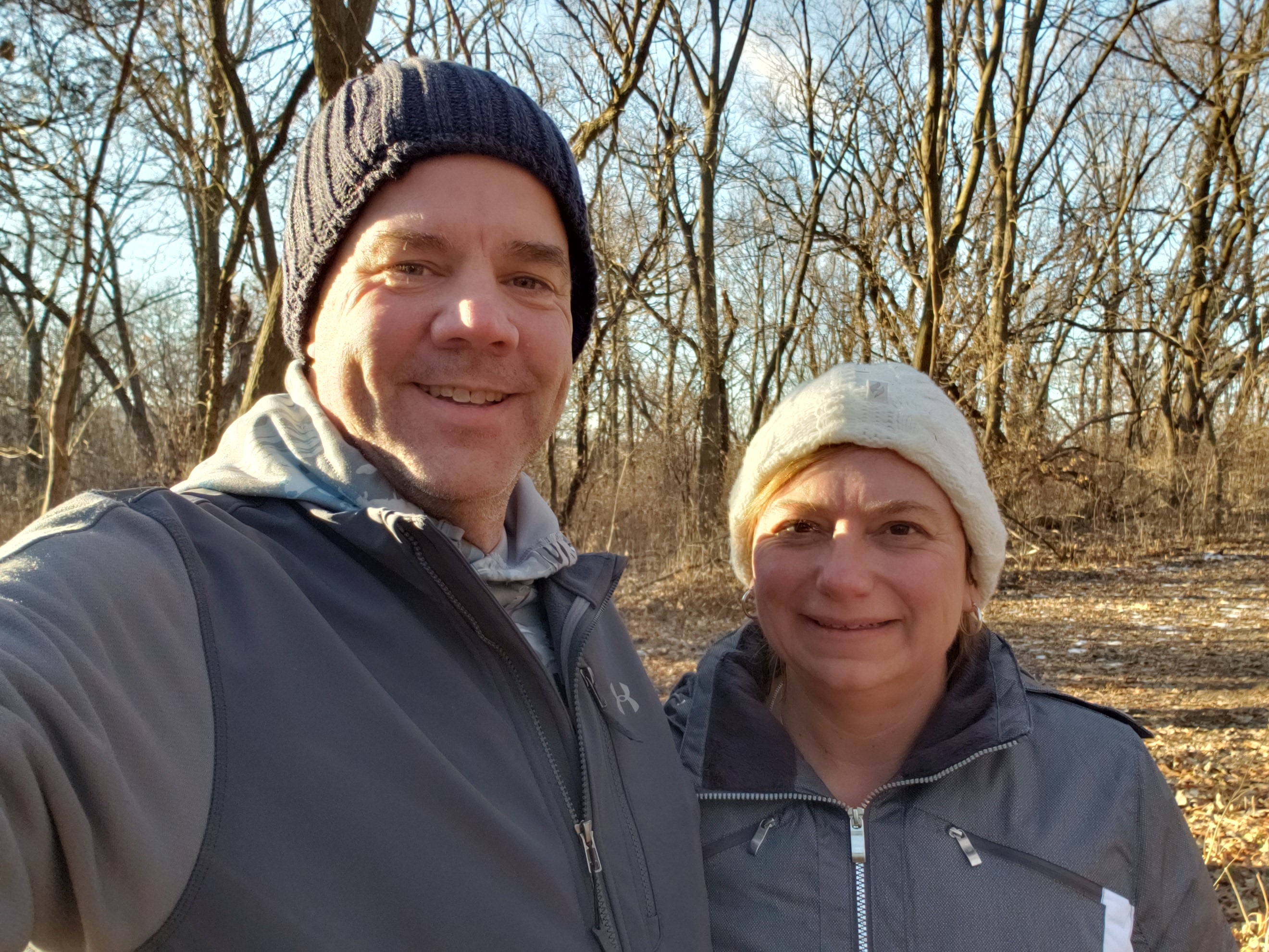
We made it to Governor Nelson Dewey State Park right at 3:00 — we had already talked about and decided that we were just going to hike one trail. Mike picked the trail that was most like the trails we enjoy hiking — through the woods and we took off down the VERY icy trail.

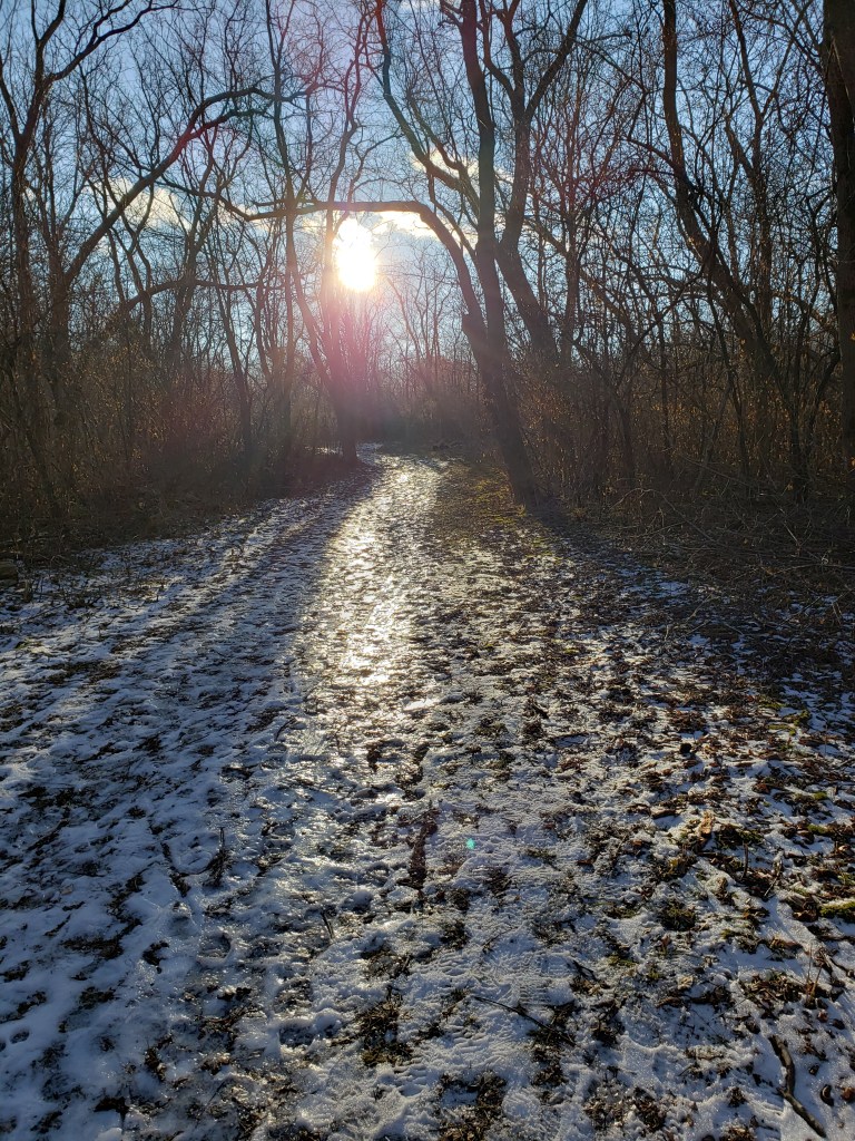
The sun reflecting off the trail was quite bright — the picture doesn’t really do it justice. The trail was so icy that most of the way we had to walk along the very edge of the trail in order to get good footing. We made it around the Woodland Trail pretty quickly — in about half an hour. We were ready to get changed and hit the road. In the middle of the summer we had to take showers before getting changed and Supper Club Saturday, but in the winter we’ve learned to change at a gas station or just in the car. This time it was in the car in the parking lot. Luckily, since losing weight and being in better shape, we are more flexible and don’t have a problem changing in the car!!

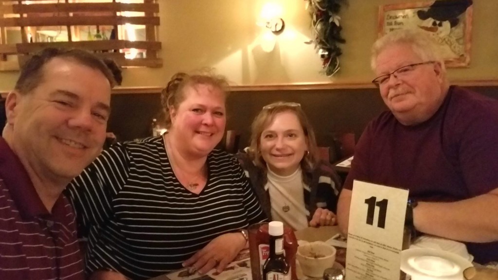
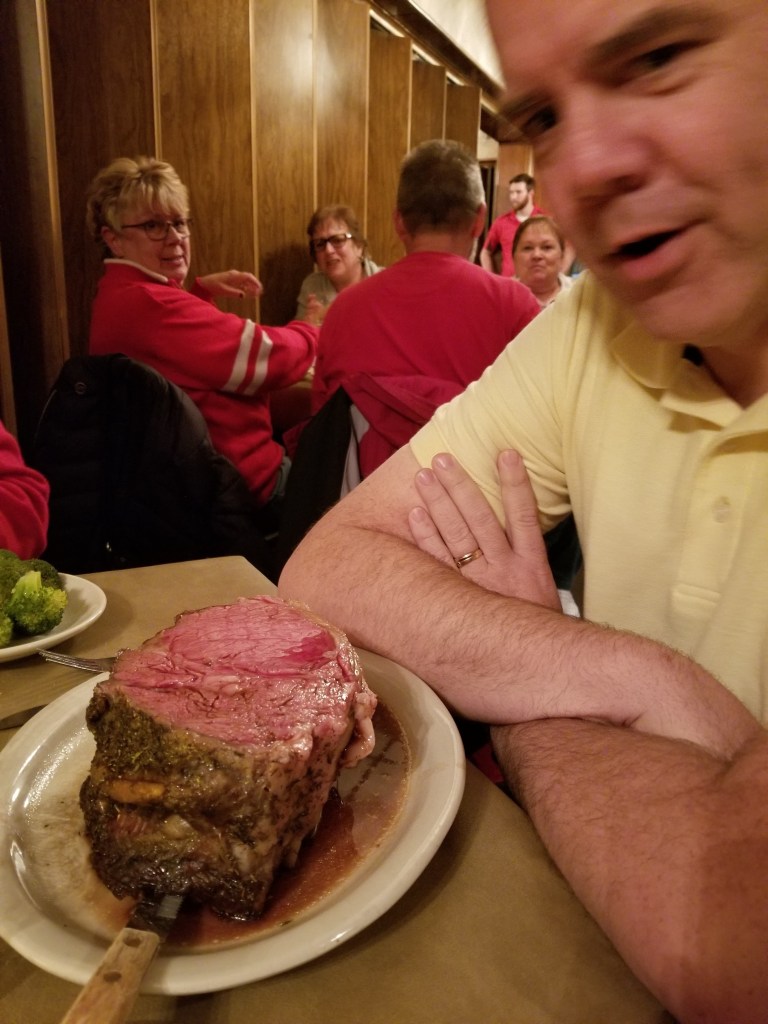
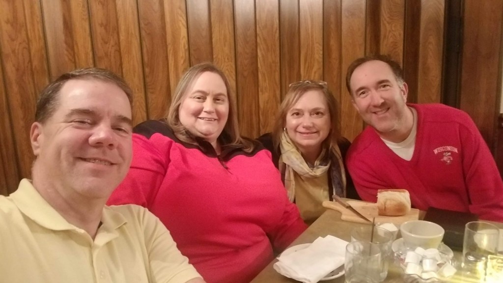
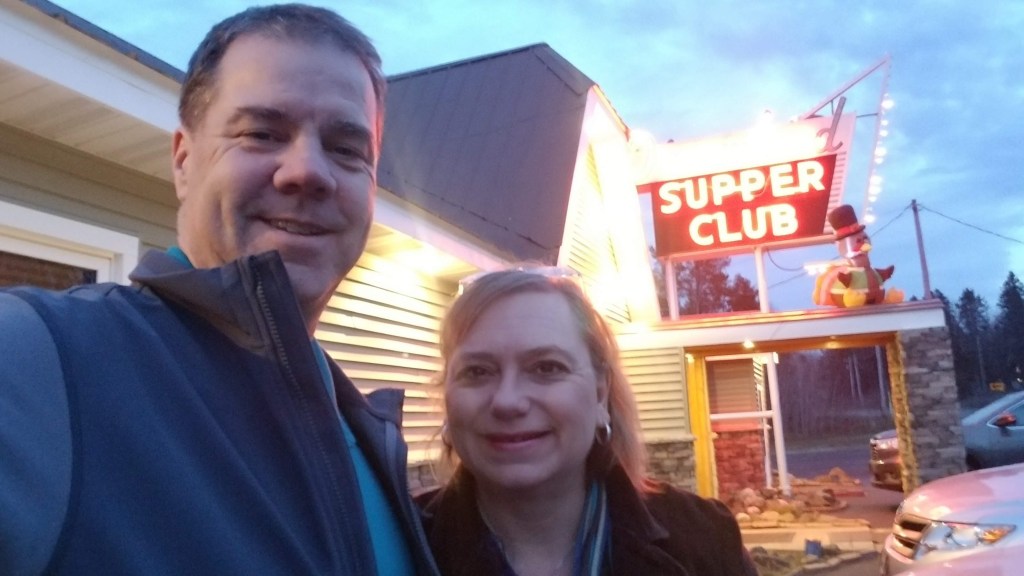
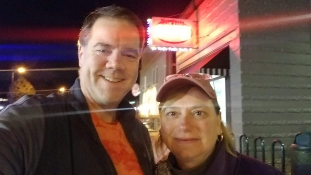
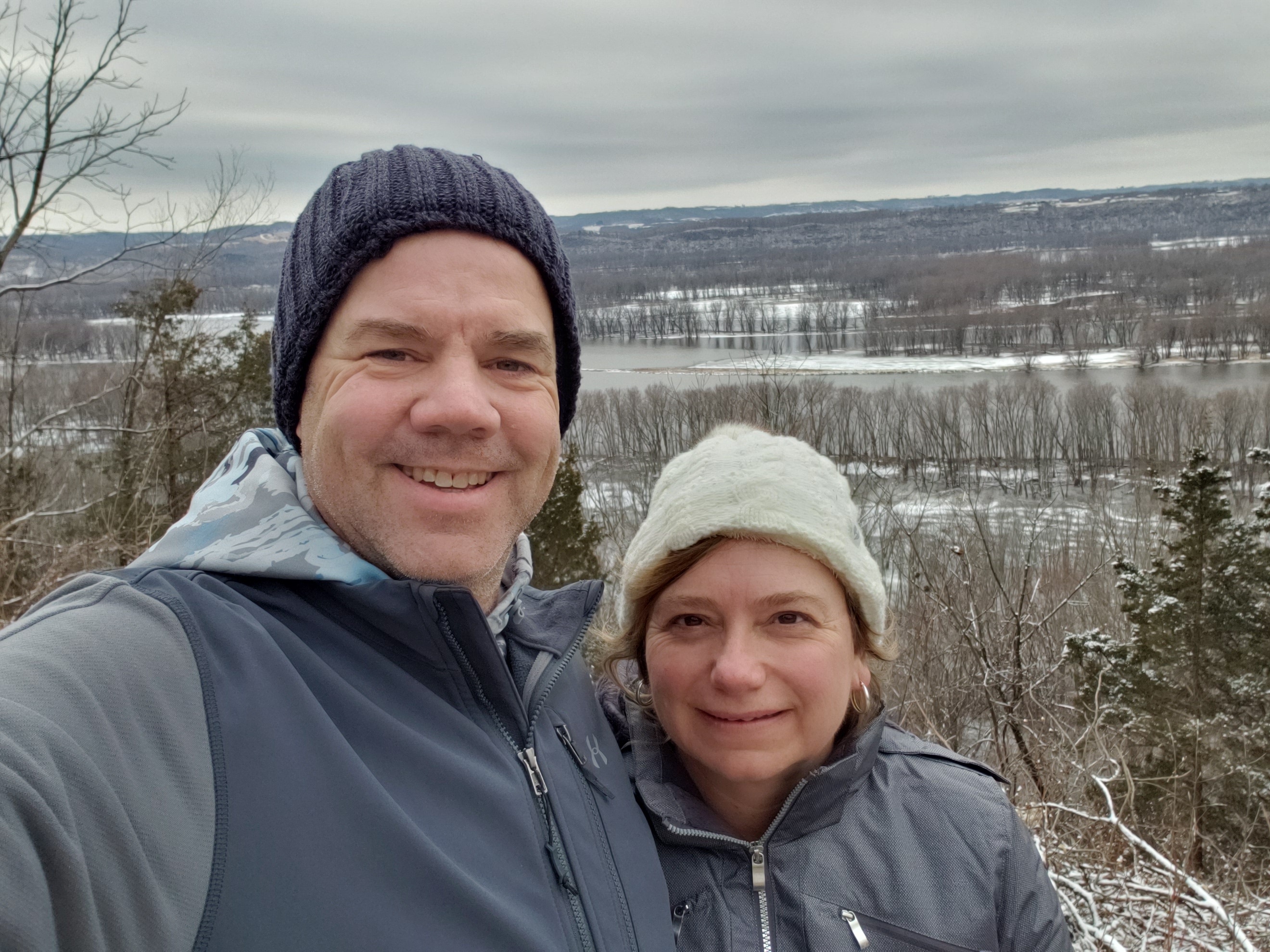
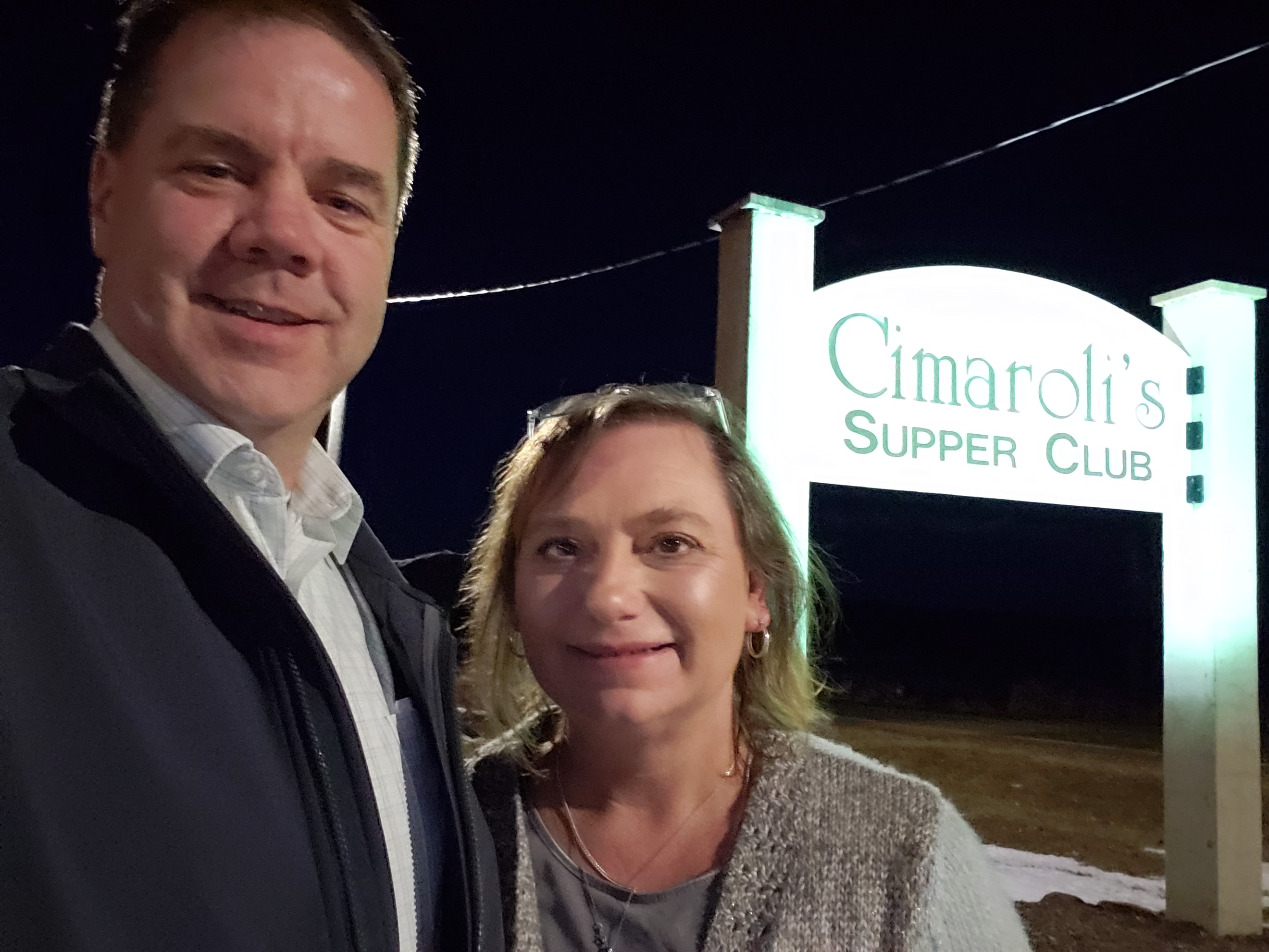
It was about 3:40 when we left — we were headed to Cimaroli’s Supper Club. We’d read reviews that said we should arrive early or there would be a wait (although probably not as bad as the Black Otter). We made it there at 4:20ish (not too bad) and got right in with no problems at all. Although there were a LOT of people there, it seems like many arrive early for a few cocktails and we were even asked if we wanted to be seated right away. Yes, yes we do — we’ve been ‘splorin’ all day! We ordered our drinks (no more wine for us at Supper Club Saturday) and an appetizer of “Portabella” Mushrooms (yes, that is how it was spelled on the menu). Mike had the prime rib and Tammy had flat iron steak and shrimp. Honestly? Neither of them were that great. Mike’s prime rib, ordered rare, was medium at best and was not seasoned at all. Instead of ordering a potato we always ask about a vegetable. The waitress said the vegetable that day was squash. Ok — sounds great. About 5 minutes before our food came out Mike said “Hmm, I hope the squash is not acorn squash.” Tammy guffawed and said she thought it would be summer squash. Well, low and behold out comes acorn squash with our meal. It turns out that it really does not have that many more carbs than summer squash, and once again Mike and his ESP strikes again. While the food wasn’t great — the company was, like always, the best!!! A day with each other is what we are looking forward to the most on ‘Splorin’ Saturdays!!!

Thankfully we “only” had a two hour drive home. Finally made it home around 7:30. We ended up driving 471 miles in 9 hours and 2 minutes. Ugh….well, it needs to be done!! We will take Wisconsin’s state motto and make it our own: Forward!!

High Cliff 12/28/2019

Christmas Holiday plans and work called for a few more weeks off from ‘Splorin.’ But we were determined to get one more day in before the end of the year. After visiting one set of friends from college for our last adventure, we decided we wanted to head to the other side of Wisconsin again to visit with another couple that we’ve known since college. Our destination this week was High Cliff State Park located in Sherwood, WI. The “fun” with this #SplorinSaturday started before it even was Saturday. The weather was looking dicey. Snow, freezing rain and rain were in the forecast. However the more we watched, the worst of the weather was to go well to our west in Minnesota and we were just supposed to see rain. In fact the forecast for Sherwood, WI said rain was supposed to start around 11AM — but was not supposed to be heavy until later in the afternoon/evening. #SplorinSaturday was a go!!!!

THIS. NEVER. HAPPENS. We left 6 minutes early (or maybe 24 minutes late). Mike wanted to leave at 5:30, Tammy decided 6:00 was better and we “compromised”. Unfortunately we are nearing the end of any parks that are close to home, so we had a 3.5 hour drive to get to the park. We’ve explained our methodology for finding restaurants before — most of the time it is the name that makes up our mind. This weeks for breakfast was no exception: Little Fat Gretchen’s in Waupaca, WI.

Of course it was the quintessential little hometown restaurant. Unfortunately we arrived a little late to witness (or eavesdrop) on the old men’s coffee klatch (they were just walking out the door as we pulled up 😦 ). So, we had to carry our own conversation — luckily after 34 years together we are pretty adept at this when we have to be. Omelettes were had and enjoyed with an awesome salad as well!! Of course we drove for 2.5 hours to get there and we were starving so that may have affected our assesment of the food, but we don’t know for sure!!! After getting our fill — it was off to the park!!!

We still had an hour to go to get there….ugh. Along the way we looked for a spot where we could change out of our ‘splorin’ clothes and into our #SupperClubSaturday clothes. We passed a Kwik Trip (more quintessential Wisconsinness) where we could change — awesome, we were ready for some hiking!! As already stated, the weather was not supposed to be that good — we thought we would pretty much have the park to ourselves. Pulling into the park (for once we didn’t have to buy a pass because we had our van with our state park sticker) we didn’t have to stop to register, but Mike wanted a map. There were three cars in the contact station parking lot purchasing day passes … so, we would not be alone. “The Plan” had us starting off on the Lime Kiln trail which is a loop trail down the short end of Lake Winnebago and climbs a portion of the hills below the cliffs. Before we could hike we had to park — usually something Mike does without even thinking. However as we went further back in the parking lot by the trail we noticed that it turned to glare ice — slow and steady got us stopped in a “parking spot”. Next came walking down to get to the beginning of the trail — across that glare ice parking lot. Lots of “walking like a penguin” got us to the trail where we figured there would be no ice. WRONG! Portions of this trail were solid ice — edge to edge. Many times we had to actually walk off the trail to get any traction, so we made lots of little loops, etc. to make sure we had good footing.

One thing that constantly amazes us is how different the environment looks from park to park, from part of a park to another part of the same park, and obviously during different times of year. On this trail there were lots of very tall and skinny trees. Since it was December, none had leaves but some had very large vines hanging down from them — Tarzan would have been right at home. It was kind of eerie.

The trail itself was really nice — it led us up the side of the hill immediately below the limestone cliffs that the park get its name from. We climbed the hill and made our way to the end and walked down to the shoreline.

The rest of the way back to the car was alternating completely clear trail and completely ice covered trail — there was no in between. It appears if the majority of the ice was caused by springs at the bottom of the hill before the shore of the lake. We made it back to the car for our first 2 miles of the day with no major mishaps or spills. Now Mike had to navigate the van out of the ice filled parking lot…again, slow and steady got us out.

The next “trail” was actually going to be a combination of three trails (Redbird, Woodland and Overlook). Mike thought it was going to be around 5 – 6 miles or so (but it is always difficult when combining trails like this — not easy to know the exact distance). Leaving the parking lot by the observation tower we passed by the Redbird statue (even though Mike completely missed it). We immediately encountered some rather unique environs — the top of the limestone bluffs are scattered with abandoned quarries. There are lots of wide open flat limestone areas and some straight up/down walls. One quarry has a huge fire ring in the middle of it — it was a community fire pit. It appeared that you could easily fit 20 or 30 people around a big roaring fire there. The rest of the Redbird trail was right along the top of the bluff overlooking Lake Winnebago. Since it was a cold and dreary day — the lake was just a “big gray blah” visible through the trees. On a clear day it would most likely be beautiful, today it was … just … OK. Walking the same trail in the summer when the trees are in full leaf we don’t think you would even know there was a lake out there.

We then made it down to the Woodland trail — this trail was basically a big loop around a big open field. There was a really cool rock wall down the side of the field with some crazy trees. All of those rocks were picked out of the field — must have been years and years of rock picking. It would be neat to know how long ago that was. Passing on the south side of the field up against the woods we had to walk through a lot of snow that had not melted because it was in the shade. We then passed onto the Overlook trail. Tammy started admitting on this trail that she was having serious pain from her new boots. Mike’s feet were fine in his new boots. The over look trail was very similar to the Woodland trail — lots of open space. The true “overlook” portion of the trail was not much of an overlook. Lots of trees blocking the view (again, in the summer there would be no chance of a view), but there were some pretty cool rock formations at the top.

Tammy being the trooper that she is, kept the hike up despite the painful boots. (although there was not much conversation for the last 2 miles). We completed the Redbird loop back to the car. Wow — 6.82 miles on that one hike. Not our longest single hike, but it was still very long.

We still were a little early to leave for #SupperClubSaturday, so we found one more trail around the Butterfly pond that was a little over a mile long. That would get us into double digits — over ten miles for the day. The wind started to really pick up on this hike. Tammy saw a deer that was standing still along the edge of the pond. Mike attempted to get his camera out, but the deer started bounding away…followed by two other deer that we didn’t see until they started moving. We then encountered another first for us — hiking through a cemetery. Around the backside of the pond is a small cemetery that has been there for a very long time (and we weren’t really hiking through it, but along a small road within it).

We made it back to the car — drove to Kwik Trip and make a “kwik” change into our dinner clothes. We were still way early for dinner. We were going to the Black Otter Supper Club in Hortonville, WI. We were warned that you needed to arrive early if we didn’t want to wait a long time. The restaurant opened at 4PM so we planned on arriving right at 4 — we’ve had good luck so far when arriving right at opening time. We were a little early, it was only 3:45, so we decided to drive past to see where we were going. Much to our surprise there was a line of people outside the restaurant!!! We quick pulled into the parking lot and got in line. The rain was coming down pretty steady by now, but luckily we were able to duck under the eave of the building. Colleen and Greg Rogalski were still on their way, but luckily we were already in line! Once again this was our favorite type of supper club — you order in the bar and do not go to your table until your food is ready. However, the massive crush of people at the restaurant, and the fact that it went from completely empty to completely full in 5 minutes, made the line at the salad bar epically long! Tammy got a bowl of soup brought it back to the table and ended up about 30 people behind the rest of us…wow!!! Mike had a huge two bone Prime Rib — which he said was OK . Tammy’s tenderloin was just OK too. But the salad bar really was phenomenal, especially if you could eat everything that was included. Tammy wanted to take a picture, but didn’t want to wait in the line again! Thankfully we had GREAT company and were able to catch up with some dear friends.

After dinner we still had a three hour drive home — under normal driving conditions. Unfortunately the precipitation that was supposed to be just rain ended up being freezing rain — so the first 100 miles of our drive back home was slow going — it was impossible to tell where the roads were icy and where they were just wet. We did finally make it home safe and sound — but, boy, that was a long and tiring day (and we can’t wait for the next one 😉 ).

Trifecta…and then some…. 12/7/19

We took a few weeks off from ‘splorin’ at the end of November. Tammy mistakenly thought that November 23rd was the Saturday after Thanksgiving (Small Business Saturday) and wanted to work at Imagination Station that day. November 29th, the REAL Saturday after Thanksgiving, we spent in Hudson with family and friends saying goodbye to Mike’s dad. We were fortunate to have all 4 of our kids home for the day to pay their respects to Grandpa Ray.

December 7th found us in Milwaukee having attended our daughter Carrie’s Marquette University Liturgical Choir’s “Lessons and Carols” concert the evening before. The concert was, as usual, wonderful — Saturday was reserved for us to get some Splorin’ on as we headed back to Eau Claire.

Not wanting to waste any limited Wisconsin December daylight, we were up and out of the hotel at 6:17AM (Mike wanted to leave by 6AM, close…so close) and on the road to breakfast.

We drove from Milwaukee to Burlington, WI for breakfast at the Pine Street Cafe. One thing that really stood out about this restaurant was its size. We believe it could comfortably seat about 1,723 people. OK, maybe not that many, but it was HUGE!!

The second thing we noticed immediately was the “old guys” coffee klatches were alive and well in Burlington. There were two tables overflowing with “older” gentlemen (Mike is getting too close in age to these gentlemen to be calling them “old”). Unfortunately due to the size of the restaurant we had to observe these two groups from afar as the hostess seated us well away from them. We had our standard breakfast omelettes with side salads (yay!) and the food was very good. On the way out of the restaurant we were treated to a gorgeous sunrise reflecting off the clouds.

We were now on our way to our first stop on this triple state park day — Big Foot Beach State Park in Lake Geneva, WI. We rolled up to find that this was an unmanned state park and we had to self-register our non-resident rental car for the day. There was only one other car in the parking lot — as we got done registering we saw the gentleman and his dog heading back to their vehicle — so we would have the park to ourselves.

“The Plan” was to break this park up into two hikes — the front and the back. The front was a combination of the Green/Red/Yellow/Blue trails and the back was Green and Orange trails. We got our hats and gloves on and were off on the hike.

We started off heading back towards Lake Geneva and Ceylon Lagoon. It was still below freezing, but not by a lot, so there was some ice on muddy stretches along the lagoon. As we made it to the back of the lagoon where we would turn off into the woods and start following the Green/Yellow trail we notice a piece of paper along the side of the trail. Closer inspection showed us that it said “Trail Closed”. It was obvious it had been on the ground for a while, and it was also obvious there were a lot of hiker tracks going down the trail. We decided to proceed with caution and would turn around if we saw anything dangerous. It became quickly apparent that the trail closure was due to the wet conditions on the trail. This portion of the trail bordered some wet lands and it was pretty obvious that the wetlands were overflowing and causing pretty wet and muddy conditions on the trail. We sunk in a couple spots, we had to traverse the sides of the trail, and we had to crawl over some fairly large downed trees. But we made it through with not too much effort. After a quarter mile we came to an orange cone in the middle of the trail that had the same “Trail Closed” message on it. So — good news we were out of the closed area and it wasn’t too bad, and even better news, it should be good hiking ahead.

We’ve done a lot of hiking at Wisconsin state parks at this point and seen just about every kind of trail, but every so often we find ourselves in a “first” situation. This was one of them. As we came to where the Green and Blue trails were supposed to intersect, we found ourselves standing beside a road in the middle of an open cut grass area. It took a minute but we realized the “trail” was supposed to just cut out across the open grass area. We walked along and found that the “trail” also turned in the middle of this grass field and went across a parking area where it finally cut back into the woods. We were now on the Blue trail and headed to go around the Red trail loop before heading back to the car for a quick break. The Red loop was very pretty and skirted the edge of the wetlands that we had to traverse earlier. As we came to the back corner of the trail, we came to an area where it looked pretty wet and muddy under the frozen surface. Mike saw this and veered to the side, Tammy somehow walked right into the middle of it got a little muddy. Navigating our way around this we saw another trail closed sign, but luckily the plan did not have us going down that route. We made it back to the car and took a quick drink of water, made our way to the pit toilets and then were off to ‘splore’ the back side of the park.

We are always on the lookout for “wildlife”. Deer, turkeys, cranes, squirrels, birds….what have you… we love to see it; Mike is always complaining that we should see more deer. As we started down the Green trail we came around a corner and saw a little buck alongside the trail up ahead — maybe 5o yards away. Took a quick picture because they often bolt as soon as they know that they have been seen. This one has obviously encountered a lot of people as he was completely unaffected by us. He just keep browsing on the bushes beside the trail. We kept slowly walking forward thinking he would bolt at any moment. We finally made it to about 10 yards away before he hopped off the trail and back into the woods. Here are a couple of pictures showing how far away we were when we first noticed him, how close we got and a zoomed in pic.

We continued on the trail to the backside of the park coming out to the edge of the Badger High School property. Along the way we noticed something brightly colored off the trail and went to investigate. Turns out it was an orienteering checkpoint with a message not to remove it. It must be something that the high school does with kids — very nice to have a state park literally in your high school’s backyard. We made it around the rest of the loop and the Orange loop with only seeing one more deer. It saw us before we saw it (imagine that!) and bounded off across the middle of the open center of the Orange loop. We thought we might see it again as we rounded the open area, but we never did. We made it back to the car and were ready to head off to our next park.

The next destination was Aztalan State Park in Jefferson, WI. We knew this was going to be a “quick” park for us as it had, at most, 2 miles of trails to hike. But we still needed to check it off the list! Arriving in the parking lot there was only one other car — another empty park for us to hike — YAY!! The trails leading from the parking lot were wide cut grass trails. It looked like the majority of the trail here would be this kind of trail and, no surprise, it was. Being that we were basically walking across a big wide open field — the wind was blowing kind of hard and it definitely was pretty chilly. As we got closer to the woods we saw that we were actually going to make it into the woods instead of just in the middle of the field. A little ways into the woods we came to the banks of the Crawfish River. We then paralleled the river for a quarter mile or so until we came to the first of the restored stockade walls. Seeing these huge trees sunk into the ground made us really appreciate the effort that it must have taken the original people to build this kind of structure.

Still walking along the river, we made our way to the South end of the park and the very large restored mound. We went up the steps to find that yes, the wind does blow more strongly the higher you get. 😉 The view was pretty neat though.

We quickly made our way to the other restored mound and back to the car. Aztalan State Park is very pretty and historic and has a lot of information on signs throughout the trails, but not much for those that are more “hike-oriented” like us. On to the third and final state park of the day.

The final park was Lake Kegonsa State Park in Stoughton, WI. We were pleasantly surprised to find a ranger in the contact station at the main entrance. Even more pleasantly surprised to find out that she would be there until 4PM and that they had bathrooms that we would be able to change into our dinner clothes in, instead of having to do it in the car or finding a gas station to do it at — WOO HOO!!! Even though there was no snow on the ground, everything was switched over to “winter” mode at this park (meaning all the trail signs, etc. were ready for skiing and not hiking). The really strange thing is that the trails are named differently and go different places in the winter. In the summer there is a “White Oak Nature Trail” that in the winter is called the “Green” trail, the “Prairie Trail” is known as the “Blue” trail, and the “Bluebird” trail is know as the “Yellow” trail and goes to completely different location.

Oh well, we started off down the White Oak Nature trail. This was a very nice little loop trail through the woods on the North side of the park. We came across a hawk along the trail that kept going from tree to tree like it was trying to lead us away from something. We have seen this many times with smaller birds, I don’t know if that is what the hawk was doing or if it was just ticked that we were walking in its woods. Eventually the hawk flew off to somewhere that we could not see. We came along a sign that said “Please stay off Indian Mound”. The funny thing about this was that it was seemingly almost completely flat ground. Had there not been a sign there, you would have never even known there was anything to stay off of. Making our way back to the parking lot off that loop were were now going to head down the Prairie trail. This was a nice level trail around the prairie. While doing this loop, we change “the plan” and decided to head off on the “Yellow” trail and loop down to the beach. We are so glad we did this as we got to see the really cool ice buildup being pushed onshore from the partially frozen lake. The ice was about half an inch thick and was piling up in ridges on the shore — very pretty.

We made our way back to the car to go to the other side of the park down by the boat lauch. These trails were through some of the small bodies of water next to the lake. Must be very pretty (and mosquito filled) in the summer, but hiking through with all the leaves down was also beautiful. Being that these were snowshoeing trails and there was no snow on the ground it was a little difficult to know exactly where the trail was supposed to go. This was very evident as we followed the trail up to Williams Knoll picnic area — we could not find where the trail went from that hill top. We could however see our car in the parking lot about 1/3 mile away. We decided just to bushwhack the rest of the way and forego trying to find the trail — we made it about halfway there when we came across the trail that we were supposed to be on. Oh well, sometimes bushwhacking can be fun!!

We had about two hours before we were to meet our good friends for Supper Club Saturday. We happened to pass by Cambridge Winery in Cambridge, WI on the way to Lake Kegonsa State Park and decided to head back there after getting changed. We were very excited to see that this winery offered more than the traditional sweet fruit wines that dominate the Wisconsin winery business. We had 45 minutes for the tasting before we had to leave for Supper Club Saturday. No worries — plenty of time (insert ominous foreshadowing music). Needless to say Tammy had a blast talking to the ladies pouring the wine and of course, tasting the wine. Suddenly we looked and we had 15 minutes to drive the 25 minutes to the supper club!!! Oh no!! We quickly paid but the ladies had to have us taste one more wine before we left. We were able to witness a beautiful sunset as we walked out to our car — wanted to enjoy it more, but we had a supper club to get to!!!

Maple Tree Supper Club was the destination to meet our good friends Beth and Frank Hoppe for Supper Club Saturday. While we were a little late due to the winery, Beth and Frank has just arrived shortly before we did and were sitting in the bar enjoying a cocktail. We joined them for a quick drink before being seated for dinner. Followers of this blog know that prime rib is Mike’s meal of choice, but they had four sizes here: 12, 14, 18 and 24 ounces) which to choose? While waiting for our table Beth and Frank ran into someone they had not seen in years and he suggested getting the 24 ounce prime rib and bringing the leftovers home. Done!!

This is probably one of the first times that Mike has actually brought food home from a restaurant in a very long time!! The food and the company was outstanding!!

We finally said our good byes and has an uneventful 2.5 hour drive home.

Why we do, what we do….and waterfalls galore!! (11/16/2019)

Today was a special day. The main reason why we do Splorin’ is because of Mike’s quadruple bypass — taking the opportunity to get in nature, get exercise, and in general to get more healthy. Today represents the one year anniversary of Mike’s open heart surgery (his “Heartiversary”). 365 days since laying on that stainless steel operating table, with his chest cracked open, a machine keeping him alive while his heart was stopped the incredibly talented surgeon and her team were rerouting his arteries in his heart. But, enough about Mike and his silly heart — this about Mike AND Tammy!!! Let the Splorin’ begin!!!

We left 8 minutes late.

We stopped for breakfast in Spooner, WI at Riverstreet Family Restaurant. Walking in we immediately noticed the “Northwoods” style decor — tables that look like they came right out of the local log cabin and different kinds of wall coverings (corrugated steel wainscoting, cedar shingle type wall covering about that, and lots of interesting decor). Tammy had her usual Veggie Omellete with a salad and Mike has his usual..wait…what?!? Mike had a Chicken Fajita Omelette. Interesting thing — every omelette had green peppers in it. Mike decided to try the fajita thinking there might not be too many green peppers — well, no foreshadowing needed — there were a TON!!! But Mike powered through it. Unfortunately no male coffee klatches today. 😦 But the restaurant was hopping and the waitresses were amazing — they kept up with everything and everyone. Also one thing that was super spectacular was the salads. It wasn’t just lettuce and tomatoes/onions. It had veggies and all sorts of different lettuces, it was outsanding!!!

Our first stop of the day was Pattison State Park. We had no idea what to expect. We arrived at the park at a little after 9AM and found the parking lot…..not only completely empty, but covered in about an inch of snow that fell on Friday.

We self registered and headed toward the far end of the parking lot (according to “The Plan”). We were to head over to Big Manitou Falls first and boy, it did NOT disappoint.

At 165 feet — this is, by far, the highest waterfall in the state of Wisconsin. While it is most likely absolutely “Gorgeous” (wait for it….) in the Summer, it is especially beautiful in Winter when it is chock full of ice. In the picture above, you can see all of the minerals in the water based on the rust “stains” of the ice.

Someone took the liberty of adding to a sign that was posted above the falls. They had the very same sense of humor as Mike….imagine that. ;-).

The views were just absolutely breathtaking. Mike even took to crawling all over the rocks. The view from the top of the falls was particularly amazing with the big drop off behind the falls.

This was just ONE side of the falls. We also were able to head to the other side of the gorge(ous waterfall). We were then on a nature trail which would lead us to the bottom of the gorge and right to the shores of the river. Before we got to the bottom, we got a glimpse of the falls from the other side.

Again.. absolutely gorgeous…and the falls don’t look bad either. 😉

We then made it down a couple of hundred feet to the edge of the river. The river held a lot of beauty, some that you could only see by looking up close. Some of the little icicle formations were crazy beautiful. Don’t exactly know how these were formed, but sometimes it is just best to observer the beauty of nature rather than questioning it.

We also saw the extreme possibilities of the river itself. While the water seemed to be at it’s “normal” level we saw many indications of when the water was high. Every large tree was wrapped with debris. This formed at least 10 feet about the current water line. It would have been absolutely amazing to see how fast the water had to have been moving when it was this high.

After having fallen in love with the falls and the bottom of the gorge, we made our way back up the 200 feet to the top. As we got back up to the top, we saw the first other people enjoying the falls — a couple over on the other side. We then headed back to the car — taking the opportunity to take the obligatory selfie by the state park sign.

It was now time to head in the backwoods of Pattison State Park to get some serious miles in for hiking. We stopped at the car to pick up our Trekking Poles. Yes, we bought trekking poles — we had never used them before but decided to try them out. Mike had already read all about the size of each section and set them appropriately. We were complete neophytes with the poles, so this was learning as we go. The first mile or so after leaving the car was on roads and very wide smooth trails to the poles were not much help and were more of an inconvenience than anything else.

“The Plan” had us doing about 5 miles of trails outback at Pattison. We made it about a mile from the car and found a sign that said the trail was close and it was a $200 fine to continue on. There were several other trails that were closed due to storms in 2018, but these were certainly not supposed be any of them. We decided to ignore the sign….for about 50 yards when we noticed the tracks of another hiker turned off and were not going this way. Tammy is a “rule follower” and was concerned about “getting in trouble” so we headed back to the picture of the map. Mike found a way using a connecting trail to get back to the Oak Ridge Trail and the River View Trail — as long as they did not have “Trail Closed” signs along them. Luckily for us, they did not — so we were able to head back out to those trails. While hiking these trails Mike discovered that he LOVES his trekking poles and Tammy discovered that they were little more work than they should be. Tammy did finally start to get the hang of them, but still is undecided as to whether they are worth it or not. As we were getting close to making it back to the car Mike made the observation that we were on the “Overlook Trail”, but had not across an overlook yet. Well we found it — it overlooked the trail that was closed.

We made it back to the car and ready to take off for our next Splorin’ adventure: Brule River State Forest, and specifically the Historic Bayfield Road Hiking Trails. As usual, Mike was having a panic attach that we would not be able to find a place to park Thankfully, as usual, Tammy was right saying “don’t worry about it until we get there”. There were only two cars there….

The description of this 2,2 mile loop trail (linked above) made it sound quite interesting and it didn’t disappoint. A little over a half mile into the trail a very luck buck got up, stopped in the middle of the trail in front of us, only to bound away off the trail. Since we were in the middle of a boardwalk sections of the trail and hikinh single file, Mike was the only one to see it. We made out way along the trail — lots of boardwalks along the trail. It was an interesting hike at the beginning as it was obvious the area was clear cut — maybe 5 years ago — as there was a long of very thin and thick underbrush. Hard to see anything except was right in front of you. We finally made it through the clearcut to more hardwood forest and began climbing uphill. Mike knew there was an overlook somewhere ahead, but obviously unsure where it was.

As we got to an increasingly steep slope we started hearing very loud voices in front of us. Since we were heading uphill we could only imagine they were at the overlook. Again we would have to make a decision, stop at the overlook and share it with other people or just keep hiking. Thankfully the other people made the decision for us, because as we neared the top they said they would “trade places” with us and keep going while we enjoyed the overlook. The picture does not even come close to doing this view justice. What you cannot see in the picture is the gray and green of the trees in the distance.

We followed this group and their dog back to the parking lot. Thankfully for the most part we were able to stay a ways behind them, but there were times we got close enough to be able to hear and see them.

Making it back to the car, we were off to our third park of the day: Amnicon Falls State Park. Boy, if you are looking for beauty per square mile – this state park certainly has to win. There are falls all along through the course of the Amnicon River throughout this park. We parked by the picnic area and head out to the island between the two branches of the river. Everywhere around the island has gorgeous views of many of the falls.

It was just amazing the amount of ice that were there on all of the falls. You would think with water running (falling?) that fast that it would be almost impossible for ice to form. It made us wonder what it must be like after it has been 20 or 30 below zero.

We had had one last trail to do — the 0.8 mile Thimbleberry Nature Trail. We only had a 30 minutes before the sunset — so the race was on. Usually “nature trails” are fairly easy and level — but not this one. We kept going down and down. We finally made to the bottom and started making our way back out. We came upon a nice little openning in the middle of the woods where the juxtaposition of the birch trees against the everygreens was amazing.

We finally made it back to the car and foud that the restrooms in the park office was open with some bathrooms so we were able to change inside — it was lovely!!!

We were now headed off to #SupperClubSaturday at the Dreamland Supper Club. It was all of 7 minutes from the state park. We decided to head to the restaurant a little early since we did not have reservations, just in case. As we pulled into the parking lot (just the third car there), they were literally just turning the outside lights on — BINGO!!!

As we walked in there was…no one…sitting at any tables. No worries we would just go into the bar and have a drink before sitting down at a table — except there was nowhere to sit at the bar. The bartender, aka the owner, said he would seat us in a minute.

We got seated an ordered our customary drinks — except they mixed up the alcohol. Mike got Gin and Diet Coke and Tammy got Whiskey and Club Soda. They corrected that quite quickly. We then ordered “chislics” for an appetizer. Apparently this is a South Dakota specialty. It is beef, lamb or pork marinated in Worcestershire and all sort of highly spiced powders. It was incredibly tasty — will definitely try it again (actually Tammy said she is going to attempt to make it at home)!!!

We then had a relish tray, soup (chicken dumpling with the dumplings) — which was awesome BTW — and a salad. Mike of course got the Prime Rib — which was awesome! Tammy got the steak and shrimp which she said was awesome as well. As usual we had a good time eavesdropping on the table behind Tammy. It was kind of funny, one of the ladies was trying to follow the Minnesota Gopher football game. At one point she walked out the the bar to see the current score. She came back and said there was 2 minutes left on the TV while there was still 8 minutes and 12 seconds left in the game in whereever she was streaming it from, but here comment was “I wish I knew how far behind my phone is…”, was hilarious – how about we just say almost 6 minutes slow?

As usual the best part about dinner was the company…Tammy for Mike and Mike for Tammy. All in all, a very awesome….Heartiversary. A two hour drive home and we both basically passed out from exhaustion.

The Willow River State Park we never knew… (11/9/2019)

Willow River State Park is the park just outside of Hudson, WI where we grew up. We spent a lot of time at this state park in our youth – going there just the two of us or with family and we thought we knew this park well. Turns out — we don’t know jack!!!! We were thinking we would save this park for last in our Splorin’ adventure since it was one that we thought we knew and loved. However, life sometimes throws you curve balls and it ended up that we could either go Splore’ this park or skip Splorin’ for this weekend as we had to attend a celebration of life for a childhood neighbor. Since the weather was absolutely gorgeous, we opted to head out to Willow River after paying our respects to the Hatch family.

“The Plan” for this park was to do two hikes — parking by the group camp and doing essentially two 3 mile loops. Given two of our last three Splorin’ adventures were overrun with millions and millions of people (ok, that’s an exaggeration, it was only thousands and thousands) Mike was concerned when we parked and saw people heading down the trail we were going to be taking. Once again, he was crotchety. However, we quickly got going and were able to separate ourselves from all the people.

We began heading down the Oak Ridge Trail and quickly peeled off to the Whitetail Trail. This was supposed to be a simple 1 mile loop. However, after starting on it we encountered a place where the trail split. Hmmm….this was not on the map. Mike quickly surmised that there were some additional trails that were just cut for cross country skiing over the winter. So, we decided to take the well-worn trail and leave the freshly cut trail for the skiers. We were back on the Oak Ridge Trail after a mile. Mike claimed he remembered this trail from cross country skiing it with his sister, Ann. Every hill that we came to would say “OK, this is the big hill that I remember at the end of the trail”. It wasn’t until we were actually at the LAST hill of the trail that he was right (just because it WAS the last hill). Oh well, he tried to remember.

Something happened along the Oak Ridge Trail that has never happened before. Mike suddenly started talking about changing “The Plan”. He mentioned that he had seen a trail that never existed at the park when we used to come here. It was going to be an additional 4 miles or so of hiking, but it sounded neat. Tammy immediately stepped up to the challenge and said “Let’s do it!!!”. She rocks!!! So we immediately had a new “The Plan” and we’d do it!

At the end of the Oak Ridge Trail we made a quick diversion to the beach — which we already knew was closed because of construction on the dam — to go to the bathroom. As we got closer to beach we saw a very strange sight (well, at least to us) — there was NO lake. There was a beach, but it led to prairie where the lake had always been. It was funny to see the “No Lifeguard on Duty” sign. They obviously would protect you from drowning in the prairie grass.

We then were able to head down the trail that we thought we knew the best — Trout Brook Trail. This was the trail that we walked many times in our younger days — hand in hand when we could only imagine what our future could bring. Little did we know that our future would stir memories we thought we had, but apparently we really didn’t. We thought we remembered wide open prairie on this trail, but now it looked so different. There wasn’t so much long grass, it was mostly trees, trees, and more trees. But, some of it looked a little familiar.

After making our way around the loop portion of the Trout Brook Trail we made it back to the bridge that would take us to the new (to us) Nelson Farm Trail. This trail would eventually wind it’s way to the falls (which we had never been to as well). Crossing the river we snapped a couple of selfies and made our way.

Mike checked on his new favorite app (The Hiking Project) and saw that we would have 306 feet elevation gain along this trail. We found that we accomplished half of this within the first half mile of the trail. We went, seemingly, straight up hill. Mike found the hill a little more challenging that typical – but he thinks it is because of carrying an extra 20 pounds or so in the backpack. Nonetheless we made it to the top of the hill a little beat, but we never stopped; we kept moving and catching our breath over the next little bit that was more or less level. The remainder of the Nelson Farm Trail was pretty — but it started to get boring as it was a wide grass trail with very thick brush on either side of the trail — not much to see.

Tammy noticed that this trail was by far the most “consistently hilly”. It was a long series of rolling hills, up and down. The gravel surface made the downhills difficult. There were a couple of these hills that we basically slid down most of the way as the it was just that steep. We did come to one very beautiful spot overlooking the non-existent lake but there were already two people there. They had left their bags on the bench and were sitting on the edge of the overlook — essentially taking all the space available. :-(. Tammy wanted to stop for a picture anyway, but Mike didn’t want to stop. Hindsight, as usual, proves that Tammy was right — we should have stopped.

We eventually made to the end of the trail and arrived at the Willow Falls. How in the world did we not know these were here? We thought this was our favorite state park yet we had no idea these falls were here!!! We decided that we would blame this on growing up without the internet. Had we had the internet and the ability to search for things, we would have known that these existed. Regardless – they were outstanding!!! Mike got the change to model the new backpack that we (well, he) carries with us when we go Splorin’ now (and if you look closely you will see our hiking poles that we have yet to use, but we will soon).

Wow, the falls, just wow….no other words can describe them. We did sit down for a couple of minutes just to take in the breathtaking view. But, we were quickly getting cold, so off we went….down the Burkhardt Trails.

This trail would either lead us up 8 billion steps to an overlook, or would take us through the woods up the hill to the overlook and then back down the 8 billion steps. Since Mike hates going up steps and would MUCH rather go up a hill, we headed for the hills. The hill was difficult — it was long but nowhere near as steep as the earlier trail. We made it to the top and began following the trails to the overlooks. We made it to the first overlook to find we were alone there! Even though Mike is not to fond of looking straight down — the railings were metal here and very sturdy so he did…OK.

As we left the first overlook it began to “fersgadruzzle”. That is a combination of freezing rain, drizzle and snow. The sky looked no different than it had all day after the sun went behind the clouds, but it was precipitating. Mike checked the radar only to see that it would be raining/snowing for the rest of the hike. We made it to the next overlook and even though there were people there, Mike still went out. He actually took a selfie there too!!!

Now we had to head down the 8 billion steps to get back to the falls bridge. The steps were metal and open mesh. It was kind of disorienting to be able to look down at the steps and see all the way to the ground. It definitely would have been easier (on the eyes at least) to climb the steps instead of descending them. We did (obviously) make it down to the falls. We took another minute to admire the falls that we never knew existed and then because of the rain were off to the car.

On our way back to the car we took the Willow Falls Trail which wound it’s way along the “lake shore” (that is in quotes because there is no lake). We decided that we have to return and do this park again once the construction on the dam is complete and the lake is back to its old self. We made it back to the car after making our way through the campground and passing a gentleman who definitely did NOT want to be passed. Sorry old man — you go slow you get left in the dust!!

Upon arriving back at the car Tammy was within inches of tapping the car — the signal to stop the hike counter on Mike’s watch when Mike told her to “WAIT!”. We had hiked 9.97 miles. We couldn’t stop there — so we did a quick lap around the parking lot to get us to 10.02 miles. We think that was the longest single hike that we have ever completed. We then were off to Tammy’s sister Vic’s house to change for dinner.

#SupperClubSaturday was to be at a place that we have been many times. We figure this was acceptable since we had been to Willow River State Park before. We went to Jake’s Supper Club.Too wet and too dark for a picture. We have probably been to this supper club at least 10 times before. Once with Tammy’s parents on one of their anniversaries, once for our senior prom, and both Meghan and Carson, and Carrie and Michael have been there for prom as well. This is a special place for us. The “specialness” fell a couple of notches for us when we were seated in a booth in the bar instead of the dining room overlooking the Red Cedar River. Next time we know not to fall for the “Would you like to sit in a booth?” question. But, we got to spend time with one another – if that is not the definition of winning, we don’t know what it is.

We love Splorin’!!!!

A Little Minnesota Splorin’ (11/02/2019)

We are trying to fit more and more and MORE into our weekends. Splorin’ is almost always our priority (because, it has literally saved Mike’s life) but spending time with dear friends is also high on our list of important things to do. This weekend we were going to be spending time with Tracy and Jerry — friends from high school — by going to an escape room and then spending the evening at an Embassy Suites Bloomington, MN. So — Splorin’ this time would be as close as we could get to there.

We started the day by heading to Not Justa Cafe in Bayport, MN. The restaurant opened at 7AM and we were actually gone early from home!!! We left at 5:54AM when we planned on on leaving at 6AM. WOO HOO!!!!!!!!!! According to Google Maps we were to arrive at 7AM (until half a mile before when it switched to 6:59AM). We thought this would be awesome, we’ll be the first ones there.

We arrived to see several cars out front and several in the parking lot. And it was still very dark outside. Holy cow — we got the second to last table available even though we walked in at 7:01AM. WTH?!? We guess they must open earlier than 7 as several people already had their food and were eating. No worries — we were able to get our order in without an issue. Hmm, what should we have? How about something original: a Veggie and Meat Lover’s omlettes with green beans on the side! (No salads, but the green beans were nice, albeit a bit greasy.)

Since we were in Minnesota and needed someplace pretty near Bloomington where were were meeting the Boesels, we decided on Hyland Nature Park Reserve. Off to the park — we were making good time until we got off of 694 at W. Bush Lake Rd. We waiting at the top of the exit ramp to turn and when the light turned green we proceeded across the overpass and kept going, and going and going. The overpass was glare ice!!! No matter what Mike did: stand on the brakes, come off the brakes, we were headed towards the wall of the overpass. We hit the wall at about 5mph. However, we had plenty of guardian angels watching over us and the car, as there was not any damage other than a little scraping of the rim of the wheel. Whew — we dodged a bullet there. OK, back on track and off to the park.

“The Plan” for today was to do a triple lollipop trail. This would get us close to 7 miles or so. Upon arrival at the park we found out that there was a craft sale that day at the nature center — where we were planning on parking. Thankfully we were there before the fair started, so there was space available for us to park. We were using our new backpack to carry our water bottles and such. Mike got it strapped on and we were off for our morning of Splorin’.

As we found the trail that we were to head down there was a big sign that said “Trail closed except for cross country skiing. All other use prohibited.”. Hmm….there wasn’t very much snow on the ground (regardless of the ice on the overpass), so we headed out figuring they just had their Winter use signs up a little early.

We made our way a little ways and then could not determine where to go — there was a paved trail and several trails that were mowed. Mike knew we should not be on the paved trail, but which mown trail? We picked one and went — only to find out that it merged back into the paved trail in about a quarter mile. We soon found ourselves at a point where the trail was completely under water and we had to walk on the street. After going on the street we made it back to the grass hiking trail — only to find it completely covered with water again. OK, our triple lollipop trail just because a double lollipop trail as we could not make it around that one area.

A little way down the trail we came to a very muddy area — reminiscent of what we saw at the very beginning of our Splorin’ at Interstate State Park. We made it around the mud without getting too wet. We were passed by several runners going in both directions. As we rounded a corner we saw a deer ahead on the side of the trail. Surely the runners that just passed would scare it away. But as we came out from behind the corner it was still there. It definitely saw us, but seemingly couldn’t care less. He started moving….towards us. He was obviously in the rut as his neck was huge! His antlers were also a little strange as they were very thick at their base, but it was basically only a fork horn. Mike thinks is was just a very old buck.

We were then off toward the next loop in the lollipop. As we got to the next trail intersection Mike had has following the left hand rule and away we went. However, Mike then checked GPS on his phone and noticed according to Google Maps we were going the wrong way! Ugh, so we reversed direction and started going the other direction. However, we found out quickly that it was just that Google Maps had not updated quickly enough and we were originally going the right direction and now were going the wrong way. UGH!!!! So we reversed course and were back on track.

Along the bottom of the last loop we saw a very large Pileated woodpecker. Mike tried his best to get a picture of it, but by the time we was able to get into a position to the the picture the woodpecker flew off to parts unknown (at least to us). We soon found ourselves at the portion of the park that was under construction. We were forced back onto the paved trail as the other hiking trails were closed. :-(.

We made it back to the car and even though it was just a little over 6 miles in just a little over 2 hours – we were tired. Mike again had blisters. :-(. But — the good news was we were off to Cowboy Jacks and their Bloody Mary Bar — that helps cure a lot of ills. We had a quite delightful weekend with Tracy and Jerry to really cap off a great SplorinSaturday!!!!

Devils Lake…yellow is so beautiful!! (10/26/2019)

We attempted to ‘Splore Devil’s Lake State Park the first week of October, but because of an all day rain across the entire state of Wisconsin, we had to postpone Splorin’ this park until later. The day after Mike’s 50th birthday was seemingly a great day to try Splorin’ here again….the park shouldn’t be that busy in the fall, right?

We started our Splorin’ day in Necedah, WI at the Little Crane Cafe. From reading the reviews of this restaurant on Google, we knew that the owner ran the restaurant the way she wanted — and she kind of had a sarcastic type personality. This was something that was right up our alley, so we were ready. The restaurant was awesome.

We sort of asked if a side salad was a possibility (knowing it probably wouldn’t be) and the waitresses response was almost exactly what we expected: “I don’t think she will do that”. LOL. We have our typical Veggie and Meatlovers type omelettes and they were very good. The coffee was actually pretty good too!! There was also an interesting table tent on each table that went along with our low carb/ no starches lifestyle:

I think the difference was about 50 cents, but I do think it makes a lot of sense. We don’t really remember any coffee klatches, but there were several people that appeared to be very local in attendance and the waitress really seemed to know everyone.

We then were off to Devil’s Lake and some awesome hiking!! Before we arrived at Devil’s Lake Mike decided to adjust the “The Plan” on the fly. Our goal is to visit all the state parks — there is a small state park just outside of Wisconsin Dells called Rocky Arbor State Park. There is only a mile or two of trails there, so while we were passing it we decided to make it back to that park AFTER doing Devil’s Lake and knock two of them out in one day. Woo hoo!!! We arrived at the South end of the lake and found that there was no attendant there and we had to pay for our daily pass with a credit card. Turns out the daily rates at this state park are higher than any other park in the Wisconsin system, oh well. We were ready to take on the park, let’s get this started. “The Plan” was first adjusted on Friday evening when Mike found a different way to Splore’ the park. The new plan was to do a loop on the East side of the lake and then one on the West side and then see what time we had left to do some additional trails. As you will see — this was blown all to heck. (just coming right out and saying it — no foreshadowing music necessary!)

The description of the first trail we were to take said that it would begin climbing elevation very quickly — and they were not lying. Upon getting onto the trail in the woods we immediately started the uphill climb and it didn’t relent until we were at the top. It was actually not too bad as the trail was mostly paved and was just a constant incline — thankfully there were hardly any steps. We popped out on the top to see a beautiful over look of the lake and the park below (and across the lake).

As you can see there was also this most beautiful woman at the top — the sites of the park and her were amazing!! We then ambled along the top of the bluff — many spots there were amazing views to be had. We were surprised by the number of people that we were seeing — we most definitely were not alone in this park. Before we started back down off the bluff we got a chance to see where we were headed — to the beach area.

We then began our descent — down many, many stone steps. Mike finds it much easier to go down the steps than up, but Tammy is undecided — either way they hurt her knees a bit. Just means there is more weight to be lost I guess. Again, we passed couple after couple and group after group of people. So many people had the same idea we had for this gorgeous Fall day.

We made it back down and began our return hike back to the parking lot where we parked. The return hike was through a boulder field at the bottom of the bluff that we just crossed. It was a really neat trail in that it was among the boulders, but we didn’t have to actually climb over the boulders as the path wound in between them all.

We made it back to the car and decided to take a quick break. Water, almonds and peanuts were had before we took off again.

This was supposed to be the loop on the West side of the lake. “The Plan” had us going up the Balanced Rock trail, across the top of the bluff, back through the woods bluff trail and back down the Potholes trail — however, “The Plan” was quickly thrown into mass chaos. As we began our way up the Balanced Rock trail, it was stone steps through the huge boulder field. It wasn’t that difficult climbing, but we ran into a lot of people coming down and we were constantly have to paused and step off the trail so people coming down could get past us. The stones steps trail did not leave lots of room to get out of the way — so sometimes we had plenty of room; other times we were leaning up against big boulders while they slid passed us. Little did we know over the next 30 to 60 minutes this would only get worse.

The higher we climbed on these steps the steeper it got and the more and more and MORE people we encountered that were coming down. It got to the point that we were waiting 5 minutes for the streams of people coming down. It would be one thing if we were just waiting for a several couples or a group of people, but for some reason every group/couple we saw had at least one dog! Some of these dogs were OK going down, but others appeared terrified. There were dogs of all sizes — Corgis, German Shephards, Labs, little ankle biters — it was crazy!! By the time we got to the top, we were so done with people. Tammy, who usually is the voice of reason and calm to Mike’s overreacting and being crotchety, was saying that she just wanted to be done. The number of people that we encountered was enough for us to alter “The Plan”. Rather than do the loop on top of the bluff and return back down the steps at the other end, we decided to continue down to the beach and go back to the car along the trail through the boulders again. It turns out this was a very good decision. As we made our way along the top of the bluff, we encountered hundreds of people. Far more people that we had ever encountered at a Wisconsin state park and even more than we saw at Umstead State Park in North Carolina — which we thought would be impossible. As we came down off the bluff we had to walk through the parking lot — it was completely full with quite a few cars looping waiting for a parking space. We also were able to see a line of cars waiting to purchases passes to get in — we would count 18 cars in line before the line curved around and out of sight (obviously there were more than 18). WOW!!

We made it back to the parking lot — but we were undeterred — we were going to have a good time, all these people be damned!!! Mike thought we would be able to find somewhere that would have fewer people. He thought that the majority of these people would think they had to be climbing the bluffs, boulders, etc. and were not just interested in taking a nice walk in the woods like we do. Off we headed towards the group camp — it was like taking Alka Seltzer — oh what a relief it was. We got off the beaten path — and the beauty, and quietness, of the trail was simply outstanding. Yellow quickly became our favorite fall color. There were so many pictures that could have been taken, these are just a couple.

Wow, the word beautiful doesn’t begin to cover it. Not more than 5 minutes down the trail and we were back in our happy place. The quiet and serenity were all it took to restore our sense of calm. We were glad to be Splorin’ again!!

Upon leaving Devil’s Lake and heading towards Rocky Arbor, we were ready for more. Surely there would not be too many people at the tiny Rocky Arbor State Park. We had read online that the park was officially “closed” but we were welcome to park at the gate and hike as much as we wanted. We arrived at the gate to see two other vehicles already parked there. That’s OK, two other groups there we think we could handle.

We thought this was just going to be a little park with a small nature trail — after all it is right off the freeway, how interesting could it be? We were very pleasantly pleased with this park!!! We immediately ran into some of the people that were already out on the trail, but they were done — so there was only one other group out there. This trail was kind of strange. We walked below some ledges on one side and above a swamp on the other. We passed a very large “balanced rock” in the middle of the swamp.

Going down around the ledges the views just kept on coming — the ledges had trees growing on top of them showing that trees can grow anywhere!

This was an amazing little park — we climbed up to the top of the ledges and made our way back passed the campground and back to the car. Upon getting back to the car – -there were 6 other cars in the lot now!!! Boy, this was an amazingly busy day for hiking!!!

We were then off to enjoy #SupperClubSaturday. We couldn’t wait. We were planning on going to Carlson’s Rustic Ridge right across the lake from Buckhorn State Park. It looked like a really nice place to eat. However, about 10 minutes from our arrival Tammy noticed on the website that this particular restaurant closed for the season on October 7th. ARGGHH!!! Both of us had looked at this and never saw that before. No matter — there was another one just up the road about 20 miles that we had seen before — The Dirty Oar Supper Club. This had to be better because it had “supper club” in the name, right? We had a difficult time finding the restaurant — due to road construction the road that takes you to the restaurant was listed as “closed” except to local traffic. We made our way along the detour, but Mike tried to get to the restaurant a couple of times only to keep seeing the road closed signs. Mike finally decided that we MUST be local traffic and kept going. We were worried that since it would be 5:30 when we arrived it might be difficult to get a table. We were very pleased to pull into the parking lot and only see about 7 or 8 other cars there — we were golden!!!

Or not. When we said that we didn’t have reservations we were told that they just seated several other tables without reservations and we could have a seat at the bar and they would see how fast they could get us a table. We sat at the bar and look at the many, many open tables trying to figure out why we couldn’t sit at one of them. The bartender let us in on the 411 — she said the the chef was there by himself and that he could only prepare meals for 18 people at a time, so they just had to stagger people to tables so that food would come out in a timely manner. We were OK with that explanation. Anyway, it was only about 15 minutes before we were seated. Dinner was very good, and the view was AMAZING. If you go to their website linked above, you will see they say they boast a “MILLION DOLLAR VIEW ON LAKE PETENWELL”. Holy cow, we think they are selling themselves short. We got to see one the most beautiful sunsets we have seen in a very long time.

Wow….words cannot describe the beauty of the sunset. It made the two hour drive home worth it!!! We were already ready for more Splorin’ next week.

Splorin’ our old backyard… 10/19/2019

We lived in Cary, NC for 6 years, less than 2 miles from William B. Umstead State Park, and the only time we ever made it close to visiting was when Mike and Meghan went rollerblading when she was about 5 yrs old. Other than that, we drove all around the park but never made it in there once. That was then, this is now. We had to do abbreviated hiking/Splorin’ today as we also wanted to do some Splorin’ in the car around our old neighborhood, grab some lunch at the North Carolina State Farmer’s Market, and we were getting together with our old neighbors later in the afternoon. But we will take any Splorin’ we can get.

Since we didn’t have a lot of time we decided to just eat breakfast at the Embassy Suites hotel that we were staying at — they almost always have decent breakfasts and this was no exception. Boring but good fuel for hiking. After eating we had a massive 10 minute drive to the state park. Mike had done the planning and we were going to be taking the Sycamore Trail along Sycamore creek — he thought it should be about a 7 mile hike with some ups and downs, but nothing major. After two days of mountain climbing, that was just fine. It was a chilly mid-40s for temperature, so we thought we would almost have the park to ourselves — we were in the South after all and we know they notoriously have very thin blood and don’t spend much time outdoors in those temps.

We arrived at the park around 8AM (30 minutes later than planned) but figured we would be able to get done by around 10:30ish and still have plenty of time to do our other Splorin’. Upon arrival at the park we noticed there were already quite a few cars there. We saw some signs and people looking like they were providing directions — so we figured there might be something going on – oh well, out of our way, we got Splorin’ to do!!!

We started down the trail (once we found it hiding behind a picnic shelter). We immediately descended to the creek and it was very pretty. We crossed on a little bridge and we were off and hiking along the creek. We came upon a gravel road that was quite the view.

We were really enjoying the trail and had a couple of little hills that we went up and down. At about the 1 mile mark we ran into our first trailmate — someone doing some trail running. Not bad – a mile into our 7 mile hike and we met our “first” other person. <Insert the loudest, most dramatic foreshadowing music that you can imagine.>

This trail is what we have coined a “lollipop trail”. The stick of this lollipop was about 2 miles and the loop about 3. Between that first mile and when we made it to the lollipop, we saw about 15 or 20 more people. Runners and hikers coming towards us, and runners coming up from behind. Boy, were we wrong about not very many people being out this morning! I guess we should have remembered we WERE in the middle of Raleigh, (population 464,758 in 2017) and not in the middle of nowhere! When we finally made it to the lollipop, we were going to follow Mike’s “left hand rule” but as we turned the corner, we saw someone walking that direction already going very slowly. Mike quickly switched us to the “right hand rule” and off down the trail we went.

Heading down a big hill on a switchback we saw something we had never seen before — a man sitting in a camp chair in the middle of the woods (well off the trail) reading a book. Hmmm, strange place to read a book, but it was nice and peaceful (except for all those trail runners). We were now down paralleling the creek again. The water was very low but given all the washouts, we could tell that there were many times the water was a LOT higher. We came upon a very pretty stone bridge.

After standing there, talking, taking several pictures and not being quiet at all, we started down the trail again only to see our second person just sitting in a chair reading a book. He is actually in that picture above if you look closely enough. Just to the left of the tree trunk right up against the water. Never even saw him.

We then crossed the road that went over the bridge and saw about 7 or 8 more people on the road walking their dogs. Over the next mile or so on the loop we saw about 20 or 30 other people – mostly running, but some just hiking like us. We saw one more person sitting on a log reading a book. Mike thinks it must be some kind of seminary or something where they were doing a “retreat”-type outing to the park. The book they were reading could have even been THE “Book”. Right before we saw the last person reading, we came upon some lovely fall colors.

Making our way back to the car, we could hardly enjoy the trail at all because we constantly had to be stepping aside for the runners, or stepping off the trail and letting others go past. Perhaps we are just too nice, but we are ALWAYS the ones to let others have the trail while we step to the side. We can be walking down a wide trail that has enough room for two people to walk side-by-side. We will have two people walking towards us and we move into single file. You would think the other people would do the same, but 90% of the time they stay side-by-side which forces us to have to step off the trail. Mike wants to just put his shoulder down and take them out, but Tammy won’t let him. :-(.

We finally made it back to the car and again, there were people EVERYWHERE!! UGH!!! Oh well, we were off to the Farmers’ Market to have lunch and do some shopping like we used to do. On our way there, we drove through our old neighborhood and it was strange — it looks so small now and there were cars everywhere. And our house was a different color which made Tammy kind of nostalgic and sad. We made it to the farmer’s market only to find that there was some kind of activity going on there and it was beyond overflowing with people. No way we had the time or patience to navigate that crowd after the crowded ‘splorin’ we had already done in the morning. So we went back to drive around Cary a little bit more. We ended up stopping at Woody’s Sports Tavern and Grill for lunch. Mike had been there a couple times to watch Packer’s games when we lived there and it was only about a mile from our house. The food was good, but it certainly was not a #SupperClubSaturday.

We did end the day very nicely visiting with friends from our old neighborhood — it was awesome catching up! Just goes to show you that no matter how far away you move or how much time goes by without seeing them, some friends will always be your friends!!

Looking for Opie on Mount Pilot (10/17/2019)

Having lived just outside Raleigh, NC for 6 years (1993-1999) we did plenty of driving back and forth between Raleigh and Hudson, WI (our hometown). One of the routes we would take to Wisconsin took us up through Winston-Salem along Highway 52 and right directly towards Pilot Mountain. The mountain just looks so cool from the highway. We would ooh and ahh every time we drove past it. INSERT YOUR PICTURE HERE TAM!!

But, I don’t think we ever even remotely thought that we would climb it some day. That drive would also take us through Mount Airy (aka Mayberry from the Andy Griffith show) and Pilot Mountain is “Mount Pilot” from the show. You can’t help but think about seeing Opie fishing along a creek when you are driving through this area (go ahead…you can start whistling). But before we get to climbing the mountain, we have breakfast and time with Meg and Carson to talk about.

Meg and Carson were planning to join us on the hike up and down the mountain, but based on Meg’s experience on Monday with Hanging Rock, they decided to partially sit this one out. One of the really cool things about Pilot Mountain is that there is a road all the way to the top where you can then walk around the pinnacle without having to hike all the way up. So, it was decided that they would meet us in the parking lot at the top and we would walk along the pinnacle together. But first was breakfast! We stopped at Cagney’s Kitchen in Winston-Salem. Even though this is a chain, and something we don’t like to do, the menu online looked so good that we had to try it. Here’s a shocker for our loyal readers: Mike and Tammy both had omelettes. No salad, but Mike was able to have a side of Country Ham — his favorite!!! No groups of old men to listen in on their conversations so we spent our time visiting with our kids. Oh well, breakfasts can be boring, let’s get to climbing!!

We arrive at the base of Pilot Mountain and we are rip raring and ready to go!! The “plan” is to take the Grindstone Trail to the top; it basically goes right up the side of the mountain, at times paralleling the road but also veering off to go above some of the cliffs. The lower portions of this trail are unbelievably beautiful with the ground cover and the brush, it is almost completely green.

Since it was mid October when we were there it made us wonder what it would be like in the middle of summer (maybe just as green, but hotter and with mosquitoes 😉 ). The trail was almost just a solid uphill climb. There were spots where we went a little side hill and some where it was more steep but the first 3/4 of the way up was pretty much just a constant uphill climb – Tammy’s worst nightmare. But — she did it like a CHAMP!! She claims it is because it wasn’t as bad as some of our other hikes, but I think it is because she is just in better shape than she was earlier in the summer.

We could tell we were getting closer to the top because every once in a while we would be able to see glimpses of the amazing views out through some of the gaps in the trees. But it was also at this point where the trail became steep, very steep. There were lots of steps — mostly made of 6×6 wood pieces, but there were some stone steps too. We came to a couple of places where you could get a good view out through the trees — again, just absolutely goregeous.

Mike was very happy because we never got to the point where we were standing right on top of a cliff where there was no ground below. There were a couple places where we would get to a wooden fence with a view — he wasn’t happy about those, but he tolerated them. We knew we were getting closer to the top when you could start seeing nothing but sky above us. We came to a point on the trail where we saw the same sign that we saw at Hanging Rock — but it was for people going down the trail, and we were going up. So — people have plunged to their death in the area that we just hiked and Mike didn’t know about it, he was happy to NOT know that…

Now that we were at the summit parking lot, on top of what is called “little pinnacle”, we took the opportunity to take a break. After all, we just hiked 2.89 miles with, to us at least, an astounding 1135 feet in elevation gain! Wow!! We took a well deserved rest to wait for Meg and Carson to arrive. We got a good 15 minute break. It was kind of chilly and really quite windy at the top. Mike was wearing his traditional shorts and short-sleeved shirt and Tammy was in her leggings and a short-sleeved shirt. Someone wearing a winter coat, hat and mittens on her way to the bathroom exclaimed “you two must be from the North dressed like that.” Not knowing which side of the “War of Northern Aggression” she was on, we just laughed and said yes, we are from Wisconsin.

Meghan and Carson arrived and we made our way to the overlook where you can see the big pinnacle. What an outstanding view. Even though it was cold, windy and the middle of October, the overlook was packed with people. We could hardly imagine what it would be like in the middle of summer during nice peak tourist season and nice weather. Doesn’t matter to us though, we were just glad to be there! We snapped some good pictures and were off to hike around the base of the big pinnacle.

It was fun to look back out from the top and see the highway (52) where we took the picture of Pilot Mountain coming IN to the park.

We made our way over to the big pinnacle and it was absolutely breathtaking to see up close. It’s kind of funny because the views looking down are so amazing that you almost forget to look up at the cliffs that are above you.

We actually saw some wildlife along the trail too (well, Mike did, and he never passes up an opportunity to take a picture).

We made our way around the big pinnacle in awe the whole way. When we had made it most of the way around, we were able to look towards Hanging Rock — that is it out in the distance there.

As we made our way around the rest of the big pinnacle, we saw a group of people that were rock climbing even though there were signs explicitly forbidding this activity. They were quite a way up the rock fact too. Definitely something that we would not even think of (well at least Mike wouldn’t anymore).

On our way back to the parking lot we took the Ledges Spring Trail while Meg and Carson made there way back to their car. We still had to hike our way back down the mountain. How difficult could that be– after all — “it’s all down hill from here”, right? WRONG!!! While obviously for the most part it was down, there were still some pretty significant portions of uphill hiking. But worse than that, the down hill was sort of like the downhill portion of Moore’s Wall Loop Trail at Hanging Rock State Park — it was lots, and lots (and lots and lots more) of stone steps. Just like going around the big pinnacle there were some cool cliffs above us.

Mike is fine with cliffs above us, not so much with those below us. We kept climbing down going over all those stone steps. If someone tries to tell you going down stone steps is easy, just send them to Tammy because she just might punch them in the face. 😉 At least when the stone steps are 18-24 inches tall and you have to jump down them.

Eventually we made it back to where the Ledges Spring Trail and the Grindstone Trail met and it was just a steady downhill from there. We eventually made it back to the car. That “down hill” portion of the trail still had a whopping 413 feet of elevation gain. Don’t let anyone tell you that you cannot go uphill going downhill.

There was no supper club at the end of this day. Instead we ran to the grocery store and grabbed a bunch of food and had a lovely evening at home with Meg, Carson and River. We ate and played games and decided it was an even better way to end a #splorinsaturday than a supper club!!!

Hangin’ at Hanging Rock 10/14 – 10/15/2019

After a fun-filled wedding in Michigan, we took to the road again and after another 13 or so hours in the car, we made our way to visit our daughter, Meghan and her husband, Carson, on the campus of Wake Forest University in Winston Salem, NC. This is situated near the Blue Ridge Mountains. Time to take our Splorin’ to the next level! While Wisconsin state parks have lots of elevation changes and may even include the word “mountain” in their name, they are not real mountains. We realize that many from out west would argue that the Blue Ridge Mountains aren’t “real” mountains either, but to us — they are mountains and we climbed them!!!

We had a guest ‘Splorer with us today — our daughter Meghan!! Staying in their apartment with them was a blast!! We never knew dorms could have apartments that nice within them. We started off, as any good day of Splorin’ does, at a little family restaurant. This time it was Mama Zoe’s in Winston-Salem. We didn’t really see our typical coffee klatches, but there were lots of locals. Mike was happy — he was able to order the “Low Carb Lover’s” breakfast — which was just eggs and meat (yeah, that’s kind of his thing whether wrapped up in an omelette or with over easy eggs). Tammy had the Kielbasa Omelette (yeah, that’s her thing — Polish if at all possible). Meghan had a Crab Cake Eggs Benedict. They also had really good coffee!! Woo hoo — perfect way to start a day of Splorin’.

We then took off for Hanging Rock State Park in Danbury, NC. Driving up to the State Park was a trip — lots of very narrow and winding roads. As we got closer you could see the mountains and sheer rock cliffs — Mike’s stomach started doing a little dance when he saw these (yes, more foreshadowing). We hit the entrance and started going up, up and up the long entrance road. Our first hike was going to be from the visitor’s center parking lot, so that’s what we were looking for. On the way up Meghan saw a deer and pointed it out — it was on Mike’s side of the car so he saw it — Tam didn’t get a chance (although she would shortly). We pulled into the visitor’s center and did the mandatory bathroom visiting. Mike got a map and quick overview from the 12 year old ranger working behind the desk (no, not really 12 years old, but as we get older they get younger 😉 ). Mike had already basically had a plan — to hike up to the park’s namesake, Hanging Rock, and then to do a little bit longer hike to the summit of Moore’s Wall on the loop trail.

Full of vim and vigor we started down the hanging rock trail only to immediately have a deer run, at three times full speed (or so it seemed), less than 10 yards in front of us. It was literally just a flash and it was gone, but it still got added to the deer count for the day. The trail at the beginning was paved and an easy downhill walk…what? Downhill? Yeah, we would pay for it later, and we did see an interesting sign.

OK, so this just got serious. Well, I guess at least we were warned. Mike’s stomach did a couple more back flips again. Nonetheless we took off down the trail. Soon enough the trail started to rise and rise. We also moved from a paved trail to a crushed gravel surface. But no matter what, we still kept going up. Mike and Tammy were pretty accustomed to hiking uphill – Meghan, not so much. We had to take frequent breaks for Meghan to stretch her calves (and truth be told, Mike and Tammy were glad for the breaks too). We met lots of people heading back down the trail and passed some people on the way up as well so we knew our pace was ok.

Soon the trail got more narrow and had a lot of steps — rocks steps, wooden steps and steps made with railroad tie-type materials. Regardless of the medium we kept going up. We came to one cross hill section where there were deep fissures in the rocks above us where we saw what we thought were rock climbers. Well, they were climbing rocks –and they somehow thought the trail was meant to go up where they were climbing.

As we passed below them, we could hear them saying “wait, does the trail keep going along the bottom of these rocks?” Yes, yes it does and they came back down and got back on the right trail. We kept going up — many rock steps and twists and turns. We met many people coming back down and passed a couple more on the way up. We were soon at the summit and it was gorgeous!! What a view.

We have to explain the picture above. Notice how far way Mike is from Meghan and Tammy? Well, Mike has this little problem of not liking sheer drop offs!! It’s not really a fear of heights, because it isn’t the heights, it’s when you cannot see ground immediately below you. So, while Tammy and Meghan were crawling all over the edge of the rocks (risking life and limb) Mike stayed well back from the edge. When he did venture even close to the edge, it was only if there was a very sturdy tree close by that he could hang on to. Tammy? According to Mike, she’s a daredevil and reckless 😉

Yes, Mike took this picture, but what you cannot see is the huge tree immediately behind him that he had a death grip on in order to take this picture. There were a couple of families there, some with very small children that were bouncing around all over the place. Mike about had a nervous breakdown just watching those kids, but he, and the kids, survived. After Meghan and Tammy got done with their death defying activities right on the edge of the mountain, we headed back down. While the hike back down was much easier, it seems to take longer because you have to be very sure of your footing in many more places than you did on the way up.

We finally arrived back down at the visitor’s center. The hike ended up being 2.8 miles and a total of 682 feet of elevation gain. When you consider that 682 feet is actually over 1.4 miles, that is pretty impressive (at least for us people from Wisconsin)!!

The plan was to now move on to Moore’s Wall Loop Trail, but Meghan decided that she had had enough for the day. Mike and Tammy were a little disappointed that we would not get to do the other trail, but also a little bit relieved after having driven 700 miles the day before. It was decided we would head off and do something else and that Mike and Tammy would come back the next day to tackle the other trail.

On the drive down the mountain and back towards Winston-Salem it was decided that we would take off for Childress Vineyards in Lexington, NC. While we all had our Splorin’ clothes on, we thought we’d be able to stop, do a tasting maybe buy some wine an then be back on our way. Little did we know that when we arrived there would be HUNDREDS of cars there!!! And many, many people milling around in very close to formal wear. We definitely were on the lower end of the “casual clothes” spectrum. Mike was finally able to convince Tammy that we were appropriately dressed for the winery when we saw several other people dressed in very similar fashion to us.

It turns out there was some kind of corporate event at the winery and that is why we saw so many people all dressed up. After a very poor attempt at up-selling us on a $30 per person wine tasting, we chose the normal tasting. We were very impressed with the wines. It most definitely was not the typical sweet wines that you find in Wisconsin — there was a nice complement of dry red wines for us to enjoy. We also had a very nice tour where we got to see barrels of wine that were barreled on our anniversary!!

We then made our way back to Winston-Salem for a quick dinner at Foothills Brewpub. It was a very nice restaurant with very good food and beer (you’ll have to take Meghan’s word for it about the beer though).

Early the next morning we (minus Meghan who opted to sleep in) were off to tackle Moore’s Wall Loop Trail back at Hanging Rock State Park, but first we stopped in King, NC at King Kitchen Family Restaurant. We arrived well before dawn and were not disappointed when we walked in and saw a table of …. wait for it …. a group of 6 or 7 seven (somewhat) elderly men. It was just like what we have seen numerous times in Wisconsin (except with Southern accents). They were talking about farming, farm machinery and just in general shooting the breeze. On an interesting note, they were talking about the similarities between tobacco and strawberry farms. Towards the end of our breakfast, an elderly couple came in — the gentleman immediately went to the table of men and started talking to them, while his wife continued on to a table. Without any prompting, the waitress brought coffee and oatmeal out to their table. The lady then took raisins (or something resembling them) from her purse and put them on her oatmeal. The gentleman continued to make the rounds of the rest of the tables in the restaurant, although he didn’t stop at ours. He was finally making it to his wife’s table by the time we were ready to leave for the Park. We got to the park at 7:30 – just a few minutes after sunrise and ready to take on another mountain!!

We were the first car in the parking lot — YAY!!! We stopped at the bathroom, of course and then we took off down the trail knowing we had another 600 – 700 foot vertical climb in front of us. We couldn’t wait. (well, Tammy wasn’t as enthusiastic as Mike — by now fair readers, you know how she feels about hills)

The first part of the hike was along the lake and through some oddly “swampy” type areas. We heard what sounded like deer running and sure enough we saw somewhere between 6 and 8 deer running towards us. They saw us and stopped, changed direction and took off running again — except for one. She started running directly at us — full speed. Obviously she did not see why the others changed direction, but when she did finally see us she abruptly followed the others as well. We also saw some kind of small mammal that we could not identify in the brush — could have been a raccoon or Mike joked it was a bobcat. About 5 minutes later we heard this really strange noise coming from back where we saw that animal. We still have no idea what it was, but having listened to bobcat calls on youtube, Mike has changed his initial assessment.

Shortly after that we began the steady uphill climb. We never stopped, we just kept going. There were times that we would hit a more flat section of the trail and we would take our time enjoying the little rest, but we just kept going. Mike commented on how it would be nice to hit the summit and be the only ones there. After all no one was in the parking lot when we got there and no one had passed us, so logic would say that we were the only ones.

As is typical, shortly after Mike made such a proclamation we heard voices coming towards us. It was a group of 3 college aged guys with a dog. Their dog immediately started barking because we must have surprised it. We passed each other — they obviously had already been to the summit. Everything Mike had read about this trail said it should be done in the direction that we were going as the other way was a much steeper climb. Oh well, these guys must have been gluttons for punishment. More importantly it threw into question if we would be alone at the top. Luckily we didn’t have to wait long to find out — in about ten minutes we saw the sign pointing to the “lookout”.

We got there and found the 20 foot tower to be completely empty — we would not have to share this with anyone. Mike’s fear was comforted a little when we discovered that it was a stone structure and not just a wooden tower. It also had a very sturdy railing. Mike led the way to the top of the tower. He found a little notch in the railing and stayed put there where he was surrounded by railing on three sides — he was happy just to look out from there. To say the view was amazing is a complete understatement. From the top you have a wide open 360 degree view for miles and miles. After enjoying the view it was time to start back down.

What Mike had read was very true — the other direction was definitely much steeper. It also consisted of most stone steps that were place to aide the climb. The problem with many of the steps is that they were between 18 and 24 inch steps!! Obviously when they were place they were not intended to be that big, but what happened is that they were washed out from underneath from water runoff. So, the climb down was a knee jarring adventure. We saw several more deer on the way back down. We passed the campgrounds where those three young guns must have come from and passed a couple women on their way up. I don’t know if they knew the steps situation or not, but I hope they made it. ;-). We made it back to the car. The hike was 4.75 miles, took 2 hours and 40 minutes, and the elevation gain was 1030 feet. A lot more than what Mike had thought he determined. From the bottom, the top looks so far away.

That would seem enough for one day — right? Nope!! We now headed back to Winston-Salem to pick up Meghan so that we could take of for the North Carolina Zoo!!! Having been there many, many times in the past with very small children, we knew it was large. It is in fact the world’s largest natural habitat zoo. We walked the whole thing, from Africa to North America and back to Africa. Mike tried to come up with an optimal route, he came close, but he thinks he can do better. We saw all the animals there were to see — most importantly the giraffes (those are Tammy’s favorites). And it was interesting to note one of the chimps was named Tammy. (yes a bit of teasing ensued) At the end of the day, the zoo “hike” ended up being 5.78 miles with an elevation gain of 417 feet!!! Wow, what a day of moving!! It felt awesome!

Of course we were all hungry and thirsty — so we took the opportunity to address the thirsty part fist. We made our way to Lumina Wine and Beer — a very lovely little wine and beer bar in Asheboro. They had lots of wines and even more beers. Meghan got the chance to try a couple of beers she hadn’t had before and Mike and Tammy just had a couple glasses of dry red wine. We enjoyed these out on the patio.

It was an very relaxing time. We then left for a barbecue place (that shall remain nameless) that Tammy thought had Eastern North Carolina barbecue. Turns out no, they did not. We got the barbecue to go so we could take it back to Meghan and Carson’s apartment — unfortunately it wasn’t very good. :-(.

Even though the day ended on a not so tasty note, overall the day was a HUGE success and a BLAST!!!