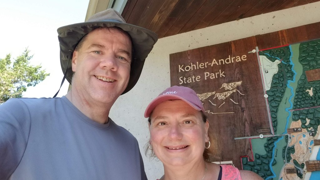
Splorin' Saturday is about slowin' down while speedin' up, takin' it easy while gettin' out an exercisin', eatin' well while still enjoyin' eatin', usin' more apostrophes and fewer g's, and most importantly spendin' time with each other in the great state of Wisconsin!!
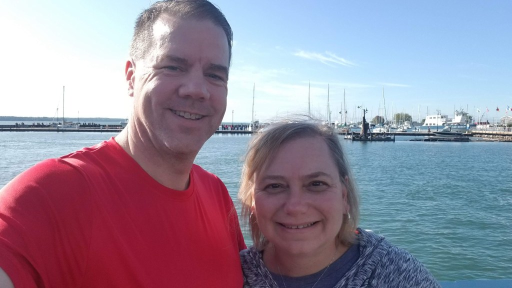
We found ourselves back in Michigan this weekend and have a whirlwind 2 wks planned after that, so Wi State Parks will have to wait a bit. Even though we were there to celebrate Mike’s nephew, Jeff’s wedding, we didn’t want to pass up the ability to ‘Splore’ if at all possible. After a 12 hour drive on Friday, we decided to do our “Supper Club Saturday” a day early and stopped in Ann Arbor at Weber’s Restaurant. It was a nice old fashioned supper club with the BEST French onion soup we have had so far. There was even a nice older gentleman playing the pinao by the time we left. We drove a little further, checked in to our hotel and had a quick drink with Mike’s brother, Pete, his wife, Karen, and the groom-to-be Jeff!! Saturday morning was wide open – the wedding was at 5 pm with the bride and groom having a special immediate family-only event at the Ukrainian church earlier; this left us time to do some Splorin’!!!!
We wanted to make sure we had as much possible time hiking as we could, so we left the hotel early — 5:45AM. Whew, but we were ready. We started off the day at our favorite type of restaurant — good ‘ole fashioned family restaurant — Nick’s Country Oven in Shelby Township, MI. We had our typical omelettes and a salad. Of course we also got to see the locals that walk in and don’t even have to order -their food is just brought to them. Love it!! While eating, we kept glancing outside and saw that it was still very dark. We only had a 20 minute drive and hoped the sun would be up by the time we got there and we took off for parts unknown to make the most of the morning.
We were headed to a Detroit Metropark: Stony Creek. We’d heard good things about it from the groom himself, so we figured we had to be right on it!! First things first — to pay for entrance to the park. Having never visited a Detroit Metropark before we (obviously) didn’t know the process. We knew it would be $10 (woo hoo, $1 cheaper than non-resident WI State Parks), but had no idea where/how to pay. We tried online, but that was only for annual passes. We got to the park right at sunrise. We though we must have to stop at the Park Office, but that was locked up tighter than a drum and completely dark. We figured it must be “self registration” wherever we parked. However, a mile down the road we came to a toll booth and paid our $10. Good-to-go!! Off to the trails.
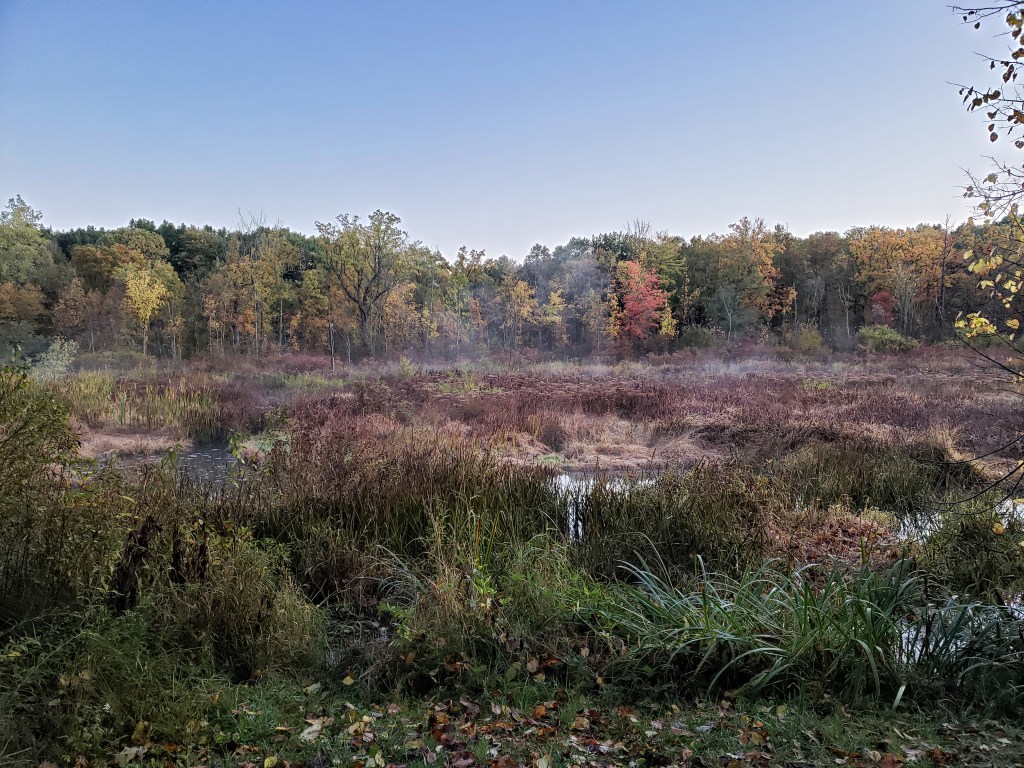
The first trail we took off on was the Osprey Rustic Trail. It was pretty chilly to start with — Tammy had a sweat shirt and long pants, Mike had his usual Splorin outfit of shorts and short sleeved t-shirt. Mike would have liked gloves, but we hadn’t purchased those….yet. This was a very pretty trail with walking along a very nice wooded marsh with some very beautiful views just after sunrise.
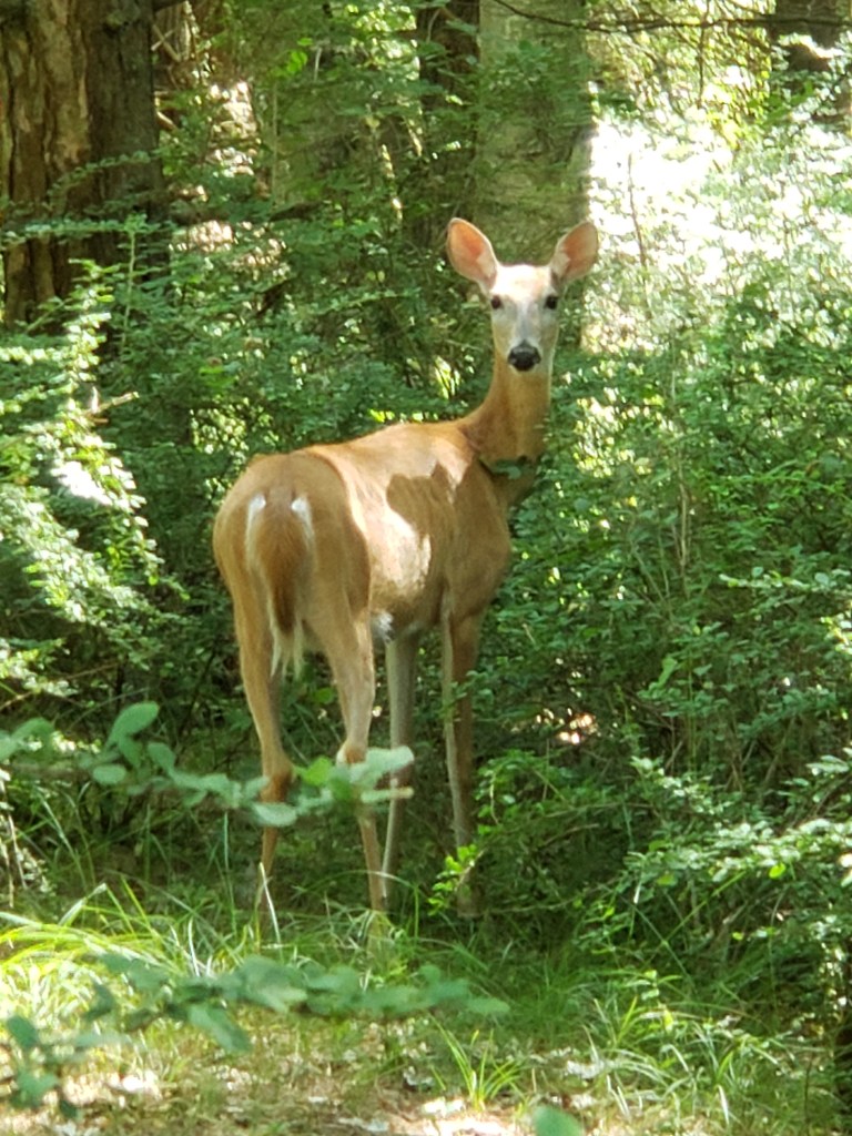
Most of the trail was not our desired trail surface — it was just cut grass. Our boots got pretty wet walking this trail. It wound it’s way along the marsh and then back through some prairie scenery. During this portion we had our first close encounter with a deer. It was about 50 yards away, we surprised it and it jumped right out onto the trail in front of us. It stood and stared at us for about 10 seconds then leaped back into the brush and disappeared.
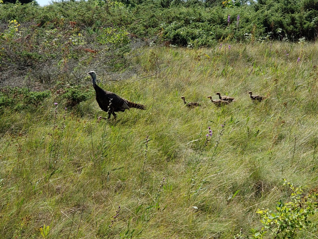
Our next trail was the East Lake Trail — this was going to be a little bit longer. Before we started the trail we had to hit the restrooms — we were surprised to find a group of wild turkeys standing right outside the doors. Apparently they were just waiting for us because as we walked up, they just walked away. The fall colors were just starting to make their way in to the park
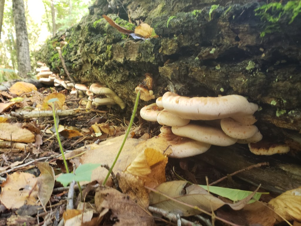
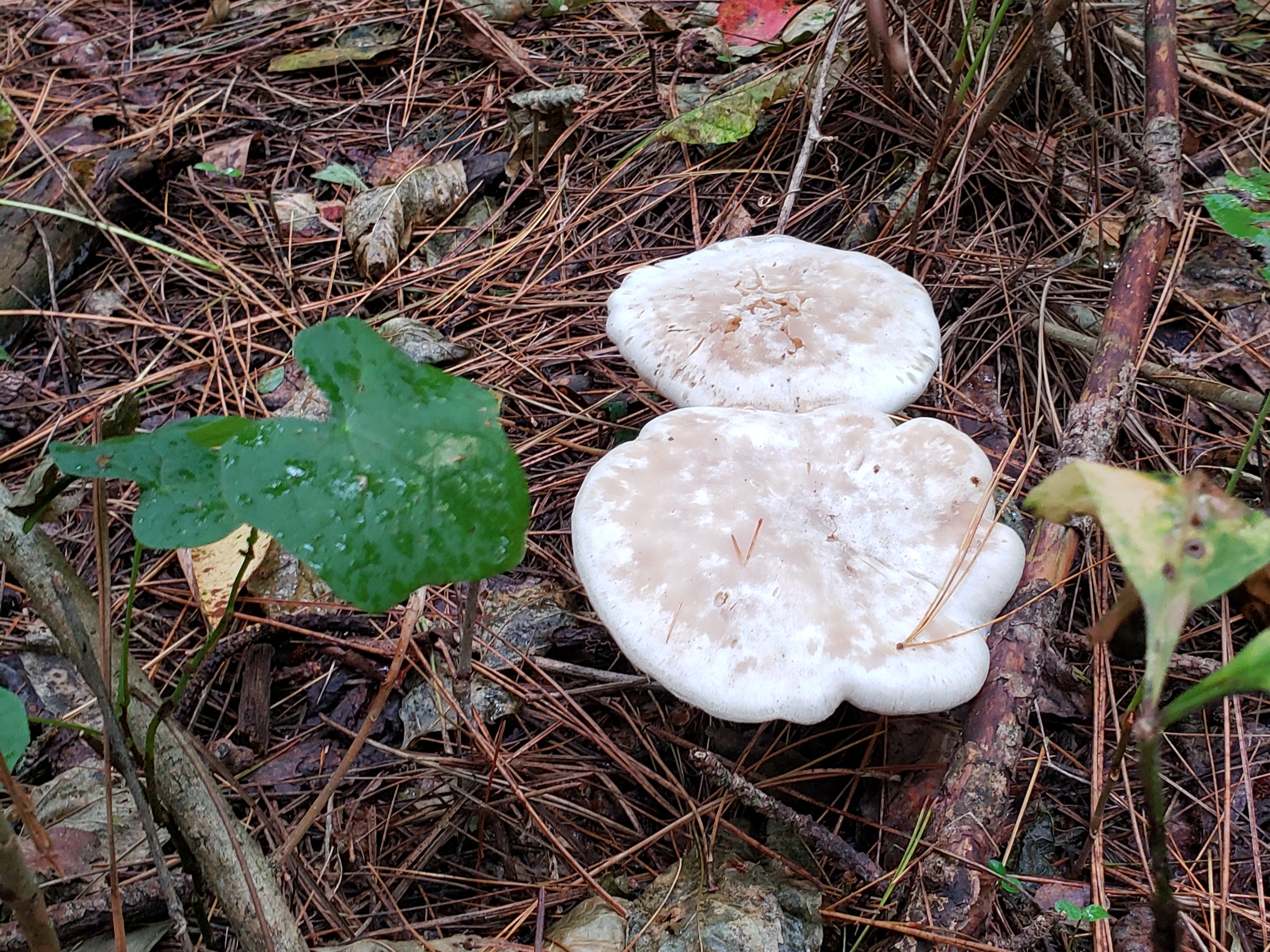
This trail would be what we would call a “double lollipop” — two loops with a connector in between. We saw lots of deer down this trail — Mike claims we only saw 5 while Tam thinks we saw 7. So, in all fairness we will say that we saw 6 deer (which makes us both wrong — that seems fair 😉 ). This was a gorgeous trail, but it started off with our least preferred surface — grass. As we got around to the backside we came across some HUGE houses (no, capital letters do not emphasize the point enough as to how large these mansions were). Shortly after the mansions on the first of the two “lollipops” we ran into a….road. Not just a dirt road to walk across, but a full fledged road with lots of cars. A quick look on Google Maps made Mike realize that we had veered off the trail and apparently followed a maintenance road. We back tracked about half a mile to find the trail that we were supposed to be on (no big deal, just an extra mile of exercise 😉 ). Getting back on the right trail was a godsend as it was our preferred trail surface at that point- compacted dirt and small (just wide enough for a single person). We finally saw a mushroom on this trail.
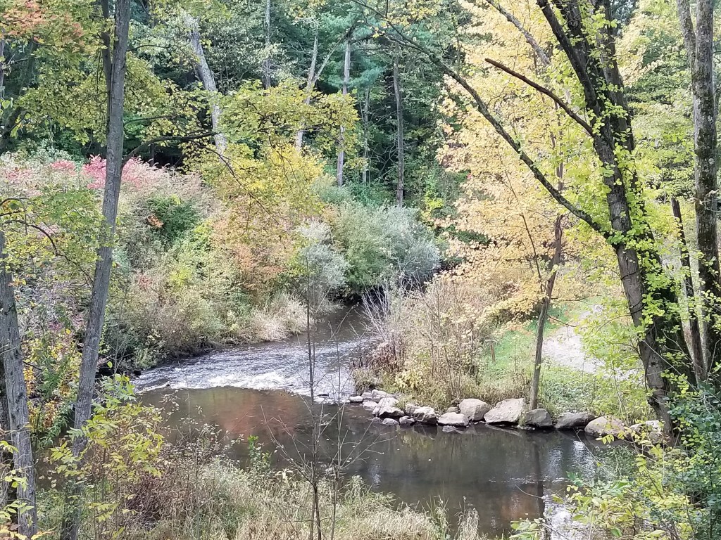
Before starting the Habitat Trail, we walked out to a little observation deck attached to the Nature Center. We had a nice view of a little creek (Stony Creek!!!) and could see a trail meandering along it. Mike said he thought that was the trail we were about to take (and, as usual, he wasn’t wrong 😉 ).
We followed the “left hand rule” again and began this trail in a clockwise fashion. We started off right along a very lovely little water hole.
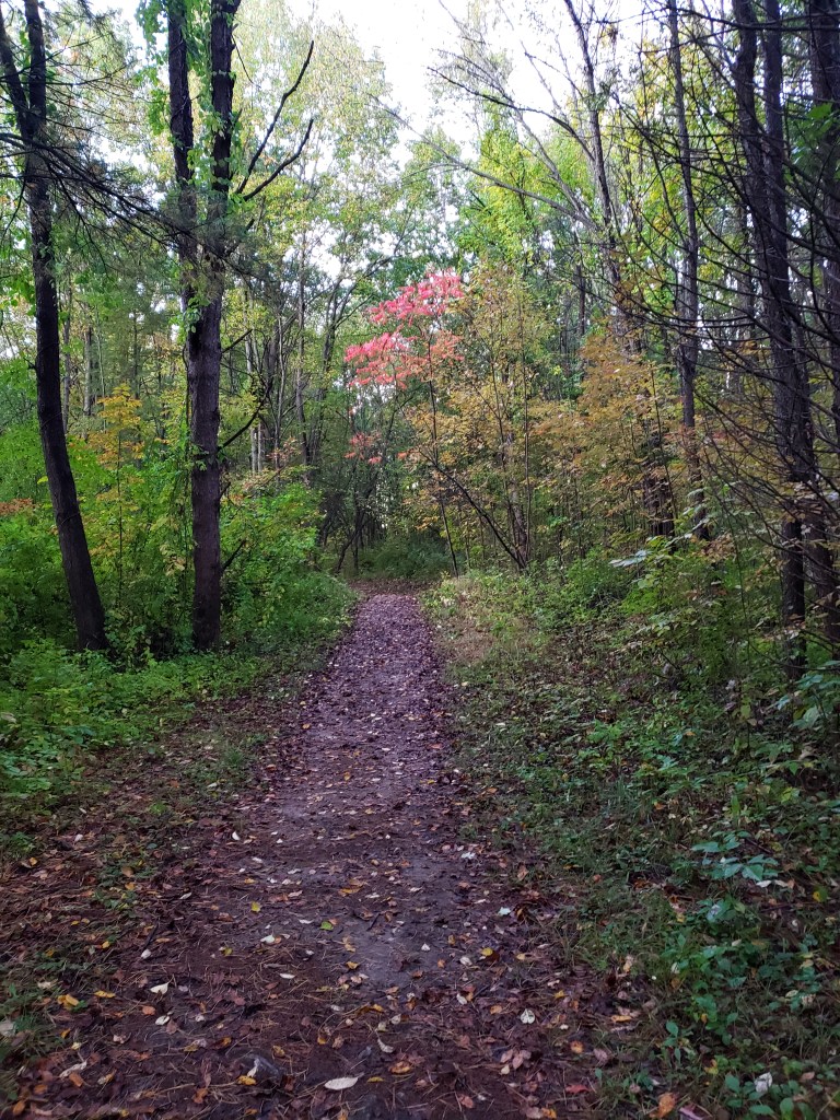
This was a very pretty trail with lots and lots of color along it.
We finished up this trail with plenty of time to spare. We even had time to try to find a tie for the wedding….at Walmart — OH, they don’t have ties anymore….at Target — OH, they have three ties (so we bought on of them).
All-in-all Michigan Splorin’ Part Deux was a huge success!!!! Love us some Michigan!!!
It was Family Weekend at Marquette University this weekend. We wanted to spend time with Carrie and her roomates (as well as buy them food and stuff) but we also did not want to miss out on a chance to do some Splorin’. This made for a perfect time to do some abbreviated Splorin’ at a state park that was not up to the task of taking us a full day of hiking.
We usually start off Splorin’ Saturday with breakfast at a mom and pop type restaurant, but since we were in Milwaukee and had Carrie and her roommate, Elena, along (YAY!!) we went to more “urban” place – First Watch in Brookfield, WI. It is a wonderful restaurant — Mike had been there with the kids before, but Tammy had never been there. The conversation at breakfast was much more lively than a typical Splorin’ Saturday as Carrie and Elena are non-stop energy and plepping (and we wouldn’t want it any other way). We didn’t get to do any eavesdropping this time, but I am sure that other tables were eavesdropping on us! Mike kind of had his usual — “The Works” omelette had all the meats plus onions, tomatoes and mushrooms, and Tammy kind of had her typical — “Fresh Market Veg” omelette with zucchini, mushrooms, shallots, tomatoes and kale. Both came with greens on the side, so we didn’t even have to ask for a salad!! The greens were supposed to have a lemon dressing – Mike apparently had one little splash on his, Tammy — not so much. It was a nice breakfast with good company.
After breakfast we dropped Carrie and Elena off at their apartment — Carrie tutors at Kosciuszko Community Center from 10 – 12 every Saturday, and Elena had some photo shoots to cover for the Marquette Wire. Then we headed north to Harrington Beach State Park, about half an hour away. We knew we would have about 2 hours to hike before we had to head back to pick up Carrie from her tutoring gig, so we didn’t waste any time. This was going to be one of our chillier splorin’ days, but we figured hiking would warm us up — no sweatshirts or jackets for us! (It was in the upper 50’s but thankfully the potential for rain had dropped to about zero per cent from the 40% we had been seeing all week.) “The Plan” had us just doing one long hike without a break– well, not really long by ‘splorin’ standards anymore – Mike figured it was just under 4 miles. Well, we don’t have much time — let’s go!!!
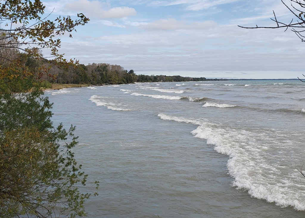
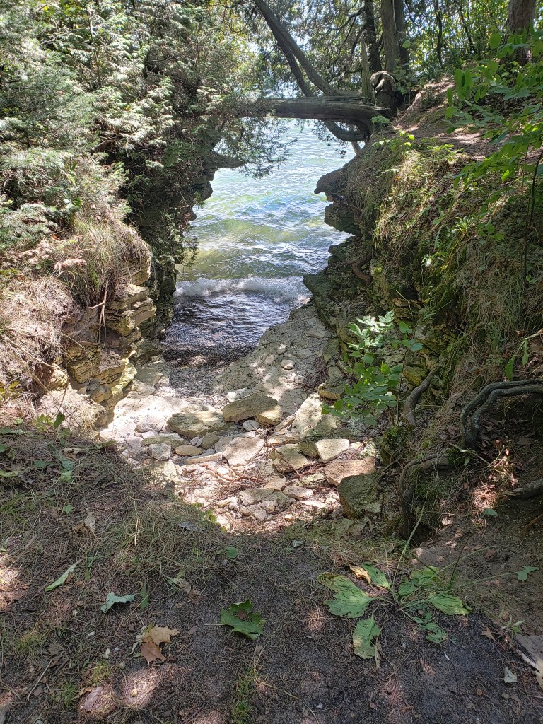
Before we even left the car we were surprised at how loud the wind was where we parked. It really seems to just be roaring through the trees. We took off and headed straight for Lake Michigan. We quickly found out the noise was not the wind howling, but rather all the waves breaking on the beach. It was gorgeous….and cold. Whew!! We wish we would have had a sweatshirt or jacket!! But we’re tough — we then headed down the trail which kept us just off the beach (but still in the wind). We made it about a third of a mile down the beach to a point sticking out into the lake; it offered a great spot to look back up the beach.
That was the end of that trail so we turned back inland to Quarry Lake. There is an accessible trail all the way around the lake. Since it once was an active quarry (imagine that) it was amazing to see the steep edges. The water was very clear, it looks like it is very deep, but apparently it is only 6 feet deep at the maximum. This picture is looking down in to the water,
That was kind of disappointing to find out — we were thinking it was hundreds of feet deep. The trail wound along the edge and offered great views of the lake and a family doing some fishing. One of the boys was even in the water up to about his knees fishing — he was pretty brave and must have been pretty cold.
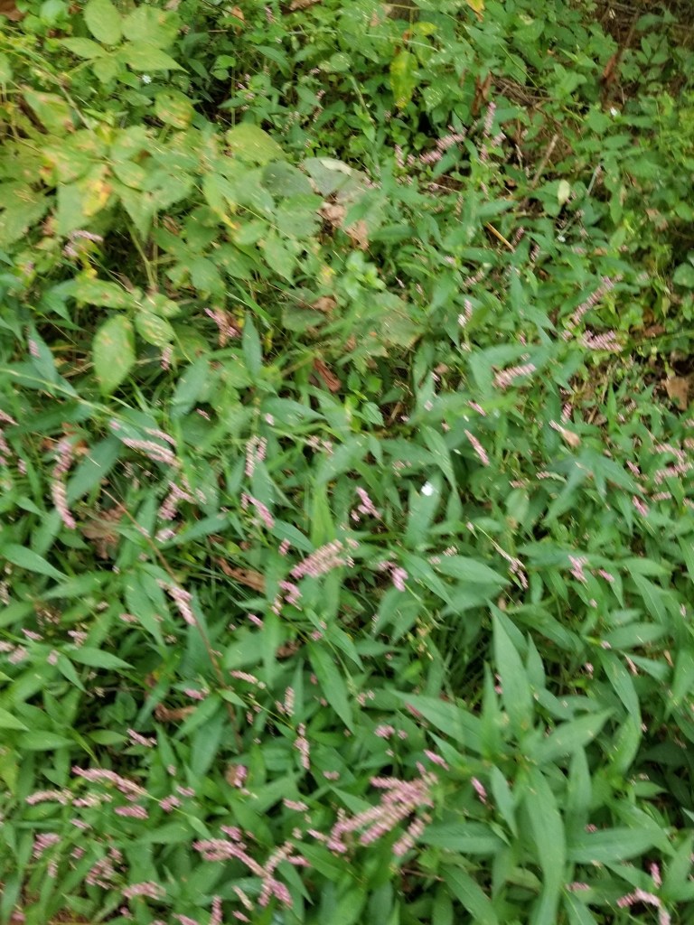
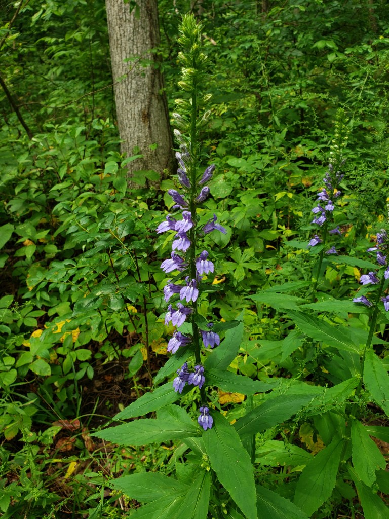
After going part of the way around Quarry Lake, we were quickly on the Whitetail Trail and moving back towards the ranger station. There were a lot of purple flowers everywhere along the path. Even some with wildlife on them.
The Whitetail trail quickly gave way to the Bobolink trail. This was a big loop trail out in the middle of a prairie overlooking Lake Michigan. Don’t know what a Bobolink is? Neither did we, but if you’re interested follow the link to see and read about what we’re not sure if we saw along it’s trail. We saw lots of little birds, but it unknown to us if they were actually Bobolinks or not. To be fair though — we didn’t see whitetail deer along their trail either. Since we did have a bit of a time crunch, we didn’t stop to take many pictures. One thing Mike did have time to notice was that every 20 feet or so there were trails that cross the path. Some looked very well worn with the grass pushed aside. We kept thinking they must be heavily used deer trails. That was until we popped out at the end of the loop onto the park road just in time for Mike to see two turkeys scurry into the grass. We walked down the road to try to see them — which we finally did. It was a family of a couple of larger turkeys and 4 to 6 “kids”. They were strutting through the long grass along those trails that we had seen. Mike was disappointed that they weren’t deer trails though- we haven’t seen any deer along our hikes in many weeks.
We were already on our way back to the car, and only had one last little nature trail to go. The nature trail was full of signs explaining all the animals that we were not seeing. One very prominently said “Deer Love It Here!” — well, no, no they didn’t. At least not while we were there. We made our way around the trail. Mike had commented earlier that we were skunked as far as seeing mushrooms too (except for one in the middle of the trial that just looked like a golf ball — boring!) before he came across this log.
We were now officially done with the park. We did 3.45 miles in just over an hour – not too shabby.
We then drove back to Milwaukee to get Carrie, and we made it with a few minutes to spare! Whew! After picking her up we went back to the hotel to hang out for a little while, then change for Mass and dinner.
#SupperClubSaturday was also a little different this time. We are wine club members at Cooper’s Hawk Winery and Restaurant and have been for years ever since we stumbled across one in Orlando, Florida before one of our cruises. They have amazing wine and food!!! We get two bottles a month and when we’re in Milwaukee we always stop in to pick them up. This time we had 4 bottles waiting for us. Another perk that we get there is $15 for each of our birthdays and loyalty rewards as well. So, we also had $40 in cash off our bill that had to be used before November 1st. We couldn’t pass it up! While not a true Supper Club, we figured since everything else was a little different this weekend it was acceptable for this to be different as well. No prime rib, so Mike had a NY strip and drunken shirmp, and Tammy had Parmesan crusted medallions and a crab cake. The food is just simply amazing. And we have never been to this restaurant when it hasn’t been SUPER BUSY! There are not enough superlative adjectives to try to describe it.
Splorin’ Saturday then took us on another detour on the way “home” to the Hilton Milwaukee City Center where we hung out at the bar for a couple of drinks while we waited for Carrie to finish with a volunteer shift she was working for the PT department’s Marquette Challenge Fundraiser. A little different, a little shorter hike, and all worth it to spend some time with Carrie and her friends. We won’t see her again til Thanksgiving so we cherish the moments we get to spend together.
Today’s Splorin’ was a little difficult to plan out because of a workshop that Tammy had to attend for 4K in the morning. Usually we’re on the road early (before sunrise now) and ready for hiking by 10AM. Because we could not leave Eau Claire until noon, we decided to hit two of the smaller state parks that just wouldn’t be big enough for an entire day of hiking, but were close enough that we would make it there and back in just half a day. Tammy didn’t have to be to school until 9:30am so we were actually able to make it to the farmer’s market in Phoenix Park before leaving!! Definitely not as many vendors as during the summer, but we managed to come home with some brussel sprouts, eggplant, and zucchini. We also had time for breakfast after we left and we wanted to go to a place we hadn’t been before, or at least hadn’t been to in a while. We picked 29 Pines Restaurant, just off of highway 29. The menu is HUGE!!! Quite a few different kinds of omelettes and they all sounded good. When we asked about our preferred side salad instead of toast or hash browns, the waitress seemed skeptical, but she was able to pull it off for us. Unfortunately when Mike said he wanted the same as Tammy, meaning a salad, she brought the wrong omelette to Mike, even though she clearly wrote down his own omelette choice. Strangely enough, she brought the salad after the omelettes. Mike was able to eat his salad while waiting for his chosen omelette to be made and Tammy actually got to eat both together which she prefers so it worked out well. All-in-all not a bad place, but we think they were just a little more busy than expected on a Saturday morning. Our eavedropping focused on the table of younger-than-we-are-used-to guys who may or may not have had a few morning cocktails before they arrived. They had a lot of fun messing with the waitress, but she took it in stride. We also do not think the couple behind us ever got the ketchup they requested right after we ordered. 😦
After Tammy’s meeting, we were ready to hit the Splorin’ open road at 11:30AM. Our first stop was going to be Merrick State Park just north of Fountain City, WI. Since Tammy’s grandparents were from Fountain City, we’d been there a million times before wso we knew the route well and thought the drive would be completely uneventful. Luckily it wasn’t!!! Mike has loved having Google Maps provide directions, rerouting us, etc. On our way Mr. Google decided to have us take a Buffalo County backroad highway instead of going the way we have every other time we have driven to Fountain City. We got to see some gorgeous scenery that we would like to see again once the trees start changing colors. However, sometimes Mr. Google just doesn’t have all the information he needs. It wanted us to turn onto “Lover’s Lane” at one point which would take us almost straight into the state park. Alas, Lover’s Lane is a private road that has a bridge covered in foliage at one end and a big iron gate at the other. Thanks Google — we took the long way around.
“The Plan” had us hiking 2.5 miles or so at Merrick and then heading off to our second destination for the day. The hiking trails at Merrick are so small they are not even named. So, we began at the nature center on what Mike figured to be a 2 mile or less loop that would take us back past the park office and around to the North Campground before returning to the car. Our experience last week at Big Bay State Park where we encountered NO BUGS had us hopeful that the bugs were done for the year. So, Mike decided not to do bug spray, and Tammy, kind of reluctantly, said she wouldn’t do any either. Luckily, Mike was smart enough to put the bug spray in his pocket (just in case). Well, less than 1/2 mile down the trail the bugs were eating us pretty badly. We thought we could tough it out — but we had to stop and put the bug spray on! Boy, that stuff is MAGIC!!! Immediately the bugs stayed away. We still had the itchies from the ones that already bit us, but the rest of the bugs beat a hasty retreat.
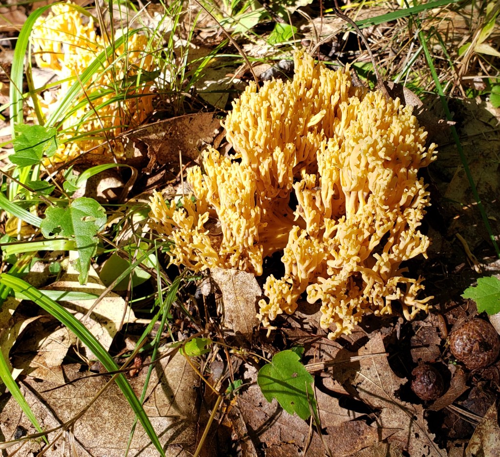
Something we noticed this day on the hiking trails that we haven’t seen as much before in our Splorin’ days — mushrooms. We encountered many different kinds throughout the day. There we several places where it looked like strings of mushrooms were growing– must have been dead trees underground or something. Mike has started enjoying taking pictures and and these mushrooms were perfect subjects — he has always loved photography and is usually pretty good at framing the shots, etc.
The trail took us up into the campground. We had to walk down the road a bit and Mike was worried that we would not be able to find the trail again because there weren’t many markings at all. Eventually we saw a sign saying there was access to the water and when we decided to give it a try — there was the trail as well!
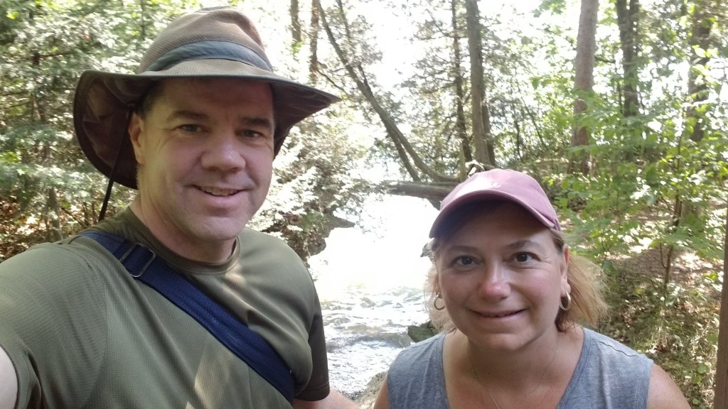
It led us quite a bit farther than Mike expected and several sections were right along the railroad tracks. We had two trains pass us, one we couldn’t see at all and the other when we were right beside the tracks. They sure are loud — but, we’re used to them having spent so much time in Fountain City. We had one more short trail to do at Merrick this one led us to a couple of places where you could take steps down to the water — we were able to get our selfie on there, and then we were ready to hit the road.
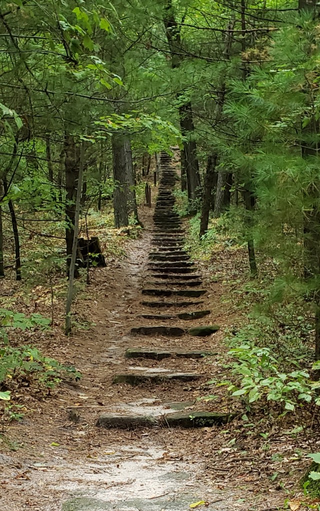
Our next destination was Mill Bluff State Park in Camp Douglas, WI. We’ve driven right past these bluffs hundreds and hundreds of times on I-94 and have seen the signs, but have never stopped before. Once again “The Plan” said there was just two trails here — one that had 223 steps to the top of Mill Bluff (Tammy was looking forward to that trail – baha!) and another which was a short distance to the north that went around a couple of other bluffs. It turns out there was actually another trail, aptly named “hiking trail”. The “hiking trail” looped around Mill Bluff and then dumped you at the bottom of the steps up the bluff. Going around and looking up, we were very worried about what the climb up the bluff would be like. While 223 steps sounds like a lot, looking up it was easy to think that it would take a LOT more than that to actually make it to the top. The beginning of the steps does not look that bad.
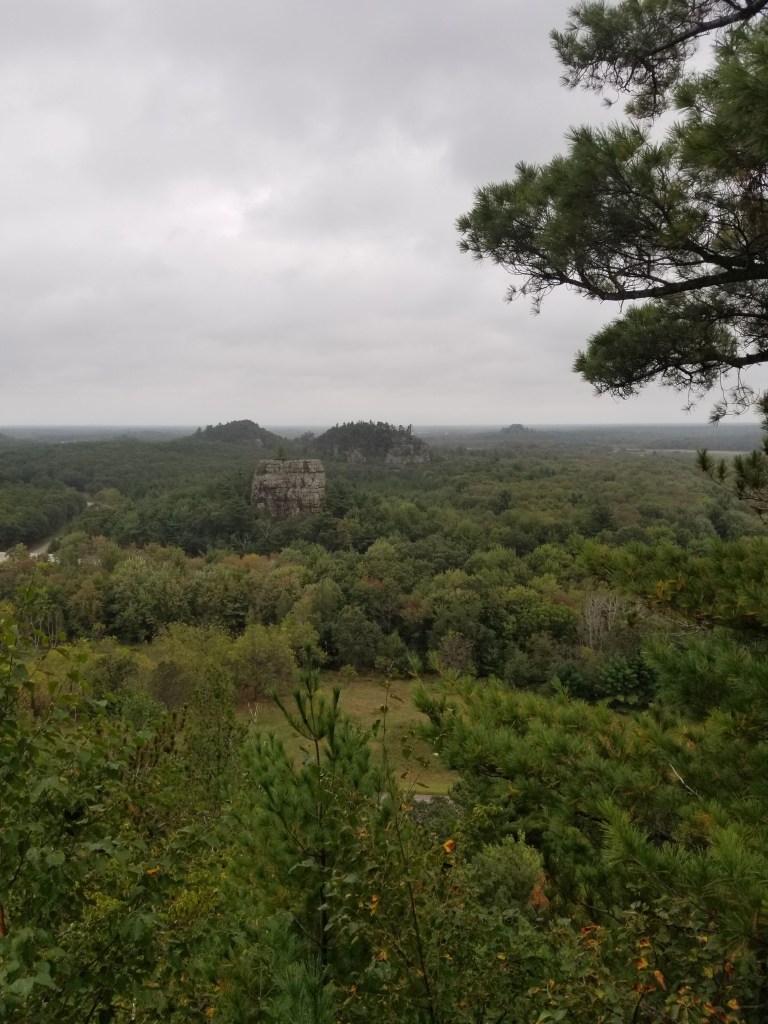
But what you don’t see yet in that picture is where the steps start to go steeply uphill. It really wasn’t that bad to make it to the top, much to our surprise. We thought it would be a much longer climb. And the view from the top was amazing! These bluffs used to be islands in Lake Wisconsin during the last ice age and the entire area was covered in 60 – 80 feet of water at that time. We were 120 feet above the base of the bluff.
Tammy was worried much more about the climb back down the steps than the climb up, but we both survived. Thankfully there was a hand rail because on the steeper sections it was difficult.
We made it back to the car and headed of to the north side of I-94 to find our last trail of the day.
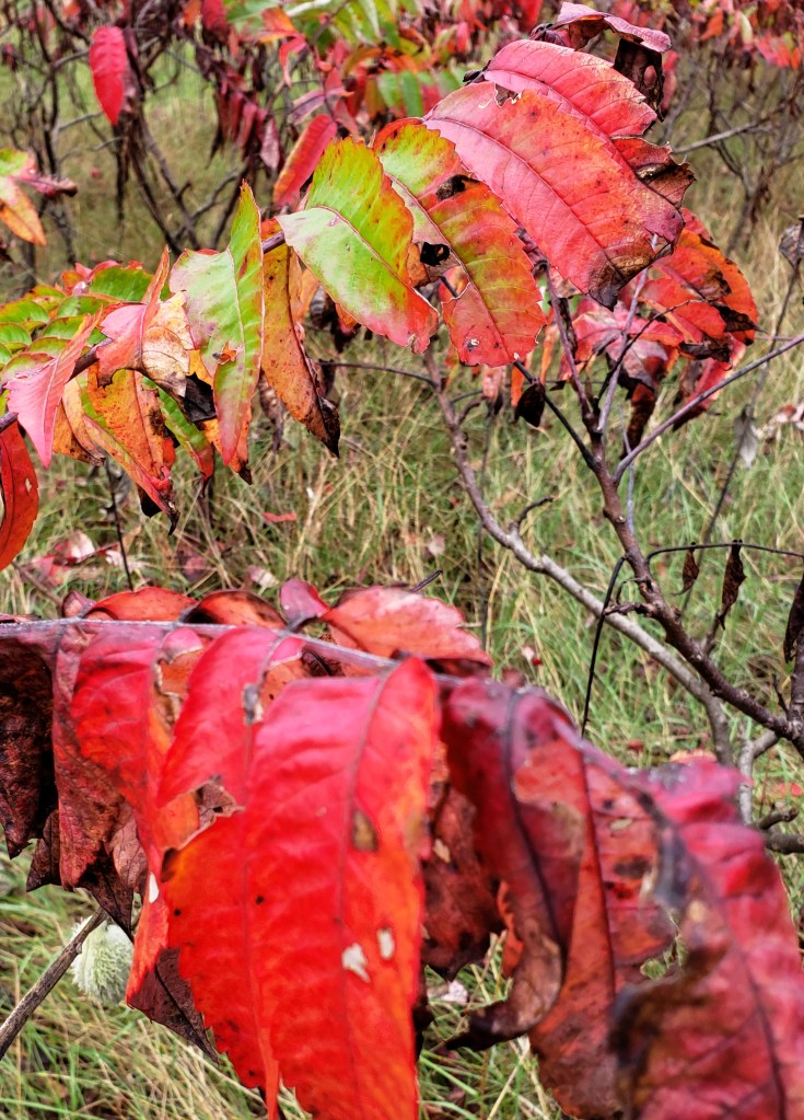
Upon arrival at the parking area, we met a mom and two daughters taking pictures. It looked like they were maybe taking senior pictures, and when we got out of the car they asked if we could take some pictures of the three of them Mike happily agreed, snapped a hundred pictures or so, and we then headed down the trail. This was a neat trail and was created as part of a Boy Scout’s Eagle project. It was a 1.25 mile loop that would go past a couple of bluffs (which we couldn’t really see due to trees and overgrowth). We did see some very pretty flowers and sumac that were turning red.
Part of the trail was through an open field that we swore we should have seen deer in — but, we’ve decided we’re just jinxed for deer lately. There were some pretty cool dead trees throughout the field.
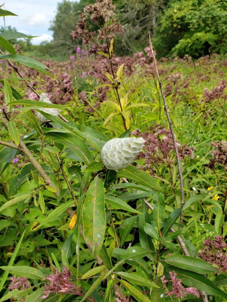
We ran into some standing water on the back side of the loop that had quite a few mosquitoes hanging out around it. Since we had not reapplied our bug spray, they were starting to get to us. We have a thing for flowers (if you could not tell from all the pics), we came across some flowers which we had never seen before. They were just about ready to pop open — but strangely enough they were on the end of a big vine.
When we were finally making our way into the end to the end of the trail — with our car in sight — Tammy gave a little gasp of surprise. She had come across a snake: here is a picture of it:
But, just seeing a snake is not the interesting part, what is interesting is the size of the snake:
That ended the wildlife sighting and hiking for the Splorin’ day. Now #SupperClubSaturday!!!
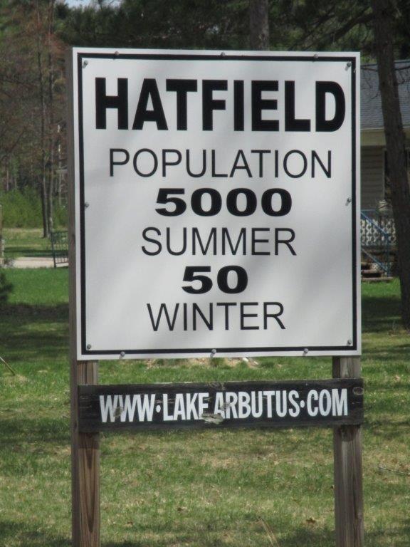
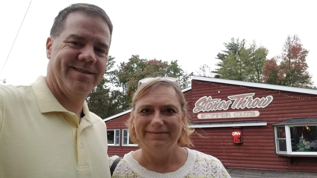
Since we would not be showering, we thought we’d stop at a truck stop and get cleaned up as much as possible. We had body wipes (think adult version of diaper wipes) to clean the bug spray off but we had to get changed too. While Mike can easily do that in the car, Tammy needs a bit more room (and privacy). Normally, we try to get reservations ahead of time so that we do not have a long wait after a long day of hiking, but the supper club we were going to, Stones Throw Supper Club in Hatfield, WI, would not take reservations for groups under 8. We were a little concerned since we were an hour later than our usual 5PM. But when we got there at 6:15PM we had no trouble getting a table. There were several UTVs in the parking lot — like 8 in a row. You know you’re off the beaten path when there are more of those than cars in the parking lot of your local supper club. But, what can you expect from a town that has this as their population sign:
It was also on the back of the servers uniforms. We had a delicious shrimp cocktail for an appetizer. Mike has his usual (which was very tasty!!) with mushrooms and onions on the side. Tammy had a cedar plank salmon which was also very good. Unfortunately the “mixed vegetables” we ordered instead of potatoes were carrots, peas, corn, and green beans — we really were only able to each the green beans out of it. But the mushrooms and onions were enough for both of us to count as a vegetable! What took the longest was our drinks. We didn’t get our cocktails until after we had eaten our appetizer and started on our salads and the refills took time too — oh well. They were incredibly difficult cocktails to make (no, not really — whiskey/diet coke and gin/club soda). All-in-all dinner was awesome! Our waitress, Robin, was very sweet and recognized our “no/low carb” lifestyle and that we are trying to be healthy. It was a real family place — the busboys/girls were definitely very young and probably somehow related — or at least we hope so. It was also very loud so not much of a chance to hear any conversations. But we did make some observations. There was a couple with an older woman (probably a grandma”) at the next table and she was just so cute having her beer with the family. When they brought out her prime rib, they had precut it for her so she was ready to eat. Tammy just wanted to give her a hug!
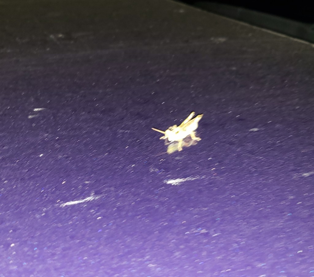
Thankfully we only had an hour drive home after dinner. Not for us, but thankfully for our “little hitchhiker” that hung onto the hood the whole way home!!! We still have no idea how he held on the whole way. It was kind of fun watching him — when we would slow down and go through a little town he would walk around a little bit, or turn sideways. But when we would pick up speed out on the open road he would turn and face forward (or stare at us, we couldn’t really tell which direction he was facing).
Even though it was an abbreviated day with lots of driving in between hikes, it was another successful Splorin’ Saturday.
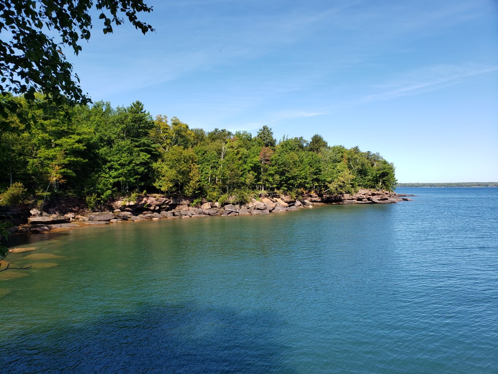
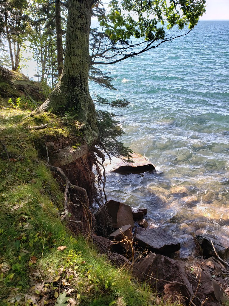
This week Splorin’ Saturday was off through the deep north woods of Wisconsin (and then some) into Lake Superior. Big Bay State Park on Madeline Island was our destination this week. This time it included a 3 hour drive, followed by a half hour ferry trip, followed by a 10 minute drive. In order to accommodate this much travel, we left at 5:30AM — whew, that was early, but we made it on time!!!
The first hour of our drive was in the dark and through the fog. As the sun began to come up, the low level fog over the fields reminded us of what you might see on an African plain. (or at least what we have seen in movies) Gorgeous! It was awesome to be heading North this weekend instead of heading South on I-94 — a very welcome change. North is Mike’s preferred direction — the scenery is much better and feels more like a “vacation” to him than going the same way he goes for work every Monday morning. Our stop for breakfast was at R Place Cafe near Cable, WI. It seemed like it was in the middle of nowhere but we pulled in around 8AM and the parking lot was packed!! We were worried that we would not find a table – no worries there were actually 2 tables available. We grabbed one in front of a big chalk board where little kids (apparently for years) have been allowed to draw, write and just doodle while their parents eat — very cute. Both Tammy and I had three egg omelettes (ham and cheese for me) and Western omelette for Tammy. They had no salads for us, so I settled for a “salad” of bacon and Tammy a “salad” of sausage patties. If you plan on going here and are not positively famished — order the two egg omelette! They were huge and the ingredients were amazing. “Real” ham and Tammy was thrilled that her Western contained TONS of tomatoes! We kind of sat back off in a corner so we couldn’t over hear the couple of elderly gentlemen of the coffee klatsch at the counter, but the table next to us was occupied by 4 people who were getting ready to participate in the CHEQUAMEGON MTB FESTIVAL. They were geared up and ready to go — just like we were ready for Splorin’.
We took off for Bayfield. We were headed to the Madeline Island Ferry Line to take us over to the island. We looked into just riding the ferry over and renting bikes (or a single tandem bike) once on the other side. However — it was more expensive to rent bikes than to pay to take our car over. Mike, keeper of “The Plan,” had us arriving at the ferry place around 9:30AM (he read that we should arrive 30 minutes before we wanted to be on the ferry) for the 10AM ferry ride. We got there about 9:34. However, after we paid we were directed to pull on the ferry and within 5 minutes we were our way to Madeline Island!! Just in time!!!
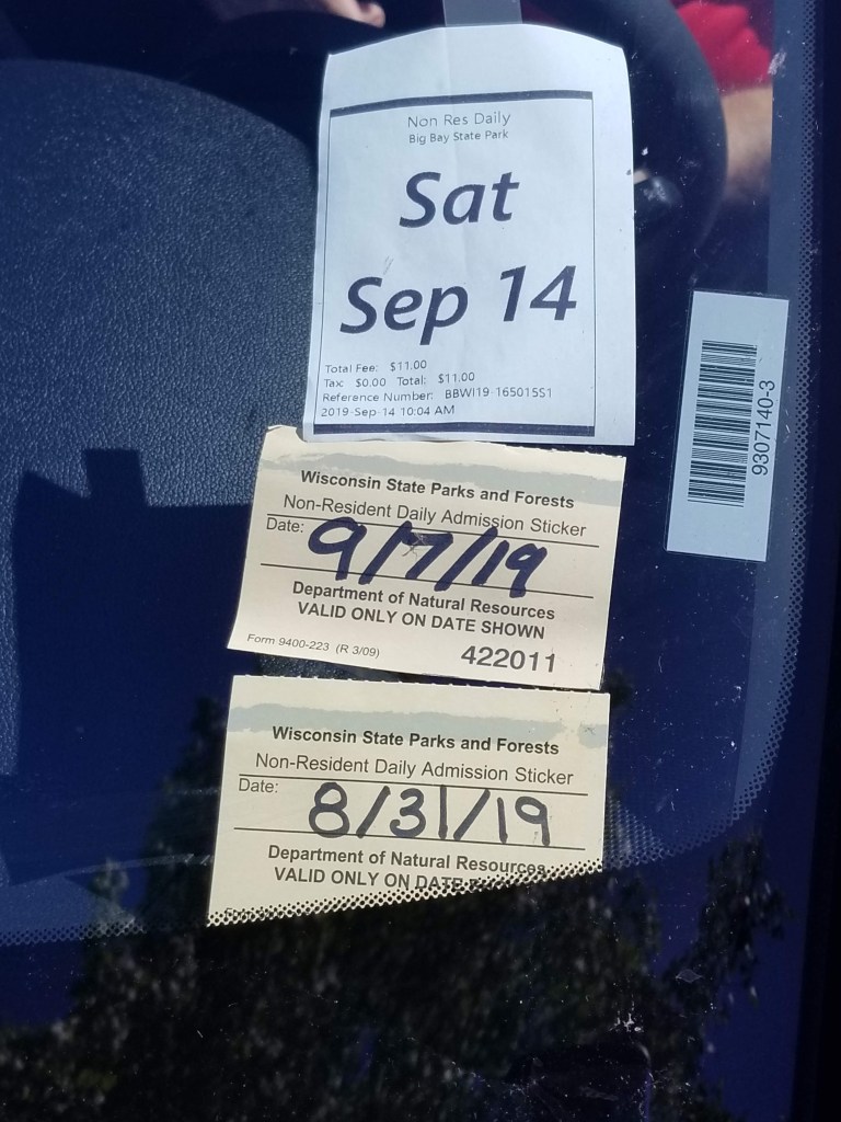
We got to the other side and drove on to the State Park and bought our non-resident single day pass for Mike’s rental car. We would have felt bad leaving the car behind in favor of bikes because it would have missed the stop at the state park and the addition of the sticker to the windshield.
This state park did not have that many miles of hiking trails — Mike had planned for us to hike about 7 miles. Given that we were having to take in to account the extra travel time, 7 miles was fine with us. The first hike of the day on “The Plan” was to take the Lagoon Ridge Trail and loop around to the Beach Boardwalk trail. It was supposed to be a 4 mile loop. The weather was cool (around 60 degrees) and since we were way “up north” Mike made the decision not to apply bug spray and Tammy decided to follow his lead. No dramatic music here because there were NO BUGS at all!!
We started down the trail and came to a sign post at the beginning of the trail. It explained that this was a pretty rustic trail. Tammy immediately noticed that there was aalso a warning on the sign post that mentioned a black bear and her cubs were often seen along the trail and hikers should give them plenty of room if they were seen near the trail. Mike was STOKED!!! Tammy was nervoous. Mike, not wanted to delay any further started down the trail. Tammy, being the mature one of the Splorin’ Saturday couple, also noticed a sign saying that the trail was closed because of trees down, standing water and impassible sections. Mike then looked at the sign and thought it looked like it was old — besides it was a small laminated sheet of paper — nothing like the caution tape and saw horses that we saw at Wildcat Mountain State Park alerting us to closed trails. But Tammy was able to convince Mike into at least going to the ranger station and asking if the trail was still closed before we started down it. This was an immediate disruption to “The Plan”. Mike looked at the map and decided we could still do what was to be the second half of the day’s hike which would bring us near the ranger station to ask about the other trail.
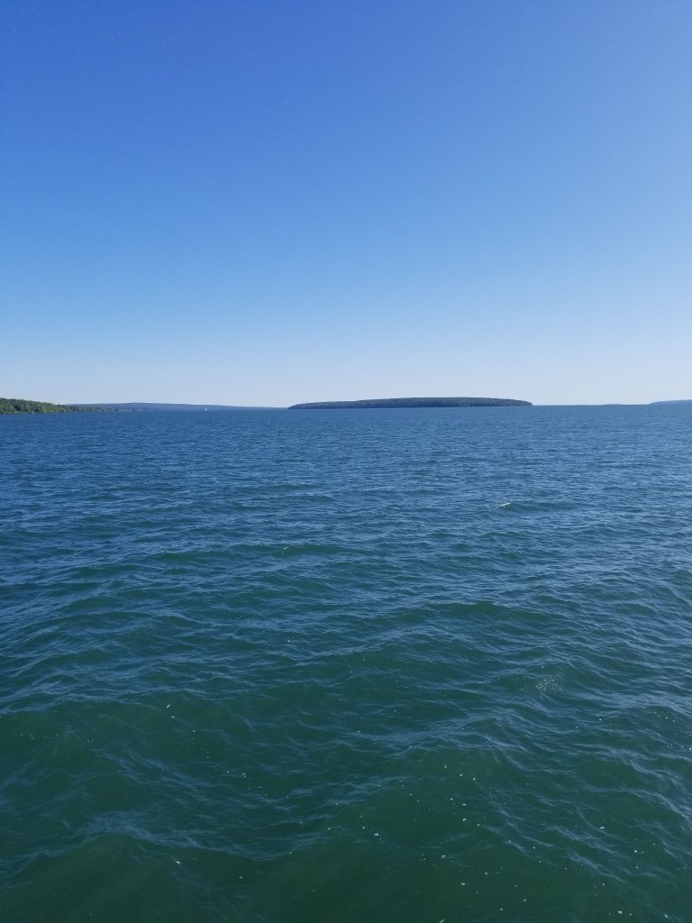
So we started off going to the left — only to see other people starting down the trail right in front of us. Mike was not pleased. When “The Plan” is disrupted, Mike is often not pleased. So, after whining, moaning, and gnashing of teeth, Tammy finally persuaded Mike to go to the right instead of the left. We started down the Woods Trail and immediately saw another signpost. Mike was ready to go into hysterics if it said this trail was closed too, but luckily it didn’t. This sign warned of standing water, muddy areas, and other hazards along the trail. Of course Mike had to say “Well, we’ll see if that sign is old too and if there really is mud or standing water on the trail…”. Of course, within the next 30 feet of the trail there were two pools of standing water and mud that we had to navigate around. Mike finally admitted maybe the Lagoon Ridge trail really was closed. Turns out there was a LOT of standing water and a LOT of mud along this trail. About halfway down the trail we passed another couple hiking the opposite direction — there were obviously less experienced Splorers as they only had tennis shoes on (like us early on in our Splorin’ career) and we heard when they hit the mud. The end of the Woods trail was a quite dramatic overlook of Big Bay — the wind was blowing and small whitecaps were on the surface of the lake.
We then walked towards the ranger station to ask about the Lagoon Ridge trail. As we made our way, we went past the overlook picnic area. Tammy said that would be a great place to play cribbage later. We made it to the ranger station and had to wait for the ranger to get done with another customer. As we stood and waited, Mike noticed a BRIGHT ORANGE sign on the bulletin board stating the the Woods trail had standing water and mud and the Lagoon Ridge trail was …. closed. 😦 How could we have missed that when we got our ticket. We waited just to double check with the ranger. She said that the trail had a lot of standing water and trees down. It was a very primitive trail and some people had difficulty staying on the trail without those extra obstacles, and with them, often got lost. We decided that in future Splorin’ trips we should always ask about trail conditions before starting The Plan. (Mike had randomly asked last week at Yellowstone Lake State Park, but not here. 😦 Oh well, that meant definitively no Lagoon Ridge trail. So Mike came up with a backup plan — we would walk up the Beach Boardwalk trail and back down the beach. But that was for later, we still had some more awesome trails to hike before getting to the backup plan.
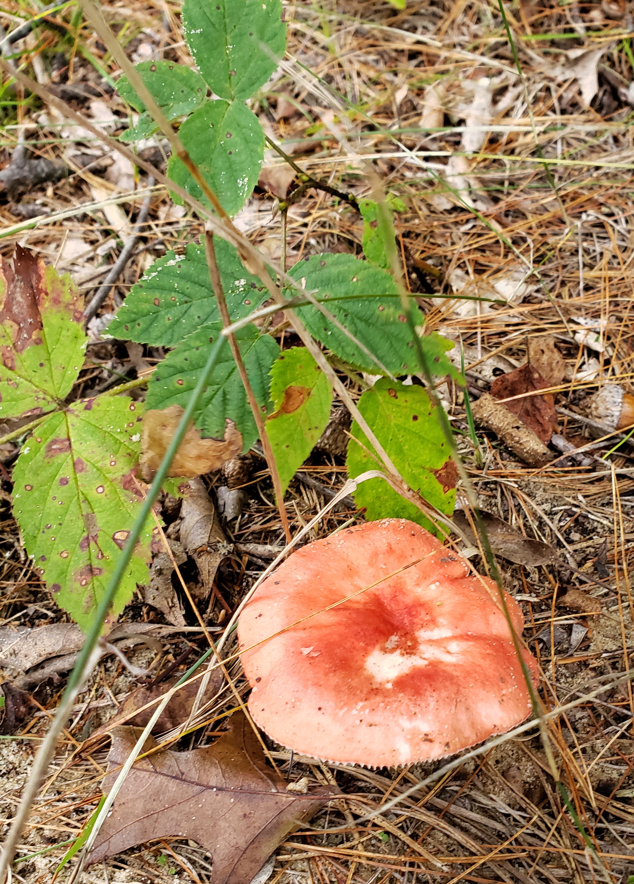
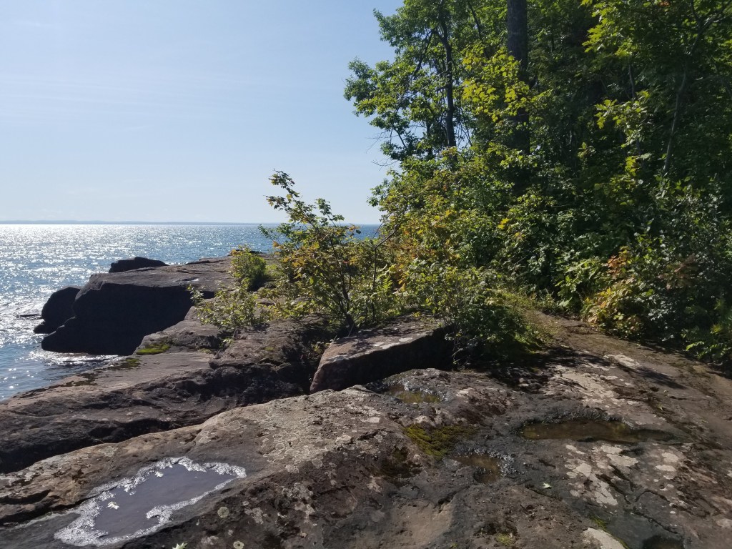
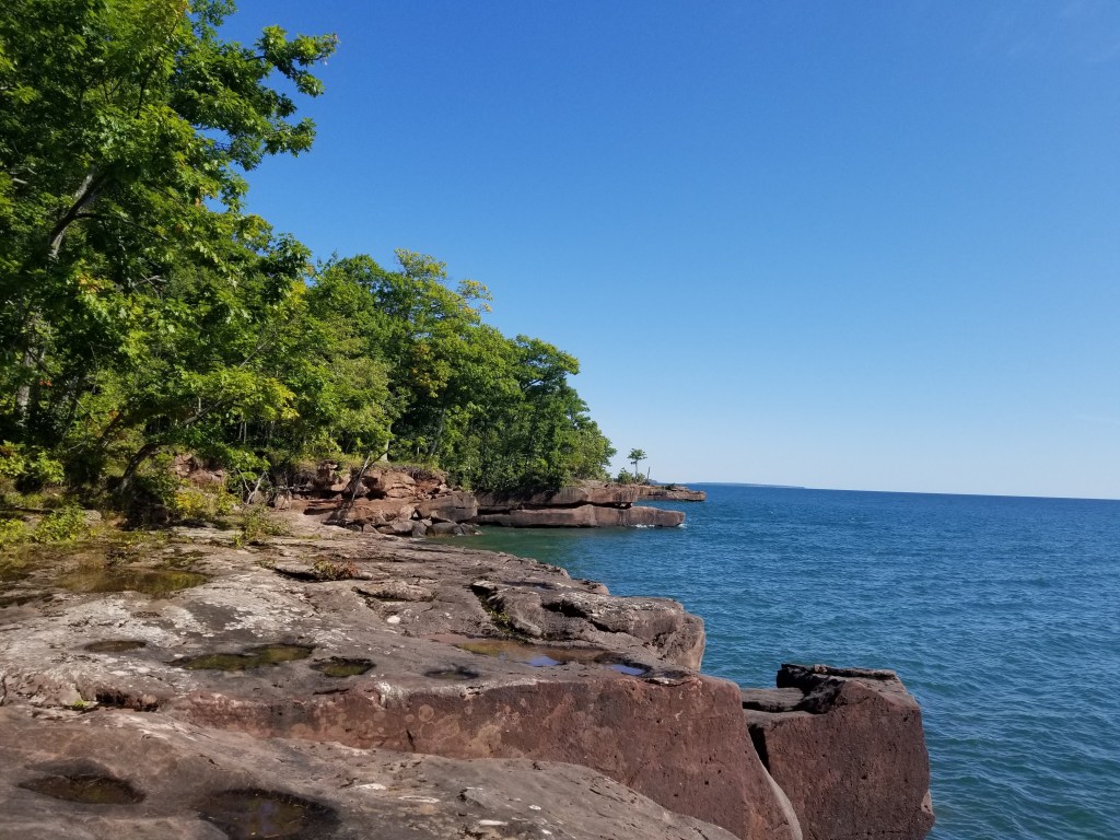
We made our way up the the Point trail. This was a beautiful trail walking along the top of the rocks right above the bay. Lots of beautiful places to stop and look at the rocks jutting out into the lake. There were also a lot of pretty changing foliage and some more strange looking mushrooms.
We met the couple that had ducked into this trail in front of us and we couldn’t figure how it took them so long to get there — we must have hiked 3 times as far as they did in that amount of time. We also passed a family with a couple of small kids. This trail had a little loop off of it which actually ended up taking us backwards on the Point Trail. Again, beautiful scenery and strange trees. Mike thought maybe we would get back onto the Point trail and meet the same family and couple again. If we did, Mike wanted to ask them if they had seen our twin brother and sister. But alas, we just missed them — by about a minute. Sad.
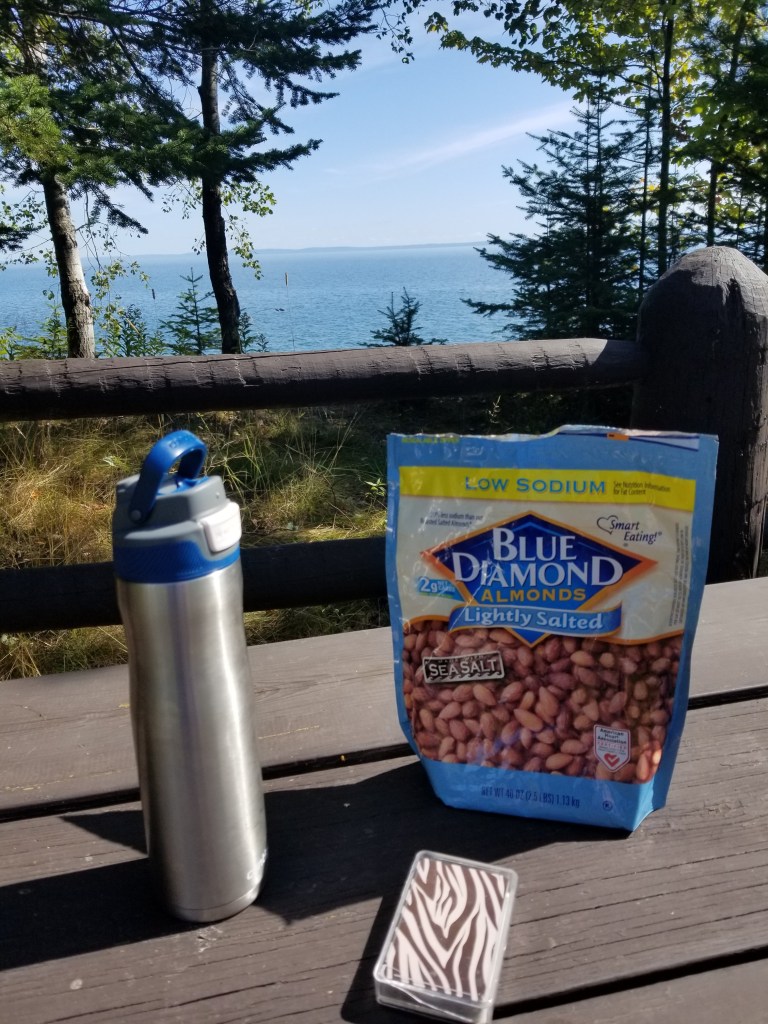
We made the rest of the way back to the car without much difficulty, yet passing a lot of gorgeous scenery — more rocks, flowers and downed trees. While we were getting close to the end of the trail — Tammy made a very astute observation. We had been walking along the edge of the water for about 1.5 miles and we saw zero sand that could pass for a beach — only rocks along the shoreline. Maybe we would not be able to walk back along the beach on our backup plan, maybe the beach would be 20 feet of sand followed by more rocks. Then from one of the points we were able to see what looked like miles and miles of sand beach – woo hoo, all hope was not lost!!! We were approaching the end of the trail and getting close to the car. Tammy suggested maybe we could just continue on to the next trail instead of stopping at the car. She is such a hiking stud that she didn’t even realize that we had already hiked over 5 miles! Mike was ready for a rest and to check on his right foot (which somehow has a predilection for blisters). Thankfully there were no blisters and the water and peanuts were a nice little break.
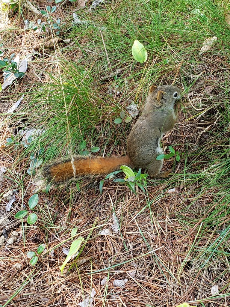
We then proceeded down the Beach Boardwalk trail. This was a much more rigid boardwalk than the cordwalk at Andrae-Kohler State Park. It extended along a small spit of land between the lagoon and Big Bay. There were lots of plants and views along the trail – including a red squirrel that scared the poop out of Tammy because it was completely oblivious to us. It just sat there digging in the pine straw trying to find food while Mike took pictures of it.
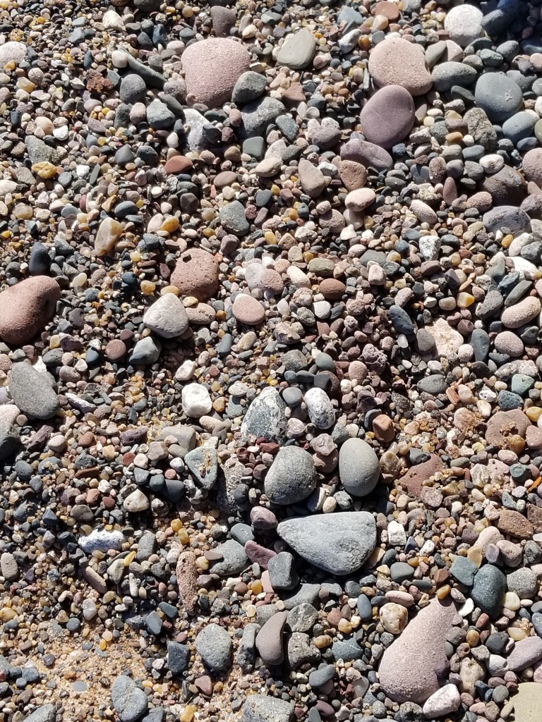
We made it all the way to the end of the state park on the trail — but the trail kept going into a town park, so…we kept walking. We made it another 1/2 mile or so to where we would cross over the inlet to the lagoon (and presumably to where the Lagoon Ridge trail would be.) We then walked out onto the beach. We thought we would talk the whole way back down along the beach. The water was very calm with almost no waves. We thought we would be able to walk right along the edge of the water where the sand should be more firm. It was very firm — but was also strewn with piles and piles of rocks. It was really kind of strange to see these piles of rocks. They would appears without any rhyme or reason (at least none apparent to us).
The further we got down the beach, the fewer piles of rocks were seen, but the once firm sand right by the edge of the water turned into very “smushy” sand. It became a lot of work trudge along through it. So, after walking about a mile down the beach on the sand, we finally decided to make our way back to the boardwalk to finish the hike on there.
We had talked about maybe trying to go to some other nature trails on the island, but to tell the truth — we were bushed. We ended up doing about 8.5 miles (“The Plan” was only for about 7 miles). We decided to just take it easy and go play some cribbage before getting ready for dinner. We headed back to the scenic overlook to grab a picnic table and play a game of cribbage.
We then went to get ready for dinner. Where we were planning to go was an hour away once we got off the ferry. We wanted to be on the 3PM ferry, but after changing we only had about 15 minutes to make it to the ferry. Mike pulled up in line for the ferry and there were a lot of cars on already and still about 5 or 6 cars in front of us. We didn’t think we would make it, but we got waved up and there was still room for 3 or 4 more cars even after we found a spot (although none were waiting). Again we were in line, on the ferry and on our way in about 5 minutes!! Timing is everything!!! Not only were we almost the last one on, but we were the third car off on the other side. We rocked the ferry (no, not literally)!
Off to #SupperClubSaturday! This weeks installment was taking us to Hyde’s on Buskey Bay. We didn’t have reservations this time because we didn’t know exactly what time we’d be arriving having to take the ferry and all. We knew it opened at 4PM and we were on schedule to get there around 4:15. We know, from previous experience, that when a supper club opens at 4, that doesn’t mean they begin serving dinner at 4. Sure enough, when we pulled up (and thankfully saw another couple heading inside in front of us) we noticed the sign that said bar opens at 4 and dinner served at 5. Tammy immediately was in love with the place. This is what she dreams of when she thinks of #SupperClubSaturday. A kitschy place, with small town feel. Janice the bartender was very friendly talking to the other two local people — they were going back and forth about local people, places and happenings. Janice talked a lot with us too — even though we were “outsiders”. She made us very strong drinks and gave us the run down on the specials. We got to overhear some stories about some of the staff members. We saw the salad bar — but unfortunately the salad bar had more “salads” than ” green salad” on it so we were not able to eat a lot of it, but it also included soup and we splurged a bit on a cup of clam chowder. The pasta salads looked good though. And there was even a dessert bar but we cannot tell you how anything tasted – just that it looked very nice. Mike’s prime rib was good — but not remarkable. “I’ve had a lot worse” was his comment. Tammy had the steak and jumbo scallops. The scallops definitely lived up to their size (big enough to share with Mike) and they were cooked perfectly. She was very impressed. While there were only 4 of us in the restaurant when we first got there, it got very busy, very fast! Our poor waitress was running around like crazy as she was the only one, but she kept a smile on her face the whole time. Luckily, another waitress started just as we were leaving.
We then began the trip home. Thankfully we had already driven over an hour from Bayfield, but we still had 2.5 hours to go. Whew — those get to be very tiring drives for Mike, but thankfully Tammy puts her music on and sings to keep Mike awake. We ran into some pretty heavy rain and saw a couple of rainbows on the way home. But no deer for the entire day. What? A great way to finish the day.
Lets get this party started... get out there on the floor... Take a chance and have a dance... you'll yell and scream for more.
It’s the “Saturday Morning Polka Show – Don Wayerski & Mark Maslowski” on Y106.5 out of Marshfield, WI. There is no better way to get geared up for hiking than listening to polka music!! We always try to tune in to this show, it is every Saturday, but sometimes we are just not close enough to Marshfield. We discovered, much the same way we found the Supper Club Directory on Travel Wisconsin –randomly searching the web — that there are a whole bunch of Wisconsin Polka radio shows listed on Wisconsin Polka Radio, but this is the one we like the best. We enjoy the local announcements, birthday and anniversary wishes and such. On our drive this day, we listened for about an hour until it started cutting out. However, Mike had the bright idea to look and see if it could be streamed online. Of course you can!!! If you’d like to listen along with us, click this link between 7 and 10AM on a Saturday and get ready to polka!!!
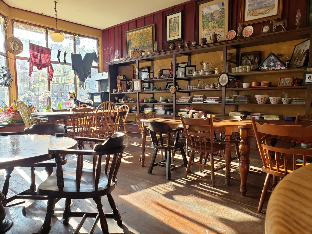
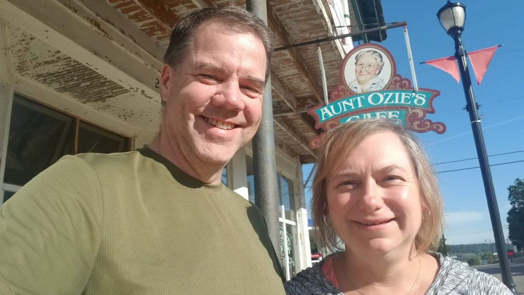
Our breakfast stop this morning was Aunt Ozie’s Cafe in Loganville, WI. What a cute little place!! Tammy must have said “Oh my God, I just love this place” about 100 times, all before we even ordered our food!! It was a little kitschy cafe that had such a eclectic set of decorations you didn’t know where to look. There were painted glass bowls from the ’70s, tea sets that could have been 200 years old, a huge safe (we think the building might have been a bank at some point in its history) an old tv from the 60’s and tons of the items were for sale too. The tables and chairs were all unique and mismatched and it just looked like someone’s living room from the “old days.” I am not sure who Aunt Ozie was, but I bet she was a fascinating lady!
When we walked in, it wasn’t too crowded except for a table with 12 people all deeply engrossed in conversation. They were obviously talking about people around town as you could hear a couple of times “he’s a really nice guy” (you just knew if you were in the Deep South we would have heard several “Bless his hearts” as well). It wasn’t the typical old guys’ klatsch around the table this time, there were 2 or 3 women as well (but it was mostly men). At one point in time another older guy in overalls walked in and the waitress called out “Good Morning Frank!” and everyone else chimed in their greetings as well. We said “the waitress” because she was the only one — yet she handled all the tables with ease and speed. By the time we left, every table was filled! Mike ordered the “Caliente” omelette (chicken, salsa, sour cream) while Tammy ordered the tomato, basil, artichoke hearts and feta omelette (at least I think that is the one she got, there were a ton of combinations of those types of ingredients — Tammy was in omelette heaven!) Mike had to practically drag Tammy out, but we did get the obligatory selfie out front.
We were then off to Yellowstone Lake State Park in Blanchardville, WI (20 miles from the Illinois border). “The Plan” had us hiking around 9 miles and maybe a couple of bonus miles if we had the time. We arrived at the park and when asked about the condition of the trails, the ranger told us that they had not been able to get out to mow the trails much during the summer because it had been too wet. We knew some of the trails were grass trails (our least favorite surface), but they must be pretty muddy if they couldn’t get out to mow — oh well, we’ll see (and tell).
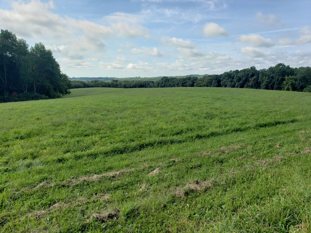
We started off to hike around three trails right by the park office. Mike promised Tammy there would be very little elevation gain at this state park (she’s learned to never listen to him on these types of promises) — the first steps onto the trail was going uphill. We started on the Oak Ridge trail — as we rounded the backside of the trail we came out into a field that had recently had hay cut on it to a beautiful view back down towards the lake.
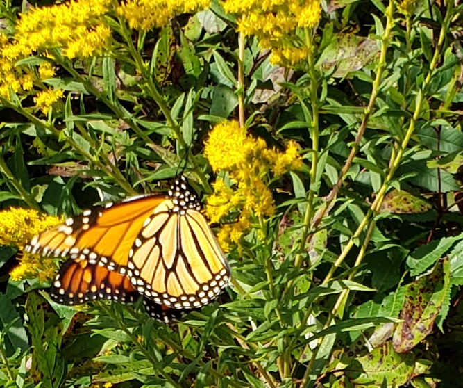
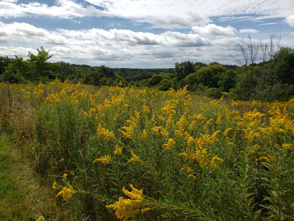
We were then off to the Prairie Loop trail where we came upon some flowers that were covered in Monarch butterflies. We tried to get a picture of more than one butterfly at a time, but could only manage one. This was an huge prarie filled with grasses and wild flowers of all kinds.
We then were off to the Wildlife trail that ran around a wetland area that was labeled on the map as a “waterfowl area”. This was a very interesting trail. It was more or less like a dike going around the corner of the lake. You were always walking a couple of feet above the waterline, but at times it was only 6 to 8 feet wide. We didn’t see any “wildlife” other a couple of frogs. Nonetheless it was a very unique perspective of a trail — essentially walking throught the middle of the lake (without getting wet!!). Interestingly enough, we did not see another person until we were almost back at the car — we made it 3.7 miles without any other hikers — YAY!!!
We headed off to the boat ramp to park for the next set of trails. “The Plan” gets interesting in some of these cases. The ultimate goal of “The Plan” is to cover as many trails as possible without covering trails more than once. This is not always easy as there are many times that there are single connector trails, loop trails with loop trails coming off of them, etc. But Mike does his best. On this hike, we were to start on the Oak Grove trail, then go onto the Windy Ridge Trail, then onto the Savannah trail, back onto the Windy Ridge trail and finally back onto the Oak Grove trail before getting back to the car — Uff Da!!! Immediately upon starting this hike we ran into a group of 3 dads and about 8 kids between the ages of 8 and 10 looking to go on the same trail as we were. Ugh!! Luckily, just like Wildcat Mountain, they made a wrong turn and we were able to jump ahead of them. We did direct them where to go (after we got in front of them). We had no worries that they would catch up to us. Turns out these trails were described as having some “steep hills”. Pshaw….the hills can’t be that steep. HAHA This is where Mike discovered and labeled the levels of discomfort for hill climbs for Tammy: they are (in order): “shit”, “fuck”, and the most difficult hills are “punch you in the nose” — luckily we only only made it to slightly above “shit” at this park. (We’ve made it to “punch you in the nose”, (Perrot and maybe even last week at Wildcat Mountain) but luckily she has only ever said it, not actually done it.)
The Savannah trail is what went almost to the “fuck” level. There was a very steep down and uphill section on this trail. We also saw some very pretty flowers along the way.
We made it back to the car without too much difficulty though and it was a pretty quick walk– we had hiked a little over 8 miles already and we were dragging a little, so we then took a water, almond and peanut break. We still had plenty of time before we were going to leave for dinner so we decided on the “longer” version of the end-of-the day planned hike. This took us back up the Oak Grove trail and then through the campground on the Timber trail and then down the Blue Ridge trail (which spans the park from end-to-end.) We were only going to be able to hike a small portion of the Blue Ridge trail, but wow — it was pretty.
This trail dumped us back to the main park road. We walked along that and through the parking lot of the pet area, beach and boat ramp to get back to where the car was parked. It was then shower time. This park had very nice showers — unisex so it is just a row of 6 showers with their own locking doors. Mike’s was awesome but apparently Tammy’s would only spray water for 4 seconds with every push of the button. It was a shower so, no big deal, just another little challenge to overcome. We still had a few minutes to spare after we got all cleaned up, so we found a nice little picnic table near the lake and played a game of cribbage.
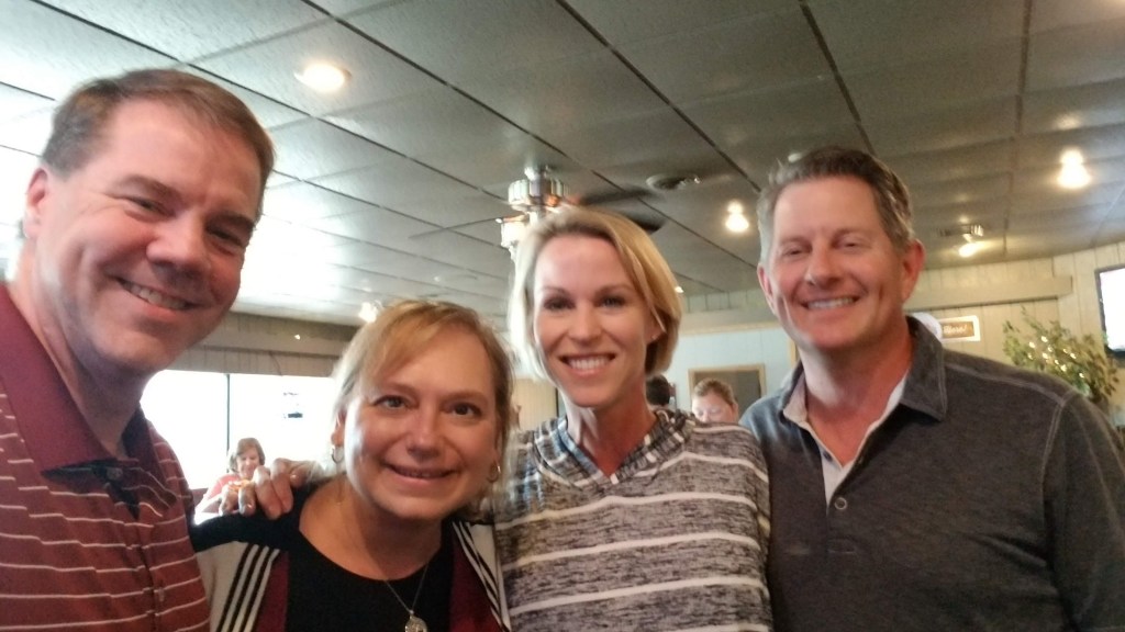
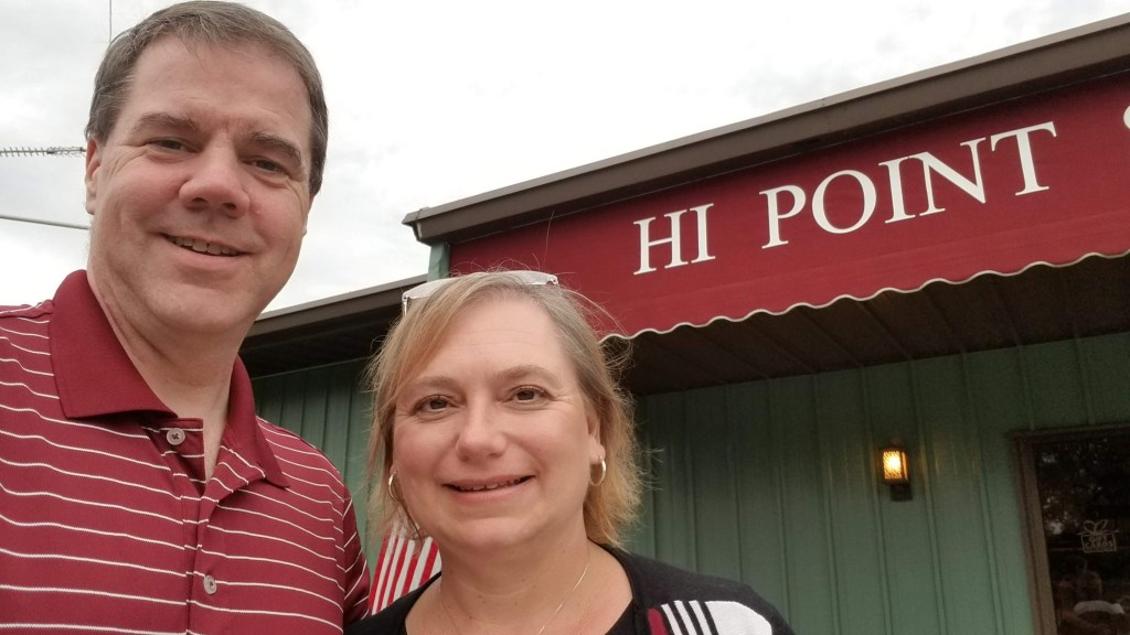
We were now off to dinner – and before dinner we were going to have drinks with a high school classmate and her husband who live in the area. We met Andrea (Crawford) Potterton and her husband, Keric at Hi Point Steakhouse in Ridgeway, WI. It was great to catch up — although half an hour before dinner was not enough time!! We will be getting together again on a future Splorin’ Saturday trip to southern Wisconsin.
Dinner was awesome again. We both had French Onion soup to start — OMG it was amazing, very flavorful, while not being too salty and the crouton didn’t even mess with Mike’s blood sugar too much. Mike had his usual Prime Rib and Tammy had a steak covered with blue cheese and mushrooms. As usual, she also brought half of it home for lunch the next day. The salad bar was stocked very well too!
We’ve mentioned before that we like to eavesdrop — you just never know what you’re going to overhear. One of the specials at the Hi Point Steakhouse was a Wagyu Strip Steak. While the waitress was telling the table behind us what the specials were, the gentleman asked “What is a Wagyu Strip Steak”? She began by explaining that is a very marbled steak and went on to explain that they massage the animals, etc. She kind of paused for a while and the man asked “but it IS a cow, right?”. Hilarious!!
Soon we were off on the 3.5 hour drive home — no polka music for that ride. It is kind of sad that we began and ended this day in darkness -summer really is officially over – but we are getting excited about the changing seasons and are looking into our options for snowshoeing this winter!!!!
Unfortunately (fortunately?) as we become more adept at hiking, we want more and more of a challenge. While last weekend’s Splorin’ was a marathon (literally — over 26 miles), it was not much of a challenge. Tammy thought we needed a more difficult hike this weekend — as you know dear readers, she just LOVES those hills! But we are getting to the end of state parks that will give us a challenge as far as elevation gain and distance. Luckily, this week we were able to visit Wildcat Mountain State Park. The only problem with Wildcat Mountain State Park is that it is right on the same route that we took to get to Wyalusing. We try to not go the same way as we have in the past for variety sake and so that we can see more of this great state, but this time we threw in the towel. We headed down highway 27 to see where it would lead us.
We stopped for breakfast in Westby, WI at Borgen’s Cafe. We pulled up front and saw a lot of motorcycles parked…everywhere! We parked (amidst all the motorcycles) and made our way into the cafe. It was packed — there were only a couple of tables open. The waitresses seemed especially harried trying to take care of everyone. It took a while for one to finally stop by our table. While we were waiting, Tammy noticed someone wearing a t-shirt that mentioned Wildcat Motorcycle Rally. Great…we somehow managed to get ourselves into the middle of some big motorcycle rally. Mike was worried we would end up seeing, and hearing, motorcycles everywhere — luckily, as usual, Mike was wrong on his worrying. Breakfast was awesome as usual — Veggie Omelette and fruit (no salad this time) for Tammy and Turkey, Bacon and Swiss omelette with a bacon side salad for Mike. This was one of the rare times we could NOT get a “real” side salad with our omelettes. Once again it was people watching that was the excitement of this Splorin’ breakfast. Lots of biker-types that seemed kind of out of place in the restaurant, but at the same time, they could have been stopping at this restaurant for years during this rally. As we were getting close to leaving, a table started filling up with ladies next to us (instead of the typical guy coffee klatsch, this one was little (old) ladies!) They ended up with 6 or 7 at a four person table. Again, obviously they were regulars (more than likely every week, not yearly like the motorcycle rallyers). Tammy enjoyed the little gnomes holding the salt and pepper shakers. Each table had a different one.
Off to the state park. Since we were about 30 minutes away from the park, Mike opted for the “long” route that would take us 40 minutes to get there — a GREAT choice. If you have never driven east from Westby towards Highway 131 on County Highway P — you are missing one of the most beautiful drives in Wisconsin. It is a super twisty route, and you pass many Amish farms, travel from high bluffs overlooking absolutely stunning valleys, and descend down into those valleys. You can only imagine how difficult those roads would be to drive in winter. Once on Highway 131 you pass over the Kickapoo River about 267 times on the way to the state park. Arriving at the state park you have to go up several very big hills and around some very narrow corners just to get to the park office. We picked up a map and the since Mike had already figured out “The Plan” for the day, when the park ranger lady asked us if we wanted any information, we said “Nope, we’re good!” <insert ominous foreshadowing music here>.
This park was going to have a lot of elevation changes — we didn’t exactly know how many, but we headed for the lower picnic area and the Hemlock trail, which we thought would have about a 300 foot elevation change. This was a loop trail — so we were going to follow “Mike’s rule” and go to the left and follow the loop in a clockwise fashion. We took off from the car looking forward to the climb ahead!! We immediately began to climb and we came to a pole in the trail with arrow on it that pointed up at a 45 degree angle. Going up the hill, we could see a trail that required some difficult climbing. It was not the typical trail (well traveled, steps, etc.), but it was obviously climbed by quite a few people. Mike went first and made it to the top, almost crawling on all fours at some points. Once at the top, the trail…..was nowhere to be seen. Mike quickly decided that we were not supposed to crawl all the way to the top. Tammy was halfway up, so Mike told her to wait and he was going to try to find where the trail was. Searching a around a little he saw steps about 50 yards away across a little valley.
He crossed over to that and was pleased to find that this was, indeed, the trail. What the heck? Oh well, Tammy then began to climb her way over. A little while earlier, Tammy had noticed what she thought was a bench. Upon further inspection, it was not a bench but a sawhorse. Now that Mike was closer, he noticed that the sawhorse had yellow caution tape all over it. While Tammy made her way, Mike decided to look at the sawhorse and caution tape — where he found signs that said “THIS SECTION OF THE TRAIL IS CLOSED”. Oh boy. We somehow went around the trail closure and got back onto the trail past where the signs were that told us not to go that way. Working our way back, we found there were a couple of trees that had fallen which hid the trail that would have taken us to the “trail closed” signs. When we made it back to the arrow that pointed us up the hill, Mike noticed there was a trail going back the other way. It turns out the arrow pointing up the hill, really meant to turn you around and follow the trail that was behind you (although it didn’t do this very well) <more ominous foreshadowing music>.
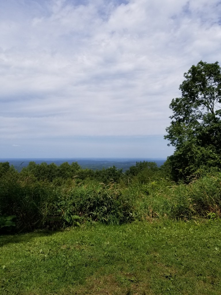
Now that we were on the right trail — we began our journey to the top of the bluff. Before we started the uphill section of the trail, we traveled for quite a ways just above the Kickapoo River — and it was quite the sight. We climbed over several freshly fallen trees (that must why the other section of the trail was closed) and across a couple spring fed streams working their way down the hillside. The trail then took a turn uphill. We began climbing, and climbing. There were quite a few switchbacks – but the climb was long and steady. Not much of a chance for break while walking. But we had to take a break — turns out we were almost to the top of the hill where we stopped — oh well, it means we arrived at the top fresh. At the top of the hill there were supposed to be two overlooks. We made our way to the first one only to find that it would have been a lovely overlook had the trees not grown up over the last 50 to 100 years. The only thing you could see from the overlook was: trees. We were worried the other overlook would be the same, but we were mistaken — it had a gorgeous view of the valley and rolling hills below.
As Tammy predicted right off that overlook there was CAUTION tape all over the trail indicating it was closed going down the other side of the overlook (where we tried to come up earlier). We had to go back down the way we came up — amazing how much easier it was to go downhill than it was going uphill. We debated if we should stop and tell the park ranger lady that she really should tell people about the closed section of the trail, and probably more importantly the seemingly incorrect arrow sign. When we made it back to that portion of the trail, we saw a family of five ( mom and dad, and very small kids (4, 8 and 10 years oldish) trying to scale the hill like we had done an hour earlier. We quickly told them they were going the wrong way and we made the exact same mistake. Tammy, being the awesome mom that she is, helped the little kids make it back down the hill without falling. The dad mentioned that they saw other people going up that hill too. Oh well, we showed them the way to go and we continued on back to the car; it was now decided that we would HAVE to stop and let the park ranger lady know about the problems with this trail. We were concerned for the safety of others — thinking that trail went to the top of the hill and then having to come back down.
We had to drive right past the park office to get to our next trail so we figured we would stop in right away. When we got into the office there was a line of 3 or 4 people waiting to check into the campgrounds, so we had to wait to talk to the ranger. While we waiting patiently in line (that’s a lie, Mike was not that patient) Mike walked around the office looking at the pamphlets, maps, etc. He found one pamphlet that sounded interesting: Sharing the Trail with Horses. We knew there were horse trails here, but we’ve been to several state parks that have horse trails and haven’t seen a single horse yet. For some reason, Mike pulled the pamphlet out and read about what to do if we encounter a horse on a trail — interesting because we had no idea there was actually a protocol for meeting a horse on a trail. It said: if you encounter a horse don’t stop, but keep walking and make verbal contact with the rider. Apparently stopping and moving off the trail is seen as predatory behavior and can spook horses. Talking to the rider let’s the horse know you are there and that their rider also knows you’re there. It was very good information (even though we knew we would never need to use it). We finally got our turn to talk to the ranger about the trail — either she didn’t really understand what we were trying to tell her (that they need better signs/markings on the trail to let people know a portion of it is closed) or she had no idea what we were talking about because she was unfamiliar with the trail, but she didn’t seem to interested in doing anything about it. She probably just thought we were whiners. That’s OK, we did the right thing – hopefully she did something. Off to our next hike.
Our next hike was to be on the Old Settler’s trail, but before that we were going to stop at Observation Point just off the upper picnic area parking lot. We already knew what we would see — a grown-over scenic overlook that if you squinted through the trees you could see….something. Boy, were we wrong!!! This was an unbelievably gorgeous view of the entire Kickapoo River valley.
This overlook was perched on top of a cliff — and thus why there were no trees to block our view. We took a couple pictures, did the National Lampoon Vacation head-nod, and began our next hike. We had to walk down the bluff to get to where the Old Settler’s trail started. This trail description said it had a 390 foot elevation change — but we had no idea if that was all at once, only once, or multiple times, so, we just took off. At the beginning of the trail there was an informational sign that said the trail was 2.5 miles long and would take 1.5 to 2 hours to hike it. GAME ON!!!! The trail almost immediately started going downhill, and downhill, and downhill… There was some very pretty rock formations along the way.
Mike’s watch said we dropped 350 feet in less than half a mile — Tammy began to worry about the climb back up almost immediately. Mike knew that halfway through the trail there was a scenic overlook, so we had to climb fairly high well before the end of the trail. What Mike didn’t know was if we stayed up high for the remainder of the trail or went all the way back down and then back up. Right at the very bottom on the this trail we came to a striking bridge over a small stream. Mike snapped a quick pic of it that we keep going back to look at.
Right before the overlook we came upon a group of 5 or 6 people hiking the same direction as we were. This was not really a trail that was conducive to passing. It had a lot of ups and downs and some very narrow sections. So, as we got closer and closer to them we saw that the overlook was just ahead of us. We hoped they would stop at the over look and we could go right past them. Thankfully they did — but they did not stay at the overlook long, and started down the trail shortly behind us. We came upon the backside of the overlook into an area that had some really cool looking limestone cliffs. They looked like they were carved by water, but we were hundreds of feet about the river level, hmmm. We couldn’t stop long for the pictures as we wanted to get ahead of the people behind us.
We began to descend again. Pretty soon we came upon the unmistakable smell of cigarette smoke. A couple minutes later we saw 4 young guys hiking down the trail ahead of us. Once again we knew we would catch up to them — we only hoped we could pass them once we got to them. Luckily, they were not paying close attention to the trail and made a wrong turn and we made the correct turn and we were able to slingshot by them. Awesome! Well, Tammy didn’t think it was so awesome because she was worried that we would have to stop on the way back up the last hill and they would pass us and laugh at us. They got closer and fell back a couple of times along the trail — but no matter where they were, we knew they were there — they were loud!!
We finally got to the final climb back out of the trail valley. Tammy had already said she would have to stop somewhere along the hill, but she would make it as far as she could (Mike doesn’t understand because there have been quite a few big hills that she’s made it up without stopping, but he just listens to her and says “yes, dear” …). We were worried about those darn, young kids and their clear, young lungs, hearts and arteries that are wide open and capable catching up and passing us. So, we just kept going at a slow but steady pace — and like the turtle, we won!! We made it all the way to the top without stopping!!! Mike was so proud of Tammy — not because she made physically it (because Mike knew she could do it), but because she mentally made it. She didn’t psych herself out thinking that she had to stop. She now knows she can do it and nothing can stop her!! The news got even better — those young guns were nowhere in sight. Not only did we stay ahead of them, we extended our lead and got further and further ahead of them!!! We then passed the sign at the top of the trail and it was the best news. Where the sign said the trail would take 1.5 to 2 hours — we did it in 58 minutes!!! Success! But, we were tired. We had to sit and drink plenty of water and eat some almonds and take a nice break before our next trail.
The “back side” of Wildcat Mountain State Park is a series of loop trails that are classified as horse trails. They are around 3 miles long each. “The Plan” had us doing two of these loops (the green and purple). The only problem was that we couldn’t just do one and then decide to not do the other because of the way they were laid out. We had to do both of them or only one and we would have to decide right away before we even started on the second trail. We had 3.5 hours before we had to leave for dinner and if we did what “The Plan” said we would be hiking about 6 miles. We can do 2 miles per hour easy (we hoped), but since we didn’t really know what the trails held, we were crossing our fingers. We started from the parking lot and Mike thought he knew where he was going. All of the other horse trails we hiked along were big, wide, grass covered trails So that is what we were looking for. We found the orienteering course where the map showed this trail starting, so we searched for the trail on the course. After a couple of wrong turns (and turning around) we found the trail and began the hike down it. We would encounter 4 overlooks on this trail — the first one very quickly. As we walked down the wide trail, we noticed several very large (and fresh) pile of horse$&@*. Maybe we will actually get to see a horse today!! As we made our way out onto the first point to the overlook we saw four horses ahead!!! Woo hoo!!! That was something new for us! As we got closer Mike hollered out a greeting and we had a short chat with the riders as they rode past us. Boy, we had forgotten just how big horses are!! We then hiked on to the overlook only to realize it had a beautiful view of the trees 15 feet in front of you. At this point, we wondered if we were confused by the definition of “overlook.”
We kept going down the nice wide trail and up the other direction came a couple more horses! 6 horses and were were barely half a mile into this 6 mile hike. We then came to the group camp area where we had to cross a dirt road a couple of times to stay on the green trail. Upon crossing the road for the second time, the trail went from being the typical wide, grass covered trail that we thought must be required for a horse trail, to a small foot- (maybe two) wide trail heading down a fairly steep side hill. No way could this be a horse trail…but there were horseshoe prints everywhere. Wow, it would take a lot of trust in your horse to ride along this trail. We came upon several downhill sections that had large limestone rocks strewn everywhere. We thought this would be very difficult for horses to climb (or descend), but there were prints everywhere — and scuff marks on almost all of the rocks from horseshoes. It was on this trail that we really questioned what we would do if we met horses along it — there really wasn’t anywhere to step off the trail without climbing up or down the side of the hill. Luckily we didn’t run into any — but we did finally run into the purple trail and a long, slow, steady climb several hundred feet back up to the top of the bluff. Tammy was not pleased, but we made it to the top and to yet another “non” scenic overlook – just more trees. We decided that maybe in the winter when all the leaves were off the trees it might be pretty, but that would required hiking along these in snowshoes to get out here. No thank you! We saw many more horses along the trail — wow, what beautiful animals!! We were quickly approaching our third overlook and we seriously discussed not walking out the point of the bluff to see if it was yet another non overlook. We decided to check in out, just in case, and it was a disappointment. Luckily we do this for the hiking and not just going for the scenic overlooks. We had one more overlook — as we walked down the trail we came to a spot where there was a break in the trees that you could see through for a long way! Here we were in the middle of the trail with a much more scenic overlook that any of the designated scenic overlooks. Go figure. (BTW — the fourth scenic overlook was a bust too.)
Before we left that last overlook we ran into 5 horses. They were resting as we passed them. We knew that must mean that we would be going downhill again — and boy did we. This hill had been covered in gravel with “steps” built into it. We cannot imagine how the horses do on these hills. Do they go right up them with no problems at all, or do they need to take occasional breaks in the middle like we do? We made it to the bottom and traversed along a little stream before we started climbing back up yet again. We were back on very narrow trails and thankfully had not met any horses — yet. A short way up the trail where it was very narrow with vegetation on each side — we saw more horses coming. The front rider called out a “Hello” to us and we responded back in kind and had a nice little conversation with them as they approached. We told them we’d step off to the side of the trail as there was no way we could keep walking as we passed them — there just wasn’t room. The lead rider said how nice it was for us to talk back to them, and so many times people are afraid of the horses and just go quiet, which spooks the horses to see people but not hear them. I mentioned that I had read the pamphlet in the park office and they were impressed that the park was “advertising” how to interact with horses on the trails.
Shortly up the trail we came to an opening that turned into a big prairie like area surrounded by woods. It was beautiful with flowers, bushes, and very tall grasses swaying in the wind. We knew we were getting close to the end of the trail, and we were both beat for the day. Tammy was disheartened to look in front of us and see a big hill we would have to climb. Mike saw off to the side that we would not have to climb that hill, but rather keep going down even further before we start to climb. He briefly foreshadowed that with her, but didn’t dwell on it. We came to a section of the trail that was a complete mud pit with standing water and everything — much like what we encountered so many times earlier in the year. We made our way through it like the pros we are!! We encountered one more group of four horses as we were finishing our final ascent back to the car. Our total horse count for the day was 29. Amazing!!! We made it back to the car and headed off to the showers. Even though this was one of the cooler days for Splorin’, a shower was very welcome.
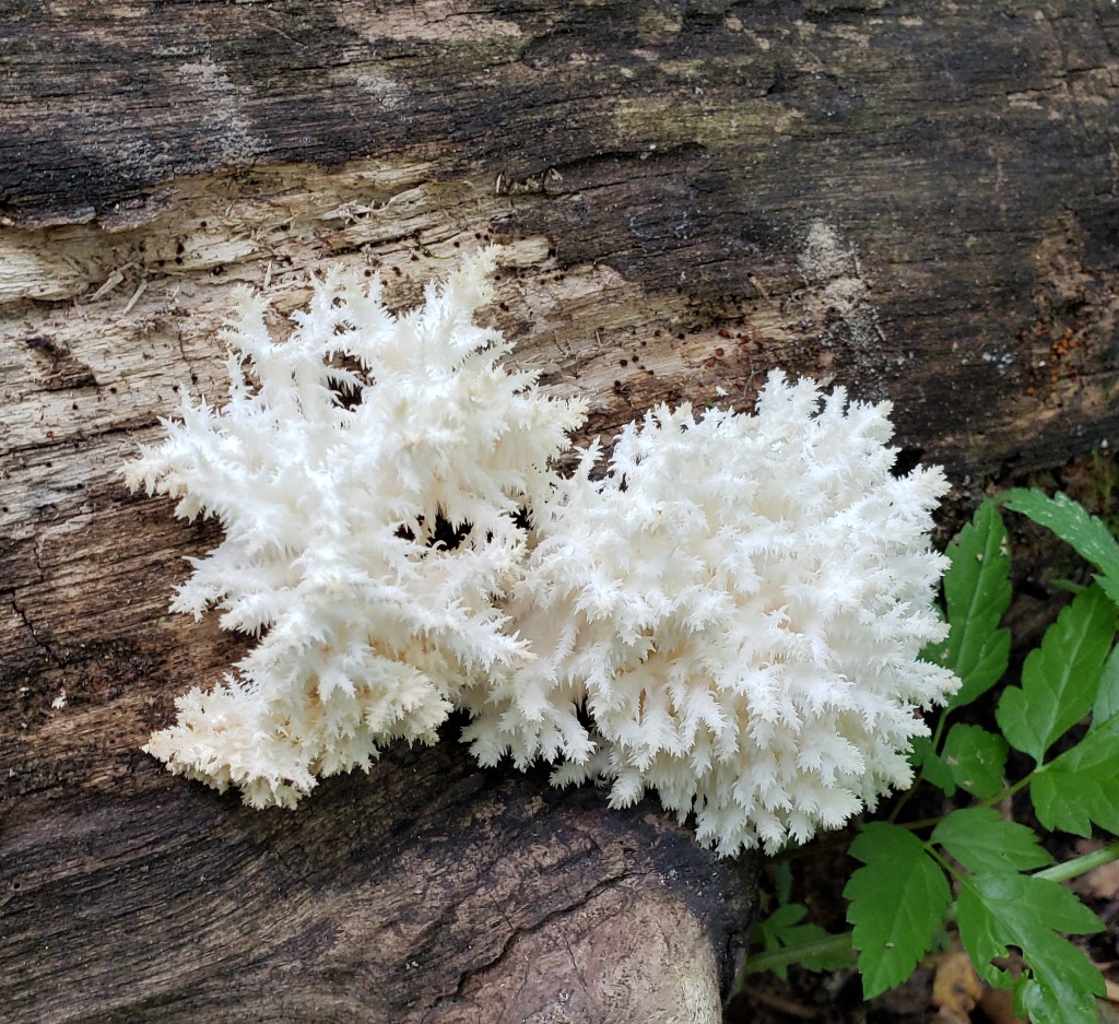
Though we definitely try to keep up a pretty good pace when we are hiking (ideally under 20 minute miles) we do stop to snap some pictures of flowers, funky looking mushrooms etc when we can. We are always amazed at the variety of plants we see in one park.
Off to dinner. When we dreamed up this idea of “Splorin’ Saturday” back at the Buck-a-neer Supper Club in Stratford, WI, we mentioned to our waitress about #SupperClubSaturday (because that was all it was at that point) — she mentioned a supper club she had just been to for a family reunion — Club Oasis Supper Club in Sparta, WI. This is your typical old fashioned supper club. We had a very nice meal and Tammy shed a few tears. The music reminded her of her mom, (so many songs from the tape in Jude’s van) Sparta was where Art and Loretta (Tammy’s grandparents) were traveling when they got into a car accident that landed them in the hospital, and Auntie Vera lived in Sparta her whole life –Tammy wondered how many times she and Uncle Romie had eaten there. We had an order of the chicken wings and the salad bar — both were good. Mike had the (surprise, surprise) prime rib while Tammy had the Pesto-Encrusted Salmon. Tammy went on and on about her Salmon, so it must have been good. (and she was excited to bring home half of it for lunch the next day) Mike’s prime rib was OK, but it did have a lot of fat on it. It was a very long day, so we were decided to take the “fast” way home this time. Besides, as it gets closer to fall, it is getting darker when we start the drive home and there is not so much to see. Wildcat Mountain was a success!!!
With Carrie all moved in and our awesome dinner (and wine) at Cooper’s Hawk behind us, we were ready to rock ‘n roll this anniversary weekend edition of Splorin’ Saturday. Three days of Splorin’ — it doesn’t get any better than that!!! Friday, we slept in a little and didn’t leave the hotel until around 8:15AM (that’s very late for a Splorin’ day). We were headed for Judi’s Place in Oostburg, WI. Since we left a little late we took the freeway to get there — we were surprised to see Judi’s Place listed on a blue information sign along the road – it must be good. It was pretty darn big and busy — and as typical there was a group of gentlemen sitting at the cafeteria-style counter. Unfortunately we were seated nowhere near them to be able to overhear what they were talking about. We were intrigued because this restaurant had all sorts of interesting omelettes and things. Mike opted for the “Steaky steaky” omelette which had sirloin steak, fried onions and mushrooms, while Tammy was VERY EXCITED to see a sauerkraut and kielbasa omelette! Mike’s omelette sure showed promise but it actually was pretty lacking. The steak tasted like….well…nothing. The onions were just diced up onions and the mushrooms seemed like canned mushrooms. There was so little flavor that Mike actually had to break down and ask for A1 steak sauce (admitting defeat on taste) in order to enjoy the omelette. Tammy loved her Polish omelette though and couldn’t wait to try it at home. (during the week when Mike is in Bloomington of course!)
After breakfast we were off for a short drive to Kohler-Andrae State Park. We broke one of Tammy’s Splorin’ rules — that we need about an hour between breakfast and the state park where we’re hiking in order to allow our yummy (or in Mike’s case today, not yummy) breakfast to settle — the state park was only 20 minutes away.
Luckily the first hike we were to take today was on the “Black River” trails which were some pretty easy trails, so no indigestion was had. The trails where across fields, through a pine plantation, and through some mature hardwood forest. All the trails were wide and grassy — nothing too difficult at all. Unfortunately nothing too exciting either.
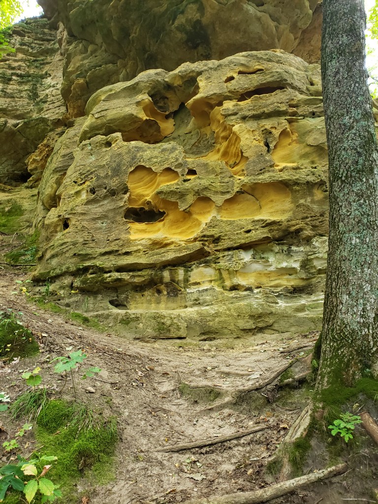
We were now going to tackle the “Kohler Dunes Cordwalk”. We didn’t know what to expect with this trail — we had never heard of “cordwalk”, but since this was across sand dunes we figured it was some type of board walk. The interesting thing to us was that the trail was described as a “moderate to difficult hiking challenge”. Turns out we agreed with that rating — there were a lot of hills in the dunes to climb up and down and at many times the “cordwalk” was extremely tilted off to one side or another. Without good mobility and balance it would be difficult trail. The main problem with this trail is that it is not a loop trail — it runs basically the length of the park parallel to the shoreline of Lake Michigan. Luckily there was a parking lot in the middle of the trail.
So, we walked up the cord walk to one end, then back to the parking lot along the beach, then to the other end of the park on the cordwalk and back to the parking lot on the beach again. The cordwalk was really cool — it led you through the dunes and around large depressions. It was a very cool walk!! Heading along the beach back it was fun to try to outrun the waves (they were very large that day!!) and keep our feet dry. Mike won that challenge, Tammy not so much. Well, Tammy didn’t really try –when it comes to waves and the beach, Tammy will always be a little kid at heart playing in the water. Upon starting the southern end of the cordwalk we began on the Creeping Juniper Nature Trail. About 1/4 of a mile down the trail we passed a big pine tree and suddenly came across about 8 or 10 birds on the ground. They were pretty small in size — about the size of small chickens. As we took pictures and tried to figure out what these were we heard a lot of noise in a little stand of juniper bushes and out pops the momma wild turkey. She was less than impressed with us, but she just gathered all the babies and led them along the trail. We didn’t want to disturb them any longer, so we kept walking down the trail.
We quickly came upon a family of 5 and told them about the turkeys and hopefully they would be able to see them. Once we reached the end of the trail we had to head back along the beach. This was much more difficult than the other beach segment. Mike walked most of the way along the side of the dune, while Tammy (who already had wet feet) stayed down near the water.
Next up was the Woodland Dunes Nature Trail, the Marsh Trail and the Black River Marsh Boardwalk (yes, boardwalk, not cordwalk). The nature trail was through a mature forest. Tammy spotted a deer ahead on the trail that was munching on some twigs. She seemed quite unimpressed with us and just moved off the trail a little bit as we approached. As we got closer we saw her fawn off on the other side of the trail. We just kept walking slowly and she moved a little ways off the trail — never stopping eating, but also never taking an eye off of us.
We left her and her fawn to their browsing while we kept heading down the trail. Much to Mike’s dismay Tammy, spotted another deer. Grrrr. Maybe Mike needs glasses. (or cataract surgery) We made it through the campground and it was pretty different than the campgrounds we usually see at Wisconsin State Parks. Usually the campgrounds are packed to the gills with people — these were pretty sparsely populated. Turns out it was because it was earlier in the day on Friday — many were yet to arrive for the weekend. We also saw something we never thought we would see in a campground — there were camping spaces right along the road — people would just park their camper on the side of the road and unload. Literally people sitting in camp chairs on the side of the road. That’s camping? The marsh board walk was neat — it took us out into the middle of the marsh, lots of pretty flowers and cattails to see.
We ran into the family that we mentioned the turkeys too — and yay! — they were able to see them (although they did say momma shuffled the babies off pretty quickly).
We had one last trail to tackle — the “Ancient Shores” trail. This was supposed to be a 1.3 mile trail that followed geography of the where the former shoreline of Lake Michigan was. It was a very unimpressive trail. But hey, a hike is a hike. The biggest thing about this trail was that it was listed at 1.3 miles but we hiked the entire trail, and even back tracked over a little bit of it, and only measured 0.9 miles. Oh well, a bad trail is still better than a good day at work. We made our way back to the almost empty campground and took a much needed shower.
A good friend of Tammy’s suggest Schwarz’s Supper Club in New Holstein, WI. We just have to preface this supper club with a HOLY COW! This is what we have been looking for in a supper club!!!
From reviews and Tammy’s friend, we knew this was yet another “order in the bar, eat in the dining room” supper club”. We got there about 4PM and planned on having a drink or two and then dinner. We walked in and were able to find a seat at the bar without a problem. After ordering our drinks were were trying to figure out how the restaurant worked. There was another couple sitting near us that ordered appetizers to eat at the bar, but were not eating dinner. Mike was finally able to get the attention of the bar tender and ask how dinner worked. They give you menus and then when you are ready to order, you stand your menu up in front of you. A waitress comes over and takes your order — you can even decide if you want to have your appetizer in the bar or at your table and 15 to 20 minutes later you hear an announcement “Mike, your table is ready”. You then go to the hostess stand and she tells you your table number — and just like Toby’s — your salad is there waiting for you!
Both of us ordered combination dinners. Mike got the “petite” prime rib and “petite” cod fillet (“petite” is in quotes because neither were small). Tammy ordered the scallops and the tenderloin. Mike’s prime rib was fabulous!!! Definitely one of the better ones that he has had. The baked cod? Not so much. But the service was amazing, and they had a great relish tray too!!!
We didn’t get to eavesdrop much, but a very elderly couple came and sat at the table next to us and they were both wearing very loose fitting, very white, pants. This was the end of summer and it appeared as if they were making a fashion statement — SUMMER IS NOT OVER YET!!! Once again, we brought the average age down by about 20 years. On the way to the hotel in Green Bay for the night, we decided it was a good thing that this supper club was so far way because if it were closer — we would go here EVERY SINGLE NIGHT!!!!! We got back to the hotel relatively early and decided to have a nightcap at the iconic Packer bar, the Stadium View.
August 24th
Happy Anniversary!!! 28 years!! I think it is safe to say Splorin’ Saturday was not something we thought we’d be doing 28 years ago. We wish we had a blog back then so we could see exactly what we were thinking about our lives ahead, but all we can say now looking back is what a ride it has been. If we keeled over dead tomorrow, wow, what a life!!! (that isn’t meant to sound fatalistic, just the truth) We wouldn’t change a thing!!! This certainly wasn’t in “The Plan”, but Mike hasn’t always been right. 😉
Speaking of “The Plan”, “The Plan” Mike had laid out 3 wks prior to this day had our Splorin’ going to a restaurant that would not be open by the time we got there. Sorry Rusty Tractor, but you have to open earlier than 8AM to catch these two Splorin’ kids. A quick replan on Friday evening found us going to Scaturo’s Bakery and Cafe in Sturgeon Bay, WI. They opened at 5AM — a much more convenient time for us (although we did not arrive until 7:03AM). There were a lot of cars in the parking lot and a group of 8 people standing outside the door when we arrived. Oh boy, really? Were we going to have to wait for the first time ever for breakfast? Whew! Nope, the group of 8 looked to be a “running club”. We quickly ducked into the restaurant and were told to grab a seat anywhere we liked. We were excited to see yet another “coffee klatch” of elderly gentleman in the room next door to us but there were no other tables in that room. We were happy they were there, but sad that we were not close enough to overhear their conversation. Mike had the “Sconnie 2.0” omelette (basically just ham and cheese) and Tammy went back to the standard Veggie Omelette and side salad. Mike skipped the lettuce salad and had a “bacon salad” (aka a side order of bacon). Food, coffee (and company) were awesome!! Will stop again if here this early in the morning for another ‘splorin’ excursion. (still a few more state parks in Door county to tackle.) We had to pay for our meal in the Bakery portion of the restaurant where we learned our waiter was the “waiter of the month” (and also shared the same last name as the restaurant — was he a son, cousin, brother?) and also that, even though bakery goods still look delicious, they are not as tempting as they used to be.
After breakfast we were off to Newport State Park. This state park is on the very tip of Door County. You can’t go much further without driving into Green Bay or Lake Michigan. This is a different kind of state park than what we have been visiting lately. Most of the parks we Splor’ have beaches, boat launches, large camping areas, etc. This state park basically has hiking trails. There are a couple of very small sand beaches on Lake Michigan, and it only has 16 camp sites. All 16 of these campsites are “backpack” camp sites — meaning that you have to hike all of your gear in (some of the sites you have a 2 mile hike from where you can park your car). With hiking being our primary purpose for visiting the state parks, we were excited that this one was so focused the same thing.
“The Plan” was not fully formed before arriving at the park. Mike had a couple routes picked out, but until we got there we didn’t really know where we were going. It turns out that the south side of the park has a couple of loop trails — which are always the best for us, but in this case the two loops shared a common central portion — so if we did both we would travel that middle portion twice — BORING!!! So, Mike came up with the idea of just doing the outside of the two loops into one big single loop.
Pulling in there were no cars….anywhere! The only cars we saw were ones that were parked in the backpack campsite parking. Awesome…the whole park to ourselves!!! We parked and layered ourselves in our bug spray and took off. A portion of this park is a pennisula out into Lake Michigan — the first “combined loop” of our day traversed the outside of this pennisula. We headed down the trail and immediately took a wrong turn. Sometimes the maps that you get for the park are not detailed enough to really see where you need to go. We knew we wanted to be hiking on the trail near the water, but we ended up at the beach almost immediately. Backtracking a little we were able to find the trail where we needed to be. A little way down the Newport Loop, we found the trail that branched off along the shoreline. This was a very cool trail. It twisted and turned along the shoreline — from which you were able to see the amazingly clear Lake Michigan water on one side and short limestone cliffs on the other.
It was here that we came across the first two backpack campsites. On the reviews we read that some people said you could bring a wagon to pull stuff to your campsite — but that wagon would have to have anti-gravity properties to be able to get to these sites!! We couldn’t see the campsites from the trail, but it was obvious they were very secluded. If you want to “get away” while camping — this state park is for you!!!
Mike read on one review that someone hiked 3 miles without seeing another person…well, we only made it 2.5 miles before we saw 2 people out searching for firewood from their campsite. A dad and his son trying to find just the right wood. We said a quick greeting and were on our way. Coming around the far side of the pennisula now on the Rowley’s Bay trail, we were coming to the last of the campsites for this portion of the trail. We heard people LONG before we saw them. It was obvious these people were much more interested in partying than real camping — or at least partying and camping. Mike still wonders how they got a keg that far out into the woods (no, we didn’t see a keg, but it seemed like it might have been a possibility –Mike seems to be particularly worried about keggers at state parks LOL). We ran into them on the trail — 4 early twenty-somethings with a hatchet looking for firewood of their own. We still did not know what we were doing for our next hike. Mike knew this portion of the hike would be about 6 miles. We talked about driving up to the far end of the park and doing the loops trails there, and Mike came up with the idea of doing the full loop of those sections. The map said that loop trail was 7 miles. That would be a trail that was longer than what we originally started Splorin’ Saturdays with — GAME ON!!! It was pretty clear by this point that there was not going to be much for hills this day so we decided to go for distance. We made it back to the car having done 5.28 miles (Mike was off by a little 😉 ). Seeing 6 people on the whole first hike was AWESOME!!! This was our kind of park — we like hiking alone!!! Back at the parking lot we were suprised to see 4 or 5 cars there since it had be so quiet (we had bet how many there might be – Tammy won). Those people must have been behind us on the trail because we never saw anyone other than those remote campsite campers.
We drove the whole 1/4 mile to the next parking lot — only to find a TON of cars. UGH!!! People everywhere. This was the primary beach for the park. We saw lots of people picnicking. We got ready for our next hike along the European Bay loop trail. 7 miles here we come!! The first part of this trail was an accessible trail (easy traveled by someone in a wheelchair, walker, or cane). When we got to the point where we took off to the north, we ran into a group of people trying to get back to the parking lot. Mike pointed out they were coming off the Lynd Point trail which went right out along the shoreline. We decided that we would take that trail on the way back if we were not completely dead by that point in time. This trail is what Mike likes to call a “multiple lollipop” trail. Which basically means it is a single trail that has several loops in the middle of it. As we come to each loop (or lollipop) we pick one way to go around that loop in this direction and then take the other side in the opposite direction. This now takes you, dear readers, to Mike’s theory of loop trail traversal for encountering the fewest people. One thing we disklike about meeting people while hiking is having to pass people, or have people pass us. So meeting people on the trail should be limited to people traveling in the opposite direction of us as much as possible. Mike’s theory is that most people when faced with a choice of going right or left, will choose the direction of their dominant hand. Since most people are right-handed they will choose to go right. So — he makes us always go to the left. We have no idea if this works or not, but it seems to make sense (at least to him). So, the first loop we hit we headed off to the left, and never saw anyone (coincidence? hmmmm).
One thing we like is seeing wildlife on the trails. Deer, turkies, snakes, frogs, etc. One thing we saw a lot of this day were snakes. We have learned exactly what a snake sounds like and how to spot them. We saw 9 snakes in this state park (all of them garter snakes). However, had we seen all we heard it would have easy been double that amount. We tried hard to get to double digits, but just couldn’t make it. Mike desperately wanted to see deer (and to see them before Tammy this time 😉 ), but alas no deer were seen. :-(. We popped out of the southern part of this trail to a road (where we would have parked if we skipped the portion we just covered). We then headed off toward Europe Lake. This next section of the trail was so unlike any other trail we’ve been on; it was crazy. We walk from lush green forest to dark almost black (think evil) forest with no undergrowth, no sunlight able to penetrate the thick trees in a matter of a few feet. Upon making it to the farthest north portion of this trail we encountered two women who were out searching for firewood for their camp. Apparently that is what you do if you camp in this state park — search for firewood. A short way down the trail we encountered two teenage girls wrapped in towels heading the way the two women just went. After they passed us, we looked at each other and almost simultaneously said — those girls smelled like they just took a shower!! Both of use were already thinking that we would like to take a shower, but this state park did not have shower facilities. We then came upon the Lake Michigan shoreline and a nice little hole through the rocks where waves were crashing in. It was gorgeous.
We now headed back down the trail and encountered a couple of groups of people walking their dogs. We also came across another first for us — two people on mountain bikes! Even though many of the trails we use have allowed mountain biking, we had never seen any before. They asked if there was any more sand on the trails and we had to tell them — yeah — we are on the Lake Michigan shore — there is a LOT of sand! We made it back to the road and decided to take a quick break on the beach before completing our hike. It was a very welcome break — we were bushed!!!
We then began the last push through this Splorin’ day. We got back to the Lynd Point trail and decided that, of course, we HAD to do it!! GAME ON!!!! The majority of the Europe Lake loop trail was big and wide and a pretty easy hiking. Along the Lynd Point trail it quickly narrowed down to a foot wide trail with lots of rocks, lots of roots and twisty and turns small rock falls to climb over. In short – this was our kind of trail!! We encountered a couple groups of people headed the opposite direction; they seemed like they were having a blast like us! Once we hit the shoreline and started making the turn south we encountered family of four. We heard the kids long before we got to them and came around a bend and saw the kids running back and forth by the water and we wondered where the parents were. A minute later we encountered a very clearly unhappy mom, and a dad who seemed to be trying to make the best of it. The mom was actually carrying a small bike. We looked at each other trying to figure out how (and why?) they had a bike out on this trail — it definitely was nowhere near capable of being biked. We said our “Hi”, “Good Afternoon” and got a grudging hello from the dad and nothing from the mom. A little bit further down the trail, Mike was convinced that we were almost back to the beach and the parking lot where we parked. We then encountered a group of 4 fairly elderly people who seemed to be having a little bit of problems moving along the trail. We stopped to talk to them briefly when they asked if they would run into the accessible trail if they kept going in the direction they were going. Mike told them they would in about 3/4 of a mile of pretty tough hiking. They then asked which way would get them back to the parking lot quicker. Even though we didn’t exactly know how far it was, we knew it would be quicker for them to turn around and we told them that — but they kept going anyway. Mike was nowhere close — it turns out we still had 0.85 miles to get to the parking lot (but it was a LOT easier than the way they were going). Mike hopes those four elderly people are still not out on that trail looking for where it intersects with the accessible trail. We made it back to the beach and saw some glimpses of the water again,
and then, FINALLY the parking lot. We got back to the car and had long drinks of water and some almonds. That hike was the longest single hike of our Splorin’ career at 7.65 miles — WHEW!! We. Were. Tired. Even though it was not very hot — we needed to get cleaned up before dinner. As we mentioned earlier, there were no shower facilities at this state park. However, we noticed on the way in that the bathrooms in the park office were quite large and had running hot water. We decided we could take a wash cloth bath and get ready in these bathrooms. Unfortunately Mike ended up with a good sized blood blister on the side of this foot, so he looked kind of funny walking around in his sandals. We got cleaned up and we were off to dinner. We had an extra 45 minutes to blow along the way. We decided that we would just go and stop somewhere if it looked interesting. Somewhere along the way we got the idea to stop at a winery if we saw one. We finally came across a sign for Simon Creek Vineyard and Winery. We were not that impressed with their wines and especially not the guy giving us the tasting. Granted, we had a really good experience with Ron at Coopers’ Hawk on Thursday so that could have factored in to our opinion of this guy too. We really like dry red wines, but it seems like most wineries in the Upper Midwest primarily make sweet wines. This was no different. Even though they had some drier wines, the taste was just not to our liking. Instead of buying a bottle of wine, Tammy found a cute little foldable sign that says “I LOVE MY HUSBAND MORE THAN WINE”, (or MAYBE it actually said “Enjoy life, Drink good wine.”) so of course Mike bought it for her. It was then time for dinner.
Donny’s Glidden Lodge was the Supper Club destination for dinner this evening . This restaurant is literally right on Lake Michigan — the dining room is about 20 feet from the shoreline and the atmosphere was just perfect to celebrate our anniversary.
This may surprise our loyal readers — but Mike had the prime rib. Tammy had the Signature Dinner – The Glidden, it was a Filet Migon with gorgonzola cheese and candied onions on toast points!!! Since it was our anniversary afterall, Tammy even ate the toast. They had an amazing salad bar as well. The service was wonderful — the waitress took very good care of us. Tammy was even able to overhear some conversation from a family seated behind us — a gentleman at the next table talked about being diagnosed with diabetes and how he was able to take control of it with diet, exercise and losing weight. Hmmm, that story sounds familiar, but not exactly sure why. ;-). We like to take a picture with the restaurant sign so that we can remember our evening. (we are getting old and our memories are not what they used to be) Tonight, there was no sign and in fact, it was hard to figure out exactly where the restaurant was located in this lodge. But we wanted a picture anyway, and we are both happy we decided to take this one.
Happy 28th Anniversary
After dinner we were off to the hotel in Green Bay again — we took the “long way” of course down Glidden Drive – a five mile drive right past hundreds of houses and lots right on Lake Michigan. Some of them were very large multimillion dollar mansions, some smaller old cottage style homes, and quite a few empty lots for sale. Tammy thinks it would be lovely to live along this drive just to sit and stare out at the lake. Mike thinks that would be boring — no barges to look at, no pirate ships — give him Lake Pepin any day!
August 25th
Wow — yesterday was quite the anniversary!!! The only way we can top that is to make it to our 29th and see where that lands us! “The Plan” had us sleeping late in Green Bay and then making our way back home, maybe finding something to do on the way. After talking about it, we decided that the “something to do” would be to go to yet another state park for a little more Splorin’.
There are many state parks that do not have a lot of hiking trails — we ended up looking for one somewhere close to our route home that had just a few miles of trails so we could tick that off our list of state parks. (we are determined to do them all!) We found Council Grounds State Park — and it became our Splorin’ destination for the day!!
Before we could Splor’, we needed to stop and get some breakfast. We decided that we would just hop in the car and start driving towards the state park and find a restaurant on the way. After half and hour on the road, Mike finally decided that we might not get lucky enough to find some place that was on one of the blue freeway signs. Mike gave Tammy Bonduel, WI as a destination for breakfast. She quickly found a couple of good candidates. It was decided that Hungry Bear Cafe and Catering would be our destination if it was not too busy. (We knew Sunday mornings were big for breakfast enthusiasts.) We were able to find our way there and while the inside of the restaurant was quite busy, there was outdoor seating that had quite a few open tables — we opted to sit outside. It was a gorgeous morning, around 65 degrees and sunny — the perfect weather for enjoying breakfast with the best of company!!!
Tammy had her typical Veggie Omelet with a salad and Mike had a ham and cheese omelette with a side of bacon salad. It was a nice little place and when Tammy went in to the bathroom, she discovered that the bear motif was VERY big on the inside. Not sure there was one foot of wall not covered by bears of all shapes and sizes!
Off to Council Grounds State Park for some Splorin’!!! Well, not a LOT of Splorin’. As we previously said this is a state park without a lot of hiking trails. After arriving we drove down to the river to hike the nature loop trail. This was supposed to be a 0.5 mile trail, but we made it all the way around the loop in about 0.3 miles. We continued down to the river to some of the fishing docks. It was a nice trail, but not a lot of diversity to see.
As we got to the river, we found that there were quite a few benches along the way — you could sit and enjoy the river view. We walked down the river to the next dock and found a couple more benches. We followed the “unofficial” trail along the river back to the parking lot and saw many, many more benches. We decided that this state park has been going out and stealing benches from every other state park — we easily saw 2 or 3 times the number of benches than we have seen in all the other state parks COMBINED!
We then headed to the southern end of the park to do our last hike of the day. We were going to go across both the Blue and Green trails. Before we got started on the trails we encountered a couple that was in a big patch of raspberries filling buckets with them. We did our “good afternoon” to them and continued on our way. The Blue and Green trails were pretty uneventful — but a good walk in the woods was all we were looking for, and that is exactly what we got! We knocked those two trails out and were ready to head home afterward. As we were getting back to the car — the couple picking raspberries were just getting done. I hope they got a lot!!
We then began our way back home. Usually after Splorin’ we hit a supper club, but this was a Sunday special edition of Splorin’ so we decided to mix it up a little. Instead of going to a supper club, we went to Eau Claire West Festival Foods Brat Barn for a fundraiser for Memorial High School Choirs. Mike had a very tasty (bunless) brat with mustard. Tammy had a (bunless) hockey puck, er, hamburger. Seriously — it looked like it had been cooked about 18 hours before and left on the counter since then (and Tammy said it tasted like that too). Oh well, it was for a good cause. We finally made it home….and crashed — whew, what a WONDERFUL SPLORIN’ three day weekend!!! All in all, we did a marathon’s worth of hiking in 3 days.
“The Plan” begins with looking at the map of the state park — this time the map had a TON of Single Track Mountain Bike trails. Many of the parks we have been to have trails designated for different uses -hiking, snowshoeing, cross-country skiing, horse trails, etc. Some of these trails can be dual use (like you can hike on a horse trail), but we read here that you are not allowed to hike on the mountain bike trails. We thought we would be seeing mountain bikes everywhere! Turns out we did not see a single mountain bike the entire day!
Mike picked the breakfast restaurant this morning and it was good, but we should have taken a close look at the map. We stopped in Prairie Du Sac, WI at the Blue Spoon Cafe. The restaurant looked really nice — right on the Wisconsin River, had lots of good Google reviews. On our way into downtown Prairie Du Sac, we drove passed the Eagle Inn, which was packed!!! Hind sight says we should have eaten there, but oh well, Splorin’ Saturday is about livin’ and learnin’. While the Eagle Inn was packed, there was almost no one at the Blue Spoon — that meant we would not get to partake in our favorite activity at restaurants and by now you should know that is listening to conversations going on around us. This restaurant just had counter service — you order, take a number and find a table. The restaurant and the views from it were stunning — very clean. The menu was less than desirable for us because everything was laden with carbs. Not a single omelette in sight! We both opted for the eggs benedicts: Mike traditional, Tammy spinach and tomato and added a salad of course. Tammy decided on an avocado vinaigrette dressing that was REALLY yummy. Mike opted for a raspberry one that ended up too sweet. Good thing we like to share. Tammy was “good” and ate everything but the english muffins; Mike opted to be “bad” and eat the english muffins under his eggs (but not the extra ones that were on the side). Breakfast and the coffee were very good — but the Eagle Inn seems like it would have been much more like our “usual” breakfast spot.
Off to the state park. The drive south of Wisconsin Dells along highway 12 is gorgeous. Going through the hills and bluffs offer quite the view from all angles. We turned off of highway 12 and headed for Mazomanie, WI. Where?!? As we passed through this charming little town, we couldn’t help but discuss how it is pronounced (or mispronounced). Is it just phonetically pronounced, or does it rhyme with Menomonie? Turns out it is phonetically pronounced as determined by MissPronouncer . If you’d like to hear it, click here. The roads and views are simply amazing — rolling hills surrounded by high bluffs — looks like it will be a great hiking location. As we got closer and closer to the park, we were getting on increasing smaller roads, twisting and turning up and down hills. We passed a couple of cyclists (who Mike was less than impressed with as they rode two abreast and would not go single file). We passed an “Adopt-a-Highway” sign that said it was adopted by “Horribly Hilly Hundreds”. Turns out that Horribly Hilly Hundreds is a cycling event where they enjoy riding uphill. It boasts 10,700 feet of elevation gain in 200K (125 miles). That’s nothing — at Perrot State Park we did 2,185 fee elevation gain in 11 miles. Hey cyclists — call us when you want a real challenge. ;-). Turns out those first two cyclists were the first of too many too count. We saw them everywhere, on the regular roads, park roads, heck we even saw them cycling by on the roads while we were on the hiking trails!! They were like ants — all in a line pedaling to the top of the park, circling and then heading back down.
On the way to the parking lot where we would begin our hiking adventures for the day we passed a stunning overlook — we knew we would be stopping back there later in the day (ok, maybe even more than once). The hiking began at the top of the park. We had no idea how much elevation change there was here, but we knew there would be some given the overlook we just passed! We went past a West Tower and began to descend…and descend…..and descend. Mike quickly admitted that yes, were were going to have to climb back up that hill to get back to where we started — although it would be on a different trail. The trails were very wide — wider than we usually see unless they are through grasslands or prairies. It was an awesome hike.
We ended up taking another couple of trails — and passing a couple of groups of hikers. One thing we noticed — other people are very loud while hiking. We can hear them a long way off. Our only hope is that we do not come across that way, and that people are surprised when they come upon us in the woods. We finally reached what we thought was the “bottom” of the hill and would now begin our climb back up. We quickly go to the “Friends Shelter” which Mike figured was halfway back up the hill (note: he was wrong). Mike also did check the map again and determined that we could climb up the hill and come out right at the overlook that we had seen earlier. Game on. We began climbing. Thankfully the trail changed from the wide open trail to about a foot wide beaten down path through the woods — somehow these are easier to hike when going up hill. Perhaps we just don’t notice the hill as much, but regardless with a couple of back and forths on the trail we popped out at the top right at the overlook. We made that whole climb without stopping — it felt awesome. The overlook did not fail to impress. Wisconsin really does have some absolutely stunning scenery!!!
The next hike of the day would take us off to the eastern side of the park. Not really a whole lot of jumping off points here, so we drove to over by the East Tower and began there. Just like where we started by the the West Tower, we immediately began to descend down some improvised steps. Mike (reluctantly and waiting to hear an f-bomb)had to inform Tammy that yes, we would be climbing back up these very same steps. They seemingly went on and on and Tammy was already worried about the climb back up. We knew we had to cross the road eventually to get out to the back side of the park but it still came as a surprise to see cyclists cruising, seemingly, through the forest. We quickly crossed the road and made it onto the “Weeping Rock” hiking trail. Once on this trail we immediately began descending a series of switchbacks making our way down to a little stream. We noticed some people on the trail behind us — we are kind of trail “snobs” — we like to hike alone. We don’t want to be pushed by anyone and we also do not want to hold someone up or have them pass us while we are taking a break, out of breath halfway up a hill. We didn’t really want to pick up our pace here as it was a stunning valley with couple of very narrow bridges over the creek. We finally made it to the “weeping rock” and it was amazing. An entire hillside of limestone with springs weeping down the sides — this must be absolutely beautiful in the winter when that water freezes. We never saw those people behind us again — perhaps they were snobs too and stopped to let us get ahead, or maybe they took longer enjoying the beauty of the trail. We then quickly began “the climb”. It started off nice and gradual, but it was the kind of trail that Tammy does not like to hike uphill: gravel, wide and straight. Mike doesn’t mind because he thinks you can just get into a rhythm and just keep going. Tammy doesn’t like it because all you have to look at is the hill ahead of you. Regardless we hiked up and Tammy never stopped — we could see a gate up the hill and Tammy decided that was where she would take a break. We made to the gate only to find — that was the TOP of the hill!! Yay!! We then had some nice level hiking across the edge of a prairie.
since we were hiking on level ground, we were able to really take in some of the beautiful flowers that we see in all the parks. We really should get a “wildflowers in Wisconsin book so we know what we are looking at.
After crossing the park road we took the “Walnut Hollow” trail. It is important to note that this is the third trail we have taken that had the word “hollow” in the name. We never really thought about it, but the other two were very hilly — this third one lived up to that “hollow” name. So much so that we had to lookup the definition of the word “hollow”, it means “valley”, yep, just what we thought. Valley is just another word for “hills” when hiking. We made it just fine however, but it was another of those long low sloped hills that Tammy hates. Along the way we came to a “night sight” trail (it connected the pool to the campground). The idea was that if you came along the trail at night with a flashlight there were animals off in the forest with red reflective eyes. We saw rabbits, deer, raccoons, and our first bear!!!! Tammy says it doesn’t count because it was just a wooden cutout in the shape of a bear, but I think it should count for like 1/4 of a bear.
We finally looped around to the bottom of the hill that would take us back to the car. Tammy knew that meant those dreaded stairs — she was not looking forward to this. We made it to the point where we would have to mount our assault on the stairs only to find a group of people in front of us. We decided to sit on the bench and take a five minute break to let those people get well ahead of us so there would be no chance of having to pass or worse yet, almost catch them only to have to stop and take a break. After five minutes we began heading up. It took us only a couple of minutes to catch up to those people — two ladies stopped in the middle of a flight of the steps. We decided we were just going to have to pass them, and maybe have them pass us again later. As we got closer we said our obligatory “Good afternoon”. Turns out that one of the ladies had just had a knee replaced so that is why she was going so slow — kudos to her, apparently she believes in Splorin’ Saturdays as well!!! We passed her and quickly came to her husband who was coming back down the path to check on her. We kept hearing little kids ahead of us too — thinking we would eventually catch up to them we suddenly popped out of the trail at the base of the East Tower. We were at the top!! Tammy and I just kind of looked at each other with the “WTH?” expression of what were we worried about? That hill was nothing!
We still had plenty of time left in the day. We were done hiking, but since we were staying in Madison for the night, we didn’t have to shower at the park. We were planning on showering at the hotel and then going to dinner. We decided to take it easy and head back to that overlook to play some cards. Luckily there was a picnic table right at the front edge of the overlook — it was in the sun, but it was a lovely day and not too hot. We sat and played a couple of games of cribbage.
We then drove to our hotel, stopping at Carr Valley cheese outlet in Middleton to pick up some fresh cheese curds. We also stopped and got a bottle of wine. We made it to the hotel, showered and we were ready for dinner.
We were excited about #SupperClubSaturday tonight. We headed to Toby’s Supper Club in Madison, WI. In our research to find the perfect supper clubs, we rely heavily on Google reviews. Not only does that give us an idea of what the food and atmosphere are like, it also let’s us in on any specific information that is important to that supper club. Our loyal readers may recall when our daughter Carrie accompanied us to the Branding Iron Supper Club in Wisconsin Rapids — that was the first time we encountered ordering food at the bar and then being seated when the food was ready. We found several reviews that mentioned they did this at Toby’s too, so we knew what was coming. We also found that it gets quite busy and sometimes you have to wait a long time. The bar opened at 3PM and they began serving dinner at 5PM. We figured getting there around 4:30PM would be perfect — and it was. We walked into this genuine old fashioned supper club all done up in wood with a big bar in the center. We took a couple of chairs at the bar and ordered drinks. Tammy had a classic Old Fashioned (in honor of Jude and Den’s wedding anniversary) — although she found it just a little too sweet for her liking.
We enjoyed the atmosphere — lots and lots of more senior people (we’re quickly getting there, but we still bring the average age down when we are present in these places). At about 4:45 the bar tender stopped by and ask if we were staying for dinner — we said we were and he got us menus and pointed out the specials of the day behind us on board. We then ordered from a waitress. The waitress came back about 10 minutes later and told us our table was ready. We were taken to the table where our salads were already waiting for us. We have to say, this is something that has been a surprise in our supper club experience and we love it — ordering food from the bar and being seated when it is ready. So — cool!!! It allows the restaurant to only have people at the table while they are eating and also allows patrons to show up and have a couple of drinks before eating and order when they are ready — rather than ordering a drink getting halfway through only to find out your table is ready and having to do the awkward do I pay for drinks at the bar, or do they go on my bill stuff.
The food was simply amazing. This was definitely one of our favorite supper clubs so far. We may just have to go back sometime.
All in all a very successful Splorin’ Saturday. We headed back to the hotel to get a good night’s sleep before our meeting in Madison the next afternoon. It was a nice change to only have a 30 minute drive.
Well, “punishment” really isn’t word for it. Maybe “challenge” is the word for it. As we progress on our journey to be more healthy, exercise more, have more fun and do more Splorin’ — we find ourselves continually trying to find more challenges. Ever since Wyalusing and Rib Mountain state parks, we seek out more elevation changes. (well, Mike for sure, Tammy, not as much 😉 This week Mike finally might have suggested our match — Perrot State Park in Trempeleau, WI.
But first, we want to give our faithful readers (thanks Carrie and Angela!!) a glimpse “behind the scenes” of the meticulous planning that goes into #SplorinSaturday. To find breakfast and supper clubs, we diligently search the interwebs to find interesting and cool places. Mike opens Google Maps to roughly the area where breakfast will occur, and searches for “breakfast”. Tammy does something similar but focuses on a specific town/city. This time we both came up with the Sunflower Cafe in Whitehall, WI. Turns out we both were right!! Arriving in downtown Whitehall, we easily locate the cafe only to find — not another single person (aside from the waitresses and presumably a cook) in the building. It was completely empty!! There were enough tables to seat about 80 people, yet we were the only ones there. This was yet another new thing for us — usually our breakfast stops are packed. The restaurant lived up to its name, with sunflowers EVERYWHERE!! It was very cute.
“Traditional” omelettes and salads were ordered and consumed. We were ready to leave and thought it would be funny to arrive, eat and leave without another customer coming in. If Tammy had not had to go to the bathroom, (again) that might just have happened. But a mom and two daughters came in right as we were getting ready to leave — oh, well… It was a great little place to eat!!!
Next stop — the state park!!! As we got closer and closer, we kept asking ourselves which bluffs would we be climbing. Those of you unfamiliar with the Driftless Area of southwestern Wisconsin, southeastern Minnesota and extreme northwestern Illinois, need to understand that the Mississippi River is banked on both sides by massive bluffs, river valleys, and plains that provide amazing views and (thankfully for us) great hiking opportunities. Arriving in the park, it is impossible to see exactly what we are in for — the trees arch over the road and all you see are trees on one side and river on the other (in this case, the Trempealeau river). Again, Mike has “The Plan” and had already advised that we were in for some serious elevation changes today. In fact, the first hike was going from river level up to the top of Brady’s Bluff, an elevation change of approximately 400 feet in less than 1/4 mile. And we were up for the challenge.
Foreshadowing — the very first step on the trail was literally onto a flight of steps (thankfully only about 10 steps), but the trail then began to wind it’s way through a vertical valley that was absolutely gorgeous!! Many, many stone steps were placed to get us up, up, up the bluff. We then encountered some steps much like the ones we did at Governor Dodge state park, and then we got to real live wooden staircases that seemingly went on forever. We kept meeting people coming down the steps, so we had to keep stepping off to the side to allow them to pass (we didn’t mind much because it allowed us to take breaks). There were many places where stone steps had been placed so precariously that there was only about 12 inches of clearance before you would step off the side of the bluff. Thankfully during those portions there were trees on either side so a fear of heights did not come into play much. We stopped and enjoyed the view, and caught our breaths, in several places along the way. Finally, we made it to the top of Brady’s Bluff (the first time) and the view was completely breathtaking!!! Looking down from there is was amazing to think that we had just climbed that entire way up.
After enjoying the view for a while. Mike informed Tammy that this was only the first time today that she could enjoy this view — we would be climbing this bluff again but from the other side! So, while we had hiked up 400 some feet, we would be hiking back down 400 feet and then back up 400 feet yet again. Lots of elevation changes!! We left the top of the bluff and began hiking down the back side. While all downhill, it was pretty cool to be going down the top of a ridge. The footing going downhill was not the best — there were no steps so trying to keep from slipping was a challenge. Mike, master of jinxes, asked “I wonder how slippery this would be if it was raining?” <yes, insert more ominous foreshadowing music>. On the backside of Brady’s Bluff we started traveling side hill below Perrot Ridge. It was pretty cool standing in the middle of a field between Brady’s Bluff and Perrot Ridge and able to look up and see where we had been (and were going to be again), and where we were directly going.
A little way down the trail we began the climb to the top of Perrot Ridge. This was a climb!! It was almost straight up. The last 100 feet was literally scrambling over rocky outcroppings. Once at the top, the view, again, was amazing!!! At one point in time there was a bench, but all that was left was a little piece of it. Tammy sat on that and Mike sat on the ground while we took a quick break to enjoy some water. Once again we were off down the back side of the ridge. We knew we had to go back down and loop around and it was a wild walk — again down hill without the aid of steps. Thankfully we were going in the direction we were, I cannot imagine have to climb down that rocky outcropping we climbed up.
On the far backside of the ridge we heard some loud noises not too far off the trail. We stopped and listened and could hear something moving through the woods, lots of foot noise and an occasional breaking branch. There was nothing to be seen, but it sounded so different than all the deer we have seen — we’re convinced it had to be a bear. Nothing else made sense, but obviously we could not confirm (or deny) that it was a bear. (Sorry Carrie) Further along the trail we heard lots and lots of yelling. Fun type yelling not not trouble type yelling. It was most definitely people enjoying themselves. Mike who has adopted the crotchety “get off my lawn” mentality, was less than impressed. The closer we got to being right below the top of Perrot Ridge it was obvious the people were up there having a good ‘ole time. Mike was wondering how they got the keg up there….but the keg was probably in the campground. As we got closer to the trail that leads up to the ridge, they popped out in front of us. All noise and full of vim and vigor. They didn’t look old enough for beer, but who knows…. We followed them down to the park entrance — they headed to the parking lot, we headed for Brady’s Bluff….again!!
Once again, we met a LOT of people coming down the bluff. One group was a family of 6: Grandma, Grandpa, Mom, Dad and a 4 (ish) year old, a 1 (ish) year old, and a dog. The 4 (ish) year old was walking. We commented on how what a trooper he must be to be climbing this bluff. Dad told us he rode in a backpack on the way up and the baby was in a front carrier. Wow — so Mom and Dad were the rockstars here!!! We kept feeling like we were making great progress climbing up. We broke into an open field with an awesome view of the Mississippi … an towards the top of Brady’s Bluff. Looking very closely we could see little tiny dots up there that were people on the trail that we were on. It was at this point, we knew we were still a LONG way from the top. But we kept pushing on. We ran into a couple on the way down — they asked Mike to take their picture. Of course, Mike was all over it, having them stand this way and that — go up a little, go down a little, etc. It was a great view to watch them descend the hill.
At the end of taking the pictures it started to mist, quickly turning into a very light rain. The guy grabbed the phone from Mike and said “it’s raining, we’ve got to get going”. We still had about another 100 feet of vertical distance to the top. It became pretty darn slick on the trail with the light rain. But, it never really rained hard. <foreshadowing –no need for music this time> Once again at the top — we enjoyed the view, but since it was raining, we didn’t stay for long.
We now were heading down the trail to the car. We knew exactly what we were in for and being that it was all downhill — it was actually pretty enjoyable. It is kind of funny, the narrow rock steps that weren’t too bad on the way up, were super slippery because of the rain on the way down. Once again we met a lot of people on our way down (their way up). The couple behind us kept reminding the people headed up: “don’t worry, it is only 1298 steps up”. LOL. We finally made it back to the car and some much needed water and almonds. That was a LOT of elevation change. Mike happily told Tammy that was about the end of our difficult walking — the next trail we were going to be taking was designated for cross-country skiing and that it will be pretty level. (can you picture Tammy rolling her eyes at this point? 😉
As we began this next hike the skies opened up and started raining pretty hard. Thankfully we were in the woods and did not have to endure much of the rain; the tree canopy blocked a lot of it, but we had lots of dripping from those trees. The first mile or so of this trail was exactly what Mike had promised — pretty level with a couple of ups and downs. But, as we approached the back portion we saw the first hill. It was a big downhill (Tammy dropped her first of many F-bombs of this hike here). Mike’s fancy watch that he uses for GPS tracking of all of our hikes (how we know how far we’ve gone, etc.) also measures the number of “flights of steps” we’ve done. It’s pretty hilarious – the watch tells Mike that he should to d0 flights of steps every day. So, every “10 flights of steps” it tells him he’s reached 1x, 2x, 3x, etc. of his goal. Mike has started being the “The Count” from Sesame Street and saying (very loudly): “50 flights of steps, ah, ah, ah…..”. With all the climbing we had already done, it was surprising that we had not surpassed our previous record for flights of steps (which was 121 at Rib Mountain). We approached a sign that read “Tow Rope Hill”. Mike wondered aloud where the tow rope was. At this time he also checked how many flights of stairs we had climbed on his watch. We can’t remember the exact number, but let’s just say it was 90. We climbed up Tow Rope Hill, and up, and up, and up….. At the top, we were both out of breath and had to stop for a breather. Tammy glanced to the right and saw yet another hill (and yes, F-bombed it). Mike’s watched now said that we had gone up…..91 flights of stairs. WHAT?!?!?! We just climbed an amazingly long and relatively steep hill. We finally determined that the watch measured flight of steps and vertical distance differently. If the vertical climb is not steep enough, it does not consider it a flight of steps. So elevation change is accurate, but “flights of stairs” is not necessarily representative of REAL LIFE.
We now had a big 3 mile loop to do. Mike was, once again absolutely sure (and obviously, absolutely wrong) this would be basically level. There were a number of very big up and downhill sections. We had to stop and rest halfway up two of the uphill sections. We wondered what in the world kind of cross-country skiers would be able to ski up these hills. They must be absolutely amazing athletes to be able to do that!!! Wow. (Zoe and Sophia — HATS OFF TO YOU!!!!!) We finally made it back around to the top of Tow Rope Hill. Mike checked the elevation on his watch at the top and at the bottom and it said that the hill was 200 vertical feet. WTH? We only got “credit” for 1 flight of steps on the way up — BULL CRAP!!!! We finally made it back to the car, a little bit worse for wear — and Tammy DEFINITELY not trusting Mike for any elevation changes any longer!!! We decided to take another hike on the Black Walnut Nature trail. In Mike’s defense, this trail is described as “relatively flat and is covered with wood chips”. We can tell you — it is neither flat, nor covered with wood chips. Up and down again, we made it through that half mile. We then had a little extra time and headed down the river trail — literally right along the Trempealeau River where we saw people in kayaks and on paddle boards. We were sucking air just trying to keep moving. We passed a dad and son fishing; Mike asked if they had caught anything — “Nothing yet” exclaimed Dad. We headed down the trail and turned around and headed back. 8 minutes later we passed Dad and son, Mike asked “It’s been 8 minutes, any luck yet?” Dad just shook his head and laughed. We then headed for the showers — time to be done for the day. After cleaning up, we stopped to get a picture in front of the State park sign and parked at another supper club — Sullivan’s — where we had gone before #supperclubsaturday morphed in to #splorinsaturday. It is literally right at the entrance to the park.
#SupperClubSaturday this week was to be at Wason’s Supper Club. This is a supper club that we have known about for YEARS!!! It is right on our way to La Crosse, WI and we have passed it about 168 times over our 23 years living in Eau Claire. We have always talked about wanting to eat there but have never made it. We actually had reservations there earlier this year after a show choir competition in Holmen, WI, but it was the middle of winter and we had 10,000 inches of snow (or there about) and we were unable to find a parking spot — UGH!!! It was amazingly unremarkable. It was good, but nothing superb to crow about (like Arthur’s last week). They had a salad bar, but nothing awesome. We missed out on some REALLY HEAVY rain while we were eating and were grateful to not be hiking or driving through it! The decor reminded Tammy of Loretta’s living room as many of our favorite Supper Clubs have and, for that memory alone, it was worth the trip.
After #SupperClubSaturday we were both absolutely beat and we took the “fast way home” which is definitely something out of the ordinary on Splorin’ Saturdays. But we were thankful to be home quicker than usual and to be able to kick back and rest.
False advertising. The day broke hot, humid and stormy. No, not really. But that was the theme of the day — unexpected outcomes. Some good, some bad…read on patient reader to hear our tale.
As is usual for a big day of Splorin’ it began early….6AM early. Off to Governor Dodge State Park today. We knew this park was big….but we had no idea how big. The Plan had us stopping for breakfast in Reedsburg, WI at Greenwood’s Cafe. This was exactly the kind of place we love — not because it had the best food, the biggest selection, the best service, etc., but because it was just good ‘ole smalltown home Wisconsin in a cafe. When arriving the door, had a note on it that mention you had to pull hard to open the door — which was true, had you not read that you may well have thought it was locked. We entered to find that there was only one table available — a table for four. The restaurant never had an open table the entire time we were there. It was constant people coming in and leaving. Almost like people waited for others to arrive before leaving themselves. Breakfast, as usual was our omelettes and salads — boring, but we enjoy boring. 😉
We were then off to the State Park. This was an unusual day in that we actually went right past where we were going to have #SupperClubSaturday on the way to the park. It was easy to find the restaurant — it was right on highway 14 outside Spring Green, WI. If you’ve heard of Spring Green, WI, it is most likely because of Frank Lloyd Wright and his famous House on the Rock. We never did stop, but drove past it twice. Maybe someday we’ll be back to enjoy the house. Shortly after passing the attraction entrance, we came to a scenic overlook that had it’s own exit and parking lot from the highway. Unfortunately, we were already past it before we really knew it and decided we would stop on our way back to the restaurant if we had time. We actually really wanted to stop back because there were parking lots on either side of the highway and a bridge over the road to get to it — that must be some scenic overlook! <insert our usual ominous foreshadowing music here>.
We arrived at the park ready to go!! Mike once again had “The Plan”. Hills and more hills; we knew there was going to be elevation changes, but it is really difficult to know exactly how much change there will be. One thing we noticed upon entering the park — there were a LOT of people here <more foreshadowing music>. We had to wait in line to get a map. We then drove, and drove and drove to get to the first parking lot. This was our first indication of exactly how big this park was. We finally got there and applied tons of bug spray because we knew we would be in the thick of the woods and in some wetland type areas. We took off from the parking lot and within 10 minutes had already climbed about 300 feet in elevation — WHEW!!! That was kind of unexpected. There were some improvised “steps” on this trail — just short enough for Mike to not have too much trouble, but just long enough for Tammy to have to stretch to make them work. We made it to the top and had a great view back down a rock lined valley that was filled with trees that had fallen/blown over. This trail led us along a ridge and eventually down to Cox Hollow Lake — literally, within feet of the water’s edge. We then crossed the wetlands that were the headwaters of the lake and began the climb back up the ridge on the other side. There were several places where we met others on the trail. Of course, you never meet others where it is easy for you to pass them — it is always where the trail is at it’s narrowest and this was no exception. As we made our way along the trail we kept hearing more and more excited voices – it sounded like kids screaming and yelling — in fun, not concern. We climbed up and down and came to a spot where at the bottom of a particular steep hill there was a nice bench with a view of the beach area. All those voices were coming from the beach — even though it was a half mile away, the sound carries quite well across the water. This trail was coming to an end in about a quarter of a mile where it would dump us onto the “Lakeview Trail”.
Ahh, “Lakeview” must be lovely to have a “view of the lake” <ominous foreshadowing music>. As we got closer to the Lakeview trail it became very thick with undergrowth. We could hear other voices and thought we didn’t want to meet anyone on this trail as there was nowhere to let them, or for us, to pass. We popped out onto the trail just as a family of three passed — a dad, a mom, and a baby — IN A STROLLER! That was a first. We’ve never seen anyone pushing a baby stroller on the trails before. Granted the trail was a grass trail, but it was nowhere near level ground, etc. We started heading up the “lakeview” trail (in the opposite direction of the stroller). We immediately asked “where’s the lake?”. According to the map that Mike always carries, it was supposed to be on our left, surely we must be able to see it soon. Long story short — we made it all the way around the trail and could only see the lake for about 50 feet (out of 1.3 miles of trail). Huh? We think this trail should be renamed to “No Lakeview Trail”.
We began backtracking to where we parked — still a couple miles to go. We knew we had a big hill to climb on this trail, but Mike remembered that there was a bench right at the bottom of that hill. We’d take a break there and drink some water before the climb. We got to the bench. It. Was. Occupied. 😦 So, instead of taking a much needed break, we had to just keep plugging along. Tammy said that we would need to take break on the way up somewhere, but that she would go as far as she could. Amazing woman that she is — we were on the way back down the other side of the hill before Mike told her she made it to the top without stopping. We continued on the trail and had one more big hill to climb — we ended up stopping in the middle and taking a break. We just had to take the big hill back down to the parking lot. Turns out going down those steps was more difficult (agilitywise) than going up them. We made it back to the car to take a much needed water break. That was an over 5 mile (in two hours) hike. Whew.
People…did we say we saw lots of people? On that first hike, we saw maybe 15 – 20 people, which for hiking is a lot for us. Little did we know, that would be a small amount of people today…. On the way to the next hike of the day, Mike worried that it looked like there was just a small parking area where the “Lost Canyon Trail” was. We then drove, and drove, and drove to get there as we came close, we saw ALL the cars. There had to be 40 or 50 cars parked all along the road near this trail. Mike immediately went into his crotchety “get off my lawn” mode. Tammy stayed much more positive. (Mike was positive too — there was going to be people EVERYWHERE on this trail.) Turns out, as usual, Tammy was mostly right — while we did see a lot of people on the trail, it was nowhere near what Mike feared. Within the first 1/4 mile of this trail it is paved and leads to a very pretty waterfall — it turns out this is all the further the great majority of people venture. We walked past this and did the old “National Lampoon Vacation” Grand Canyon head nod — and moved on. This was an exceptionally beautiful trail — leading right along a very small stream that wound it’s way through a canyon with sides of limestone. Our only worry as we walked along this trail was looking at the steep sides of the canyon. We knew we would need to climb these sides eventually.
Those of you that know Tammy, know that she does not very often use profanity. Mike uses it all the time. However, on these hikes whenever it is evident that we are going to hike up a big hill, Tammy inevitably drops an F-Bomb. She also drops an F-Bomb when we come to a huge downhill section of the trail (because that means there will be a corresponding uphill section somewhere). It is actually quite funny!!! We cross over the stream and you can see about a half mile uphill climb in front of us — “F&$%” says Tammy. Pictures are not in the Plan when we are on a hill, sorry dear reader. We move along the hill passing several families with very small children just hopping and bopping along the trail. It is at this point that we are much less impressed with what we are able to do — but, we try to remember those kids are 45 years younger than we are!!! We make it up the hill with a couple of switch backs and find ourselves immediately behind a group of 5 or 6 people hiking in front of us. We always have a difficult time passing people. Not because we can’t, but because we don’t want to pass people and then encounter a big hill that we have to take a break in the middle of and then have them pass us. This time, we had no problem passing this group and staying ahead of them. We made it back to the car and took another water break. We then took a “quick” trip to find the shower houses in the campground. We found them and then decided to take a little drive (but nothing is little in this park).
Mike was able to talk Tammy into one more hike for the day. He (somehow) convinced here that it would be a relatively easy, no elevation change hike. Taking the “Upland Trail” was supposed to be a nice easy hike. For the most part it was — we looped a corn field which was land-locked within the state park — still don’t know how it is planted and picked.
There were several big hills out behind the corn field that we had to go down (and obviously back up), but we made it around pretty quickly. By the time we made it back to the car, we were both ready to be done and to take a shower. As usual the shower felt great — not just to get rid of the sweat and dirt, but also to scrub off the several coats of bug spray too. We clean up pretty ok sometimes.
We were then off to dinner — but first, we were going to stop at the scenic overlook. We pulled off into the parking lot of the overlook with high hopes. We had to cross over the highway on a bridge specifically built for the overlook. It was a 1/4 mile walk to the overlook where you could see….NOTHING!!! It was definitely a pretty spot in the woods, but because all the trees and underbrush had grown, you could not see a thing — it looked just like any other trail that we had walked along all day long. Perhaps if there were no leaves on the trees or undergrowth, you MIGHT have been able to see something. What a disappointment. Our only consolation was that we were not the only “suckers” to fall for the “scenic overlook” ruse — we saw several groups coming and going as we made it back to the car.
Now, finally off to #SupperClubSaturday. We were going to Arthur’s Supper Club (in honor of Tammy’s Grandpa Arthur 😉 ). The interesting thing about this supper club was that they have a “Prime Rib Buffet” on the first Saturday of every month. Mike was excited, but was honestly not expecting much. Too often when a restaurant has prime rib on a buffet, it is overcooked and not very tasty. Boy, that was WRONG this time!! Mike absolutely loved the prime rib. He actually said that it was better than most of the supper clubs that we had been too (that is saying a lot!!!). Tammy had her usual scallops and those were good and the salad bar even warranted seconds!! She did learn a lesson about ordering a cocktail however. She usually orders “Gin and soda with a lime”. Don’t know if it was the waitress or the bartender who took “soda” to mean 7-Up, but nonetheless, it was WAY too sweet for her — she now knows to order “Gin and CLUB soda with a lime”. Mike still just orders “whiskey and diet coke” (hard to screw that one up).
The drive home was uneventful — although the last hour was on the freeway. Yeah, we don’t like to take the “fast” way – but sometimes you just want to get home!